Items related to Rand McNally Easy to Read Folded Map: Tennessee State...

Rand McNally Easy to Read Folded Map: Tennessee State Map

 
9780528024665: Rand McNally Easy to Read Folded Map: Tennessee State Map

This specific ISBN edition is currently not available.

Synopsis

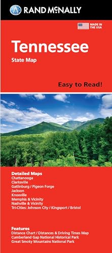
Rand McNally's Easy To Read State Folded Map is a must-have for anyone traveling in and around Tennessee, offering unbeatable accuracy and reliability at a great price. Our trusted cartography shows all Interstate, U.S., state, and county highways, along with clearly indicated parks, points of interest, airports, county boundaries, and streets. The easy-to-use legend and detailed index make for quick and easy location of destinations. You'll see why Rand McNally folded maps have been the trusted standard for years. -Regularly updated, full-color maps. -63% larger map with a bigger type size than the Rand McNally Folded Map. -Clearly labeled Interstate, U.S., state, and county highways. -Indications of parks, points of interest, airports, county boundaries, and more. -Mileage and driving times map. -Detailed index. -Convenient folded size. Coverage Area: Detailed maps of Chattanooga, Clarksville, Cumberland Gap National Historical Park, Gatlinburg/Pigeon Forge, Great Smoky Mountains National Park, Jackson, Knoxville, Memphis & Vicinity, Nashville & Vicinity, Tri-Cities: Johnson City/Kingsport/ Bristol. Product Details: Dimensions (unfolded): 28 x 40.

"synopsis" may belong to another edition of this title.

  • PublisherRand McNally
  • Publication date2021
  • ISBN 10 0528024663
  • ISBN 13 9780528024665
  • BindingMap
  • LanguageEnglish

(No Available Copies)

Search Books:


Create a Want

Can't find the book you're looking for? We'll keep searching for you. If one of our booksellers adds it to AbeBooks, we'll let you know!

Create a Want