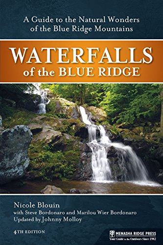
Waterfalls of the Blue Ridge: A Hiking Guide to the Cascades of the Blue Ridge Mountains - Softcover
Synopsis
Waterfalls of the Blue Ridge, now in its fourth edition, combines the pleasure of hiking with the wonder of one of nature's most captivating sights: waterfalls. Outlining hikes that feature more than 110 waterfalls in the Blue Ridge Mountains, this guide has been updated with 30 new waterfalls, updates to existing routes, and new photos. Offering something for hikers of every level of experience, waterfalls range in height from 10 to 500 feet, some requiring no hike at all while others include hikes of up to 10 miles. In this guide, today's most experienced guidebook author Johnny Molloy teams up with Nicole Blouin along with Marilou and Steve Bordonaro to introduce hikers to waterfalls spanning two states, four national forests, three national parks, and eight state parks all throughout the Blue Ridge.
"synopsis" may belong to another edition of this title.
About the Author
Johnny Molloy is a veteran outdoor author based in Johnson City, TN. Nicole Blouin is an active outdoors enthusiast and cycling guide who lives in Santa Fe, NM. Marilou Bordonaro and Steve Bordonaro are freelance outdoor authors and live in Dahlonega, GA.
From the Back Cover
At times magical, the waterfalls of the Blue Ridge Mountains are framed in Southern Appalachian majesty. Add hiking to a waterfall, and you double your pleasure. With Waterfalls of the Blue Ridge, updated by veteran outdoors writer Johnny Molloy, you can explore more than 110 waterfalls ranging from 50 to 100 feet high.
For this latest edition, over 30 new waterfalls were added. Some require no hike at all, while others can be seen only from the trail, with hikes ranging from a half-mile to several miles round-trip.
Covering the mountainous region along the Blue Ridge Parkway, including Great Smoky Mountains National Park and Shenandoah National Park, Waterfalls of the Blue Ridge takes you to two states, four national forests, three national parks, and eight state parks, as well as other preserves where waterfalls abound.
With this guide's useful maps and pertinent information, you can plan waterfall adventures that suit your time and desires. Choose a waterfall trail on which to spend the whole afternoon, or chart out a circuit and visit several in one day. Each profile provides key information such as waterfall height, trail distance and difficulty, detailed waterfall descriptions, and specific trailhead directions, including GPS trailhead coordinates.
From the Inside Flap
At times magical, the waterfalls of the Blue Ridge Mountains are framed in Southern Appalachian majesty. Add hiking to a waterfall, and you double your pleasure. With Waterfalls of the Blue Ridge, updated by veteran outdoors writer Johnny Molloy, you can explore more than 110 waterfalls ranging from 50 to 100 feet high.
For this latest edition, over 30 new waterfalls were added. Some require no hike at all, while others can be seen only from the trail, with hikes ranging from a half-mile to several miles round-trip.
Covering the mountainous region along the Blue Ridge Parkway, including Great Smoky Mountains National Park and Shenandoah National Park, Waterfalls of the Blue Ridge takes you to two states, four national forests, three national parks, and eight state parks, as well as other preserves where waterfalls abound.
With this guide's useful maps and pertinent information, you can plan waterfall adventures that suit your time and desires. Choose a waterfall trail on which to spend the whole afternoon, or chart out a circuit and visit several in one day. Each profile provides key information such as waterfall height, trail distance and difficulty, detailed waterfall descriptions, and specific trailhead directions, including GPS trailhead coordinates.
Excerpt. � Reprinted by permission. All rights reserved.
Excerpt: 5 entries from the book's first section
Section: SHENANDOAH NATIONAL PARK AND LURAY
#1 OVERAL RUN FALLS AND TWIN FALLS
Distance: 6.8 miles round-trip
Difficulty Level: Strenuous
Overall Run Falls is Shenandoah's highest cataract. A grand vista, plus a warm-up fall along the way, complement the spectacle. Start with a pleasant mountaintop stroll on the Appalachian Trail, then wend your way down the slopes of Hogback Mountain, crossing many flats. Pass wide Twin Falls, then come to Big Falls. From a rocky precipice, you can see the nearby cataract and a whole lot more in the yon.
From the parking area, join the Appalachian Trail, southbound. Gently climb through lovely fern-carpeted woodland, passing a few rock outcrops. At 0.4 mile, turn right onto the Tuscarora-Overall Run Trail. Stroll downward. Rock and wood erosion bars cross the trail and form steps. Make a couple of switchbacks before coming to another trail junction at 1.1 miles. Here, meet a connector to the Traces Nature Trail. You aren't far from Mathews Arm Campground, a fine base camp to explore the falls of Shenandoah.
Turn right, staying on the Tuscarora-Overall Run Trail. Stair-step down Hogback Mountain. At 1.6 miles, hop over uppermost Overall Run. This trickling branch increases hope there is a waterfall at the end of this thus far dry hike. The adjacent high elevation flats seem to attract bears, as I have seen them multiple times hereabouts.
At 2.9 miles, the trail intersects the Mathews Arm Trail. Keep right. Walk just a short distance coming to another concrete signpost. Here, pass the now abandoned section of Matthews Arm Trail. At this point you are wondering where the water is coming from for the falls. The Tuscarora-Overall Run Trail answers the question, and turns left down toward Overall Run on wood and earth steps. Reach the first cataract, Twin Falls, at 3.1 miles. A side trail leads left to Twin Falls and a rock outcrop where you can view it. Overall Run is split by a large boulder, forcing the water to divide, resulting in two streams dropping 29 feet.
Keep astride the canyon, passing through laurel-oak woods. Tempting outcrops lure you to the edge of the valley. Come to a wide open cliff at 3.4 miles. The world opens beyond. To your left tumbles Big Falls 93 feet over a huge rock face into the gorge below. More rock forms a wall on the far side of the falls. The Overall Run canyon plunges below. It's a long way down there! The canyon maw divulges Page Valley and Massanutten Mountain in the backdrop. In the distance rise the Alleghenies and West Virginia: a great waterfall and a great view.
Directions
The hike starts from the parking area just south of the Hogback Mountain Overlook, milepost 21.1 on Skyline Drive. To reach the trailhead from the Thornton Gap entrance station, take Skyline Drive north for 10.4 miles to the parking area on the west side of Skyline Drive, just before Hogback Mountain Overlook.
Trailhead GPS Coordinates: N38" 45.617', W78" 16.994'
#2 PINEY RIVER FALLS
Distance: 6.8 miles round-trip
Difficulty Level: Moderate-Strenuous
Piney River Falls is one of the least-visited cataracts at Shenandoah, and I am flummoxed as to why. The trailside scenery meets high Shenandoah standards. The falls are a worthy destination. Start your hike at the back of the field between Skyline Drive and the parking area across from the old CCC camp building. Look for the concrete post marked "Piney Branch Trail." Hike through black locust trees taking over an old pasture. Up to 1/3 of the land within the park was once field, pasture or meadow--treeless. At 0.1 mile, intersect the Appalachian Trail (AT) and continue straight on a track much fainter than the AT. Just ahead, cross a grassy lane, also growing up with trees. Note the apple trees.
The Piney Branch Trail winds downhill in very gentle loping switchbacks. Come to the upper reaches of the Piney River at mile 1.3. Big boulders line the small river. The grassy area beside the stream makes for a good sitting spot. Curve right away from Piney River, crossing spring branches flowing between rocks. Park personnel did an outstanding job keeping a dry track in this mushy area.
Meet the Pole Bridge Link Trail at 1.5 miles. Turn right, staying with the now-narrower and even less-used piece of the Piney Branch Trail. Wildflowers thrive in the Piney River Valley. The mountain laurel-lined path follows an old road on a slight downgrade. The gorge of Piney River cuts ever deeper to your right. At mile 2.0, the old road continues straight, but the Piney Branch Trail veers right and follows another old road. At 2.7 miles, the trail nears the Piney River. A spur trail leads right to the riverside and a nice picnic spot.
Cross the Piney River at 3.0 miles. This is a rock hop at normal flows, but it takes a little footwork. Another method is to simply shed your shoes and socks and walk through the water with a stout stick as an aid. At lower levels, this crossing will be a breeze. You are now on the southern side of the river, and the falls are only 0.4 miles distant. Watch and listen for other cascades along Piney River while making your way downstream. Cove hardwoods of yellow birch, black birch, red maple and basswood shade the frothing watercourse.
Stumble through river rubble--flood-strewn rocks from high-water events. Ferns spread wide beside rock outcrops. Sycamores find their place amid the rocks and water. Pass two house-sized rock bluffs on your right at mile 3.2. A hard-to-reach falls spills to your left. This part of the gorge is rugged. Begin listening for Piney River Falls, which are only 0.2 mile away. At mile 3.4, turn left on a side trail leading to the cataract. Piney River Falls is a 25-foot, tiered cascade that flows over mossy rock into a deep and wide pool. Rock slabs border much of the drop and make for good observation locales. It's a good place to cool off after a hot hike. Relax a spell.
Directions
From the Thornton Gap entrance of the park, take Skyline Drive north for 9.4 miles to the old CCC building in the upper Piney River area. The entrance road is on your right at milepost 22.1, just north of the turn to Mathews Arm Campground on the left. Park in the designated visitor parking area across from the CCC building. The Piney Branch Trail starts between the parking area and Skyline Drive.
Trailhead GPS Coordinates: N38" 45.030', W78" 17.539'
#3 HAZEL FALLS
Distance: 5.2 miles round-trip
Difficulty Level: Moderate
This waterfall walk takes you into "Hazel Country," a heavily settled area in pre-park days. The route traverses hill and hollow for the Hazel River, where a rock indentation forms a natural shelter, a cave of sorts, beside an alluring waterfall, all located within a deep stone amphitheater. The difficulty of this hike is hard to rate: the first 2.4-mile portion is an easy stroll on old settler roads, but the last 0.3-mile trek to the falls and cave is on a steep footpath. Though rugged, this section has been upgraded by the park service. It was once an eroded user-created mess of a path.
Leave Skyline Drive on the Hazel Mountain Trail. At 0.4 mile, veer right, still on the Hazel Mountain Trail, as the Buck Ridge Trail drops left. Striped maples crowd the path and form a dense canopy overhead. The trail bears left, levels out, and crosses several small spring branches dribbling off Buck Ridge. Sidle alongside the Hazel River at mile 1.0. The valley spreads wide into a cove. This was farmland way back when.
Turn left on the White Rocks Trail at mile 1.6. The path ascends slightly, leaving Hazel River, then levels out along an old road shaded by maples. Large boulders are strewn about the forest, which morphs to pine and chestnut oak as the trail tops out on the ridge. Wild azaleas bloom in May. An aquatic symphony drifts from below. Come to a trail junction at mile 2.4. The White Rocks Trail continues forward, while the Cave/Falls Trail footpath veers right. Follow the Cave/Falls Trail downhill, diving steeply, mitigated by stone steps.
Reach the Hazel River at 2.5 miles. Notice the peeling trunks of the many yellow birches. Turn right, following the footpath upstream. Pass a sizeable trailside tulip tree as you dance betwixt boulders. Reach the rock shelter on your right just before the waterfall. A natural rock amphitheater enfolds the scene. The rock indentation lies on your right at the base of a huge, granite bluff--quite a sturdy roof. The cave is about 10 feet deep, 25 feet wide, and 7 feet high. It gets a little deeper in one spot. Hazel Falls slices about 25 feet down a slender chute into a punchbowl, and forms the centerpiece of this picturesque mountain mosaic.
Directions
The trailhead and parking area is located on the east side of milepost 33.5 of Skyline Drive, Meadow Spring. It can be accessed by driving south for 2 miles from the Thornton Gap entrance on Skyline Drive.
Trailhead GPS Coordinates: N38" 38.250', W78" 18.845'
#4 WATERFALLS OF WHITEOAK CANYON
Distance: 5.4 miles round-trip
Difficulty Level: Strenuous
It's hard to keep track of all the falls at Whiteoak Canyon. There are six sequentially numbered falls. The count starts from the Blue Ridge and Skyline Drive then ends at the base of the canyon. Just to confuse matters further, this hike starts at the bottom of Whiteoak Run and heads upstream. From bottom up is the best way to see all the falls in the least miles hiked. Note: beware the warm weather weekend crowds. I highly suggest heading in a different direction during these times.
Leave the parking area on a trail easement through private property, reaching Cedar Run. At this point, the streambed is often dry, even though Cedar Run may be flowing upstream. Span Cedar Run on a metal bridge. Beech, sycamore, black birch and magnolia shade the track. When you reach Cedar Run Trail junction at mile 0.2, veer right, staying on the Whiteoak Canyon Trail. Then bridge Whiteoak Run, a rocky river if there ever was one. Gently ascend the creek bank. Sycamores overhang the stream. Note rock walls and piles, evidence that this area was once cultivated.
Pass the junction with the Whiteoak-Cedar Run Link Trail at 0.8 mile. Stay on the east bank of Whiteoak Run, entering a rock garden. The canyon closes. The stream gathers in deep pools. The path becomes correspondingly rockier and steeper. Rock hop Negro Run, which has a falls of its own, on your right. Just beyond this crossing close in on Lower Whiteoak Falls at 1.4 miles. A short trail leads left to the precipitous two-tiered 60-foot cataract, which spills over an open rock face. The uppermost falls, where this hike ends, is the canyon's tallest at 86 feet. The ones in between--the ones hard to count because they are indiscernible where they start or stop--purportedly range between 45 and 65 feet each.
The main trail switchbacks, meandering far from the stream. The area can be confusing, as erosive user-created trails continue straight up the canyon. Climb sharply along the base of a bluff in pines, well above the stream, sometimes traversing open rock. In places, steps have been chiseled into this bare stone. At 1.7 miles, come to a cedar tree that mans a rock slab overlook into the canyon. Catch glimpses of the crashing falls below, and the lands beyond the canyon. The stream and path come together again by 1.9 miles. This is where the numbered falls get confusing. Just enjoy the cataracts and leave the counting to others.
Begin a pattern of coming to a falls, then switch backing away and uphill to the base of another falls. Huge walls rise beyond the stream. Pass an overhanging boulder on your right at 2.3 miles. Keep climbing through a wonderment of rock and water, where pools
"About this title" may belong to another edition of this title.
Search results for Waterfalls of the Blue Ridge: A Hiking Guide to the...

Seller Image
Waterfalls of the Blue Ridge: A Hiking Guide to the Cascades of the Blue Ridge Mountains
Seller: Zoom Books Company, Lynden, WA, U.S.A.
Seller rating 5 out of 5 stars
![]()
Condition: very_good. Book is in very good condition and may include minimal underlining highlighting. The book can also include "From the library of" labels. May not contain miscellaneous items toys, dvds, etc. . We offer 100% money back guarantee and 24 7 customer service. Seller Inventory # ZBV.0897329945.VG
Seller Image
Waterfalls of the Blue Ridge: A Hiking Guide to the Cascades of the Blue Ridge Mountains
Seller: Greenworld Books, Arlington, TX, U.S.A.
Seller rating 5 out of 5 stars
![]()
Condition: good. Fast Free Shipping �" Good condition. It may show normal signs of use, such as light writing, highlighting, or library markings, but all pages are intact and the book is fully readable. A solid, complete copy that's ready to enjoy. Seller Inventory # GWV.0897329945.G
Seller Image
Waterfalls of the Blue Ridge: A Hiking Guide to the Cascades of the Blue Ridge Mountains
Seller: -OnTimeBooks-, Phoenix, AZ, U.S.A.
Seller rating 5 out of 5 stars
![]()
Condition: very_good. Gently read. May have name of previous ownership, or ex-library edition. Binding tight; spine straight and smooth, with no creasing; covers clean and crisp. Minimal signs of handling or shelving. 100% GUARANTEE! Shipped with delivery confirmation, if you're not satisfied with purchase please return item! Ships USPS Media Mail. Seller Inventory # OTV.0897329945.VG
Stock Image
Waterfalls of the Blue Ridge: A Guide to the Natural Wonders of the Blue Ridge Mountains
Seller: ThriftBooks-Phoenix, Phoenix, AZ, U.S.A.
Seller rating 5 out of 5 stars
![]()
Paperback. Condition: Good. No Jacket. Pages can have notes/highlighting. Spine may show signs of wear. ~ ThriftBooks: Read More, Spend Less. Seller Inventory # G0897329945I3N00
Stock Image
Waterfalls of the Blue Ridge: A Guide to the Natural Wonders of the Blue Ridge Mountains
Seller: ThriftBooks-Reno, Reno, NV, U.S.A.
Seller rating 5 out of 5 stars
![]()
Paperback. Condition: Good. No Jacket. Pages can have notes/highlighting. Spine may show signs of wear. ~ ThriftBooks: Read More, Spend Less. Seller Inventory # G0897329945I3N00
Seller Image
Waterfalls of the Blue Ridge: A Hiking Guide to the Cascades of the Blue Ridge Mountains
Seller: Goodwill Books, Hillsboro, OR, U.S.A.
Seller rating 5 out of 5 stars
![]()
Condition: acceptable. Fairly worn, but readable and intact. If applicable: Dust jacket, disc or access code may not be included. Seller Inventory # GICWV.0897329945.A
Stock Image
Waterfalls of the Blue Ridge: A Guide to the Natural Wonders of the Blue Ridge Mountains
Seller: ThriftBooks-Atlanta, AUSTELL, GA, U.S.A.
Seller rating 5 out of 5 stars
![]()
Paperback. Condition: Good. No Jacket. Pages can have notes/highlighting. Spine may show signs of wear. ~ ThriftBooks: Read More, Spend Less. Seller Inventory # G0897329945I3N00
Stock Image
Waterfalls of the Blue Ridge: A Guide to the Natural Wonders of the Blue Ridge Mountains
Seller: ThriftBooks-Dallas, Dallas, TX, U.S.A.
Seller rating 5 out of 5 stars
![]()
Paperback. Condition: Very Good. No Jacket. May have limited writing in cover pages. Pages are unmarked. ~ ThriftBooks: Read More, Spend Less. Seller Inventory # G0897329945I4N00
Stock Image
Waterfalls of the Blue Ridge: A Guide to the Natural Wonders of the Blue Ridge Mountains
Seller: ThriftBooks-Atlanta, AUSTELL, GA, U.S.A.
Seller rating 5 out of 5 stars
![]()
Paperback. Condition: Very Good. No Jacket. May have limited writing in cover pages. Pages are unmarked. ~ ThriftBooks: Read More, Spend Less. Seller Inventory # G0897329945I4N00