Items related to Yosemite SE: Ansel Adams Wilderness (National Geographic...
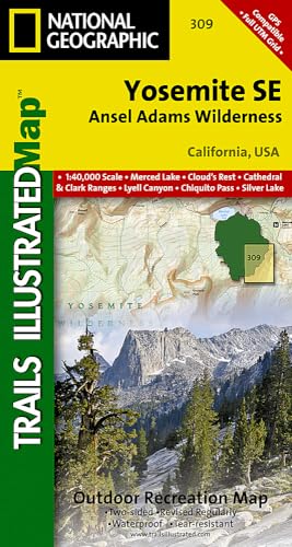
Yosemite SE: Ansel Adams Wilderness (National Geographic Trails Illustrated Map) (National Geographic Trails Illustrated Map, 309)
Synopsis
• Waterproof • Tear-Resistant • Topographic Map
National Geographic's Trails Illustrated map of Yosemite SE delivers unmatched detail and valuable information to assist you in your exploration of this breathtaking wilderness. Created in partnership with local land management agencies, this expertly researched map delivers unmatched detail and helpful information for experienced outdoor enthusiasts and casual visitors alike. Some of the key areas of interest included are Tuolomne Meadows; Garnet, Thousand Island, Tenaya and Merced lakes; Moraine Meadows; Quartz Mountain; and the Cathedral Range.
With miles of mapped trails including portions of the Pacific Crest and John Muir trails, this map can guide you off the beaten path and back again in some of the most stunning scenery in the Sierras. Trail mileage between intersections will help you choose the path that's right for you. The Sierra Vista Scenic Byway is noted for those wishing to take in the scenery by car. Recreation features are clearly marked, including campgrounds, trailheads, picnic areas, alpine ski areas, and horse stables. The map base includes contour lines and elevations for summits, passes and many lakes.
Every Trails Illustrated map is printed on "Backcountry Tough" waterproof, tear-resistant paper. A full UTM grid is printed on the map to aid with GPS navigation.
Other features found on this map include: Ansel Adams Wilderness, Cathedral Range, Inyo National Forest, Mount Lyell, Mount Ritter, Ritter Range, Sierra National Forest, Yosemite National Park.
- Map Scale = 1:40,000
- Sheet Size = 36" x 22"
- Folded Size = 4" x 7.5"
"synopsis" may belong to another edition of this title.
About the Author
Founded in 1915 as the Cartographic Group, the first division of National Geographic, National Geographic Maps has been responsible for illustrating the world around us through the art and science of mapmaking.Today, National Geographic Maps continues this mission by creating the world's best wall maps, recreation maps, atlases, and globes which inspire people to care about and explore their world.
"About this title" may belong to another edition of this title.
Buy New
View this item
US$ 17.73
US$ 4.35 shipping from United Kingdom to U.S.A.
Destination, rates & speeds
Search results for Yosemite SE: Ansel Adams Wilderness (National Geographic...
Seller Image
Yosemite SE: Ansel Adams Wilderness (National Geographic Trails Illustrated Map) (National Geographic Trails Illustrated Map, 309)
Seller: Goodwill Industries of VSB, Oxnard, CA, U.S.A.
Seller rating 5 out of 5 stars
![]()
Condition: Good. The book is nice and 100% readable, but the book has visible wear which may include stains, scuffs, scratches, folded edges, sticker glue, torn on front page,highlighting, notes, and worn corners. Seller Inventory # 4JQO8Z006H7Y
Quantity: 1 available
Stock Image
Yosemite Se: Ansel Adams Wilderness Map
Seller: PBShop.store UK, Fairford, GLOS, United Kingdom
Seller rating 5 out of 5 stars
![]()
UNK. Condition: New. New Book. Shipped from UK. Established seller since 2000. Seller Inventory # EA-9781566954136
Quantity: 2 available
Stock Image
Yosemite SE, Ansel Adams Wilderness
Seller: PBShop.store US, Wood Dale, IL, U.S.A.
Seller rating 5 out of 5 stars
![]()
UNK. Condition: New. New Book. Shipped from UK. Established seller since 2000. Seller Inventory # EA-9781566954136
Quantity: 2 available
Seller Image
Yosemite Se: Ansel Adams Wilderness Map
Seller: AHA-BUCH GmbH, Einbeck, Germany
Seller rating 5 out of 5 stars
![]()
Karte. Condition: Neu. Neuware - Coverage of the Tuolomne Meadows and Hoover Wilderness area of Yosemite National Park includes Ansel Adams Wilderness, Yosemite Wilderness, Mono Basin National Forest Scenic Area, Monroe Hall Research Natural Area, Humbolt - Toiyabe National Forest, Twin Lakes. Includes UTM grids for use with your GPS unit. Seller Inventory # 9781566954136
Quantity: 1 available
Seller Image
Yosemite Se: Ansel Adams Wilderness
Print on DemandSeller: moluna, Greven, Germany
Seller rating 5 out of 5 stars
![]()
Condition: New. Dieser Artikel ist ein Print on Demand Artikel und wird nach Ihrer Bestellung fuer Sie gedruckt. KlappentextrnrnCoverage of the Tuolomne Meadows and Hoover Wilderness area of Yosemite National Park includes Ansel Adams Wilderness, Yosemite Wilderness, Mono Basin National Forest Scenic Area, Monroe Hall Research Natural Area, Humbolt - Toiya. Seller Inventory # 101192057
Quantity: Over 20 available