Items related to Titanic Reference Map, Second Edition
Synopsis
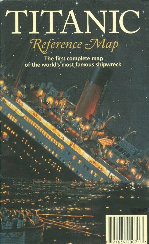
The first complete map of the world's most famous shipwreck. The two-sided full-color infographic map unfolds to 39" x 26". The map side illustrates the course of the Titanic and her rescue ships as well as pre- and post-disaster shipping lanes. Deep-ocean diagrams of the search process and other Titanic-related points of interest are also included. The ship side contains color-coded deck plans, cutaway views and escape routes, portraits of noted passengers and crew, a full bibliography and more.
"synopsis" may belong to another edition of this title.
From the Publisher
Used copies of this map might have an older print date. New copies purchased directly from Amazon will have the most current print date.
"About this title" may belong to another edition of this title.
Search results for Titanic Reference Map, Second Edition

Stock Image
Titanic Reference Map: The First Complete Map of the World's Most Famous Shipwreck
Published by
Hedberg Maps, Minneapolis, 2005
ISBN 10: 1593530110
ISBN 13: 9781593530112
Used
Trade paperback
Seller: 2Vbooks, Derwood, MD, U.S.A.
Seller rating 5 out of 5 stars
![]()
Trade paperback. Condition: Fine. 2nd Revised edition. Revised. Audience: General/trade. No previous owner's name. Clean, tight pages. INCLUDES WHITE STAR LINE BOARDING PASSES (2) AND TICKET TRAVELING EXHIBIT HALL FROM jUN 11, 2005 AND CLIPPER CITY OF BALTIMORE PHAMPHLET eb 66. Seller Inventory # Alibris.0039133
Stock Image
Titanic Reference Map - Second Edition
Published by
Hedberg Maps, Inc., Minneapolis, MN, USA, 2006
ISBN 10: 1593530110
ISBN 13: 9781593530112
Used
Seller: Post Horizon Booksellers, Nokomis, SK, Canada
Seller rating 5 out of 5 stars
![]()
No Binding. Condition: Near Fine. 2nd Edition. 66 x 99cm (23 x 14.5cm folded) full-color info-graphic map, in original folds without tears. Second edition, revised and updated, second printing, 2006, stated. Seller Inventory # 048725
Buy Used
US$ 25.68
US$ 18.50 shipping
Ships from Canada to U.S.A.
Ships from Canada to U.S.A.
Quantity: 1 available