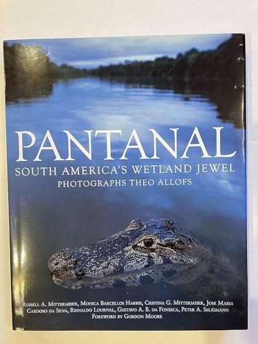
Items related to Pantanal: South America's Wetland Jewel
Synopsis
A spectacular tour of the world's largest wetland.
The Pantanal covers 81,000 square miles in the middle of South America, extending over parts of Brazil, Bolivia and Paraguay.
About half the size of California and 20 times the size of the Everglades, the Pantanal flood plain is the largest wetland network on Earth.
Pantanal reveals the abundant wildlife and beauty of this remarkable eco-system, home to some of the most spectacular concentrations of flora and fauna on the planet.
The text explains the Pantanal's ecology, its people, plants and animals, presented in five chapters:
- The Pantaneiro: People of the Pantanal
- Wetlands
- Grasslands
- Forests of the Pantanal
- Caiman: the comeback crocodile.
The book also examines the impact of deforestation, overfishing and overhunting in the Pantanal and the efforts by conservationists to protect this magnificent region for future generations.
Pantanal is a superbly photographed tour of one of the most memorable regions on the planet.
"synopsis" may belong to another edition of this title.
About the Author
Theo Allofs is an award-winning wildlife and nature photographer, whose images regularly appear in Smithsonian, National Geographic, Outdoor Photographer, GEO and American Photo.
Russell A. Mittermeier is the president of Conservation International, of which all the authors are members.
Excerpt. � Reprinted by permission. All rights reserved.
From the
Introduction
Home to some of the most spectacular concentrations of wildlife on Earth, the Pantanal region of Brazil, Bolivia and Paraguay is the world's largest contiguous wetland on the planet. Located between 16� and 22� South, and 55� and 58� West (see map page 7), it covers some 210,000 sq km. This area, about half the size of California, consists mainly of the low-altitude (average 80-180 m) floodplain of the Rio Paraguay and its tributaries, which drop off the Brazilian Cerrado, or planalto (central plateau). This huge, seasonally-flooded swampland is far more impressive and beautiful than any comparable region found elsewhere in the world.
The Pantanal covers a vast expanse in the middle of South America. With an average width of 500 km, it stretches in a north-south direction some 950 km along the upper Rio Paraguay basin. It is bordered to the east by the savannahs and woodlands of the Brazilian Cerrado, extending as far as the Chapada dos Parecis; to the northwest by the semideciduous forests of the transition zone between Amazonia and the Cerrado; to the southwest by the Chaco formations (a wetland ecosystem of open vegetation and temperate climate) of Paraguay and Bolivia; and to the south by low-lying mountains, the Serras da Bodoquena and Maracaj�. To the west, it gently undergoes a transition into the dry forests of extreme eastern Bolivia along the Serra do Amolar. Some 70 percent of the Pantanal lies within the Brazilian states of Mato Grosso and Mato Grosso do Sul (which accounts for 40 percent and 60 percent, respectively, of the Brazilian side), with the remaining land lying within Bolivia (20 percent) and Paraguay (10 percent).
This enormous floodplain has been traditionally divided into subregions, based on history, soil type, vegetation, and its main rivers. C�ceres, Pocon�, Barao de Melga�o, Paiagu�s, Paraguai, Nhecol�ndia, Abobral, Aquidauana, Miranda, and Nabileque are some of the main Brazilian subregions.
"About this title" may belong to another edition of this title.
- PublisherNew Holland Publishers Ltd
- Publication date2007
- ISBN 10 1845378199
- ISBN 13 9781845378196
- BindingHardcover
- Number of pages176
- Rating
Buy New
Learn more about this copy
US$ 196.85
Shipping:
US$ 33.29
From United Kingdom to U.S.A.

Top Search Results from the AbeBooks Marketplace
Stock Image
Pantanal: South America's Wetland Jewel
Published by
New Holland Publishers Ltd, 2007
ISBN 10: 1845378199
ISBN 13: 9781845378196
Used
Hardcover
Seller: The Mill Bookshop, Gatehouse of Fleet, United Kingdom
Seller rating 4 out of 5 stars
![]()
Hardcover. Condition: Near Fine. Dust Jacket Condition: Very Good. Publisher New Holland, London 2007. Near Fine condition. In blue boards with silver lettering. Minimal wear. Tight binding, all pages intact, no markings or inscriptions. Original blue pictorial unclipped d/j in very good condition, slight creasing and discolouration to ends of spine and top edge. Heavy book which will incur extra postage charge. Seller Inventory # ABE-1688396153923
Quantity: 1 available
Stock Image
Pantanal: South America*s Wetland Jewel
Published by
New Holland Publishers Ltd, 2007
ISBN 10: 1845378199
ISBN 13: 9781845378196
New
Hardcover
Seller: dsmbooks, Liverpool, United Kingdom
Seller rating 4 out of 5 stars
![]()
Hardcover. Condition: New. New. book. Seller Inventory # D8S0-3-M-1845378199-4
Quantity: 1 available