Items related to GIS for Everyone
Synopsis
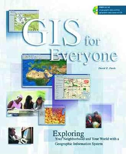
Geographic information systems (GIS) have a wide variety of applications -- from monitoring all rail systems and airplane noise levels to finding the perfect vacation spot or the quickest route to work. This guide to GIS explains how geographic information can be made visually understandable to users everywhere. Included is information on the latest version of ArcExplorer 3, a free GIS data viewer, and an access code for downloading detailed data about specific regions and neighborhoods.
"synopsis" may belong to another edition of this title.
From the Author
If you would like to learn more about Geographic Information Systems, participate in a dicussion with other readers, or download geographic data about your neighborhood, visit us at www.esri.com/gisforeveryone. Although, the best way to learn what GIS can do is to use it, so buy this book and get started making your own maps.
About the Author
Davis is a geographer and technical writer at ESRI Press.
"About this title" may belong to another edition of this title.
- PublisherEsri Press
- Publication date1999
- ISBN 10 1879102498
- ISBN 13 9781879102491
- BindingPaperback
- Number of pages156
- Rating
Buy New
Learn more about this copy
US$ 17.29
Shipping:
US$ 6.50
Within U.S.A.

Top Search Results from the AbeBooks Marketplace
Stock Image
GIS for Everyone
Seller: SecondSale, Montgomery, IL, U.S.A.
Seller rating 5 out of 5 stars
![]()
Condition: Very Good. Item in very good condition! Textbooks may not include supplemental items i.e. CDs, access codes etc. Seller Inventory # 00075081902
Quantity: 1 available
Stock Image
GIS for Everyone
Seller: Wonder Book, Frederick, MD, U.S.A.
Seller rating 5 out of 5 stars
![]()
Condition: As New. Like New condition. With CD! A near perfect copy that may have very minor cosmetic defects. Seller Inventory # N22B-01854
Quantity: 1 available
Stock Image
GIS for Everyone
Seller: Wonder Book, Frederick, MD, U.S.A.
Seller rating 5 out of 5 stars
![]()
Condition: Good. Good condition. Sorry, CD missing. A copy that has been read but remains intact. May contain markings such as bookplates, stamps, limited notes and highlighting, or a few light stains. Seller Inventory # W01A-01584
Quantity: 1 available
Stock Image
GIS for Everyone: Exploring Your Neighborhood and Your World with a Geographic Information System [With CD-ROM]
Seller: ThriftBooks-Atlanta, AUSTELL, GA, U.S.A.
Seller rating 5 out of 5 stars
![]()
Paperback. Condition: Very Good. No Jacket. May have limited writing in cover pages. Pages are unmarked. ~ ThriftBooks: Read More, Spend Less 1.08. Seller Inventory # G1879102498I4N00
Quantity: 1 available
Stock Image
GIS for Everyone : Exploring Your Neighborhood and Your World with a Geographic Information System
Seller: Better World Books: West, Reno, NV, U.S.A.
Seller rating 5 out of 5 stars
![]()
Condition: As New. Used book that is in almost brand-new condition. Seller Inventory # 42601823-75
Quantity: 1 available
Stock Image
GIS for Everyone
Seller: HPB-Diamond, Dallas, TX, U.S.A.
Seller rating 5 out of 5 stars
![]()
paperback. Condition: Very Good. Connecting readers with great books since 1972! Used books may not include companion materials, and may have some shelf wear or limited writing. We ship orders daily and Customer Service is our top priority!. Seller Inventory # S_402991242
Quantity: 1 available
Stock Image
GIS for Everyone : Exploring Your Neighborhood and Your World with a Geographic Information System
Published by
Redlands, CA, U.S.A.: Environmental Systems Research Institute, 1999, 1999
ISBN 10: 1879102498
ISBN 13: 9781879102491
Used
Soft cover
Seller: Bingo Used Books, Vancouver, WA, U.S.A.
Seller rating 5 out of 5 stars
![]()
Soft cover. Condition: Very Good. trade paperback in very good - condition. NO CD-ROM. Seller Inventory # 17717
Quantity: 1 available
Stock Image
Gis for Everyone: Exploring Your Neighborhood and Your World With a Geographic Information System
Published by
Redlands, California, U.S.A.: Esri Pr, 1999
ISBN 10: 1879102498
ISBN 13: 9781879102491
Used
Soft cover
Seller: Bingo Used Books, Vancouver, WA, U.S.A.
Seller rating 5 out of 5 stars
![]()
Soft cover. Condition: Very Good. trade paperback in very good+ condition. Seller Inventory # 67510
Quantity: 1 available
Stock Image
Gis for Everyone: Exploring Your Neighborhood and Your World With a Geographic Information System
Published by
ESRI Press, Redlands, California, U.S.A., 1999
ISBN 10: 1879102498
ISBN 13: 9781879102491
Used
Soft cover
Seller: Granada Bookstore, IOBA, Woodlawn, IL, U.S.A.
Seller rating 5 out of 5 stars
![]()
Soft cover. Condition: Fine. Sealed Cd Included. Seller Inventory # 005740
Quantity: 1 available
Stock Image
Giss for Everyone
Seller: Wired For Work Solutions, LLC, Front Royal, VA, U.S.A.
Seller rating 4 out of 5 stars
![]()
Condition: New. Seller Inventory # BK0662
Quantity: 1 available