
Items related to Understanding a Nautical Chart: A Practical Guide to...
Synopsis
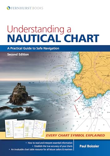
We all rely on charts to navigate at sea – but are we missing essential information? A mass of data is included on each chart and deciphering the many symbols and abbreviations can be complicated. The accuracy of some charted depths can be trusted entirely while others should be treated with caution. This book will tell you where to find and how to understand this vital knowledge. This updated second edition explains how charts are compiled before guiding you through the elements that make up these vital navigational tools. Improve you understanding of charts and you will navigate with increased safety and confidence. Understanding a Nautical Chart offers superb value as, in addition to a wealth of practical advice, there is a key to all the recently updated chart symbols and abbreviations from Symbols and Abbreviations Used on Admiralty Charts (5011). It includes information on electronic charts, explains how to update a chart and how to establish the accuracy of each chart. It is ideal for professional mariners and leisure sailors.
Table of Contents
1-What is a Chart? 2-A Chart is Never 100% Accurate. 3-What the Chart-Maker Does for Us. 4-Other Relevant Documentation. 5-How to Use a Chart. 6-Orientation. 7-The Basics (and Where to Find Them). 8-Depth and Elevations. 9-Landmarks, Lights and Coastal Features. 10-Dangers: Wrecks, Rocks and Obstructions. 11-Navigation Restrictions and Limits. 12-Radar and Radio. 13-Tides, Tidal Streams and Currents. 14-Small Craft Features. 15-Other Charting Authorities. 16-GPS. 17-Digital Charting. Symbols & Abbreviations used on Admiralty Paper Charts.
"synopsis" may belong to another edition of this title.
About the Author
Paul Boissier was formerly a senior Admiral in the Royal Navy and has spent much of his professional life at sea in a wide variety of vessels, commanding two submarines and a warship. He is also a very experienced yachtsman and has cruised extensively. These perspectives, from the cockpit of a yacht and the bridge of a large ship, make him the ideal author for a COLREGs guide that will be equally useful to leisure boat users and professional mariners. Paul is currently the Chief Executive of the RNLI, the charity that saves life at sea, and operates over 340 lifeboats around the UK and the Republic of Ireland.
"About this title" may belong to another edition of this title.
Search results for Understanding a Nautical Chart: A Practical Guide to...

Stock Image
Understanding a Nautical Chart: A Practical Guide to Safe Navigation
Published by
Fernhurst Books (edition 2), 2018
ISBN 10: 1912177072
ISBN 13: 9781912177073
Used
Paperback
Seller: BooksRun, Philadelphia, PA, U.S.A.
Seller rating 5 out of 5 stars

Paperback. Condition: Very Good. 2. It's a well-cared-for item that has seen limited use. The item may show minor signs of wear. All the text is legible, with all pages included. It may have slight markings and/or highlighting. Seller Inventory # 1912177072-11-1
Stock Image
Understanding a Nautical Chart â" A Practical Guide to Safe Navigation
Seller: WorldofBooks, Goring-By-Sea, WS, United Kingdom
Seller rating 5 out of 5 stars
Paperback. Condition: Very Good. The book has been read, but is in excellent condition. Pages are intact and not marred by notes or highlighting. The spine remains undamaged. Seller Inventory # GOR011292410
Buy Used
US$ 12.04
US$ 7.40 shipping
Ships from United Kingdom to U.S.A.
Ships from United Kingdom to U.S.A.
Quantity: 3 available
Seller Image
Understanding a Nautical Chart : A Practical Guide to Safe Navigation
Seller: GreatBookPrices, Columbia, MD, U.S.A.
Seller rating 5 out of 5 stars
Condition: New. Seller Inventory # 29911552-n
Stock Image
Understanding a Nautical Chart - 2e (Paperback)
Published by
Fernhurst Books Limited, Leamington Spa, 2018
ISBN 10: 1912177072
ISBN 13: 9781912177073
New
Paperback
Seller: Grand Eagle Retail, Bensenville, IL, U.S.A.
Seller rating 5 out of 5 stars
Paperback. Condition: new. Paperback. We all rely on charts to navigate at sea but are we missing essential information? A mass of data is included on each chart and deciphering the many symbols and abbreviations can be complicated. The accuracy of some charted depths can be trusted entirely while others should be treated with caution. This book will tell you where to find and how to understand this vital knowledge. This updated second edition explains how charts are compiled before guiding you through the elements that make up these vital navigational tools. Improve your understanding of charts and you will navigate with increased safety and confidence. Understanding a Nautical Chart offers superb value as, in addition to a wealth of practical advice, there is a key to all the recently updated chart symbols and abbreviations from Symbols and Abbreviations Used on Admiralty Charts (5011). It includes information on electronic charts, explains how to update a chart and how to establish the accuracy of each chart. It is ideal for professional mariners and leisure sailors. AUTHOR: Paul Boissier was formerly a senior Admiral in the Royal Navy, and has spent much of his career at sea in a wide variety of vessels, commanding two submarines and a warship. He is also a very experienced yachtsman and has cruised extensively. He is now the Chief Executive of the RNLI, the charity that saves lives at sea, and operates over 340 lifeboats around the UK and the Republic of Ireland. 284 diagrams, 9 colour photos This updated edition explains how to read, interpret and understand nautical charts and establish their accuracy. It is an invaluable chart table resource for all leisure sailors and professional mariners. Includes a special reference section with the updated Symbols and Abbreviations Used on Admiralty Charts (5011) in full. Shipping may be from multiple locations in the US or from the UK, depending on stock availability. Seller Inventory # 9781912177073
Stock Image
Understanding a Nautical Chart Format: Paperback
Seller: INDOO, Avenel, NJ, U.S.A.
Seller rating 5 out of 5 stars
Condition: New. Brand New. Seller Inventory # 9781912177073
Seller Image
Understanding a Nautical Chart : A Practical Guide to Safe Navigation
Seller: GreatBookPrices, Columbia, MD, U.S.A.
Seller rating 5 out of 5 stars
Condition: As New. Unread book in perfect condition. Seller Inventory # 29911552
Seller Image
Understanding a Nautical Chart â" A Practical Guide to Safe Navigation
Seller: WeBuyBooks, Rossendale, LANCS, United Kingdom
Seller rating 5 out of 5 stars
paperback. Condition: Very Good. Most items will be dispatched the same or the next working day. A copy that has been read, but is in excellent condition. Pages are intact and not marred by notes or highlighting. The spine remains undamaged. Seller Inventory # rev4296283403
Buy Used
US$ 12.39
US$ 13.28 shipping
Ships from United Kingdom to U.S.A.
Ships from United Kingdom to U.S.A.
Quantity: 1 available
Stock Image
Understanding a Nautical Chart - 2e
Seller: PBShop.store US, Wood Dale, IL, U.S.A.
Seller rating 5 out of 5 stars
PAP. Condition: New. New Book. Shipped from UK. Established seller since 2000. Seller Inventory # FW-9781912177073
Seller Image
Understanding a Nautical Chart: A Practical Guide to Safe Navigation
Seller: Book Bunker USA, Havertown, PA, U.S.A.
Seller rating 5 out of 5 stars
Paperback. Condition: New. *Brand new* Ships from USA. Seller Inventory # 9781912177073
Stock Image
Understanding a Nautical Chart - A Practical Guide to Safe Navigation
Seller: Chiron Media, Wallingford, United Kingdom
Seller rating 5 out of 5 stars
paperback. Condition: New. Brand new book, sourced directly from publisher. Dispatch time is 24-48 hours from our warehouse. Book will be sent in robust, secure packaging to ensure it reaches you securely. Seller Inventory # 6666-GRD-9781912177073
Buy New
US$ 20.32
US$ 8.58 shipping
Ships from United Kingdom to U.S.A.
Ships from United Kingdom to U.S.A.
Quantity: 1 available