
Items related to Mapping Spaces: Networks of Knowledge in 17th Century...
Synopsis
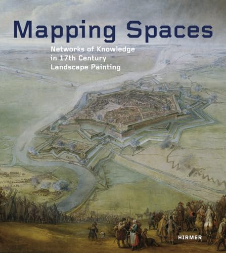
Seventeenth-century Europe saw a fruitful creative exchange between the arts and contemporaneous scientific thought. Mapping Spaces traces the multifaceted dimensions of this exchange with contributions from more than forty leading scholars who, together, reflect on the influence of science and technology on the arts through the specific study of the process of mapping in Dutch landscape paintings of the mid-seventeenth century.
The dialogue between the arts and sciences, the contributors find, extends back well beyond the new media and digital satellite imagery of modern times. Many Dutch painters of the period are believed to have employed systems of remote sensing for their paintings. For his well-known historical battle scenes, for instance, Pieter Snayers would have required an understanding of both ballistics and geography. Bringing these and many other insights together with more than 350 large-format illustrations, Mapping Spaces presents readers with past exchanges of knowledge that surprisingly anticipate the techniques of mapping used today.
"synopsis" may belong to another edition of this title.
About the Authors
Ulrike Gehring is professor of art history at the University of Trier, Germany.
Peter Weibel is an Austrian artist, theorist, and curator whose recent work included the curation of the Fourth Moscow Biennale of Contemporary Art in 2011.
"About this title" may belong to another edition of this title.
Search results for Mapping Spaces: Networks of Knowledge in 17th Century...

Stock Image
Mapping Spaces. Networks of Knowledge in the Landscape Painting of the 17th Century.
Published by
München / Hirmer Verlag,, 2014
ISBN 10: 3777422304
ISBN 13: 9783777422305
Used
Hardcover
Seller: Antiquariat Willi Braunert, München, Germany
Seller rating 4 out of 5 stars

4°, OPpBd. 500 Seiten Neues Exemplar. New copy. Sprache: Deutsch Gewicht in Gramm: 3000. Seller Inventory # 13050
Buy Used
US$ 89.94
US$ 30.23 shipping
Ships from Germany to U.S.A.
Ships from Germany to U.S.A.
Quantity: 15 available
Seller Image
Mapping spaces. Networks of knowledge in 17th century landscape painting ; [ZKM, Museum of Contemporary Art, April 12 - July 13, 2014].
Seller: Antiquariat Bookfarm, Löbnitz, Germany
Seller rating 5 out of 5 stars

Hardcover. Condition: Gut. 504 S. Ehem. Bibliotheksexemplar mit Signatur und Stempel. GUTER Zustand, ein paar Gebrauchsspuren. Ex-library with stamp and library-signature. GOOD condition, some traces of use. M10164 9783777422305 Sprache: Englisch Gewicht in Gramm: 2820. Seller Inventory # 2542842
Buy Used
US$ 89.93
US$ 44.78 shipping
Ships from Germany to U.S.A.
Ships from Germany to U.S.A.
Quantity: 2 available
Seller Image
Mapping Spaces. Networks of Knowledge in 17th Century Landscape Painting. Ausstellungskatalog.
Seller: Antiquariat Uwe Berg, Toppenstedt, Germany
Seller rating 5 out of 5 stars
504 S., reich bebildert, englischsprachig, OPbd., 4*. Sauberer Pappband. 69 Sprache: Englisch Gewicht in Gramm: 1000. Seller Inventory # 319134
Buy Used
US$ 103.78
US$ 45.90 shipping
Ships from Germany to U.S.A.
Ships from Germany to U.S.A.
Quantity: 1 available
Seller Image
Mapping spaces : networks of knowledge in 17th century landscape painting ; [ZKM, Museum of Contemporary Art, April 12 - July 13, 2014]. [Exhibition Mapping Spaces. Networks of Knowledge in 17th Century Landscape Painting]. ZKM Karlsruhe. Ed. by Ulrike Gehring and Peter Weibel. [Transl. Samuel Brody .]
Published by
Munich : Hirmer, Â 2014., 2014
ISBN 10: 3777422304
ISBN 13: 9783777422305
Used
Hardcover
Seller: Licus Media e.K., Utting a. Ammersee, Germany
Seller rating 4 out of 5 stars
Gebundene Ausgabe. Condition: Befriedigend. en. 504 S. : zahlr. Ill., Kt. ; 30 cm Illustrierter Original-Pappeinband (kein Schutzumschlag). Eine hintere Einbandecke etwas gestaucht und schadhaft, eine Seite mit kleinem Einriss, sonst textsauber und sehr gut erhalten. Keine Besitzvermerke. 9783777422305 Werktäglicher Versand. Jede Lieferung m. ordentl. Rechnung und ausgew. MwSt. Der Versand erfolgt als Büchersendung / Einschreiben mit der Deutschen Post bzw. als Päckchen / Paket mit DHL. Die Lieferzeit ist abhängig von der Versandart und beträgt innerhalb Deutschlands 3-5 Tage, in der EU 5 - 12 Tage. KEIN Versand an Packstationen. Körperschaften und juristische Personen werden auf Wunsch per offener Rechnung beliefert. ***ATTENTION U.S. CUSTOMERS: Due to the new tariffs, we are unable to ship packages to the USA at this time. Thank you for understanding.*** Sprache: Englisch Gewicht in Gramm: 2778. Seller Inventory # 93428
Buy Used
US$ 138.37
US$ 117.55 shipping
Ships from Germany to U.S.A.
Ships from Germany to U.S.A.
Quantity: 1 available
Stock Image
Mapping Spaces. Networks of Knowledge in the Landscape Painting of the 17th Century. Kunst - Gehring, Ulrike und Peter Weibel
Published by
München / Hirmer Verlag, 2014
ISBN 10: 3777422304
ISBN 13: 9783777422305
Used
Hardcover
Seller: BUCHSERVICE / ANTIQUARIAT Lars Lutzer, Wahlstedt, Germany
Seller rating 5 out of 5 stars
Condition: gut. 2014. Mapping Spaces. Networks of Knowledge in the Landscape Painting of the 17th Century. In deutscher Sprache. pages. Seller Inventory # BN513788
Buy Used
US$ 265.09
US$ 44.72 shipping
Ships from Germany to U.S.A.
Ships from Germany to U.S.A.
Quantity: 1 available
Stock Image
Mapping Spaces; Networks of Knowledge in 17th Century Landscape Painting
Seller: BWS BKS, Ferndale, NY, U.S.A.
Seller rating 2 out of 5 stars

Hardcover. Condition: New. Seller Inventory # 111900