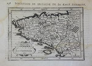
BRITANNIA: DESCRIPTION DE BRETAIGNE EN LA GAUIE LIONNOISE: MAP
Petrus Bertius & Jodocus Hondius II
From Hornseys, Ripon, United Kingdom
Seller rating 5 out of 5 stars
AbeBooks Seller since September 19, 2019
From Hornseys, Ripon, United Kingdom
Seller rating 5 out of 5 stars
AbeBooks Seller since September 19, 2019
About this Item
DH302104. Original and scarce miniature map of the Brittany region of France. Printed in 1618 in 'La Geographie Racourcie' in Paris. Size: 13.8cm x 9.7cm. Original copper engraving. Map features a decorative title cartouche with text in Latin. French title above the map with French text to the reverse. Includes a scale in miles. Age staining to the margins which only very slightly affects the map. In very good, clean condition overall. These miniature maps by Bertius and engraved by Hondius have been referred to as 'undoubtedly the finest set of miniature maps ever printed'. Seller Inventory # 000307
Bibliographic Details
Title: BRITANNIA: DESCRIPTION DE BRETAIGNE EN LA ...
Publisher: Paris, France
Publication Date: 1618
Binding: No Binding
Condition: Very Good Plus
Edition: 1st Edition thus
Store Description
All books are offered subject to prior sale. We accept payment by cash, sterling cheque, credit card (not amex), paypal, postal orders and by bank transfer. Please contact us for more information.
We make every effort to describe our books as accurately as possible. If however you wish to return a book, please do so within 30 days and contact us prior to posting.
Orders usually ship within 1 business day. Shipping costs are based on books weighing 2.2 LB, or 1 KG. If your book order is heavy or oversized, we may contact you to let you know extra shipping is required.
Payment Methods
accepted by seller