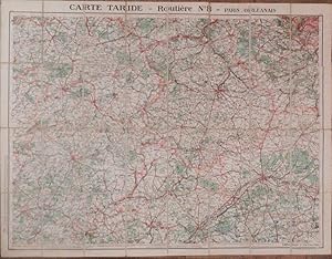
Carte Taride - Routiere No. 8 - Paris Orleanais.
FRANCE
From Arader Galleries - AraderNYC, New York, NY, U.S.A.
Seller rating 5 out of 5 stars
AbeBooks Seller since December 2, 2005
From Arader Galleries - AraderNYC, New York, NY, U.S.A.
Seller rating 5 out of 5 stars
AbeBooks Seller since December 2, 2005
About this Item
Fine folding chromolithographed map (28 x 36 inches) laid down on linen in 32 sections, printed paper covers on verso. A detailed road map of the area spanning Argentan in the northwest, Versailles in the northeast, Orleans in the southeast, Le Mans and Bauge in the southwest, roughly centered on Chartres. Seller Inventory # 72map328
Bibliographic Details
Title: Carte Taride - Routiere No. 8 - Paris ...
Publisher: Paris: Gaillac-Monrocq et Cie, ca 1920s
Store Description
We guarantee your satisfaction.
Shipping costs are based on books weighing 2.2 LB, or 1 KG. If your book order is heavy or oversized, we may contact you to let you know extra shipping is required.
Payment Methods
accepted by seller