DAWSON'S MAP OF THE DOMINION OF CANADA
[Canada]: [Dawson Brothers]
Published by Dawson Brothers, Montreal, 1872
Used
From
William Reese Company, New York, NY, U.S.A.
Seller rating 4 out of 5 stars
![]()
AbeBooks Seller since July 13, 2006
This specific copy is no longer available. Here are our closest matches for DAWSON'S MAP OF THE DOMINION OF CANADA.
About this Item
Description:
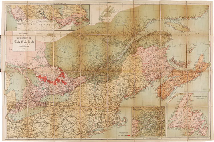
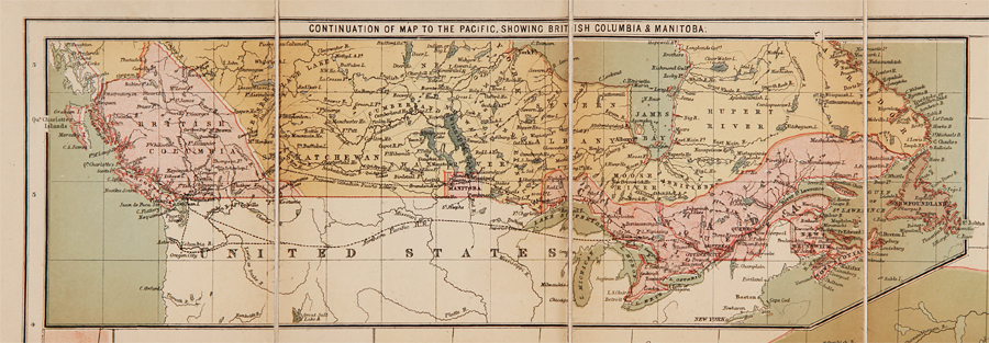
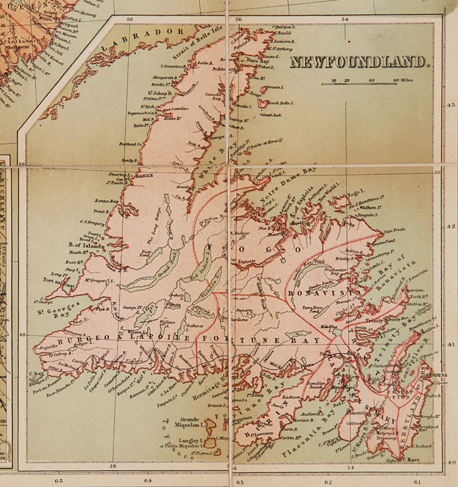
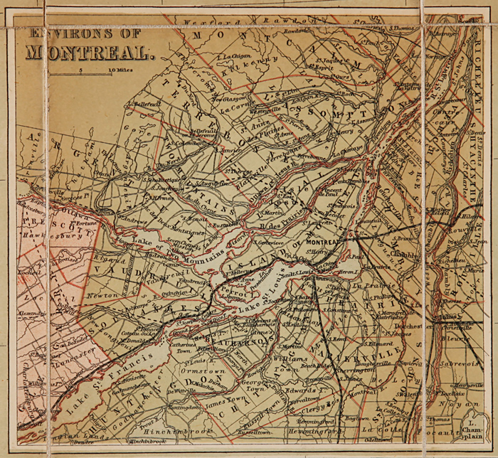
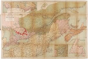
Colored folding map, 33 x 22 1/2 inches. Folded into original pebbled cloth. Front board detached. Bisected and mounted on linen, as issued. Old bookplate and withdrawal stamp on front pastedown, short closed tear along linen fold of upper outer section, not affecting map itself. A handsome, detailed folding map showing southeast Canadian territory including Cape Breton, and the Province of Quebec. Two small insets show Newfoundland and the environs of Montreal, and one larger inset extends to British Columbia and Manitoba. The map also provides details of the northeast United States, spanning from eastern Michigan all the way to New York Harbor. Also illustrated are railway routes completed and those under construction, and "Free Grant Lands" are identified by a color illustration. An interesting late 19th- century map of Canada, published only one year after western British Columbia joined the Canadian Confederation to help form the Canadian Pacific Railway. Seller Inventory # WRCAM39322
Bibliographic Details
Title: DAWSON'S MAP OF THE DOMINION OF CANADA
Publisher: Dawson Brothers, Montreal
Publication Date: 1872
Top Search Results from the AbeBooks Marketplace

Seller Image
Dawson's Map of the Dominion of Canada
Published by
Montreal, Montreal, 1888
Used
Hardcover
Seller: High Ridge Books, Inc. - ABAA, South Deerfield, MA, U.S.A.
Seller rating 5 out of 5 stars
![]()
Original cloth folder. Fine condition, full color in Canada by province. The main map shows to Lake Huron only, but inset maps show Manitoba and the rest of Western Canada to the Pacific. Other inset maps are of Montreal and Newfoundland. Seller Inventory # m00053
DAWSON'S MAP OF THE DOMINION OF CANADA.
Published by
Montreal: Dawson Brothers, 1872., 1872
Used
Seller: William Reese Company, New York, NY, U.S.A.
Seller rating 4 out of 5 stars
![]()
A handsome, detailed folding map showing southeast Canadian territory including Cape Breton, and the Province of Quebec. Two small insets show Newfoundland and the environs of Montreal, and one larger inset extends to British Columbia and Manitoba. The map also provides details of the northeast United States, spanning from eastern Michigan all the way to New York Harbor. Also illustrated are railway routes completed and those under construction, and "Free Grant Lands" are identified by a color illustration. An interesting late 19th-century map of Canada, published only one year after western British Columbia joined the Canadian Confederation to help form the Canadian Pacific Railway. Folded into original pebbled cloth. Front board detached. Bisected and mounted on linen, as issued. Old bookplate and withdrawal stamp on front pastedown, short closed tear along linen fold of upper outer section, not affecting map itself. Seller Inventory # 39322