About this Item
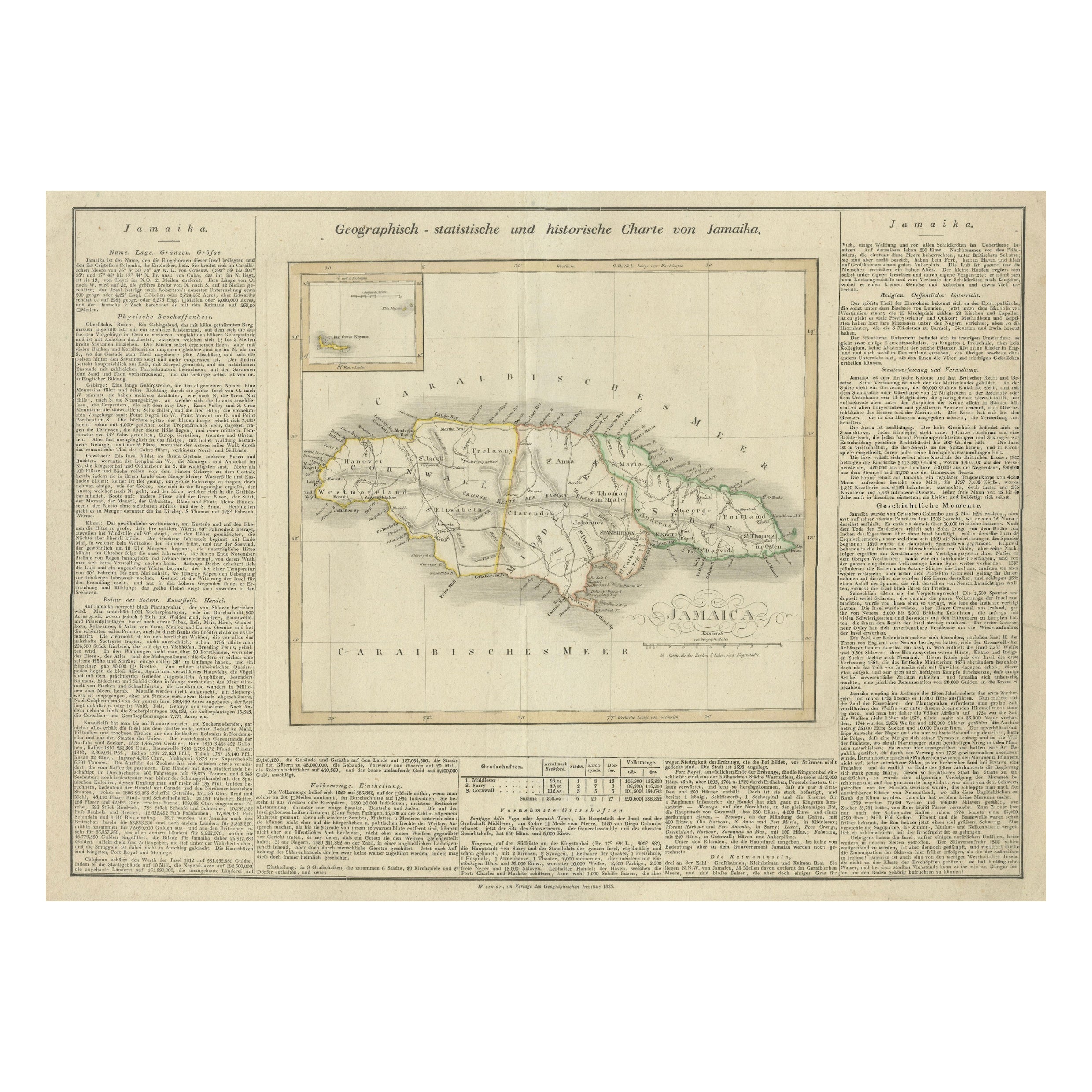
This map of Jamaica is an interesting historical document. This map is part of an atlas that was issued in six editions in English, French, and German between 1822 and 1827. This one is from a German edition. The map provides a detailed representation of Jamaica, including its various regions and towns. For its time, it was one of the most detailed maps available commercially. The extensive narrative text surrounding the map offers detailed information about Jamaica's climate, towns, soil, government, and history. This level of detail is valuable for historical and geographical research. The atlas being published in Weimar is noteworthy because Weimar was a center of cultural and intellectual activity in Germany during this period. Publishing an atlas in Weimar would have potentially given it a certain prestige and connection to the intellectual movements of the time. Maps from this atlas are increasingly rare in the market, making any surviving copies valuable to collectors and historians. The combination of detailed geographical information and extensive narrative text, along with the historical context of its publication, makes this map particularly interesting to researchers and collectors. The map not only provides a visual representation of Jamaica as it was known in the early 19th century but also offers insights into how the island was perceived and described by contemporary scholars. In conclusion, this map from the atlas is a fascinating artifact that offers a rich blend of cartographic detail and historical context, and its publication in Weimar adds an extra layer of cultural significance. The presence of English city names on the map of Jamaica can be attributed to several historical and practical reasons: 1. **British Colonial Rule**: Jamaica was a British colony from 1655 until its independence in 1962. During this period, English became the dominant language, and British influence permeated all aspects of Jamaican life, including place names. The cities, towns, and other geographical features were named or renamed in English, reflecting British administration and control. 2. **Intended Audience**: Even though the map is in German, the intended audience might have included German-speaking scholars, traders, or individuals with interests in British colonies. Including English place names would make the map more useful and relevant to them, as these were the official and commonly recognized names at the time. 3. **Standardization**: Maps often used the official names for places to ensure clarity and avoid confusion. Since Jamaica was under British rule, the English names were the official designations for the locations on the island. ### Conclusion The use of English city names on the map of Jamaica in a German atlas reflects the colonial history of Jamaica and the practical need to provide accurate and recognizable information to the map's users. It demonstrates how colonial influence persisted in the documentation and mapping of the region during that period. Identifying places on this historical map of Jamaica that have since changed names or are no longer in use can be quite fascinating. Here are a few notable examples: ### 1. **Port Royal** - **Historical Significance**: Once known as the "wickedest city on earth," Port Royal was a notorious pirate haven in the late 17th century. - **Current Status**: Much of Port Royal sank into the sea after a devastating earthquake in 1692. While the name Port Royal still exists, its prominence and physical structure have changed significantly. ### 2. **Spanish Town (formerly St. Jago de la Vega)** - **Historical Significance**: Originally the Spanish capital of Jamaica, St. Jago de la Vega was renamed Spanish Town by the British. - **Current Status**: Spanish Town remains an important historical site, but its prominence as a political center has diminished since Kingston became the capital. ### 3. **Savanna-la-Mar** - **Historical Significance**: This town was once a sign.
Seller Inventory # BG-13744-3
Contact seller
Report this item