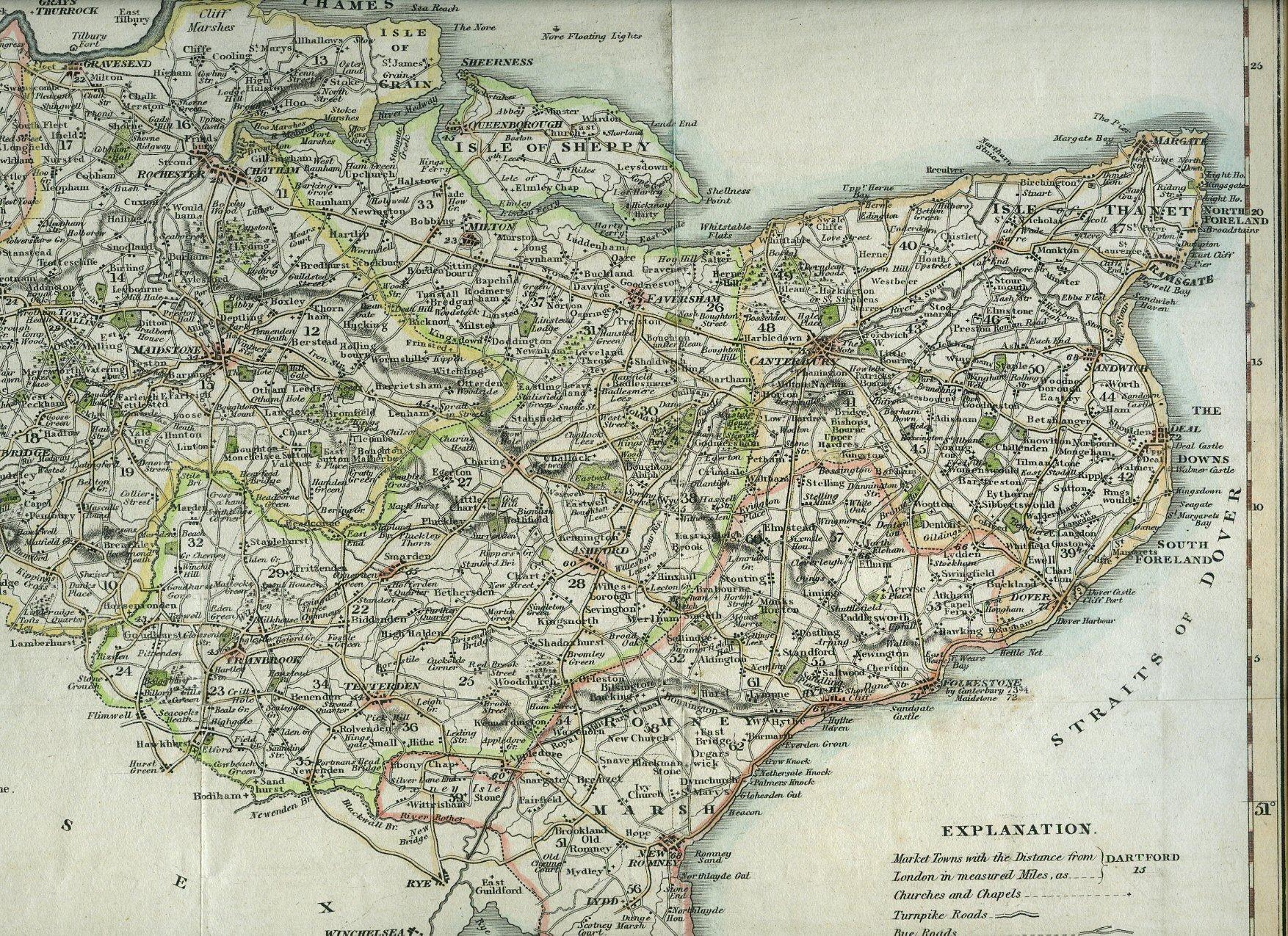
A Hand-Coloured Map of Kent 1829
Published by Published by G. Virtue, 26 Ivy Lane, London . London 1829., 1829
Condition: Used - Very good
Sold by Little Stour Books PBFA Member, Canterbury, United Kingdom
Association Member:
Heritage Bookseller
AbeBooks Seller since November 17, 1999
Seller rating 5 out of 5 stars
![]()
Used
Condition: Used - Very good
Price:
US$ 310.61
US$ 40.21 shipping
Ships from United Kingdom to U.S.A.
Ships from United Kingdom to U.S.A.
Quantity: 1 available
Add to basket