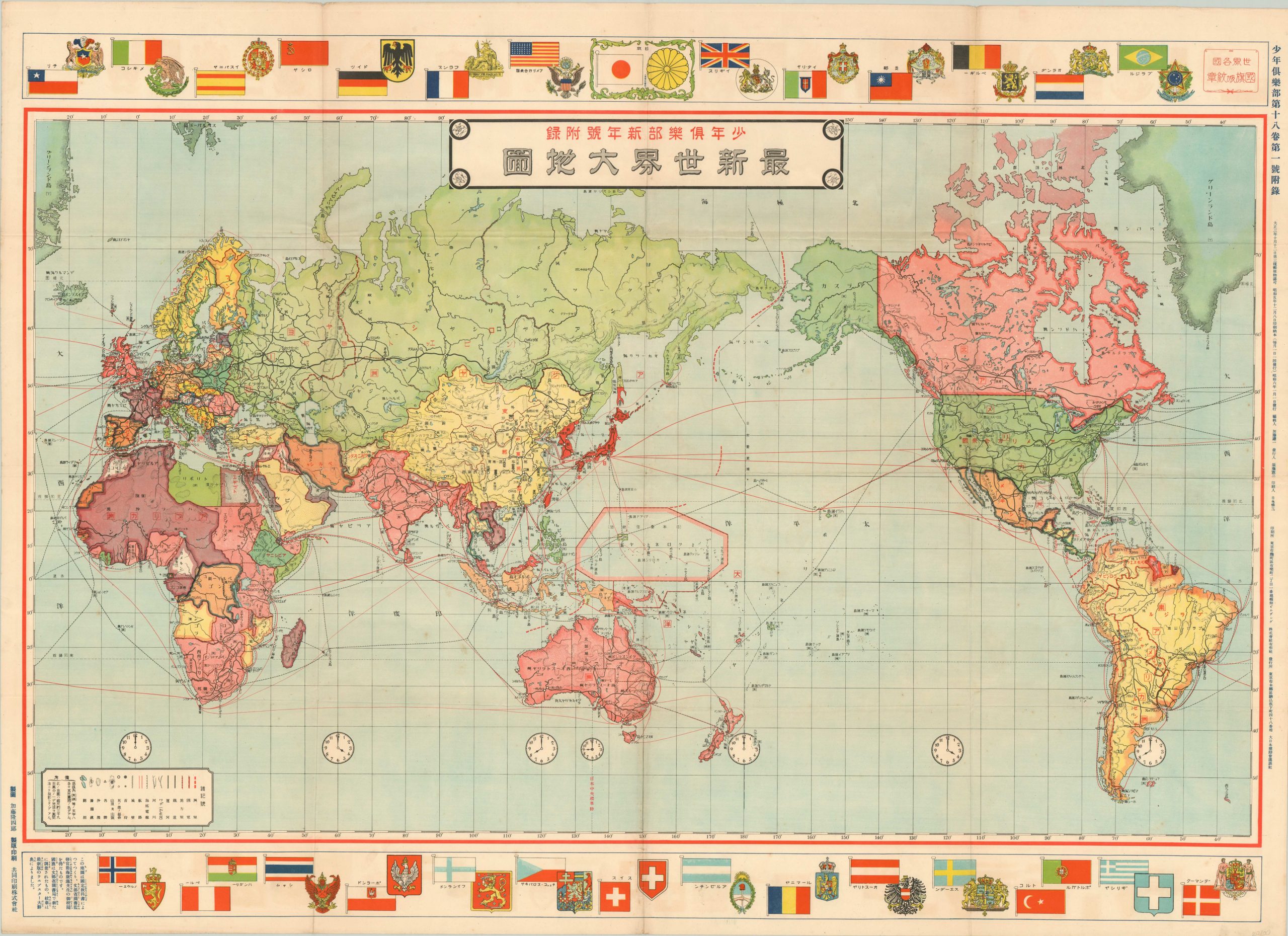
[Japanese World Map] - Japanese world map published during the interwar period, at a time of significant imperial expansion.
42.9
Sold by Curtis Wright Maps, Berwyn, IL, U.S.A.
Association Member:
AbeBooks Seller since February 15, 2023
Sold by Curtis Wright Maps, Berwyn, IL, U.S.A.
Association Member:
AbeBooks Seller since February 15, 2023
This large world map is a fascinating reflection on the Japanese efforts to put themselves on equal footing with various western powers in the years between the First and Second World Wars. The map is similar in cartographic style to more familiar western maps - with political affiliation highlighted in vibrant color and prominent transportation routes, geographic features, and economic resources labeled across the image. Time zones are also noted, though they would have been of little use to the majority of Japanese citizens at the time of publication. The Empire of Japan is highlighted in dark red, though the territorial extent does not include Chinese Manchuria, which would be invaded in 1931. Along the top and bottom of the sheets are various national ensigns and coats of arms, with the Rising Sun and Chrysanthemum taking the central spot, flanked by the United States and Britain - certainly a conscientious decision of the mapmaker. Sheet Height (in) 30.9 Condition B+ Light toning visible around the edges of the sheet and faint soiling in the lower right corner. Creasing and minor wear along originally issued fold lines, and a few tiny scattered spots throughout the image. Remains in very good condition.
Seller Inventory # 2700
| Order quantity | 5 to 14 business days | 3 to 6 business days |
|---|---|---|
| First item | US$ 12.00 | US$ 18.00 |
Delivery times are set by sellers and vary by carrier and location. Orders passing through Customs may face delays and buyers are responsible for any associated duties or fees. Sellers may contact you regarding additional charges to cover any increased costs to ship your items.