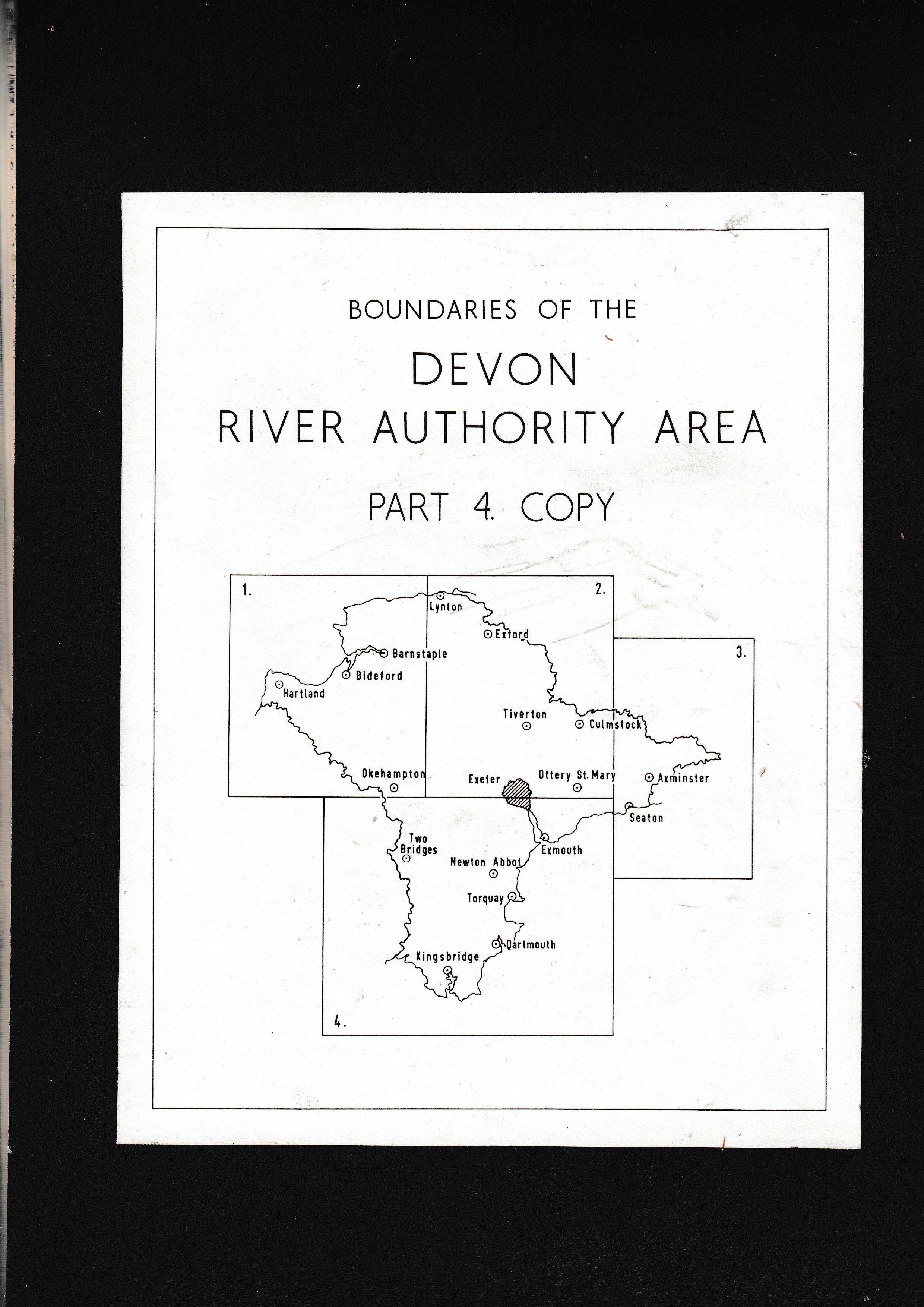
Map. Boundaries of the Devon River Authority Area. Part 4.
Sold by The Sanctuary Bookshop., Lyme Regis, United Kingdom
AbeBooks Seller since July 21, 2000
Used - No Binding
Condition: Used - Near fine
Quantity: 1 available
Add to basketSold by The Sanctuary Bookshop., Lyme Regis, United Kingdom
AbeBooks Seller since July 21, 2000
Condition: Used - Near fine
Quantity: 1 available
Add to basketThis a magnificent heavy linen-backed map. Measuring 110 x 128 cm when fully open (Image 2). Dissected into 18 panels each 22 x 36 cm (Image 1 & 2). The area covered stretches Westwards from Two Bridges to just before Seaton Eastwards (see 2nd Image, which shows our Quadrant 4 on the cover). One internal section, 22 x 36 cm, is signed in blue ink by a "J. Crooks", as: "A True copy under the Water Resources Act of 1963" (Image 3). More information on request. Thank You.
Seller Inventory # 007232
All books listed for sale are guaranteed as described, or better, and may be returned within seven days, if unsatisfactory for any reason. We endeavour to ship all purchases books within two working days of receipt of payment. Post and packing and any additional instructions, such as insurance, are extra at cost. Overseas purchasers, please specify your shipping preference. We accept UK Sterling Cheques, UK Sterling Bank Drafts, Paypal, and most Credit Cards, including Visa, Mastercard, Switch, ...
More InformationShipping costs are based on books weighing 2.2 LB, or 1 KG. If your book order is heavy or oversize, we may contact you to let you know if there are extra shipping costs.