About this Item
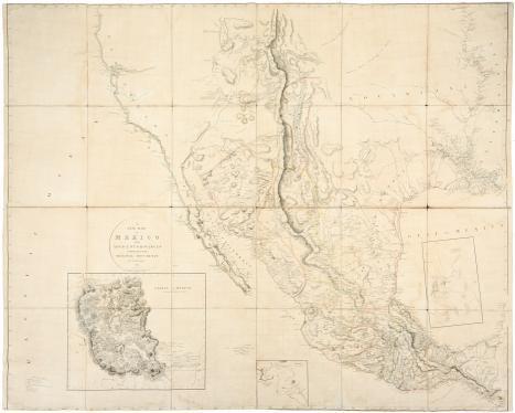
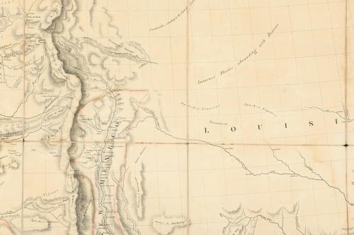
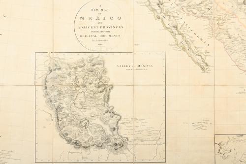
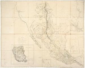
ARROWSMITH, Aaron (1750-1823). A New Map of Mexico and Adjacent Provinces Compiled from Original Documents by A. Arrowsmith 1810. London: A. Arrowsmith 10 Soho Square, 5th October 1810. Fine folding engraved map (51 x 83 4/8 inches), in 24 sections laid down on cartographic linen. Showing Mexico, extending in the east from the Mississippi Delta to the Pacific Ocean in the west; and north-south from 42� to 15�, thus including present Texas and the Southwest and California to above Mendocino, with 3 insets (some browning). Provenance: from the important cartographical library of Warren Heckrotte, his sale, Rare Cartography, Exploration and Voyages, Part I, 29th October, 2015, lot 107 The most accurate and important map of Texas in the first quarter of the 19th century First issue, stating that Arrowsmith is Hydrographer to H.R.H. the Prince of Wales, rather than to His Majesty, and the eastern boundary of Texas running along the Mermento River, as first delineated by Alexander von Humboldt, beginning "about a hundred miles east of the mouth of the Salinas, or well into Louisiana, at the mouth of what is called the Mermento River, and then runs northeast along that river and then northwest to only a little above the 32nd parallel, and then runs slightly south of west, with San Saba around 100 miles beyond the boundary" (Streeter 1046D). This was the first large-scale map to depict the important discoveries of Pike and Humboldt in the Southwest, and it became the most influential and widely copied map of the region of its the era. The boundary of Texas follows Humboldt's lines. "By combining the best parts of Humboldt's and Pike's maps and avoiding their errors, and by adding his own new information, Arrowsmith contributed a significantly improved depiction of the region" (Martin & Martin 25). The insets are: Valley of Mexico from Mr. Humboldt's Map Vera Cruz Acapulco. Warren Heckrotte writes that "Arrowsmith shows the route of the Dominguez - Escalante expedition. I know of no earlier representation of this expedition. Humboldt did not show it. Where did Arrowsmith get this information? I have the first three issues: this one, the original; additions to 1815, in the atlas to Thomson's Alcedo; and additions to 1816, removed from a copy of the atlas.There is an issue, additions to 1817 and the last issue, ca 1820. I have not determined what changes or additions Arrowsmith made." One of the first great British cartographers of North America, Arrowsmith introduced a new standard of excellence in mapmaking in the late 18th century and almost single-handedly made London the center for the cartographic trade. Arrowsmith built his great success on this ability to attract both commercial and general viewers through his combination of visual and scientific appeal. The most influential and respected map publisher of the late 18th and early 19th centuries, Arrowsmith issued maps that were the result of careful synthesis rather than systematic, scientific inquiry. His role in cartographic production was to gather the best available information from a wide variety of sources, weigh the relative merits of conflicting data, and compile the most accurate depiction possible of an area. Arrowsmith accomplished this synthesis better than any other commercial mapmaker of his day and, as a result, his maps were the most sought after and highly prized on three continents.
Seller Inventory # 72map395
Contact seller
Report this item
