Texas and the Indian Territory
O.W. Gray & Son
Publication Date: 1877
Used
From
Art Source International Inc., Boulder, CO, U.S.A.
Seller rating 3 out of 5 stars
![]()
AbeBooks Seller since July 13, 2001
This specific copy is no longer available. Here are our closest matches for Texas and the Indian Territory by O.W. Gray & Son.
About this Item
Description:
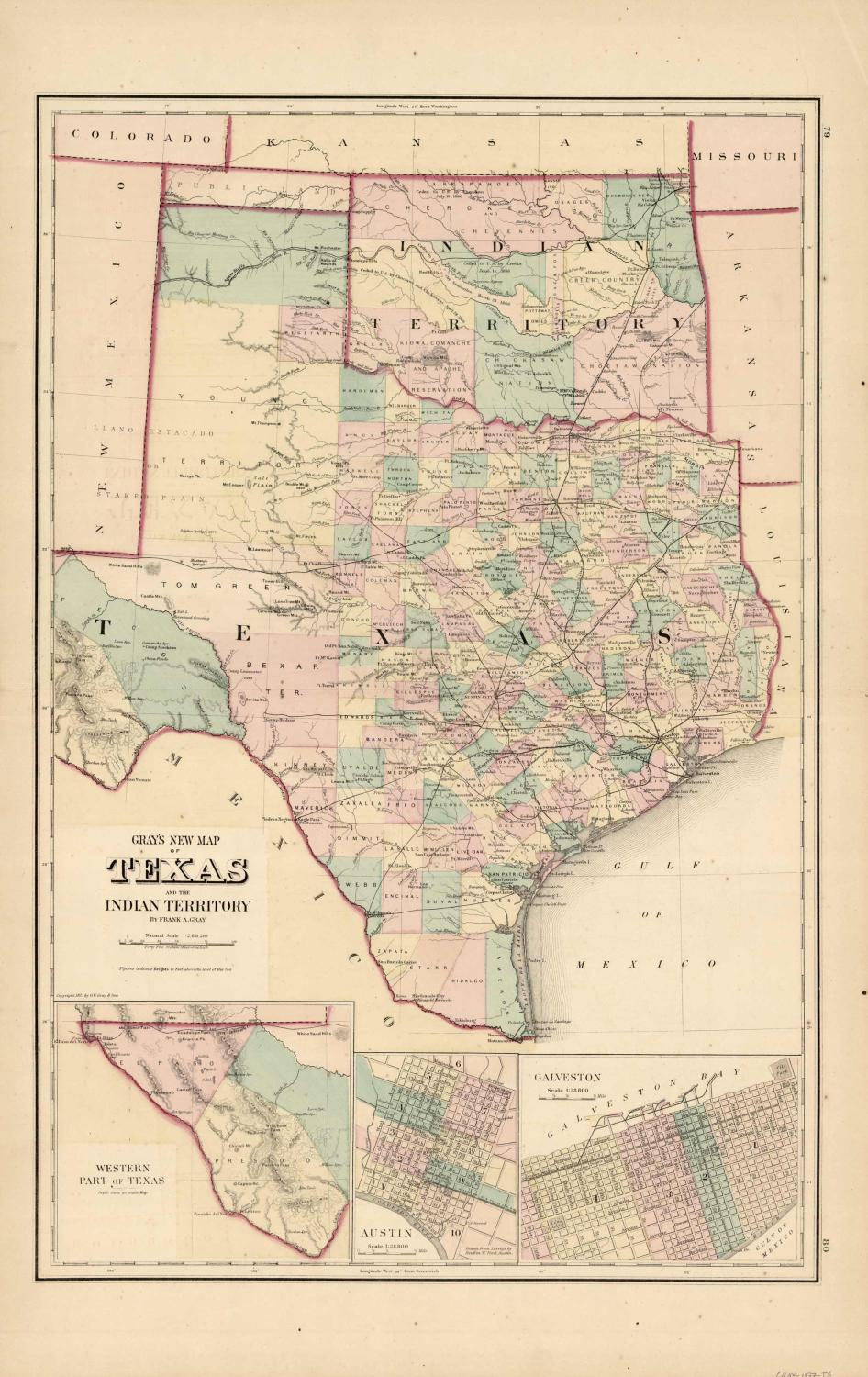
This hand colored map was made by O.W.Gray in 1877. Regions are distinguished by color. Other details include rivers, lakes, mountains, railroads, and the names of regions. This map measures 16.5 by 25 inches. Seller Inventory # 58337
Bibliographic Details
Title: Texas and the Indian Territory
Publication Date: 1877
Top Search Results from the AbeBooks Marketplace

Seller Image
Gray's 1876 Map of Texas and the Indian Territory
Used
Seller: Art Source International Inc., Boulder, CO, U.S.A.
Seller rating 3 out of 5 stars
![]()
This remarkable map of Texas and the Indian Territory was issued as part of Ormando W. Gray�s �Atlas of the United States with General Maps of The World Accompanied by Descriptions Geographical, Historical, Scientific and Statistical�. O.W. and various partners published atlases from around 1871 �" 1889. We love his maps and the wonderfully precise hand-coloring he and his firm turned out. This map measures 17 inches by 28.5 inches. Seller Inventory # 58638
Quantity: 1 available
Seller Image
Grays New Map of Texas and the Indian Territory'
Used
Seller: Art Source International Inc., Boulder, CO, U.S.A.
Seller rating 3 out of 5 stars
![]()
This hand colored map is from "The National Atlas, containing Elaborate Topographical Maps of the United States and the Dominion of Canada, with Plans of Cities and General Maps of the World", published by O.W. Gray in 1886. This map measures 23 inches by 15 inches. Seller Inventory # 58820
Quantity: 2 available
Seller Image
Grays New Map of Texas and the Indian Territory'
Used
Seller: Art Source International Inc., Boulder, CO, U.S.A.
Seller rating 3 out of 5 stars
![]()
This hand colored map is from "The National Atlas, containing Elaborate Topographical Maps of the United States and the Dominion of Canada, with Plans of Cities and General Maps of the World", published by O.W. Gray in 1880. This map measures 26.5 inches by 17.25 inches. Seller Inventory # 58796
Quantity: 1 available