
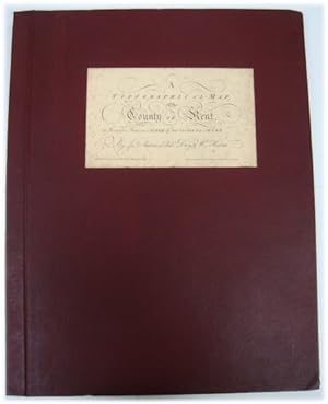
A Topographical Map of the County of Kent in Twenty Five Sheets, on a Scale of Two Inches to a Mile, from an Actual Survey; in Which are Expressed All the Roads, Lanes, Churches, Towns, Villages, Noblemen and Gentlemens Seats, Roman Roads, Hills, Rivers.
Andrews, J
Published by Harry Margary, Lympne Castle, Kent, 1968
Condition: Used - Very good
Hardcover
Sold by PsychoBabel & Skoob Books, Didcot, United Kingdom
AbeBooks Seller since October 6, 2003
Seller rating 5 out of 5 stars
![]()
Used - Hardcover
Condition: Used - Very good
Price:
US$ 345.24
US$ 16.76 shipping
Ships from United Kingdom to U.S.A.
Ships from United Kingdom to U.S.A.
Quantity: 1 available
Add to basket