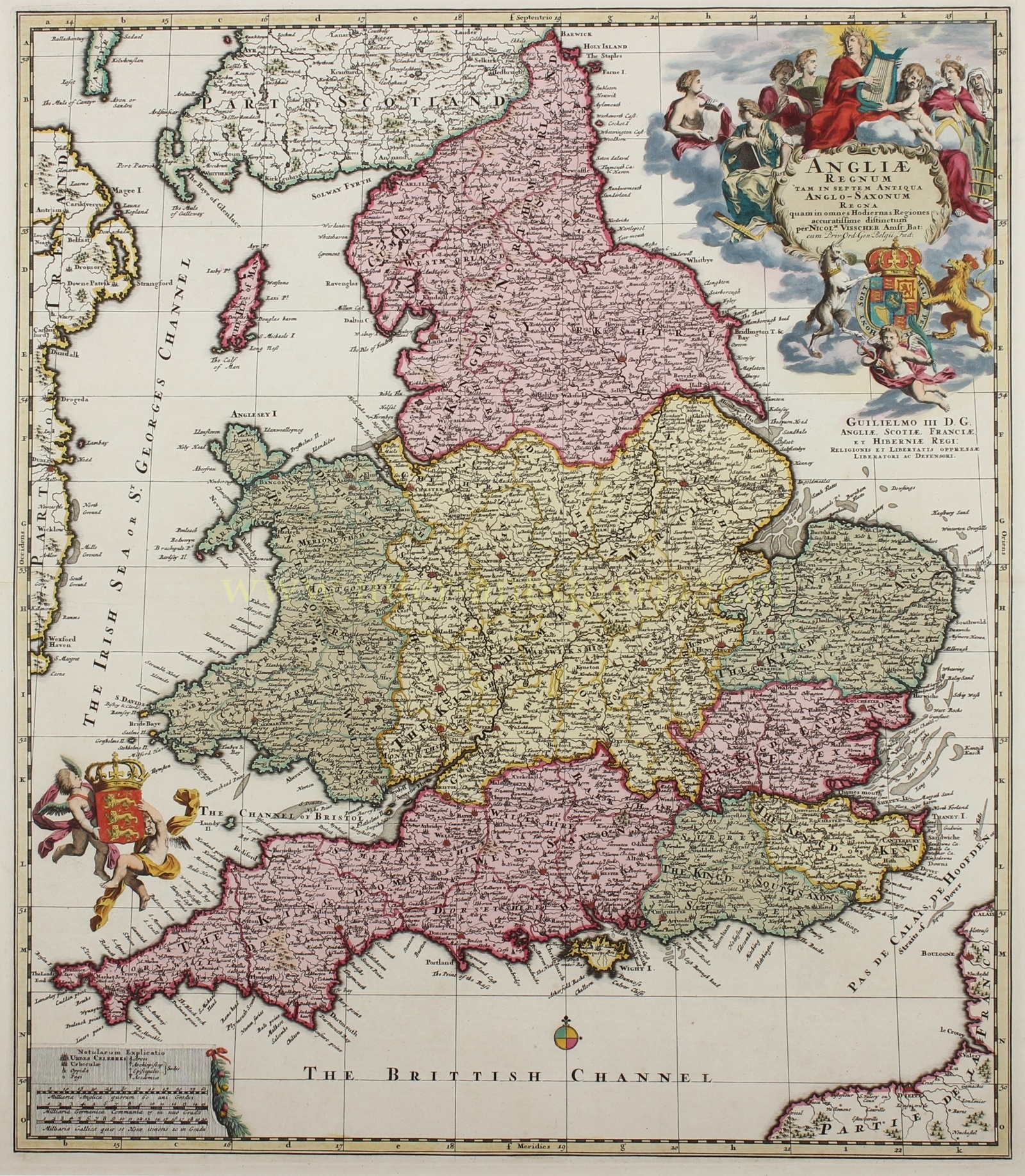
England - Nicolaas Visscher, c
Visscher II-- Nicolaes
Sold by Inter-Antiquariaat Mefferdt & De Jonge, Amsterdam, Netherlands
Association Member:
AbeBooks Seller since November 19, 2019
Used
Quantity: 1 available
Add to basketSold by Inter-Antiquariaat Mefferdt & De Jonge, Amsterdam, Netherlands
Association Member:
AbeBooks Seller since November 19, 2019
Quantity: 1 available
Add to basketTHE KINGDOM OF ENGLAND IN THE 17TH CENTURY "Angliae Regnum tam in Septem Antiqua Anglo-Saxonum Regna quam in Omnes Hodiernas Regiones Accuratissime Distinctum" [The Kingdom of England very accurately depicted both into the seven ancient Anglo-Saxon Kingdoms and into all present regions.] Copper engraving published by Nicolaes Visscher II around 1690. With original hand colouring. Size: 49 x 56.1 cm. Nicolas Visscher II's beautiful map of England is a fascinating blend between a historical and modern map. The kingdom of England emerged from the gradual unification of the early medieval Anglo-Saxon kingdoms known as the Heptarchy: East Anglia, Mercia, Northumbria, Kent, Essex, Sussex, and Wessex. The map shows these seven kingdoms, but also depicts the contemporary counties. After a series of conflicts between the Dutch and the English, it was the Glorious Revolution (1686-1688) that made Dutch stadholder William of Orange king of England. Relationships between both countries at the end of the 17th century were therefore very good. Dutch publisher Nicolaes Visscher praised the new English king with this map. It would take almost a century before a next Anglo-Dutch war. The map is dense with the names of towns and cities, with post roads delineated throughout. At top right there is an elaborate title cartouche with several allegorical figures flocked around Saint Cecilia and her lyre; below is the royal arms and a dedication to William III. The cartouche is signed by draftsman Philip Tideman and engraver Gilliam van der Gouwen. Another cartouche at bottom left includes a key and three distance scales, and two putti hoist the royal arms of England at left. Price: Euro 550,- (incl. frame).
Seller Inventory # 26126
Terms of sale
We are certified members of the NVvA (Dutch Association of Antiquarian Booksellers) and the ILAB and sell maps, prints and drawings according to the terms of these organisations.
General Terms of Sale of the NVvA
1.2 The applicability of any terms or...
More InformationPrices are in euro; shipping and insurance cost is extra. Items remain our property until paid in full. Shipping of items after receipt of payment. Preferred method of payment: bank transfer or credit cards [credit cards cost 2% extra]. Return policy: with notification, within 30 days after delivery date, full refund. The risk of returning items is for the account of the sender.