
Order Total (1 Item Items):
Shipping Destination:

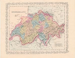
Switzerland Map (17 results)
Skip to main search results
Product Type
- All Product Types
- Books (16)
- Magazines & Periodicals
- Comics
- Sheet Music
- Art, Prints & Posters
- Photographs
- Maps (1)
-
Manuscripts &
Paper Collectibles
Condition
- All Conditions
- New
- Used
Binding
Collectible Attributes
- First Edition (2)
- Signed
- Dust Jacket
- Seller-Supplied Images (3)
- Not Printed On Demand
Seller Location
Seller Rating
-

A Handbook to Switzerland: Eighth Edition - Revised
Published by Ward, Lock and Co., Limited, London, Melbourne, 1111
Book
Hardcover. Condition: Fair. with general and railway maps of Switzerland; Five district maps and plans of Bale, Zurich, Lucerne, Berne, Lausanne and Geneva (illustrator). 5th or later Edition. Undated edition. Firmly bound, pink cloth boards. Fading and a few marks on spine. Wear on the top and bottom ends of the spine. Front fold out map badly torn. No jacket.
-
TOOGRAPHISCHER ATLAS DER SCHWEIZ - LUZERN [POCKET MAP]
Published by Schweixerische Landestopogaphie, Bern, 1917
Pamphlet. Condition: Very Good. Lge Color FoldOut Map (23 X 32 Inches), Folds to 5.25 7.5 Inches, Blue Illus Paper Covers, owner namestamps else VG (Scale 1:25,000).
-
SWITZERLAND, AN ANTIQUE MAP CIRCA 1860
Published by LONDON PRINTING AND PUBLISHING COMPANY, London, 1860
Seller: K Books Ltd ABA ILAB, York, YORKS, United Kingdom
Association Member: ABA ILAB PBFA
Seller Rating:

Book First Edition
Single Sheet Engraving. Condition: Very Good. No Jacket. First Edition. SWITZERLAND, AN ANTIQUE MAP CIRCA 1860. MEASURES 13 X 10 INCHES, ELABORATE BORDER, CIRCA 1860. DISPATCH WELL PACKED ROLLED IN A STRONG TUBE, VERY GOOD CONDITION, SPLENDID VALUE.
-
Map, Antique of Switzerland - 19th Century
Publication Date: 1880
Seller: K Books Ltd ABA ILAB, York, YORKS, United Kingdom
Association Member: ABA ILAB PBFA
Seller Rating:
Book
No Binding. Condition: Very Good. An antique map, very good condition. Mounted - matted - and ready to frame. Mount size approx 12 x 10 inches, 36 x 30 cms. Original contemporary colouring. Circa 1880. Very detailed - Shows - Switzerland l - and coloured - attractive and reasonably priced - quite detailed.
-
MANOVERKARTE FUR DIE DIVISIONS UND BIRGADEUBUNGEN VI. - VILL. DIVISION IMP SEPTEMBER 1891
Publication Date: 1891
Seller: Xerxes Fine and Rare Books and Documents, Glen Head, NY, U.S.A.
Seller Rating:
Condition: VG. 1891 Eidg. Topographisches Bureau. The main cities in this area of Switzerland are Frauenfeld and Winterthur. Map is 21 x 30 inches, in Color. Each section of map is mounted on linen. VG.
-
GENERALKARTE DER SCHWEIZ BLATT I. NORDWESTLICHES VIERTEL
Publication Date: 1881
Seller: Xerxes Fine and Rare Books and Documents, Glen Head, NY, U.S.A.
Seller Rating:
Condition: VG. 1881 Eidg. Topographisches Bureau. Monochrome map, 21 x 30 inches. Each section of map is mounted on linen. Small owner name on front cover. VG.
-
GENERALKARTE DER SCHWEIZ BLATT I. NORDWESTLICHES VIERTEL
Publication Date: 1871
Seller: Xerxes Fine and Rare Books and Documents, Glen Head, NY, U.S.A.
Seller Rating:
Condition: VG. 1871 Eidg. Topographisches Bureau. Map is 21 x 30 inches. In black and white. Each section of map is mounted on linen. Small owner name on front. VG.
-
Map of Switzerland - an Original Engraving
Seller: K Books Ltd ABA ILAB, York, YORKS, United Kingdom
Association Member: ABA ILAB PBFA
Seller Rating:
Book
No Binding. Condition: Very Good. A fine Engraving - printed circa 1870. Mounted and ready to frame. A fine opportunity to purchase an attractive and decorative engraved Map of Switzerland.
-
Switzerland - Detailed Map Showing Roads, Towns , Explanation of the Signs Etc - an Original Antique Engraved Map
Published by George Virtue, 1836
Seller: K Books Ltd ABA ILAB, York, YORKS, United Kingdom
Association Member: ABA ILAB PBFA
Seller Rating:
Book
No Binding. Condition: Very Good, Some Folds Showing. Engraved By Starling (illustrator). An original antique engraved map, printed circa 1836. Hand-colouring not contemporary but delicately and expertly executed. Mounted and ready to frame. A fine opportunity to purchase an attractive and decorative map - Switzerland - Detailed Map Showing Roads, Towns , Explanation of the Signs.
-
Switzerland - Antiquarian Coloured Map
Published by H.G.Collins, London
Seller: K Books Ltd ABA ILAB, York, YORKS, United Kingdom
Association Member: ABA ILAB PBFA
Seller Rating:
Book
No Binding. Condition: Very Good. An original antique map of Switzerland, ca. 1860. Mounted and ready to frame. Contemporary Colouring in outline. In excellent condition, decorative and impressive.
-

Original Hand-Colored Gray's New Map of Spain and Portugal By Frank A. Gray (and) Map of Germany Austria and Switzerland
Published by O.W. Gray & Son, Philadelphia, PA, 1882
First Edition
Not Bound. Condition: Very Good. Map. One sheet, printed with 2 maps, from the 1882 O.W. Gray National Atlas, New York Edition: Gray's New Map of Spain and Portugal by Frank A. Gray, copyright date of 1878, with inset Environs of Madrid, Gibraltar, Environs of Lisbon (and) Germany Austria and Switzerland. With hand-coloring in pastel tones and red border outlining. Approx. 14 3/8" x 17 1/4" overall size; a little even toning to the paper; couple of small nicks at edges; tiny corner bend; in very good condition.
-

Soft cover. Condition: Fine. No Jacket. One full page colour illustration of 16th c. Ptolemaeus Atlas (first published map of Switzerland) (illustrator). 518 Lots described in this impressive catalogue, including our most important edition of Ptolomy and the most important Atlas of the 16th c. (1513) . See Index for geographical coverage in catalogue. Condition is Fine and catalogue is not annotated.
-
Switzerland Map Antique Map
Publication Date: 1756
Seller: K Books Ltd ABA ILAB, York, YORKS, United Kingdom
Association Member: ABA ILAB PBFA
Seller Rating:
Book
No Binding. Condition: Very Good. Antique map . Hand coloured, engraved map. mounted - matted - and ready to frame .12 x 10 inches. a vg copy of an attractive decorative hand coloured antique map. . A splendid map, colouring not contemporary but delicately and expertly done - a fine map of Switzerland - entitled 'Carte Des 13 Cantons Suisses - fine cartouche.
-
Switzerland
Published by Charles Desilver, Philadelphia, 1856
Seller: Main Street Fine Books & Mss, ABAA, Galena, IL, U.S.A.
Association Member: ABAA ILAB MWABA
Seller Rating:
Map
[14�" X 12" (image 12" X 10"). Hand colored. Very good. Light foxing; minor mounting traces on verso. Lovely, beautifully multi-colored colored example with sharp ornamental border.
-
Blatt - Feuille XVII. Topographische Karte der Schweiz (Dufourkarte) Carte topographique de la Suisse (Carte Dufour) 1: 100000.
Seller: Michael Graves-Johnston, ABA, ILAB, London, United Kingdom
Seller Rating:
Uberdruck, 2 Farben. Bern: Eidg. Landestopographie, Service topographique federal, 1923 Folding map backed on linen discected into 18 segements. A very nice copy. We have been selling antiquarian books on Africa, Oceania, archaeology, anthropology, travel and the ancient world for over forty years. All our books are carefully catalogued and they are in excellent condition unless stated in the description. All shipments are fully insured at our expense. All books are carefully packaged and despatched by registered or recorded mail, or by a courier service; the customer is always able to track their shipment. All sales are accompanied by a VAT invoice. [ ].
-
Topographischer Atlas der Schweiz 1: 50,000. Zweisimmer-Gemmi.
Seller: Michael Graves-Johnston, ABA, ILAB, London, United Kingdom
Seller Rating:
Bern: Schweiz. Landestopographia, 1924 Coloured folding map, linen backed and discected into 18 sections. A very nice copy. We have been selling antiquarian books on Africa, Oceania, archaeology, anthropology, travel and the ancient world for over forty years. All our books are carefully catalogued and they are in excellent condition unless stated in the description. All shipments are fully insured at our expense. All books are carefully packaged and despatched by registered or recorded mail, or by a courier service; the customer is always able to track their shipment. All sales are accompanied by a VAT invoice. [ ].
-
Chateau d'Oex-Col des Mosses. Echelle 1:25000.
Seller: Michael Graves-Johnston, ABA, ILAB, London, United Kingdom
Seller Rating:
Berne: Edite pour le Ski-Club Alpina Chateau d'Oex par le Service topographique federal, 1927 Coloured folding map backed on linen discected into 24 segements. A very nice copy. We have been selling antiquarian books on Africa, Oceania, archaeology, anthropology, travel and the ancient world for over forty years. All our books are carefully catalogued and they are in excellent condition unless stated in the description. All shipments are fully insured at our expense. All books are carefully packaged and despatched by registered or recorded mail, or by a courier service; the customer is always able to track their shipment. All sales are accompanied by a VAT invoice. [O].
