Order Total (1 Item Items):
Shipping Destination:

Barrott H N (2 results)
Feedback
Skip to main search results
Search filters
Product Type
- All Product Types
- Books (2)
- Magazines & Periodicals (No further results match this refinement)
- Comics (No further results match this refinement)
- Sheet Music (No further results match this refinement)
- Art, Prints & Posters (No further results match this refinement)
- Photographs (No further results match this refinement)
- Maps (No further results match this refinement)
- Manuscripts & Paper Collectibles (No further results match this refinement)
Condition
Binding
- All Bindings
- Hardcover (2)
- Softcover (No further results match this refinement)
Collectible Attributes
- First Edition (No further results match this refinement)
- Signed (No further results match this refinement)
- Dust Jacket (No further results match this refinement)
- Seller-Supplied Images (2)
- Not Print on Demand (2)
Free Shipping
- Free Shipping to U.S.A. (No further results match this refinement)
Seller Rating
-
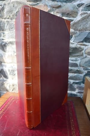
An Atlas of Old Edinburgh
Published by West Port Books / Andrew Elliot, Edinburgh, 2008
ISBN 10: 0954301021 ISBN 13: 9780954301026
Half Leather Hardback. Condition: New. Second, Revised Edition. 2008. vii + 131pp. Original half brow leather with gilt titles and 5 raised bands to spine"The development and history of a city is most graphically portrayed through its maps. Edinburgh is fortunate in the work of its early cartographers and is one of the better mapped cities of Europe. The first publication of this atlas in 2000 was highly succesful and in response to demand we present this second and revised edition containing new maps and improved presentation. Part One of the atlas is a collection of most of the classic city views and maps beginning with the earliest recorded, that of the English occupation in 1544. It includes the map of the city siege of 1573, the splendid bird's eye view of the Rev. Robert Gordon in 1647, the first proper map by James Edgar in 1742, James Craig's proposed New Town in 1767, John Ainslie's map of 1780 together with many others. Part Two of the atlas presents the city in sixty sections and in more detail. A new and innovative method of presentation has been used. The available antique maps have been rescaled and reorientated to exactly the same scale and orientation and for each section alternative and directly comparable maps of the different periods are provided. For the older central areas up to eight successive maps are provided for each section and for the nineteenth century extensions two-three maps per section. It is thus possible to trace in detail the development of any particular area.". Heavy book so extra postage will be required for non-UK customers. NEW BOOK.
-
An atlas of Edinburgh.
Published by [Edinburgh]: West Port Books, 2000., 1791
Seller: Spike Hughes Rare Books ABA, Innerleithen, United Kingdom
Seller rating 5 out of 5 stars

Folio, pp.[i11] - vii, [3], 135, [1] blank, being a collection of various plans of the city from the earliest examples, half publisher's brown calf, gilt, cloth sides, a fresh copy. One of the copies issued in a half calf binding. [Extra charges required for overseas].