
Order Total (1 Item Items):
Shipping Destination:

Christos Zacharakis (7 results)
Skip to main search results
Product Type
- All Product Types
- Books (7)
- Magazines & Periodicals
- Comics
- Sheet Music
- Art, Prints & Posters
- Photographs
- Maps
-
Manuscripts &
Paper Collectibles
Condition
Binding
Collectible Attributes
- First Edition
- Signed
- Dust Jacket (4)
- Seller-Supplied Images (3)
- Not Printed On Demand
Free Shipping
Seller Location
Seller Rating
-

A Catalogue of Printed Maps of Greece 1477-1800
Published by A.G. Leventis Foundation, Nicosia, Cyprus, 1982
Seller: Arader Galleries of Philadelphia, PA, Philadelphia, PA, U.S.A.
Seller Rating:

Softcover. Condition: Very Good. Dust Jacket Condition: Good. Soft cover book in very good condition. Dust jacket in good condition. 469pp. Tight spine with clean text.
-
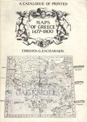
CATALOGUE OF PRINTED MAPS OF GREECE 1477-1800.|A
Published by (A.G. Leventis Foundation), Nicosia, 1982
Seller: Oak Knoll Books, ABAA, ILAB, NEW CASTLE, DE, U.S.A.
Seller Rating:
4to. dust wrapper, stiff paper wrappers. xv, 469; 15+(1) pages. This catalogue covers a period of more than 300 years of printed European cartography concerning Greece. With over 2,000 maps listed alphabetically by the makers' names, and 500 black-and-white illustrations. Bibliography and an index. Dust wrapper is torn at the edges and spine ends, with a piece missing at the top edge of the back cover. Spine is bumped at the head and tail. Laid-in is a 15-page pamphlet limited to 2,000 copies as addendum et corrigendum to the catalogue. Slight rubbing to the wrappers. dust wrapper, stiff paper wrappers.
-
A Catalogue of printed Maps of Greece 1477-1800.
Published by Nicosia., 1982
Seller: Biblion Antiquariat, Z�rich, ZH, Switzerland
Association Member: GIAQ ILAB VEBUKU
Seller Rating:
4�. XV, 469 S., viele Abb. OKart. Sch�nes Exemplar. Massgebliches Werkverzeichnis der griechischen Kartographie. Sprache: englisch.
-
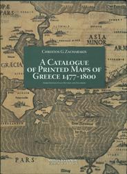
CATALOGUE OF PRINTED MAPS OF GREECE 1477-1800.|A
Published by Sylvia Ioannou Foundation, Athens, 2009
Seller: Oak Knoll Books, ABAA, ILAB, NEW CASTLE, DE, U.S.A.
Seller Rating:
cloth, dust jacket. 9.75 x 13.25 inches. cloth, dust jacket. 358 pages. In its third edition, this catalogue covers a period of more than 300 years of printed European cartography concerning Greece. With nearly 4,000 maps listed alphabetically by the makers names and 500 black-and-white illustrations, this is the most inclusive cartographical bibliography produced about Greece from the period of 1477 to 1800. Maps are listed in alphabetical order under the name of the particular cartographer, publisher, and engraver. Variant maps also show some of the inaccuracies of the time including the Ptolemaic style of cartography for Greece. An area of special attention is the Eastern Mediterranean basin, which has been the center of the civilized European world for many centuries. The cartographic descriptions of the region were especially necessary during ancient times, and relevant maps of the area were followed up and developed by the efficient Byzantine administration. Such rich material was later used by European cartographers of the sixteenth, seventeenth, and eighteenth centuries. Like any other scientific and artistic activity of the period under review, cartography was influenced by the intense interest in Greece and enhanced by the revival of Greek culture and the flourishing of classical studies during and after the Renaissance. Available in Greece & the UK from AdVenture Publishing.
-

A Catalogue of Printed Maps of Greece 1477-1800
Published by AdVenture SA Publications, Atene, 2009
ISBN 10: 9608779243ISBN 13: 9789608779242
Book
Couverture rigide. Condition: Neuf. Dust Jacket Condition: Neuf. 3�me �dition. A CATALOGUE OF PRINTED MAPS OF GREECE 1477-1800 Christos G. Zacharakis 3rd edition (Athens 2009), fully revised and enlarged, with 3.910 entries and 2.000 pictures. The only cartobibliographical book about Greece and the surrounding area. It features Mainland Greece, the Archipelago, the Ionian Sea, Crete and Cyprus with its surrounding area. Maps of the Middle East depicting Cyprus and maps of the Balkans including parts of the Greek regions are also being presented for the first time. Hardcover, 34 x 25 cm, 358 pages. ISBN: 978-960-87792-4-2. Published by AdVenture Publications. RRP: ?200.00 Language : english text Codice della LIbreria 010880 Size: 340 x350 mm.
-

A Catalogue of printed Maps of Greece 1477-1800. Zacharakis, Chr
Published by Zacharakis Christos, 1982
Book
Hardcover. Condition: Gut. A Catalogue of printed Maps of Greece 1477-1800. Zacharakis, Christos G. Verlag: Nicosia, 1982 Titel: A Catalogue of printed Maps of Greece 1477-. Verlag: Nicosia, Erscheinungsdatum: 1982 Einband: OKart. Nicosia, 1982. 4�. XV, 469 S., viele Abb. OKart. Sch�nes Exemplar. Massgebliches Werkverzeichnis der griechischen Kartographie. Sprache: Englisch.
-
Hardcover. Condition: As New. Athens: Sylvia Ioannou Foundation, 2009. Hardcover in publisher's pictorial dust-wrapper. Like New. "In its third edition, this catalogue covers a period of more than 300 years of printed European cartography concerning Greece. With nearly 4,000 maps listed alphabetically by the makers names and 500 black-and-white illustrations, this is the most inclusive cartographical bibliography produced about Greece from the period of 1477 to 1800.".
