
Dou Johannes (5 results)

- Hardcover
Seller: Antiquariaat A. Kok & Zn. B.V., Amsterdam, , NetherlandsAntiquariaat A. Kok & Zn. B.V.
Contact seller5-star sellerCondition: Used
US$ 25.97
US$ 32.40 shippingShips from Netherlands to U.S.A.Quantity: 1 available
Alphen a.d. Rijn, Canaletto, 1969. [45] pp, incl. [11] pages text. B./w. text-ills & 15 b./w. plts. Green iImit. leather with gilt dec. / lettering. Oblong folio.Introduction in Dutch language by G.'t Hart. - Containes: 1: Reduced facsimile edition of the third edition of the map of the Rijnland "Hooge Heemraedschap van Rhynland…"by Johannes Dou(w) and Steven van Broeckhuysen "Hooge Heemraedschap van Rhynland"; 2. Map of the Haarlemmermeer, made by Melchior Bolstra, titled "Kaart van Rijnlands waterstaat" and created in 1739/1740 by Melchior Bolstra; 3: A map by Melchior Bolstra, depicting the project for a drainage system at Katwijk, etc.

Published by Paris: Circa 1805 1805
- Art Print
Seller: Wittenborn Art Books, San Francisco, CA, U.S.A.Wittenborn Art Books
Contact seller5-star sellerCondition: Used - Good
US$ 150.00
US$ 10.00 shippingShips within U.S.A.Quantity: 1 available
Condition: Good. Engraving. 42 x 33 cm. sheet size. Lettered below image with title and production details: "Peint par Gerard Dou" and "Dessiné par Gianni" and "Gravé par J: Defrey".Rustic interior with an elderly couple seated around a side-table, the woman reading the Bible while the man looks on; within arched composition; af…ter Gerrit Dou. c.1800-1805Etching and engraving.
 More images
Published by Isaak Tirion,, [Amsterdam], 1746
Seller: Antiquariaat FORUM BV, Houten, , NetherlandsAntiquariaat FORUM BV
Contact seller5-star sellerCondition: Used
US$ 7,083.56
US$ 28.66 shippingShips from Netherlands to U.S.A.Quantity: 1 available
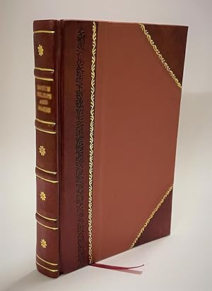
Strikingly hand-coloured third corrected state of this finely engraved wall map. In 1745 the waterboard of Rijnland ordered the surveyor Melchior Bolstra to correct the outdated map of Dou and Broeckhuysen of 1647. The results of Bolstra's new survey were engraved into the original plates by David Coster. A map of the Haarlemmer…meer with dotted lines to indicate its increasing size from 1531 untill 1740 and a plate with technical drawings of sluices and waterlevels were added. A very good, hand-coloured copy of this renowned map of the Rijnland district. Some slight signs of wear to the spine, some minor water staining to the bottom margin near the gutter throughout and the margins are very slightly soiled, all barely affecting the plates.l Donkersloot-De Vrij 715. Half red sheepskin and intricately marbled paper sides. With 15 double-page engraved plates, all coloured by hand, including 13 maps. The plate size is mostly ca. 44.5 x 55 cm and ca. 41.5 x 55 cm, the map of the Haarlemmermeer has plate size 55 x 63 cm. An illustration of existing and projected sluices for drainage of the polder and another illustration with title, both after drawings by Melchior bolstra. All plates mounted on stubs so that they open flat.
- Hardcover
- Print on Demand
Seller: True World of Books, Delhi, , IndiaTrue World of Books
Contact seller5-star sellerLeatherBound. Condition: New. BOOKS ARE EXEMPT FROM IMPORT DUTIES AND TARIFFS; NO EXTRA CHARGES APPLY. LeatherBound edition. Condition: New. Reprinted from 1620 edition. Leather Binding on Spine and Corners with Golden leaf printing on spine. Bound in genuine leather with Satin ribbon page markers and Spine with raised gilt band…s. A perfect gift for your loved ones. Pages: 439 NO changes have been made to the original text. This is NOT a retyped or an ocr'd reprint. Illustrations, Index, if any, are included in black and white. Each page is checked manually before printing. As this print on demand book is reprinted from a very old book, there could be some missing or flawed pages, but we always try to make the book as complete as possible. Fold-outs, if any, are not part of the book. If the original book was published in multiple volumes then this reprint is of only one volume, not the whole set. Sewing binding for longer life, where the book block is actually sewn (smythe sewn/section sewn) with thread before binding which results in a more durable type of binding. Pages: 439.

- Art Print
Seller: Inter-Antiquariaat Mefferdt & De Jonge, Amsterdam, , NetherlandsInter-Antiquariaat Mefferdt & De Jonge
Contact seller5-star sellerCondition: Used
US$ 3,836.93
US$ 48.14 shippingShips from Netherlands to U.S.A.Quantity: 1 available
WALL MAP OF NORTH HOLLAND "'T Hoogheemraadschap vande Uytwaterende Sluysen in Kennemerlant ende West-Frieslant" [The Hoogheemraadschap (water board) of Uitwaterende Sluizen in Kennemerland and West Friesland], copper engraving after the design of Johannes Dou I, published in Amsterdam by Andries and Hendrik de Leth in 1729. Colo…ured by a later hand. Four sheets joined. Size: 86 × 112 cm. This map is a characteristic example of Dutch water management cartography. To protect the low-lying Holland polderland situated in a deep basin from the waters of the sea and rivers, a large number of waterschappen (water boards) were established throughout western Netherlands, each responsible for hydraulic works and flood protection within its district. For efficient water management, accurate overview maps were of vital importance. The Dijkgraaf (dike reeve) and High Heemraden (board members) of the water board of the Uitwaterende Sluizen in Kennemerland and West Friesland commissioned the surveyor and mapmaker Johannes Dou I (16151682) to chart their jurisdiction in the northern part of Holland. Dou spent an astonishing twenty years on the project, completing in 1682 an enormous map composed of sixteen sheets. Two years later, a reduced version on four sheets was produced, as well as a smaller single-sheet edition. All three versions of the map were engraved by Koenraet Decker (16511709), a pupil of Romeyn de Hooghe and Abraham Deur. Although their names appear only on the sixteen-sheet edition, it has been shown that the copperplates were reused and copied multiple times, both individually and in sets of three maps. While the cartographic content remained unchanged, small variations can be found in the coats of arms of the water board officials. Based on the heraldry on this particular copy those of Dijkgraaf Aris van der Mienden, and Hoogheemraden Gijsbert Ramp, Claas Swaan, Cornelis van Eyck, Adriaan Warmenhuisen, and Rentmeester en Secretaris (land agent and secretary) Johan Baert we can date this example to 1729. Johannes Dou I was admitted as a land surveyor by the Hof van Holland (High Court of Holland) on 10 September 1635. He studied at the University of Leiden, and after his father's death in 1635 he was appointed, together with Steven van Broeckhuysen, as permanent surveyor of the Hoogheemraadschap van Rijnland. From 1637 onwards he also practised as a notary public. Literature: o.a. Donkersloot - de Vrij, Topografische kaarten van Nederland vóór 1750, p. 147-148, no. 751. Price: Euro 3.250,-.


