Fullarton Bartholomew (17 results)
 More images
- Map
Seller: theoldmapman, Clevedon, SOMER, United Kingdomtheoldmapman
Contact seller5-star sellerCondition: Used
US$ 17.72
US$ 8.60 shippingShips from United Kingdom to U.S.A.Quantity: 1 available
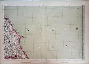
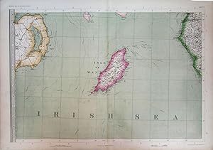
Single sheet. Original antique map with original hand colouring of the county boundaries as issued. The Imperial Map of England & Wales according to the Ordnance Survey, with the latest additions; shewing clearly every feature of the country, railways and their stations, Roads, Canals, Rivers, Gentlemen's Seats, &c. &c. On the S…cale of 4 Miles to an Inch. 69 x 49.5 cm.
 More images
- Map
Seller: theoldmapman, Clevedon, SOMER, United Kingdomtheoldmapman
Contact seller5-star sellerCondition: Used
US$ 27.26
US$ 8.60 shippingShips from United Kingdom to U.S.A.Quantity: 1 available
Single sheet. Original antique map with original hand colouring of the county boundaries as issued. The Imperial Map of England & Wales according to the Ordnance Survey, with the latest additions; shewing clearly every feature of the country, railways and their stations, Roads, Canals, Rivers, Gentlemen's Seats, &c. &c. On the S…cale of 4 Miles to an Inch. 69 x 49.5 cm.
 More images
- Map
Seller: theoldmapman, Clevedon, SOMER, United Kingdomtheoldmapman
Contact seller5-star sellerCondition: Used
US$ 32.71
US$ 8.60 shippingShips from United Kingdom to U.S.A.Quantity: 1 available
Single sheet. Original antique map with original hand colouring of the county boundaries as issued. The Imperial Map of England & Wales according to the Ordnance Survey, with the latest additions; shewing clearly every feature of the country, railways and their stations, Roads, Canals, Rivers, Gentlemen's Seats, &c. &c. On the S…cale of 4 Miles to an Inch. 69 x 49.5 cm.
 More images
- Map
Seller: theoldmapman, Clevedon, SOMER, United Kingdomtheoldmapman
Contact seller5-star sellerCondition: Used
US$ 35.44
US$ 8.60 shippingShips from United Kingdom to U.S.A.Quantity: 1 available
Single sheet. Original antique map with original hand colouring of the county boundaries as issued. The Imperial Map of England & Wales according to the Ordnance Survey, with the latest additions; shewing clearly every feature of the country, railways and their stations, Roads, Canals, Rivers, Gentlemen's Seats, &c. &c. On the S…cale of 4 Miles to an Inch. Creases down the map near the centrefold have been flattened and strengthened verso. 69 x 49.5 cm.
 More images
- Map
Seller: theoldmapman, Clevedon, SOMER, United Kingdomtheoldmapman
Contact seller5-star sellerCondition: Used
US$ 38.16
US$ 8.60 shippingShips from United Kingdom to U.S.A.Quantity: 1 available
Single sheet. Original antique map with original hand colouring of the county boundaries as issued. The Imperial Map of England & Wales according to the Ordnance Survey, with the latest additions; shewing clearly every feature of the country, railways and their stations, Roads, Canals, Rivers, Gentlemen's Seats, &c. &c. On the S…cale of 4 Miles to an Inch. 69 x 49.5 cm.
 More images
- Map
Seller: theoldmapman, Clevedon, SOMER, United Kingdomtheoldmapman
Contact seller5-star sellerCondition: Used
US$ 38.16
US$ 8.60 shippingShips from United Kingdom to U.S.A.Quantity: 1 available
Single sheet. Original antique map with original hand colouring of the county boundaries as issued. The Imperial Map of England & Wales according to the Ordnance Survey, with the latest additions; shewing clearly every feature of the country, railways and their stations, Roads, Canals, Rivers, Gentlemen's Seats, &c. &c. On the S…cale of 4 Miles to an Inch. Closed split on lowest 8 cm of the centrefold. 69 x 49.5 cm.
 More images
- Map
Seller: theoldmapman, Clevedon, SOMER, United Kingdomtheoldmapman
Contact seller5-star sellerCondition: Used
US$ 38.16
US$ 8.60 shippingShips from United Kingdom to U.S.A.Quantity: 1 available
Single sheet. Original antique map with original hand colouring of the county boundaries as issued. The Imperial Map of England & Wales according to the Ordnance Survey, with the latest additions; shewing clearly every feature of the country, railways and their stations, Roads, Canals, Rivers, Gentlemen's Seats, &c. &c. On the S…cale of 4 Miles to an Inch. 69 x 49.5 cm.
 More images
- Map
Seller: theoldmapman, Clevedon, SOMER, United Kingdomtheoldmapman
Contact seller5-star sellerCondition: Used
US$ 38.16
US$ 8.60 shippingShips from United Kingdom to U.S.A.Quantity: 1 available
Single sheet. Original antique map with original hand colouring of the county boundaries as issued. The Imperial Map of England & Wales according to the Ordnance Survey, with the latest additions; shewing clearly every feature of the country, railways and their stations, Roads, Canals, Rivers, Gentlemen's Seats, &c. &c. On the S…cale of 4 Miles to an Inch. 74 x 26 cm.
 More images
- Map
Seller: theoldmapman, Clevedon, SOMER, United Kingdomtheoldmapman
Contact seller5-star sellerCondition: Used
US$ 46.34
US$ 8.60 shippingShips from United Kingdom to U.S.A.Quantity: 1 available
Single sheet. Original antique map with original hand colouring of the county boundaries as issued. The Imperial Map of England & Wales according to the Ordnance Survey, with the latest additions; shewing clearly every feature of the country, railways and their stations, Roads, Canals, Rivers, Gentlemen's Seats, &c. &c. On the S…cale of 4 Miles to an Inch. 69 x 49.5 cm.
 More images
- Map
Seller: theoldmapman, Clevedon, SOMER, United Kingdomtheoldmapman
Contact seller5-star sellerCondition: Used
US$ 46.34
US$ 8.60 shippingShips from United Kingdom to U.S.A.Quantity: 1 available
Single sheet. Original antique map with original hand colouring of the county boundaries as issued. The Imperial Map of England & Wales according to the Ordnance Survey, with the latest additions; shewing clearly every feature of the country, railways and their stations, Roads, Canals, Rivers, Gentlemen's Seats, &c. &c. On the S…cale of 4 Miles to an Inch. 69 x 49.5 cm.

Language: German
Published by London, A. Fullarton, ca. 1860., 1860
Seller: Alte Bücherwelt, Perg, AustriaAlte Bücherwelt
Contact seller4-star sellerCondition: Used
US$ 49.64
US$ 20.08 shippingShips from Austria to U.S.A.Quantity: 1 available
41 x 29 cm Sketch Map of the Dutch Possessions in the Indian Archipelago, gest. v. J. Bartholomew, hrsg. A. Fullarton, London, ca. 1860, Orig. Stahlstich, grenzkoloriert, Format 41 x 29 cm, Blattgröße 47,5 x 31 cm, sehr guter Zustand. Sprache: Deutsch Gewicht in Gramm: 550.

Language: German
Published by Edingburgh, A. Fullarton, 1880., 1880
Seller: Alte Bücherwelt, Perg, AustriaAlte Bücherwelt
Contact seller4-star sellerCondition: Used
US$ 65.01
US$ 20.08 shippingShips from Austria to U.S.A.Quantity: 1 available
57 x 47,5 cm Indian Archipelago, compiled form the varios surveys of the british & dutch governments and other materials in possesion of the royal geographical society, bgy J. Bartholomew jun., hrsg. von A. Fullarton, Edinburgh, o.J. (ca. 1880), Origl. Stahlstich, grenzkoloriert, 57 x 47,5 cm (Blatgröße) guter Zustand. Sprache:…Deutsch Gewicht in Gramm: 550.

Language: German
Published by ca. 1850., 1850
Seller: Alte Bücherwelt, Perg, AustriaAlte Bücherwelt
Contact seller4-star sellerCondition: Used
US$ 111.10
US$ 20.08 shippingShips from Austria to U.S.A.Quantity: 1 available
47 x 31 cm West Coast of South America, including Chile & Part of Bolivia & Peru, hrsg. v. A. Fullarton & Co, London o.J. (ca. 1850), Original Stahlstich grenzkoloriert, mit florarer Bordüre, obere Karte zeigt Peru u. Bolivien (v. Swanston); seitlich zwei dekorative kolorierte Figuren (Araucano Indian u. Chilian Miner); untere K…arte zeigt Chile (v. Bartholomew). Format 47 x 31 cm sehr guter Zustand Sprache: Deutsch Gewicht in Gramm: 550.


