
Order Total (1 Item Items):
Shipping Destination:

Geographer (218 results)
Skip to main search results
Search filters
Product Type
- All Product Types
- Books (167)
- Magazines & Periodicals (1)
- Comics (No further results match this refinement)
- Sheet Music (No further results match this refinement)
- Art, Prints & Posters (No further results match this refinement)
- Photographs (No further results match this refinement)
- Maps (17)
- Manuscripts & Paper Collectibles (33)
Condition Learn more
Binding
Collectible Attributes
Language (4)
Free Shipping
Seller Location
Seller Rating
-

Results of Spirit Leveling in Wyoming 1896 to 1912, inclusive
Language: English
Published by Government Printing Office, Washington, D.C., U.S.A., 1914
First Edition
Flexible Cloth. Condition: Near Fine. No Jacket. First Edition. Wonderful as new condition in maroon pebble cloth soft flex covers, clean and no marks.
-
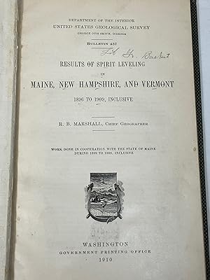
Results of Spirit Leveling in Maine, New Hamshire and Vermont 1896 to 1909, Inclusive (USGS Bulletin 437)
Published by Dept of Interior/United States Geological Survey, Washington, D.C., 1910
Seller: Clausen Books, RMABA, Colorado Springs, CO, U.S.A.
Association Member: IOBA RMABA
Seller rating 5 out of 5 stars

Cloth. Condition: Good. Ex-library with the usual stamps and labels; binding little rubbed with wear to corners; textblock aged but clean and tight; 59p., including index; work done in cooperation with the State of Maine during 1899 to 1909, inclusive. Spirit leveling is designed to collect accurate elevation data. Size: 8vo - 7 3/4" - 9 3/4 " Tall. Ex-Library Hardcover.
-

A Geographical and Commercial View of Northern Central Africa: containing a particular account of the course and termination of the great river Niger
Language: English
Published by British Library, Historical Print Editions, 2011
ISBN 10: 1241322619 ISBN 13: 9781241322618
Condition: New.
-

A Geographical and Commercial View of Northern Central Africa: Containing a Particular Account of the Course and Termination of the Great River Niger (Paperback or Softback)
Language: English
Published by British Library, Historical Print Editions 3/1/2011, 2011
ISBN 10: 1241322619 ISBN 13: 9781241322618
Paperback or Softback. Condition: New. A Geographical and Commercial View of Northern Central Africa: Containing a Particular Account of the Course and Termination of the Great River Niger. Book.
-

Taylor and Skinner's Maps of the Roads of Ireland: Surveyed in 1777 and Corrected Down to 1783 (Paperback or Softback)
Language: English
Published by Legare Street Press 9/9/2021, 2021
ISBN 10: 1014212278 ISBN 13: 9781014212276
Paperback or Softback. Condition: New. Taylor and Skinner's Maps of the Roads of Ireland: Surveyed in 1777 and Corrected Down to 1783. Book.
-

A Geographical and Commercial View of Northern Central Africa: containing a particular account of the course and termination of the great river Niger
Language: English
Published by British Library, Historical Print Editions, 2011
ISBN 10: 1241322619 ISBN 13: 9781241322618
Condition: As New. Unread book in perfect condition.
-

Condition: As New. Unread book in perfect condition.
-
Condition: Like New. In unused condition, may show some slight shelf wear, but otherwise unread. This title was digitally scanned from a rare, out of print edition, and will have some visual artifacts from that process.
-

Sailing Directions for the English Channel and Coast of France; With an Accurate Description of the Coasts of England, South of Ireland, and Channel Islands, by J. and A. Walker. by J. Walker
Language: English
Published by HardPress Publishing, 2018
ISBN 10: 0371866731 ISBN 13: 9780371866733
Seller: PBShop.store UK, Fairford, GLOS, United Kingdom
Seller rating 5 out of 5 stars
US$ 24.44
US$ 5.56 shipping
Ships from United Kingdom to U.S.A.Quantity: 15 available
Add to basketPAP. Condition: New. New Book. Shipped from UK. Established seller since 2000.
-
Condition: New.
-

Taylor And Skinner's Maps Of The Roads Of Ireland, Surveyed 1777
Seller: Rarewaves.com USA, London, LONDO, United Kingdom
Seller rating 5 out of 5 stars
US$ 31.75
Free Shipping
Ships from United Kingdom to U.S.A.Quantity: Over 20 available
Add to basketPaperback. Condition: New.
-
United States Geological Survey Bulletins Nos. 515-519 [Spirit Leveling]
Language: English
Published by U.S Government Printing Office, Washington D.C., 1912
Hardcover. Condition: Good. No Jacket. Good/No Jacket. Ex-Library. Five bulletins bound into one volume. Contents: "Results of Spirit Leveling in Pennsylvania, 1899-1911," Results of Spirit Leveling in Florida, 1911," Results of Spirit Leveling in Alabama, 1911," "Results of Spirit Leveling in Ohio, 1911" and "Results of Spirit Leveling in Tennessee, 1910 and 1911." Each volume has identical black-and-white frontis photograph depicting geological survey bench marks. Cloth cover moderately-to-heavily stained and moderately worn at extremities; library spine lettering. Internal library marks limited to bookplate inside front cover, very small inkstamps to first five pages, and small perforated library seal to title page. Interior otherwise clean and tight.
-

Taylor and Skinner's Maps of the Roads of Ireland
Seller: Rarewaves.com USA, London, LONDO, United Kingdom
Seller rating 5 out of 5 stars
US$ 32.16
Free Shipping
Ships from United Kingdom to U.S.A.Quantity: Over 20 available
Add to basketPaperback. Condition: New.
-

PAP. Condition: New. New Book. Shipped from UK. Established seller since 2000.
-

Living Translocality: Space, Culture and Economy in Contemporary Swahili Trade (Erdkundliches Wissen)
Language: English
Published by Franz Steiner Verlag, U.S.A., 2012
ISBN 10: 3515100946 ISBN 13: 9783515100946
First Edition
Trade Paperback. Condition: New. First Edition. This is a new paperback first edition copy, white-brown spine.
-
New York Catatonk Quadrangle: Surficial Geology [map]
Language: English
Published by New York Geological Survey, Albany, 1908
No Binding. Condition: Very Good. Color map, 20 by 18 inches, folded into eighths as issued, 1:25,000. This is the 1908 reprint of the 1901 map edition. Minor separation along creases at margin. Probably extracted from the 'USGS Geological Atlas - Watkins Glen-Catatonk Folio #169 [1909].' NewShelf 13.
-
International Boundary Study, Vol. 41
Seller: PBShop.store UK, Fairford, GLOS, United Kingdom
Seller rating 5 out of 5 stars
US$ 32.12
US$ 5.56 shipping
Ships from United Kingdom to U.S.A.Quantity: 15 available
Add to basketPAP. Condition: New. New Book. Shipped from UK. Established seller since 2000.
-
-

PAP. Condition: New. New Book. Shipped from UK. Established seller since 2000.
-

HRD. Condition: New. New Book. Shipped from UK. Established seller since 2000.
-
International Boundary Study, 1970-1972
Seller: PBShop.store UK, Fairford, GLOS, United Kingdom
Seller rating 5 out of 5 stars
US$ 34.54
US$ 6.71 shipping
Ships from United Kingdom to U.S.A.Quantity: 15 available
Add to basketPAP. Condition: New. New Book. Shipped from UK. Established seller since 2000.
-
Bulletin 674; Spirit Leveling in the State of Washington, 1896 to 1917, Inclusive
Language: English
Published by Government Printing Office, Washington, D.C., 1918
Seller: Barry Cassidy Rare Books, Sacramento, CA, U.S.A.
Seller rating 5 out of 5 stars
Hardcover. Condition: Very Good. Ex-library. Possible copy of R. B. Marshall ("(Sgd) R. B. Marshall" black ink stamp on a front flyleaf). Original publisher's maroon cloth binding with gilt lettering on spine (including number "674"). 6" x 9 1/4." 204 pages, complete. One black-and-white plate, complete. Index in back. Pages are virtually pristine and intact except for "U.S. Geological Survey, Topographic Files" black ink stamp on a front flyleaf, tiny stain on a few of the back leaves, and light age toning. Covers are very clean and intact except for slight wear to extremities, a few small scratches, light rubbing, and a few small stains and marks on front and back. A Very Good, almost Near Fine copy. This is Bulletin 674, a report by the United States Department of the Interior and U.S. Geological Survey (USGS) about "spirit leveling" in the state of Washington from 1896-1917, inclusive. The Introduction clarifies that this work, Bulletin 674, contains both previously published information from Bulletins 457 and 557 as well as results from later work. The benchmarks used in Washington spirit leveling are briefly described as having two forms, a circular bronze or aluminum tablet cemented in a drill hole in the rock wall of a public buildings, bridge abutment, or other architectural structure or, in the absence of rock or architecture, a wrought-iron post set into the ground. The numbers stamped on the benchmarks show the "elevations to the nearest foot as determined by the levelman." The Introduction also explains the differences between primary and precise leveling. The report is principally a list of "primary leveling" and "precise leveling" benchmarks with about a line or two per entry describing where that benchmark is located in Washington (in this Bulletin, the types of leveling are interspersed together). The list is alphabetical by location (town, landmark, and the like) within a specific quadrangle or region. Example entry associated with primary leveling: "Blalock Island Quadrangle. [Region] From Castlerock west along Spokane, Portland & Seattle Ry. to McCredie (2 lines). Primary leveling in 1906 by John R. Evans and in 1913 by D. S. Birkett. [Constituent location] Castlerock, in NW. 1/4 sec. 8, T. 4 N., R. 24 E., north bank of river, opposite rock 100 feet north of river, 30 feet north of shack at ferry landing; aluminum tablet stamped '247'; Feet: 248.299." Example entry associated with precise leveling: "Ellensburg Quadrangle. [Region] From Ellensburg along Northern Pacific Ry. to Thrall and from Wenas to Yakima. Precise leveling by the U. S. Coast and Geodetic Survey. [Constituent location] Yakima, in vertical face of stone wall at northeast corner of Sloan's drug store, 0.32 meter east of door, 0.33 meter from edge of wall, 1.2 meters above sidewalk; red metal disk (C. & C. S. 'A2'); Feet: 1,067.730." Appendix ("Secondary elevations") in the back. Small printed note in back says additional copies of this book may be procured from the Superintendent of Documents at the Government Printing Office in Washington, D.C. Credits on title page: Franklin K. Lane as Secretary of Department of the Interior; George Otis Smith as Director of USGS; and Henry Landes as State Geologist (in connection with "work done in cooperation with the State of Washington from 1909 to 1916, inclusive").
-
Bulletin 566; Results of Spirit Leveling in Utah, 1897 to 1914, Inclusive
Language: English
Published by Government Printing Office, Washington, D.C., 1915
Seller: Barry Cassidy Rare Books, Sacramento, CA, U.S.A.
Seller rating 5 out of 5 stars
Hardcover. Condition: Very Good. Ex-library. Original publisher's maroon cloth binding with gilt lettering on spine (including number "566"). 6" x 9 1/4." Seventy-seven pages, complete. One black-and-white plate, complete. Index in back. Pages are virtually pristine and intact except for blue ink library stamp on front free endpaper and light age toning. Covers are very clean and intact except for a few scratch marks on front, a few small marks on front and back, and slight wear to extremities. A Very Good, almost Near Fine copy. This is Bulletin 566, a report by the United States Department of the Interior and U.S. Geological Survey (USGS) about "spirit leveling" in Utah from 1897-1914, inclusive. The Introduction clarifies that Bulletin 489 contains earlier information about Utah benchmarks from 1897-1910 and that this publication, Bulletin 566, picks up from where Bulletin 489 left off. Bulletin 566 contains the results of Bulletin 489, but with corrections that match said results with a 1912 adjustment, as well as spirit leveling results from USGS since 1910 (the last year covered by Bulletin 489). The benchmarks used in Utah spirit leveling are briefly described as having two forms, a circular bronze or aluminum tablet cemented in a drill hole in the rock wall of a public buildings, bridge abutment, or other architectural structure or, in the absence of rock or architecture, a wrought-iron post set into the ground. The numbers stamped on the benchmarks show the "elevations to the nearest foot as determined by the levelman." The report is principally a list of "primary leveling" benchmarks with about a line or two per entry describing where that benchmark is located in Colorado. The list is alphabetical by location (town, landmark, and the like) within a specific quadrangle or region. Example entry: "Desert Lake Quadrangle. [Region] From point 1.7 miles of Farnham southeast along Denver & Rio Grande R. R. to point near Cedar. [Constituent location] Farnham, 2.7 miles south of, in base of milepost 172; spike with aluminum tag stamped '5381'; Feet: 5,383.84." Appendix A ("Elevations adjusted by the United States Coast and Geodetic Survey from precise leveling") and Appendix B ("Secondary elevations") are in the back.
-
Bulletin 565; Results of Spirit Leveling in Colorado, 1896 to 1914, Inclusive
Language: English
Published by Government Printing Office, Washington, D.C., 1915
Seller: Barry Cassidy Rare Books, Sacramento, CA, U.S.A.
Seller rating 5 out of 5 stars
Hardcover. Condition: Very Good. Ex-library. Original publisher's maroon cloth binding with gilt lettering on spine (including number "565"). At least two tipped-in Errata (each is a typed leaf) included. 6" x 9 1/4." 192 pages, complete. One black-and-white plate, complete. Index in back. Pages are virtually pristine and intact except for black ink library stamp on front pastedown, black ink signature of "H. H. Hodgeson" on a front flyleaf, and a small dampstain limited to fore-edge of text block. Covers are very clean and intact except for moderate wear to extremities, a few tiny glue stains and other marks, and possible glue application or repair on spine. A Very Good copy. This is Bulletin 565, a report by the United States Department of the Interior and U.S. Geological Survey (USGS) about "spirit leveling" in Colorado from 1896-1914, inclusive. The Introduction clarifies that Bulletin 486 contains earlier information about Colorado benchmarks from 1896-1910 and that this publication, Bulletin 565, picks up from where Bulletin 486 left off. Bulletin 565 contains the results of Bulletin 486, but with corrections that match said results with a 1912 adjustment, as well as spirit leveling results from USGS since 1910 (the last year covered by Bulletin 486). The benchmarks used in Colorado spirit leveling are briefly described as having two forms, a circular bronze or aluminum tablet cemented in a drill hole in the rock wall of a public buildings, bridge abutment, or other architectural structure or, in the absence of rock or architecture, a wrought-iron post set into the ground. The numbers stamped on the benchmarks show the "elevations to the nearest foot as determined by the levelman." The Introduction also explains the differences between primary and precise leveling. The Table of Contents shows that some areas of Colorado were measured using primary leveling while others used precise leveling. The report is principally a list of "primary leveling" and "precise leveling" benchmarks with about a line or two per entry describing where that benchmark is located in Colorado. The list is alphabetical by location (town, landmark, and the like) within a specific quadrangle or region. Example entry under "Precise Leveling": "Platte Canyon Quadrangle. [Region] From Platte Canyon along Colorado & Southern Ry. to Bailey. [Constituent location] Platte Canyon, 2.10 miles south of, 210 feet north of head gate in Platte River, 5 feet west of track, on top of large bowlder [sic]; square marked 'U. S. 5592 B. M.'; Feet: 5,591.752." Example entry under "Primary Leveling": "Boulder Quadrangle. [Region] From Chipmunk Gulch along road north to St. Vrain Creek, thence along creek road to Lyons. [Constituent location] Ward, 1 mile north of, 200 feet south of San Blas mill, in top of rock, east side of road; bronze tablet stamped '8901 Denv'; Feet: 8,899.089." Appendix A ("Elevations adjusted by the United States Coast and Geodetic Survey from precise leveling") and Appendix B ("Secondary elevations") are in the back.
-
Bulletin 654; Spirit Leveling in Nevada, 1897 to 1916, Inclusive
Language: English
Published by Government Printing Office, Washington, D.C., 1917
Seller: Barry Cassidy Rare Books, Sacramento, CA, U.S.A.
Seller rating 5 out of 5 stars
Hardcover. Condition: Very Good. Ex-library. Original publisher's maroon cloth binding with gilt lettering on spine (including number "654"). 6" x 9 1/4." Ninety-one pages, complete. One black-and-white plate, complete. Index in back. Pages are virtually pristine and intact except for light age toning. Covers are very clean and intact overall but have a few scratches and spots of discoloration on back, fading or sunning on spine, and light to moderate wear to extremities. A Very Good copy. This is Bulletin 654, a report by the United States Department of the Interior and U.S. Geological Survey about "spirit leveling" in Nevada from 1897-1916, inclusive. The Introduction notes how all of the results of previous Nevada spirit leveling were published in Bulletin 488 and that results of later work are published herein. The benchmarks used in spirit leveling are briefly described as having two forms, "a circular bronze or aluminum tablet . cemented in a drill hole in solid rock in the wall of some public building, a bridge abutment, or other substantial masonry structure," or "where masonry or rock is not available . a hollow wrought-iron post . which is set about 3 feet in the ground." The numbers stamped on the benchmarks show the "elevations to the nearest foot as determined by the levelman." The report is principally a list of "precise and primary leveling" benchmarks with about a line or two per entry describing where that benchmark is located in Nevada. The list is alphabetical by location (town, landmark, and the like) within a specific quadrangle or region. Example entry: "[Region] From Lida east along road to fork east of county line, thence southeast to Seattle well. [Constituent location] Eagle City, 300 feet north of well, 125 feet north of road, in limestone ledge; aluminum tablet stamped '8'; Feet: 5,699.922." A brief Appendix about "Secondary Elevations" is in the back.
-
Bulletin 573; Results of Spirit Leveling in Arizona, 1899 to 1915, Inclusive
Language: English
Published by Government Printing Office, Washington, D.C., 1915
Seller: Barry Cassidy Rare Books, Sacramento, CA, U.S.A.
Seller rating 5 out of 5 stars
Hardcover. Condition: Very Good. Ex-library. Original publisher's maroon cloth binding with gilt lettering on spine (including number "573"). 6" x 9 1/4." 123 pages, complete. One black-and-white plate, complete. Index in back. Pages are virtually pristine and intact except for five blue ink library stamps on front and back pastedowns and front free endpaper and light age toning. Covers are very clean and intact except for light to moderate wear to extremities, fading along spine and near spine on front and back. A Very Good copy. This is Bulletin 573, a report by the United States Department of the Interior and U.S. Geological Survey (USGS) about "spirit leveling" in Arizona from 1899-1915, inclusive. The Introduction clarifies that this work, Bulletin 573, contains both the earlier information about Arizona spirit leveling as found in Bulletin 463 and results from later work. The results in Bulletin 573 were changed to match a 1912 adjustment. The benchmarks used in Arizona spirit leveling are briefly described as having two forms, a circular bronze or aluminum tablet cemented in a drill hole in the rock wall of a public buildings, bridge abutment, or other architectural structure or, in the absence of rock or architecture, a wrought-iron post set into the ground. The numbers stamped on the benchmarks show the "elevations to the nearest foot as determined by the levelman." The Introduction also explains the differences between primary and precise leveling. The Table of Contents shows that some areas of Arizona were measured using primary leveling while others used precise leveling. The report is principally a list of "primary leveling" and "precise leveling" benchmarks with about a line or two per entry describing where that benchmark is located in Arizona. The list is alphabetical by location (town, landmark, and the like) within a specific quadrangle or region. Example entry under "Precise Leveling": "Red Rock Quadrangle. [Region] From Yuma west along Southern Pacific R. R. to New Mexico State line (part of line). [Constituent location] Picacho, 11 feeet northeast of track, in north corner of northwest concrete pier of water tank; aluminum tablet; Feet: 1,620.89." Example entry under "Primary Leveling": "Desert Well Quadrangle. [Region] From Highland Canal southeast along Florence Road to Desert Well. [Constituent location] Mesa, 6.25 miles southeast of, 60 feet south of road, on north side of giant cactus about 30 feet high; iron post stamped '1295 Phnx'; Feet: 1,295.679." Appendix A ("Elevations adjusted by the United States Coast and Geodetic Survey from precise leveling") and Appendix B ("Secondary elevations") are in the back.
-
Bulletin 561; Results of Spirit Leveling in Hawaii, 1910 to 1913, Inclusive
Language: English
Published by Government Printing Office, Washington, D.C., 1914
Seller: Barry Cassidy Rare Books, Sacramento, CA, U.S.A.
Seller rating 5 out of 5 stars
Hardcover. Condition: Near Fine. Ex-library. Original publisher's maroon cloth binding with gilt lettering on spine (including number "561"). 6" x 9 1/4." Forty-two pages, complete. One black-and-white plate, complete. Index in back. Pages are virtually pristine and intact except for two blue ink library stamps on front free endpaper and light age toning. Covers are very clean and intact except for a few faint marks on front, slight wear to extremities, and light rubbing. A Near Fine copy. This is Bulletin 561, a report by the United States Department of the Interior and U.S. Geological Survey about "spirit leveling" in the Territory of Hawai'i from 1910-1913, inclusive. The Introduction notes the scope of work as follows: "All results of spirit leveling in the Territory of Hawaii by the United States Geological Survey are included in this report, arranged by quadrangles. All of the elevations are based on tidal bench marks of the Coast and Geodetic Survey, the Corps of Engineers, United States Army, and the Hawaii Railroad Co." The benchmarks used in Hawai'i spirit leveling are briefly described as having two forms, a circular bronze tablet cemented in a drill hole in the rock wall of a public buildings, bridge abutment, or other architectural structure or, in the absence of rock or architecture, a wrought-iron post set into the ground. The numbers stamped on the benchmarks show the "elevations to the nearest foot as determined by the levelman." The report is principally a list of "primary leveling" benchmarks with about a line or two per entry describing where that benchmark is located in Hawai'i. The Introduction says no precise leveling has been carried out yet in Hawai'i. The list is alphabetical by location (town, landmark, and the like) within a specific quadrangle or region. Example entry: "[Region] From point 2.3 miles northwest of Hakalau post office west, northwest, and north to Pohakupuka schoolhouse. [Constituent location] Hakalau post office, 2.3 miles northwest of, concrete culvert on county road, seaward side of south end; chisel point painted 'U. S. B. M.'; Feet: 321.06." A brief Appendix about "Secondary Elevations" is in the back.
-

Taylor And Skinner's Maps Of The Roads Of Ireland, Surveyed 1777
Seller: Rarewaves.com USA, London, LONDO, United Kingdom
Seller rating 5 out of 5 stars
US$ 44.84
Free Shipping
Ships from United Kingdom to U.S.A.Quantity: Over 20 available
Add to basketHardback. Condition: New.
-
Taylor And Skinner's Maps Of The Roads Of Ireland, Surveyed 1777
Seller: Ria Christie Collections, Uxbridge, United Kingdom
Seller rating 5 out of 5 stars
US$ 29.91
US$ 16.02 shipping
Ships from United Kingdom to U.S.A.Quantity: Over 20 available
Add to basketCondition: New. In.
-

A Geographical and Commercial View of Northern Central Africa: Containing a Particular Account of the Course and Termination of the Great River Niger in the Atlantic Ocean.
Language: English
Published by British Library, Historical Print Editions, 2011
ISBN 10: 1241322619 ISBN 13: 9781241322618
Seller: Ria Christie Collections, Uxbridge, United Kingdom
Seller rating 5 out of 5 stars
US$ 29.94
US$ 16.02 shipping
Ships from United Kingdom to U.S.A.Quantity: Over 20 available
Add to basketCondition: New. In.
