Order Total (1 Item Items):
Shipping Destination:

John J Abert (10 results)
Skip to main search results
Search filters
Product Type
- All Product Types
- Books (10)
- Magazines & Periodicals (No further results match this refinement)
- Comics (No further results match this refinement)
- Sheet Music (No further results match this refinement)
- Art, Prints & Posters (No further results match this refinement)
- Photographs (No further results match this refinement)
- Maps (No further results match this refinement)
- Manuscripts & Paper Collectibles (No further results match this refinement)
Condition Learn more
- New (No further results match this refinement)
- As New, Fine or Near Fine (3)
- Very Good or Good (3)
- Fair or Poor (No further results match this refinement)
- As Described (4)
Binding
- All Bindings
- Hardcover (8)
- Softcover (No further results match this refinement)
Collectible Attributes
Language (2)
Free Shipping
- Free Shipping to U.S.A. (No further results match this refinement)
Seller Location
Seller Rating
-
Western America in 1846-1847: the Original Travel Diary of Lieutenant J. W. Abert Who Mapped New Mexico for the United States Army
Published by John Howell Books, 1961
Hardcover. Condition: Good. . . . . Folio, hardcover. No dj. Good condition. Old moisture marking to bottom edge of covers and textblock. Contents free of writing or marking. Binding square and tight. 115 pp. text, illustrations. Foldout maps at rear. 19th, American, Century, Exploration, History, Southwest, Western,
-
Western America in 1846-1847; The Original Travel Diary of Lieutenant J. W. Abert who mapped New Mexico for the United States Army
Published by John Howell - Books, 1966
Seller: Midway Book Store (ABAA), St. Paul, MN, U.S.A.
Association Member: ABAA ILAB MWABA
Seller rating 5 out of 5 stars

Hardcover. Condition: near fine. Folio. 103pp. With illustrations in color from his Sketchbook. Limited to 3000 copies. Two folded bound maps in rear. In a light chipped mylar wrapper jacket.
-

Hydrographical basin of the upper Mississippi River : from astronomical and barometrical observations, surveys, and information
Published by Minnesota Historical Society, St. Paul, Minnesota, 1965
Hardcover. Condition: Very Good. 1 map ; 91 x 76 cm. "Printed from an original copy, 1965." Accompanied by text: Joseph N. Nicollet and his great map. This copy with one minor misfold to the map; but still nearly fine. Rare, even in this reprinted form.
-
Western America in 1846 - 1847; The Original Travel Diary of Lieutenant J.W. Abert who mapped New Mexico for the United States Army
Language: English
Published by John Howell Books, San Francisco, California, 1966
Hardcover. Condition: Near Fine. Abert, J.W. (illustrator). Limited Edition. Hardcover folio of 14 inches tall in near fine condition. Limited edition of 3,000 copies. Cream colored cloth with an upper central motif of the seal of 'The Corps of Topographical Engineers' in yellow, framed behind an irregular border in green of a prickly pear cactus. Clear vinyl Dust Jacket.The text is from Abert's original travel diary kept on this expedition, and the illustrations, watercolors, in color are from his original sketchbook. Included as appendices are Abert's original notes concerning animals, birds and plants, and another concerning notes on minerals and fossils. Two large folding maps in fine condition are included at the end. Also included are a glossary of Spanish and Native terms and a letter directing Abert to continue with the First United States Survey of New Mexico.Also included are a list of references and Index. A valuable first person written and observed source from the first United States survey of New Mexico. Southwest, New Mexico, Topographical Survey, Maps, Journal, Drawings and Watercolors, Limited Edition.
-
Western America in 1846-1847: The Original Travel Diary of Lieutenant J. W. Abert Who Mapped New Mexico for the U. S. Armu
Published by John Howell Books, San Francisco, CA, 1966
First Edition
Cloth. Condition: Very Good. No Jacket. First Edition. Edited by John Galvin and has his bold signature on the title page. Contains illustrations from Abert's sketchbook. Limited to 3000 copies. Fold-out maps. Glassine DJ,chipped. Rittenhouse considered this "One of the largest and most lavish books about the Santa Fe Trail.It includes his travel diary from Fort Leavenworth to Santa Fe and return. Contains many comments on the SFT found in no other published Abert report." Designed and printed by Lawton and Alfred Kennedy. Copies signed by Galvin are scarce. Signed By Editor.
-
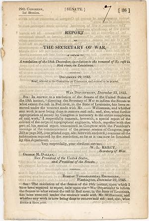
Report of the Secretary of War, in answer to a resolution of the 18th December, in relation to the removal of the raft in Red river, in Louisiana. December 29, 1845. Read, referred to the Committee on Commerce, and ordered to be printed
Language: English
Published by Ritchie & Heiss, printers, [Washington, D.C.], 1845
Seller: Kaaterskill Books, ABAA/ILAB, East Jewett, NY, U.S.A.
Association Member: ABAA ILAB IOBA
Seller rating 5 out of 5 stars
First Edition
Removed. First edition. 13 pp. Illus. with 1 b/w drawing. 8vo. 29th Congress, 1st session. Senate. Doc. no. 26. Rfats were a contlinual problem for navigation. OCLC locates onlt 4 hard copies: Tulane, Historic New Orleans, LSU, NSU Louisiana. Inked numeral on title else a very good copy.
-
Western America in 1846-1847: The Original Travel Diary of Lieutenant J.W. Abert Who Mapped New Mexico for the United States Army
Language: English
Published by John Howell, 1966
Hardcover. Condition: As New. Rockwell Kent (illustrator). Pristine new condition.
-
Western America in 1846-1847: The Original Travel Diary of Lieutenant J.W. Abert Who Mapped New Mexico for the United States Army
Published by John Howell, San Francisco, 1966
Seller: 32.1 Rare Books + Ephemera, IOBA, ESA, Princeton, NJ, U.S.A.
Association Member: IOBA
Seller rating 4 out of 5 stars

Hardcover. Folio. Limited edition [1 of 3,000. Illustrated. Maps. Profusely illustrated in color, this is the diary of Lt. J.W. Abert who mapped New Mexico for the United States Army. Fold-out maps included. Ivory cloth hardcover; topographical engineers insignia on front board; gilt text on spine; Very Good with some light handling in white cloth and acetate jacket.
-
Western America in 1846-1847: The Original Travel Diary of Lieutenant J.W. Abert Who Mapped New Mexico for the United States Army
Published by John Howell, San Francisco
Seller: Spafford Books (ABAC / ILAB), Regina, SK, Canada
Seller rating 5 out of 5 stars
1966. (Folio) Very good plus. 116pp. Frontispiece, illus., maps. Mylar wrap slightly torn. Fold-out maps. Illustrations in colour from the author's sketchbooks. Limited to 3000 copies.
-

Topographical Engineer John Abert Writes About Surveys In The State Of MississippiAs Soon As Practicable
Seller: Stuart Lutz Historic Documents, Inc., South Orange, NJ, U.S.A.
Association Member: ABAA ESA ILAB PADA
Seller rating 5 out of 5 stars
Signed
JOHN ABERT (1788-1863). John Abert was born in Virginia in 1788 and graduated from West Point in 1811. He served during the War of 1812 in defense of Washington, and following the war became head of the Topographical Bureau in Washington, DC. As such, he was responsible for many of the expeditions dispatched to explore and map Americas westernmost regions, such as the Fremont Expedition of 1842 to 1844.ALS. 1pg. March 25, 1829. Topographical Bureau. An autograph letter signed J.J. Abert to a member of the United States Corps of Engineers in Washington, DC. Abert penned: You have been assigned to Superintendent certain surveys in the State of Mississippi you will therefore repair to Vicksburg in that State as soon as practicable, &in relation to the duty by the enclosed copy of a series of resolutions from the Legislature of the State of Mississippi, and of a letter from the Honble. Mr. Plumeron. You will furnish this Bureau with an estimate of the necessary expenses, limiting yourself on this subject to your own compensation & To the compensation of an assistant To the requisite instruments and the accessories All other expenses must beby the State or individualized intersession in the Survey. The letter has waterstaining in the upper right corner, is missing some of the upper left (not affecting any text) and some darkening to the lower margin.