Map Chart (154 results)

Published by The University of the State of New York 1936
- Softcover
Seller: Dick's Book Barn, Trumansburg, U.S.A.Dick's Book Barn
Contact seller5-star sellerCondition: Used - Very good
US$ 15.00
US$ 5.50 shippingShips within U.S.A.Quantity: 1 available
Add to basketSoft cover. Condition: Very Good. No Jacket. New York State Museum Handbook 16 This copy is in excellent condition; tight and clean; the wraps show no wear. B&W photos and fold-out Chart and map (illustrator).
- Softcover
Seller: Terrace Horticultural Books, St. Paul, U.S.A.Terrace Horticultural Books
Contact seller4-star sellerCondition: Used - Very good
US$ 8.00
US$ 6.99 shippingShips within U.S.A.Quantity: 1 available
Add to basketStapleBound. Condition: Very Good. Copyright Date: 1964 Octavo, November 1964, PP.1075-1088, Offprint From American Journal Of Science, Vol.262.. Map, Folding Chart (illustrator).
Published by New York, Charles Scribner's Sons 1913
- Hardcover
Seller: Alec R. Allenson, Inc., Westville, U.S.A.Alec R. Allenson, Inc.
Contact seller4-star sellerHardcover. Chapters 1-5; sections 121-145. xiii, 337 p.; 19.5 cm. (The historical Bible ; 5) Good orig. maroon cloth. Occasional marking. 1 col. map & 1 col. chart (illustrator).

Language: English
Published by Commonwealth of Pennsylvania; Department of Internal Affairs, Harrisburg, PA 1971
- Softcover
- First Edition
Seller: Dorley House Books, Inc., Hagerstown, U.S.A.Dorley House Books, Inc.
Contact seller4-star sellerCondition: Used - Very good
US$ 25.00
US$ 8.65 shippingShips within U.S.A.Quantity: 1 available
Add to basketPaperback. Condition: Very Good. 1st. 1st printing; in sturdy slipcase ; 104 clean, unmarked pages. 51 figures, 7 tables,; 2 Fold-out map/chart (illustrator).
Seller: Terrace Horticultural Books, St. Paul, U.S.A.Terrace Horticultural Books
Contact seller4-star sellerStapleBound. Condition: Solid Ex. Library. Copyright Date: 1953 Sm Quarto, , PP. 1229-1246, Bulletin OIf The Geological Sociey Of America Vol. 64, 1953. Map, Fold Out Chart (illustrator).
Published by Board Of Geological Survey
- Softcover
Seller: Terrace Horticultural Books, St. Paul, U.S.A.Terrace Horticultural Books
Contact seller4-star sellerPaperback. Copyright Date: 1909 Octavo, 1909, PP.120, Good, Clifford WEtmores Copy, Crease At Cover. Map, Soils Form Chart, Text Figures (illustrator).
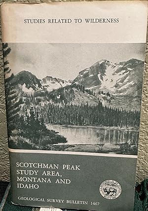
Mineral Resources of the Scotchman Peak Wilderness Study Area, Lincoln and Sanders Counties, Montana, and Bonner County, Idaho
U.S. Geological Survey & U.S. Breau of Mines & Color Fold Out Map and Geology Chart
Published by U. S. Government Printing Office, Washington, D. C. 1981
- Softcover
- First Edition
Seller: Crossroads Books, Reno, U.S.A.Crossroads Books
Contact seller5-star sellerCondition: Used - Very good
Original price: US$ 31.00; 25% offCurrent price: US$ 23.25
US$ 5.05 shippingShips within U.S.A.Quantity: 1 available
Add to basketSoftcover. Condition: Very Good. First Edition. Unmarked. Two plates folded in rear pocket. ; Book Description; Spine has staples. Pages are clean and not marred by notes or folds. Covers are square with wear as noted. Ships Safe and Fast. ; U. S. Geological Survey Bulletin; Vol. 1467; B&W Illustrations; 8vo 8" - 9" tall; 26 pag…es DV3.
Published by Uitgegeven Door Het Rijksherbarium Te Leiden; Rijksherbarium, Leyden, Holland 1970
- Softcover
Seller: Terrace Horticultural Books, St. Paul, U.S.A.Terrace Horticultural Books
Contact seller4-star sellerCondition: Used - Good
US$ 24.00
US$ 6.99 shippingShips within U.S.A.Quantity: 1 available
Add to basketSoft cover. Condition: Good. Copyright Date: 1970 Octavo, PP.1-224, 225-569 Plus 572-579 Index, Each Issue Has An Illustration Of C. L. Blume (1829-1862) On The Cover Very Good, Ex. Lee Library New York State Extension, Geneva, Cornell University Volume X V I I I, No. 1, 2 Plus Index and Original Card Folder For The Set. Text Fi…gures, Tables, Maps, B & W Photos, One Folding Map Of Doma Peaks And One Folding Chart Of Vegetation IN Rear Pocket Of No.1 (illustrator).
Published by US Dept. of Agriculture, Washington, DC 1940
- Softcover
Seller: Riverow Bookshop, Owego, U.S.A.Riverow Bookshop
Contact seller5-star sellerWraps. Condition: G/No Dustjacket. Washington, DC: US Dept. of Agriculture. G/No Dustjacket. 1940. . Wraps. USDA-Bureau of Plant Industry . 8vo., 52 + map pp., worn and well-used but clear and bright . Large fold-out map and chart (illustrator).
Language: English
Published by Geological Society Of America 1949
- Softcover
- First Edition
- Signed
Seller: Arroyo Seco Books, Pasadena, Member IOBA, Pasadena, U.S.A.Arroyo Seco Books, Pasadena, Member IOBA
Contact seller4-star sellerCondition: Used - Near fine
US$ 41.98
US$ 8.00 shippingShips within U.S.A.Quantity: 1 available
Add to basketSoft cover. Condition: Near Fine. 1st Edition. 923-968 Pp. Brown Printed Wrappers.Near Fine. Generically Inscribed By Author. Per Wikipedia, Chester Ray Longwell (1887 - 1975) Was An American Geologist Who Conducted Extensive Research Into The Geology Of The Basin And Range Province In Nevada. His Fieldwork Led To A More Complet…e Understanding Of Paleozoic And Lower Mesozoic Stratigraphic Sequence In The Southern Great Basin. Elected A Fellow Of The Geological Society Of America In 1923, Longwell Served As Society's President In 1949. He Was Elected A Member Of The National Academy Of Sciences In 1935. From 1953 To 1954, He Served As President, American Geological Institute. He Was Elected To The American Philosophical Society In 1948 And The American Academy Of Arts And Sciences In 1953. Photographs, Chart, Folding Map (illustrator). Inscribed by Author(s).
Language: English
Published by Roy Anderson, Ketchikan Ak 1945
- Hardcover
- First Edition
- Signed
Seller: Arroyo Seco Books, Pasadena, Member IOBA, Pasadena, U.S.A.Arroyo Seco Books, Pasadena, Member IOBA
Contact seller4-star sellerCondition: Used - Near fine
US$ 45.50
US$ 8.00 shippingShips within U.S.A.Quantity: 1 available
Add to basketHardcover. Condition: Near Fine. 1st Edition. 160 Pp. Green Cloth With Paste-On Illustration, Map And Folding Chart Of Tlingit People Tipped On To Rear Pastedown, As Issued. With The Printed Bookmark Made For This Book. First Printing, 1945. Signed By Author On Front Pastedown. Near Fine. Folding Map And Chart Of Tlingit-Speakin…g People (illustrator). Signed by Author(s).
Published by The Haynes Foundation, Los Angeles 1953
- First Edition
Seller: sonalsorises, los angeles, U.S.A.sonalsorises
Contact seller2-star sellerCondition: Used - Fine
US$ 22.00
US$ 7.00 shippingShips within U.S.A.Quantity: 1 available
Add to basketCondition: Fine. First Edition. First Edition. Original red cloth, gilt titles on cover. Fold-out map and fold-out chart. 63 pages. We could locate no others copies for sale. Scarce. Map and Fold-out Chart (illustrator).
Language: English
Published by Vanderpool & Cole 1827
- Hardcover
- First Edition
Seller: Shaker Mill Books, W. Stockbridge, U.S.A.Shaker Mill Books
Contact seller5-star sellerCondition: Used - Good
US$ 150.00
US$ 6.75 shippingShips within U.S.A.Quantity: 1 available
Add to basketHardcover. Condition: Good. No Jacket. 1st Edition. Tight binding, solid, full leather boards with gently rubbed corners, gilt lettering and decoration to spine strip, yellow edges, frontispiece with notable theologians opposite elaborately decorated half title page, very nice colorful fold-out map opposite title page, black and… white fold-out map at beginning of text and fold-out historical and ecclesiastical chart after page 420, 36 page History of the Jews at rear, previous owner's bookplate to front paste down and his name and purchase details (he paid $1.75 in 1827) to early blank page, more to rear end paper, foxing throughout that does not affect readability. Fold-out map, fold-out chart (illustrator).
Published by Missionary Education Movement, New York 1912
- Hardcover
Seller: COVENANT HERITAGE LIBRIS, Saint John, CanadaCOVENANT HERITAGE LIBRIS
Contact seller5-star sellerCondition: Used - Good
US$ 13.00
US$ 65.00 shippingShips from Canada to U.S.A.Quantity: 1 available
Add to basketHardcover. Condition: Good. Binding tight, Statistical chart has tear but is complete. B2 4. Large Fold-Out Statistical Chart, Colour Fold Out Map, Photos (illustrator).
 More images
Published by The Ryerson Press, Toronto 1944
- Softcover
- First Edition
Seller: COVENANT HERITAGE LIBRIS, Saint John, CanadaCOVENANT HERITAGE LIBRIS
Contact seller5-star sellerCondition: Used - Good
US$ 15.00
US$ 65.00 shippingShips from Canada to U.S.A.Quantity: 1 available
Add to basketSoft cover. Condition: Good++. First Edition. Live and Learn books. S10 5. Map of Toronto Juvenile Delinquency Rates Toronto and Chart (illustrator).
Language: English
Seller: K Books Ltd ABA ILAB, York, United KingdomK Books Ltd ABA ILAB
Contact seller5-star sellerCondition: Used - Very good
US$ 61.97
US$ 26.07 shippingShips from United Kingdom to U.S.A.Quantity: 1 available
Add to basketNo Binding. Condition: Very Good. A splendid map. . In very good condition. Printed circa 1809. Chart of the Red Sea, showing Abyssinia from the Straits of Babel, Mandeb to Salaka, from observations taken from the Honourable Company's Cruiser Panther.
Published by Lund Humphries 1947
- Hardcover
Seller: Daisyroots Books, GRANGE OVER SANDS, United KingdomDaisyroots Books
Contact seller4-star sellerCondition: Used - Good
US$ 68.86
US$ 40.11 shippingShips from United Kingdom to U.S.A.Quantity: 1 available
Add to basketCondition: Good. Lund Humphries 1947 hardback, maroon cloth boards, colour map on back end papers, radical chart on front end paper Boards have a slight bloom on them which doesn't affect them Internally clean and sound . Comprehensive work with lots of additional charts and tables internet room C1/5.
Published by Longmans, Green, London 1904
- Hardcover
Seller: BOP Books, Tauranga, New ZealandBOP Books
Contact seller1-star sellerCondition: Used - Very good
US$ 110.65
US$ 29.00 shippingShips from New Zealand to U.S.A.Quantity: 1 available
Add to basketHardcover. Condition: VG. No Jacket. Reprint. The first edition of Webb's "Celestial Objects" was published in 1859 with this new impression being a reprint of the greatly enlarged and revised fifth edition of 1893 by T E Espin. Webb had died in 1885. The intent of the book (this being vol 1 only of two volumes) was to encourage… the owners of "ordinary telecopes" to examine more closely the celestial bodies most suited for this purpose. 235 pages including two appendices, fold out map of the Moon (this has a tear at the gutter end confined to the margin; map paper very delicate requiring cautions handling, tissue protected full page Mars chart with chart key on facing page, tissue protected frontis photo of Webb has watermark on verso, less apparant to frontis with little intrusion to portrait, foxing to this page mainly confined to portrait margins, small sketches, diagrams, tables etc intext. Dark red hard covers VG with few tiny marks both boards, light wear spine hinges and extremities, gilt spine titles and rules, small vertical mark centre spine, black e/papers, light browning to half title, foxing to frontis verso, text block otherwise excellent and tight in the covers, no inscriptions. Photo, Diagrams, Moon Map, Mars Chart (illustrator).

Published by London: Letts, Son & Co. Map Chart & Globe Sellers 1817
- Softcover
- First Edition
Seller: MW Books, New York, U.S.A.MW Books
Contact seller5-star sellerFirst Edition. Worn folding map in the original stiff-card wrappers, edges very slightly dust-dulled and toned. Wear and tear as with age. Remains well preserved overall; bright and clean. Physical description; 1 folding map. Subjects; Wiltshire. Map of Wiltshire. English Maps. 19th century maps. 3 Kg.
Published by L H Young 1832
- Hardcover
Seller: Shaker Mill Books, W. Stockbridge, U.S.A.Shaker Mill Books
Contact seller5-star sellerCondition: Used - Good
US$ 150.00
US$ 6.75 shippingShips within U.S.A.Quantity: 1 available
Add to basketHardcover. Condition: Good. No Jacket. Full leather boards w/gilt tiling at spine are well-bound. light rubbing & some worm-work along spine fold, 2" of split at lower rear edge of spine. 3 different period signatures on early pages. Fold-outs have some creasing, but are fully intact. pages are unmarked, some off-setting/foxing…throughout. A good, solid copy protected in mylar. 46 engravings, a fold-out map & a fold-out chart (illustrator).

Published by London: Letts, Son & Co. Map Chart & Globe Sellers 1817
- Softcover
- First Edition
Seller: MW Books Ltd., Galway, IrelandMW Books Ltd.
Contact seller5-star sellerCondition: Used
US$ 148.51
US$ 16.09 shippingShips from Ireland to U.S.A.Quantity: 1 available
Add to basketFirst Edition. Worn folding map in the original stiff-card wrappers, edges very slightly dust-dulled and toned. Wear and tear as with age. Remains well preserved overall; bright and clean. Physical description; 1 folding map. Subjects; Wiltshire. Map of Wiltshire. English Maps. 19th century maps. 1 Kg.
Published by Tribal/Harijan Research Inst (1994), Bhubaneswar 1994
- Softcover
Seller: Expatriate Bookshop of Denmark, Svendborg, DenmarkExpatriate Bookshop of Denmark
Contact seller5-star sellerCondition: Used
US$ 40.00
US$ 148.79 shippingShips from Denmark to U.S.A.Quantity: 1 available
Add to basketorig. wrappers. (4),68 pages., 21x14cm, Ethnographic study of a "denotified/ ex-criminal/ vulnerable community" of Orissa. Contents: Introduction; Demographic Composition; Habitat & Settlement; Economic Life; Social Organisation; Life-Cycle Rituals; Caste Council; Religious Life; Strategy for Development. Printer's colophon at b…ottom of last page reads: "OGP - MP - PTS (TW) 11 - 500 - 6.1-1994" [ie: published in an edition of 500 copies]. Rear cover stained, minor rubbing, VG. Folding map, folding chart (illustrator).

Published by Consejo Superior., Madrid 1944
- Softcover
Seller: Expatriate Bookshop of Denmark, Svendborg, DenmarkExpatriate Bookshop of Denmark
Contact seller5-star sellerCondition: Used
US$ 57.00
US$ 148.79 shippingShips from Denmark to U.S.A.Quantity: 1 available
Add to basketorig. wrappers. 24x17cm, 314,(1) pages., "Echinococcus granulosus [hydatid tapeworm] in Spain" Includes textual tables & photos, a photoplate, folding chart & folding map. Contents: Nomenclatura de la afeccion; Datos naturalistas sobre la equinococosis; Unicismo o pluralismo de la tenia causante de la equinococosis; Fase larvari…a de los ciclofilididos y en especial de los equinococos; Equinococosis en general; Equinococosis granulosa humana; Equinococosis segun su topografia; Equinococosis neuroaxiales; Equinococosis alveolar; Reflexiones sobre la casuistica hispana de la equinococosis humana; Bibliografia equinococosica hispana. The bibliography on tapeworm in Spain runs 48 pages and describes & annotates 446 items, mostly 19th-20th Century. Unopened. Rubbed,wrappers soiled, a 2cm rear hinge tear, Good. Folding chart & map, (illustrator).
 More images
Published by University of Delhi, Delhi 1977
- Hardcover
Seller: Expatriate Bookshop of Denmark, Svendborg, DenmarkExpatriate Bookshop of Denmark
Contact seller5-star sellerCondition: Used
US$ 59.00
US$ 148.79 shippingShips from Denmark to U.S.A.Quantity: 1 available
Add to basketorig. cloth. Condition: some rubbing,Good +. 22x14cm, viii,223 pp, Includes 2 photoplates, 1 map-plate,1 chart-plate. 2 photoplates,1 map,1 chart (illustrator).
Published by Forfatterens Forlag, Kjøbenhavn 1826
- Hardcover
Seller: Expatriate Bookshop of Denmark, Svendborg, DenmarkExpatriate Bookshop of Denmark
Contact seller5-star sellerCondition: Used
US$ 79.00
US$ 148.79 shippingShips from Denmark to U.S.A.Quantity: 1 available
Add to basketLater boards. 20x12cm, 184 pp., Recent binder's blind boards. Includes a large folding map & a large folding chart. Text entirely in Danish: "Holstein's Conquest & Conversion to Christianity by Charlemagne". Some foxing. All edges gilt. VG. Folding map & chart. (illustrator).
Published by James Brash and Company, Glascow, Scotland 1820
- Hardcover
Seller: Riverow Bookshop, Owego, U.S.A.Riverow Bookshop
Contact seller5-star seller1/4 Leather. Condition: VG/NO DUSTJACKET. Glascow, Scotland: James Brash and Company. VG/NO DUSTJACKET. 1820. . 1/4 Leather. 8vo., 296 pp., nicely rebound . Map and Chart (fold-out) (illustrator).
Published by C.A. Reitzels Forlag, København 1932
Seller: Expatriate Bookshop of Denmark, Svendborg, DenmarkExpatriate Bookshop of Denmark
Contact seller5-star sellerCondition: Used
US$ 40.00
US$ 148.79 shippingShips from Denmark to U.S.A.Quantity: 1 available
Add to basketorig.wrappers. 23x15cm, 70 pp., Series: Danmarks Geologiske Undersøgelse, IV. Række, Bd. 2, Nr. 9. Danish text. Includes an 11-page German summary: "Der Ruckzüg des Eisrandes von Ostjütland nach Seeland-Funen durch Leitheschiebe beleuchtet". Minor rubbing. Corner bump. VG. Folding map & chart. (illustrator).
Published by Verein für Heimatsgeschichte, Ober-Ramstadt 1977
Seller: Expatriate Bookshop of Denmark, Svendborg, DenmarkExpatriate Bookshop of Denmark
Contact seller5-star sellerCondition: Used
US$ 57.00
US$ 148.79 shippingShips from Denmark to U.S.A.Quantity: 1 available
Add to basketorig.wrappers. Condition: Minor rubbing. VG. 24x15cm, 160 pp. Folding map & chart. (illustrator).
Published by National Museum of Denmark, Copenhagen 1966
Seller: Expatriate Bookshop of Denmark, Svendborg, DenmarkExpatriate Bookshop of Denmark
Contact seller5-star sellerCondition: Used
US$ 57.00
US$ 148.79 shippingShips from Denmark to U.S.A.Quantity: 1 available
Add to basketorig.wrappers. 25x18cm, xii, 140 pp, University of Copenhagen doctoral dissertation. Series: Language and Culture of Rennell and Bellona Island Full title reads: "The Religion of Bellona Island: A Study of the Place of Beliefs & Rites in the Social Life of Pre-Christian Bellona: Part 1: The Concepts of Supernaturals". Contents:…Introduction: Field Work & Sources; The Purpose of the Present Study; Methods; Limitations of the Present Study; Positive Factors; Negative Factors; General Evaluation of the Material; Present-day Attitudes; Informants; Bellona Society: An Outline: Geography & Economy; Clans, Subclans & Lineages; The Household; Marriage; Parents & Children; Siblings & Cousins; Mother's Brother & Man's Sister's Child; Affinal Kinsmen; Social Stratifications & the Political System; The Universe: Creation of the World; The Universe; The Gods in General: Types &Physiognomies of the Gods; Relationship of Gods to Flora & Fauna; Worshipped & Non-worshipped Gods; Duality of the Worshipped Gods; The Sky Gods ('atua ngangi); The Gods in Ngabenga; Tehainga'atua; Other Sky Gods; The District Gods ( ngasuenga); 'Aitu and ngasuenga; Tehu'aingabenga; Other District Gods; The Significance of District Gods; Non-worshipped Gods ('apai); The Culture Heroes (kakai); The Hiti; The Ancestors: Death & Afterlife; Annihilated Ancestors; Worshipped Ancestors; Man & Supernaturals: The Supernaturals: An Outline; Relations to Nature; Social Relations; Ancestors; Origins & Explanations; Transactions; Appendix: The Sacred & the Profane: A Survey of Some Bellonese Concepts. Some rubbing & soil to wrappers, VG. Folding map & chart (illustrator).

The Port of Callao, in the South Sea.
1753 Jefferys Map of Callao (Lima), Peru and Chart of Adjacent Coastline
- Softcover
- Map
Seller: Geographicus Rare Antique Maps, Brooklyn, U.S.A.Geographicus Rare Antique Maps
Contact seller4-star sellerSoft cover. Very good. Fold lines visible. Size 9 x 15 Inches. This is a rare work by the British cartographer Thomas Jefferys, a 1753 map of Callao and Lima in Peru. It depicts the coastline of the Lima region while also serving as a nautical chart, noting soundings, islets, and other features. A Closer Look This overhead view…of the coast is oriented towards the east, covering an area of about 30 miles, from Ancon in the north to Chorrillos in the south. Waterways, agricultural and urban areas, and elevation are indicated. Scales are given in toises and Spanish fathoms. The motivation for the map's production is not immediately clear, but Jefferys' connections with the Crown and the map's dedication to 'His Catholic Majesty' would suggest it was considered important information for the Court, especially given the regular warfare between Britain and Spain across the 18th century. Although produced during a period of peace, the British and Spanish had recently negotiated an end to the War of Jenkins' Ear (1739 - 1748), which was fought in the Americas but became subsumed under the wider War of Austrian Succession (1740 - 1748). Afterwards, the two empires avoided direct confrontations but generally fell into opposing camps, as during the Seven Years' War (1756 - 1763) and the American Revolutionary War (1775 - 1783). Lima and Callao Lima was founded in 1537 as a power base for Francisco Pizarro in his fight against both indigenous forces and Spanish rivals. The city was built somewhat inland to protect from seaborne attack, and Callao developed as the port to Lima. Lima was the capital of the Viceroyalty of Peru from 1543 onwards. The city walls were built between 1684 and 1687, to guard against attack from pirates who roamed the Pacific Ocean. Callao was founded two years after Lima, about 15 km to the west, and grew into a major port, not just for Lima but for all of Spanish South America. Any goods bound for export coming from the southern half of Spanish South America went through Callao, even if originating east of the Andes in what is now Argentina. Thereafter, they were sent to Panama and carried overland to Caribbean ports or travelled west across the Pacific as part of the Manila Galleon Trade. In 1746, a powerful earthquake followed by a tsunami completely destroyed Callao and badly damaged Lima. Afterwards, Callao had to be entirely rebuilt, including fortifications at the end of the promontory on which Callao sits, which are faintly visible here. The resulting structure, the Fortaleza del Real Felipe, was built between 1747 and 1774 and was thus under construction when this map was made. The importance of defending Lima and the risk of seaborne pirate attack meant that the project received considerable resources and became one of the most important structures in the Spanish New World colonies. Its value was proven a century later, ironically against the Spanish, when the former imperial master launched a failed attempt to recapture independent Peru in 1866. Publication History and Census This map was made by Thomas Jefferys, known as the 'Geographer to the Prince of Wales' and later as 'Geographer to the King.' It is undated but appeared in 1753 in the important publication The Gentleman's Magazine . It is only independently cataloged in the holdings of a small handful of institutions, though is likely to be distributed in institutions holding copies of The Gentleman's Magazine from 1753. References: OCLC 45130851.


