Order Total (1 Item Items):
Shipping Destination:

National Geographic Society Magazine (4 results)
Feedback
Skip to main search results
Search filters
Product Type
- All Product Types
- Books (3)
- Magazines & Periodicals (No further results match this refinement)
- Comics (No further results match this refinement)
- Sheet Music (No further results match this refinement)
- Art, Prints & Posters (No further results match this refinement)
- Photographs (No further results match this refinement)
- Maps (1)
- Manuscripts & Paper Collectibles (No further results match this refinement)
Condition
- All Conditions
- New (No further results match this refinement)
- Used (4)
Binding
Collectible Attributes
- First Edition (1)
- Signed (No further results match this refinement)
- Dust Jacket (1)
- Seller-Supplied Images (3)
- Not Print on Demand (4)
Free Shipping
- Free Shipping to U.S.A. (No further results match this refinement)
Seller Rating
-

No Binding. Condition: Good. No Jacket. Large Fold Out Chart Of 36" X 40". One Side Contains Color Map Of The Countries Of Cambodia; 'South 'Viet Nam; "Thailand; Burma; Laos; North Viet Nam, Etc With A Small Insert Of Map Of "Early Man In Southeast Asia." And Historic Kingdoms And Colonies. Also Included Are Color Images Of Several Ethnic Groups And Their Historic Ancestors Around The Edges- Including: Siamese Thai; City Dwellers; Khmwe; Xhm; Ciwrnmwaw; Rhoda; Chinese; Yao; Meo; Black Thai; Nama; Chin; Kachin; Akha, Etc. The Other Side Contains A Huge Detailed Map Of Asia, The Indian Ocean; Philippine Sea; Arctic Ocean.Includes Soviet Socialist Republic, Parts Of Europe, Indonisia, And New Guuinea. No Markings; Map In Very Good Condition; No Nicks On Creases. Very Rare Map.
-
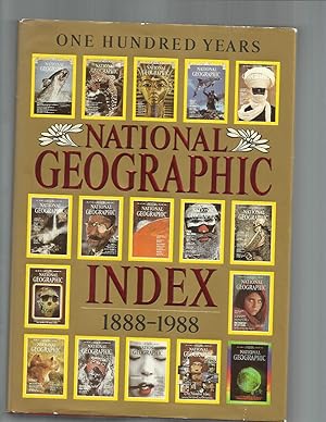
NATIONAL GEOGRAPHIC INDEX: 1888~1988. ONE HUNDRED YEARS.
Published by Washington DC. 1989. National Geographic Society, 1989
big thick red, gilt & embossed decorative faux leather "leatherette" hardbound 4to ~ 4� (quarto). very heavy, international or priority shipping will cost extra. dustwrapper in protective plastic book jacket cover. fine cond. binding square & tight. covers clean. edges clean. contents free of all markings. dustwrapper in near fine cond. missing 1cm piece on rear at bottom, not price clipped (no price listed). nice clean copy. looks new. like new. no library markings, store stamps, stickers, bookplates, no names, inking , underlining, remainder markings etc ~ 5th printing. full color endpaper maps. 1215p. glossy pages throughout. a to z listings. illustrated throughout with glossy full color photos, maps & drawings. almost every page illustrated. world history. geography. travel. exploration. archaeology. anthropology. art history. ~ THIS COMPREHENSIVE index turns an entire century's worth of NATIONAL GEOGRAPHICS into a reference work and historical chronicle. It also recounts in words and more than a thousaad images the story of the National Geographic Society and its magazine. Spanning issues from October 1888 through December 1988, the volume catalogs the some 7,000 magazine articles published during those years, making their subject matter immediately accessible. The alphabetical listings at the heart of the index include thousands of subject categories and specific entries on nature, science, biography, history, technology, and geography in its many forms. Within subject listings, article titles are given in chronological order from most recent to oldest. Features include titles of other Society publications and educational products, such as map supplements, books, television programs, and videos. Nonmagazine entries are symbol coded to speed the user's search for the precise information desired. Additionally, word guides above entry columns make the search easier, as do printed alphabetical thumb tabs. Typography has been designed so that subject headings stand out as pages are scanned. Especially useful is the extensive cross~indexing designated by "See also" references. A prime resource for the many members who preserve their GEOGRAPHICS, this index is also indispensable to libraries, where newer Society members or their children may increase their general knowledge or research school reports. In all. this volume lists the contents of 1,148 magazine issues.
-
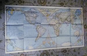
A Map of the World; Rare Excl. cond. December 1941
Published by National Geographic Society (U.S.), 1941
Map First Edition
No Binding. Condition: Very Good. 1st Edition. A Map of the World; sheet map (folded) Excellent no marks supple paper no pin holes at corners. Grosvenor, Gilbert [Editor] | Darley, James M [Cartographer] Material type: Map Map Publisher: Washington, D.C. : National Geographic Society, 1941 Description: 1 map : color ; 2 hemispheres, each 50 cm in diam., on sheet 56 x 104 cm, folded to 16 x 21 cm James Darley, Chief Cartographer. , Scale 1:35,000,000 ; Azimuthal equal area projection; (W 180°--E 180°/N 90°--S 90°). - 1 map : color ; 2 hemispheres, each 50 cm in diam., on sheet 56 x 104 cm, folded to 16 x 21 cm Relief shown by hachures and spot heights. "International boundaries as of Sept. 1, 1939." "December, 1941." Ancillary maps: World mapping -- Time zones -- Land hemisphere -- Water hemisphere -- Density of population (Western hemisphere) -- Density of population (Eastern hemisphere). Insets: Land Hemisphere -- World mapping -- Water hemisphere -- Time zones -- Density of population.
-

Sammlung von 9 Karten
Seller: Celler Versandantiquariat, Eicklingen, Germany
Association Member: GIAQ
Seller rating 5 out of 5 stars

James M. Darley, Washington, (um 1957). 9 farbige mehrfach gefaltete Karten, broschiert, unterschiedliche Ma�e und Ma�st�be---Verlag: James M. Darley Verlag: James M. Darley - gute Exemplare/ Enthalten sind folgende Karten: Antarctica Ma�stab 1 : 7 000 000/ The United States Ma�stab 1 : 7 603 200/ Central Canada Ma�stab 1 : 2 851 200/ Germany Ma�stab 1 : 1 520 640/ Italy Ma�stab 1 : 2 154 240/ National Parks Monuments and Shrines of The United States and Canada Ma�stab 1 : 7 603 200/ Battlefields of The Civil War with Descriptive Notes Ma�stab 1 : 2 851 200/ The World Ma�stab 1 : 63 360 000/ Southern Africa Ma�stab 1 : 7 920 000 - 262 Gramm.