
Official Use Only (9 results)

Published by Naval Intelligence Division, England 1944
- Hardcover
Seller: Bücher-Insel Antiquariat Rolf Selbert, Kassel, GermanyBücher-Insel Antiquariat Rolf Selbert
Contact seller4-star sellerCondition: Used
US$ 23.54
US$ 45.71 shippingShips from Germany to U.S.A.Quantity: 1 available
611 S. Zahlreiche Karten, Diagramme, Schaubilder, Fotos auf Kunstdruckpapier, hinten große Faltkarte in Tasche. Englischer Text. Staunenswert gründlich und umfassend! Leinen Griff- und Altersspuren, Text/Schnitte etwas nachgebräunt, innen sauber/gut, kpl.
 More images
Language: English
Published by Government Monotype Press, Simla 1915
- Hardcover
- First Edition
Seller: FOLIOS LIMITED, Oxford, United KingdomFOLIOS LIMITED
Contact seller5-star sellerCondition: Used - Good
US$ 4,775.51
US$ 46.36 shippingShips from United Kingdom to U.S.A.Quantity: 1 available
Hardcover. Condition: Good. First Edition. Demy 8vo. iv, 211 pp., lacking folding map, numerous tables, contemporary printed vellum, slightly soiled, paper browned, index, printed at the Government Monotype Press. Scarce and rare guide used only by British military during the First World War in Iraq. The work covers history, geo…graphy, population, natural resources of Iraq, together with notes on the Turkish army in the country and navigation in Tigris and Euphrates. It also describes routes in Mesopotamia which includes 36 different routes including Kuwait to Basrah, Umm Qasr to Zubair, Fao to Basrah, and Basrah to Baghdad. The political situation in Iraq at that period was intimately connected with that in Arabia and the Arab Gulf. During the 19th century the British who were base in India gradually built up for themselves a special position in the Arab Gulf and Lower Mesopotamia. Almost the whole trade of the region was in British hand. #34120.
Published by Printed in France by Army Printing and Stationary Services 1917
Seller: E.J Morten Booksellers BA, MANCHESTER, , United KingdomE.J Morten Booksellers BA
Contact seller4-star sellerCondition: Used
US$ 54.58
US$ 16.56 shippingShips from United Kingdom to U.S.A.Quantity: 1 available
Original paper covers 7pp Royal West Kent Regiment ink Stamp to front covers O/w A Vg copy and SCARCE.
Published by Printed in France by Army Printing and Stationary Services 1917
Seller: E.J Morten Booksellers BA, MANCHESTER, , United KingdomE.J Morten Booksellers BA
Contact seller4-star sellerCondition: Used
US$ 54.58
US$ 16.56 shippingShips from United Kingdom to U.S.A.Quantity: 1 available
Original paper covers 9pp Queens Own Royal West Kent ink Stamp to front cover Vg Copy and SCARCE.
Published by Army Printing and Stationary Services 1917
Seller: E.J Morten Booksellers BA, MANCHESTER, , United KingdomE.J Morten Booksellers BA
Contact seller4-star sellerCondition: Used
US$ 54.58
US$ 16.56 shippingShips from United Kingdom to U.S.A.Quantity: 1 available
Original paper covers 10pp Queens Own West Kent ink stamp to front cover Vg and SCARCE.
Published by Naval Intelligence Division Admiralty SW1 January 1943
Seller: E.J Morten Booksellers BA, MANCHESTER, , United KingdomE.J Morten Booksellers BA
Contact seller4-star sellerCondition: Used
US$ 61.40
US$ 16.56 shippingShips from United Kingdom to U.S.A.Quantity: 1 available
Original Blue Card Covers 52pp, Silhouettes , Photographs, SCARCE German Naval Vessel Intelligence Booklet In Vg Condition.
 More images
Published by Director General of Ordnance Survey, London 1959
Seller: Polar Books, Llandudno, CONWY, United KingdomPolar Books
Contact seller5-star sellerCondition: Used - Very good
US$ 47.76
US$ 33.12 shippingShips from United Kingdom to U.S.A.Quantity: 1 available
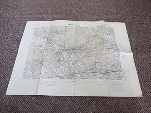
Map. Condition: Very Good. No Dust Jacket. Early Edition. Helizincograph Folding paper map, printed on a type of waxed linen surface. Reduced from G.S.G.S. 2748 issued by the war office Map measure 58cm x 40cm. The camps round Bisley are shown as are the shooting ranges, The Royal Military College as well as Broadmoor Lunatic As…ylum. Interesting map. Poorly folded Quantity Available: 1. Shipped Weight: Under 1 kilogram. Category: Geography & Maps; Pictures of this item not already displayed here available upon request. Inventory No: 4035.
 More images
Published by Simla Government Monotype Press. - Calcutta Superintendent Government Printing India. 1911 1907
Seller: HALEWOOD AND SONS ABA ILAB Est. 1867., PRESTON, , United KingdomHALEWOOD AND SONS ABA ILAB Est. 1867.
Contact seller2-star sellerCondition: Used
US$ 13,637.49
US$ 16.03 shippingShips from United Kingdom to U.S.A.Quantity: 1 available
Royal 8vo Hardbacks in worn contemporary Half Calf. Ex "Officers Library of the Prince of Wales Volunteers."( with neat stamps to endpapers.) Comprising volumes 1 to 6 and with Supplement vol. 1 - supplement A - Operations against the Mohmands (including operations in the Khaiber, 1st - 7th May) 1908. With 52 folding Maps and Ch…arts (some in end pockets.) The 2nd Supplement volume is not present. Vol. 1 lacks General map from front pocket and vol. 3 lacks Afghanistan map from end pocket otherwise a Very Good set of this extremely Rare and Important work. (extra postage required for overseas shipping).
 More images
Published by Saint LouisAeronautical Chart and Information Center. . 1970
- Map
Seller: Robert Frew Ltd. ABA ILAB, London, , United KingdomRobert Frew Ltd. ABA ILAB
Contact seller5-star sellerCondition: Used
US$ 1,705.54
US$ 13.25 shippingShips from United Kingdom to U.S.A.Quantity: 1 available
2 maps (78 x 102 cms.) printed back to back in colour on a single sheet of rayon (artificial silk), marked "For official use only " in red. Muscat and Oman on one side, on verso Saudi Arabia, Southern Yemen and the Trucial States with the Persian Gulf top right. An excellent example, clean and crisp. "This chart is reproduced fr…pm ONC J-7. 3rd edn with boundary and country names revision by SPC. RE 1969." "Base information compiled May 1960 (PIE) from source dated August 1945 to 1959 revised March 1968 from source dated October 1966." The Escape and Evasion / Operational Navigational Charts (ONCs) are used by UK forces. They are maps produced by the American Aeronuatical Chart and Information Center on a scale of 1:1,000,000, designed for pilots to identify topographical features but also as Escape and Evasion maps for downed crew. They are made of artificial silk to be tough, quiet and resilient and to be easily folded and pocketed or otherwise hidden. This one was produced in the middle of the Dhofar Rebellion (1962-1976).


