Order Total (1 Item Items):
Shipping Destination:

Ogilby John, Signed (5 results)
Skip to main search results
Search filters
Product Type
- All Product Types
- Books (5)
- Magazines & Periodicals (No further results match this refinement)
- Comics (No further results match this refinement)
- Sheet Music (No further results match this refinement)
- Art, Prints & Posters (No further results match this refinement)
- Photographs (No further results match this refinement)
- Maps (No further results match this refinement)
- Manuscripts & Paper Collectibles (No further results match this refinement)
Condition Learn more
- New (No further results match this refinement)
- As New, Fine or Near Fine (No further results match this refinement)
- Very Good or Good (2)
- Fair or Poor (No further results match this refinement)
- As Described (3)
Binding
- All Bindings
- Hardcover (3)
- Softcover (No further results match this refinement)
Collectible Attributes
- First Edition (4)
- Signed (5)
- Dust Jacket (No further results match this refinement)
- Seller-Supplied Images (3)
- Not Print on Demand (5)
Language (1)
Price
- Any Price
- Under US$ 25 (No further results match this refinement)
- US$ 25 to US$ 50 (No further results match this refinement)
- Over US$ 50
Free Shipping
Seller Location
Seller Rating
-
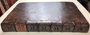
Hardcover. Condition: Good. First. THE FIRST BRITISH ROAD ATLAS, FROM THE LIBRARY OF THE FATHER OF BRITISH MOTORING. First edition, second issue. London: the author, 1675. Folio (15 7/8" x 10 7/8", 403mm x 278mm). [Full collation available.] With 102 engraved plates: a title-page by Wenceslaus Hollar after Francis Barlow, a double-page map of Britain and 100 double-page strip-maps of roads. Bound in contemporary blind-panelled calf (re-backed). On the spine, seven raised bands. Author and title gilt to the second panel, date gilt to the tail. Re-backed. Scuffed, rubbed and worn, particularly to the fore-corners. Tanned, with some passages of foxing. An old tape repair to the front free end-paper, creased with some offsetting. A repaired pre-printing trimming-tear to pl. 8 (following p. 18). Plate 51 shaken, cropped at the left-hand edge. Plates 69 and 100 low impressions, with the plate just cropped at lower-right, affecting the plate-number but not the cartography. Filled loss to the upper fore-corners of pl. 96, outside the plate-mark. Plate 45 distended from the text-block, with some sanguine chalk in the margins. Armorial bookplate of Ditton Park to the front paste-down, with three campaigns of shelf-marks in sanguine ink below ("E-x.", "G-x.", "K-i." with "E" and "G" struck through). A type-written note signed by Arthur Collis laid in. John Ogilby (1600-1676) was a Scottish-born royalist -- itself remarkable -- who flourished in the years following the Restoration of the monarchy after the British Civil War. He was a translator and playwright, and planned the coronation of Charles II. For all that, however, the great monument of Ogilby (sometimes Ogelby or Ogilvy) is not his Iliad or Aeneid but the Britannia, the first road atlas of Britain, the surveying (the engraved title by Wenceslaus Hollar shows the use of the surveyor's wheel, called the "waywiser" by Ogilby) having been undertaken at enormous expense. The strip map derives from the Roman itinerarium, the list of stops along a road, and is well-suited to translating long routes into the familiar rectangular aspect of a map; the one inch to one mile scale made the distances uniformly comprehensible. Ogilby enhances this with the motif of the ribbon, a jibe no doubt at Oliver Cromwell's puritanical persecution of pompousness in dress. Though projected to survey the whole of Britain (i.e., England, Wales and Scotland), Britannia ran to just one volume (of a presumed two). The present example is the second issue of the work, with the following points: the four-page description of London, the absence of the dedication to Gilbert Sheldon Archbishop of Canterbury (accounting for the jump from quire E to quire H) and a catchword of "132" at D1r. (Donald Hodson's unpublished 2000 University of Exeter doctoral dissertation, The early printed road books and itineraries of England and Wales, lays out a much more nuanced archaeology of states.) Ditton Park, between Heathrow airport and Slough, has long been held by the Montagu(e) family; the bookplate with the baron's coronet above the Douglas-Montagu arms was used by John Walter Edward Douglas-Scott-Montagu, second Baron Montagu of Beaulieu. Baron Montagu (1866-1929) was the great English evangelist of motoring (i.e., driving cars); the Spirit of Ecstasy bonnet mascot (hood ornament) of the Rolls Royce is based on the mistress of Baron Montagu, who is also said to have introduced King Edward VII to motoring. His son, the third baron (d. 2015) established the National Motor Museum in his father's honor. ESTC R483348.
-
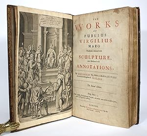
The Works of Publius Virgilius Maro, Translated, Adorned with Sculpture, and Illustrated with Annotations
Published by Thomas Roycroft, London, 1668
Seller: Minotavros Books, ABAC ILAB, Whitby, ON, Canada
Seller rating 5 out of 5 stars

Signed
Hardcover. Condition: Very Good. No Jacket. 2nd Edition. 4to - over 9¾ - 12" tall. Second edition. Paneled brown calf. A.E.G. [10], 136, 177-528 pp. Text apparently continuous per catchwords, but signatures skip from S4 to Aa in Aeneis Book I (commensurate with other copies of this edition). Embellished with 100 engravings, including double-page map, plus engraved frontis., woodcut initials, headpieces and endpiece. Some engravings signed by in plate by Pierre Lombart and Wenceslaus Hollar. Recently professionally rebacked, new leather spine w/ spine label and gilt stamped compartments. Calf boards rubbed and scuffed. Light foxing. Paper repair to p. 197 to tear at bottom edge, text only marginally affected but still readable. ESTC R34731. Signed.
-

AN // EMBASSY // FROM THE // East-India Company // OF THE // UNITED PROVINCES, // TO THE // Grand Tartar Cham // EMPEROUR OF // CHINA, // Delivered by their Excell[en]cies // PETER DE GOYER, and JACOB DE KEYZER, // At his Imperial City of // PEKING. // WHEREIN // THE CITIES, TOWNS, VILLAGES, PORTS, RIVERS, etc. // In their Passages from CANTON to PEKING, // Are Ingeniously Described by MR. JOHN NIEVHOFF, Steward to the // AMBASSADOURS. // ALSO// An Epistle of Father JOHN ADAMS their Antagonist, concerning the whole// Negotiation. // WITH //An Appendix of several Remarks taken out of Father ATHANASIUS KIRCHER. //Englished and set forth with their several Sculptures, by JOHN OGILEY, Esq; Master of // his Majesties Revels in the Kingdom of Ireland. // LONDON, // Printed by John Macock for the Author, MDCLXIX.
Published by Printed by John Macock for the Author [Ogilby],. c.1669, London, 1669
Seller: Alexandre Antique Prints, Maps & Books, Toronto, ON, Canada
Seller rating 4 out of 5 stars

First Edition Signed
Edition : First or 1669 Edition in English., Contemporary mottled full calf, rebacked expertly saving the original spine, spine with seven raised gilt bands; compartments densely gilt ornamentated; with gilt lettered title on brown morocco label on two and three. Blind dentelle pattern tooled on edges of covers; pasted and free endpapers marbled. , John or Johann Nieuhof, 1618 ? 1672 is best known for the account of his journey from "Guangzhou"Canton to Peking in 1655-1657, which enabled him to become an authoritative Western writer on China. The book was first published in Dutch in 1665 by Johan's brother Hendrik and the Amsterdam based publisher and printer Jacob van Meurs. The publication was successful, several edited editions followed, geared towards commercial interests, also translated into French, German, Latin and eventually into English. The English version was not published by Van Meurs, but by John Ogilby instead. The book consists of the notes and illustrations that Nieuhof made in his position as a steward on Peter de Goyer and Jacob de Keizer's embassy to the emperor of China. The work itself is split into two parts. The first part contains the written account of the embassy led by Peter de Goyer and Jacob de Keizer to the emperor of China. It details the entire journey from "Guangzhou"Canton to Peking and back again. This part also contains descriptions and depictions of all that the embassy came to pass on its trip. The second part consists of an overview of China, describing bridges, mountains, temples, customs and costumes supported by illustrations. Prior to this period, the image of the Chinese in Europe was dominated by fantasy illustrations. Many subsequent artists and architects based their work on Nieuhof's pictures. The present copy John Ogilby?s translation and the first Edition in English. Apart from 'An embassy from the East-India Company??, Nieuhoff?s account of his journey, it also includes ?A Narrative of the Success of an Embassage sent by John Maatzuyker's de Badem, General of Batavia?? and Kircher?s ?An Appendix or Special Remarks taken at large out of Athanasius Kircher/ His / Antiquities of China.?, Size : Folio (418 x 270mm.), engraved frontispiece portrait of John Ogilby by Lilly and engraved by Lombart; engraved illustrated title signed and dated by ?W.[enceslas] Hollar, 1668.?; printed title in red and black ink; map of China signed by Hollar [double page], dedication leaf to King Charles; with 17 full-page and 2 double-page plates. 121 in-text illustrations throughout, as well as head-piece vignettes and rubricated, historiated initials at openings of dedication and sections; one endpiece.Wide margined, large paper copy; main text jumps from 184 to 205 without loss of content. , References : Cordier (Sinica) II, 2347; Lust 536; Wing N1153, John Ogilby?s Englis, PP. illustrated title, blank, printed title, blank, map; dedication leaf to King Charles; 327, bl.; 1-18; appendix 1-106, [19 ill.]. A fine, attractive and handsome copy with text and plates clean and crisp.
-
Britannia. Volume the First: or an Illustration of the Kingdom of England and Dominion of Wales: By a Geographical and Historical Description of the Principal Roads thereof.
Published by London: Printed by the Author at his House in White-Fryers, 1675, 1675
Seller: Arader Galleries - AraderNYC, New York, NY, U.S.A.
Seller rating 5 out of 5 stars
First Edition Signed
1st Edition. Folio (16 x 10 1/2 in.; 40.6 x 26.7 cm). Engraved frontispiece by Wencelaus Hollar after Francis Barlow, letterpress title-page printed in red and black, double-page map of England and Wales signed James Moxon in lower left corner, 100 double-page engraved road maps, engraved headpieces and historiated initials. BINDING/CONDITION: Some browning and foxing to text, about 15 maps browned, paper flaw in upper left corner of map 8 and so printed, map 45 and text partially sprung from text block, left margin of map 51 cropped slightly affecting first portion of the route, lower margins of maps 69 and 100 shaved costing plate number. Contemporary calf; covers scuffed, rebacked, some edges renewed. (64F5A) FIRST EDITION OF "THE FIRST SURVEY OF THE ROADS OF ENGLAND AND WALES" (Chubb). The second issue, with catchword "132" on D1r and without the dedication to Archbishop Gilbert. All published. Ogilby's work was composed of 73 major roads and cross-roads, presented in a continuous strip form. For the first time in England, an atlas was prepared on a uniform scale, at one inch to a mile, based on the statute mile of 1,760 yards to the mile. Villages and mansions along the roads are identified, and in some cases the names of the residents are also given. According to one source, Ogilby claimed that 26,600 miles of roads were surveyed in the course of preparing the atlas, but only about 7,500 were actually depicted in print. "In its comprehensiveness, its incorporation of new devices of computation and delineation, and its opulence of paper, design and decoration, it immediately set a new standard for map-making in England.this volume was an attempt at a scientific study not only of the roads but also the terrain and habitations on either side of the roads" (K.S. Eerde, "John Ogilby and the Taste of his Times," 1976, p. 137). PROVENANCE: The Dukes of Buccleuch (small engraved armorial ticket of Ditton Park on pastedown and shelfmark) REFERENCES: Chubb CI; ESTC R483348; Wing O-168. Signed by Author(s).
-
Atlas Japannensis: being Remarkable Addresses by way of Embassy from the East-India Company of the United Provinces to the Emperor of Japan.
Published by London: Tho. Johnson for the Author, 1670., 1670
Seller: Arader Galleries - AraderNYC, New York, NY, U.S.A.
Seller rating 5 out of 5 stars
First Edition Signed
1st Edition. Folio (16 x 10 2/8 inches). Engraved title-page, letterpress title-page printed in red and black, five fine large double-page folding engraved maps and views of Batavia and Japan (that of Iedo creased), 20 double-page views, plans and scenes of Japanese culture, illustrated throughout with engraved vignettes of life in Japan, head-pieces and initials. (some minor spotting, occasional marginal worming, repair to foot of 3D2). Late 19th-century half speckled calf (rebacked to style). First edition in English, "English'd, and Adorn'd with above a hundred several sculptures, by John Ogilby Esq; Master of His Majestie's Revels in the Kingdom of Ireland." First published as "Gedenwaerdige Gesantschappen der Oost-Indische Maetschappy in't Vereenigde Nederland aen de Kaisaren van Japan" published in Amsterdam in 1669, a year earlier in Amsterdam. An attractive copy of Montanus's rich cornucopia of accounts from emissaries of the Dutch East India Company, with an AUTOGRAPH NOTE SIGNED BY THE TRANSLATOR JOHN OGILBY TO THE FIRST EARL OF SHAFTESBURY, THE LORD ASHLEY, dated October 15th 1670, laid down on the front paste-down: Received of the Right Honourable the Lord Ashley by the hand of Mr. Tho: Stimpson the fund of four pounds ten shillings being [some words obscured by Ogilby] for the 2 first volumes of my English Attlas, that is to say Affrica & Japan. I say received John Ogilby". Anthony Ashley-Cooper (1621-1683) was a prominent English politician in the interregnum period during the reign of Charles II. He was a patron of John Locke, who attended him initially as his physician, and as his secretary. In 1663 Ashley was one of the eight Lords Proprietors given the title to a large tract of land in North America that became the Province of Carolina. With Locke he co-wrote the "Fundamental Constitutions of Carolina" in 1669. "Exceedingly rare. The plates to this work represent a high-water mark in book illustrations of the 17th century. Apart from these, this book remains one of the most curious of the numerous works of travel in the Orient during the 17th century" (Cox I:325). Cordier Japonica 384; Lowndes 4, 1719; Wing M-2485. Signed by Author(s).