Order Total (1 Item Items):
Shipping Destination:

Phillips John Rider (1 results)
Skip to main search results
Product Type
- All Product Types
- Books (1)
- Magazines & Periodicals
- Comics
- Sheet Music
- Art, Prints & Posters
- Photographs
- Maps
-
Manuscripts &
Paper Collectibles
Condition
- All Conditions
- New
- Used
Binding
- All Bindings
- Hardcover
- Softcover
Collectible Attributes
- First Edition
- Signed
- Dust Jacket
- Seller-Supplied Images
- Not Printed On Demand
Seller Location
Seller Rating
-
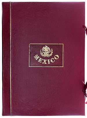
Mexico illustrated in Twenty-Six Drawings. With descriptive Letter-Press in English and Spanish.
Published by LondonE. Atchley Library of Fine Arts 106 Great Russell Street ., 1848
Seller: Robert Frew Ltd. ABA ILAB, London, United Kingdom
Association Member: ABA ILAB PBFA
Seller Rating:

Book First Edition
FIRST EDITION. Folio (63 x 45 cm). Bilingual (English & Spanish) text comprising printed title and 26 leaves between original red cloth backed yellow coated end-papers, together with the plates tipped in loosely within the restored original cloth portfolio, comprising original boards with yellow coated endpapers, original gilt lettered red morocco title label to upper cover, rebacked in matching red morocco, renewed cloth sides and silk ties. 26 (including title) tinted lithographs by Messrs Rider and Walker after drawings Phillips and Rider printed by Day & Son all with original hand-colour. Ex libris G. Toulmin Esq. with his old ownership inscription to title-page dated 28 May 1856. A very handsome copy of this book published almost concurrently with the end of the Mexican-American War. Originally published at �4.4s. plain and �10.10s. coloured, as here, from that furnace of bibliophilia at 106 Great Russell Street. The work was clearly published both as a purely topographical work of the highest quality and as an attempt to capitalise on the interest that the Mexican-American War had generated in England as well as the United States. The plates derive from a fascinating number of sources, ranging from straightforward eyewitness records by both John Phillips and Alfred Rider, to an adaptation of a 17th- century engraving first published by Arnoldus Montanus, to a number of views taken from the earlier work of Carl Nebel and Pedro Gualdi. The main thrust of the work is to offer a fine topographical overview of the country. The order of the plates leads the viewer on a tour of the country starting at Campeche on the southern rim of the Gulf of Mexico, along the coast to Vera Cruz, turning inland to Mexico City via Jalapa, Orizaba, and Puebla. After some time spent in the capital and its environs, the tour turns north up through the center of the country to San Luis Potosi and Monterey before finally heading east and returning to the Gulf at the mouth of the Rio Grande at Matamoros. The lithographs are the work of Day & Son, "Lithographers to the Queen." Day & Son was the foremost lithography firm in Britain for much of the 19th century, and continued in various forms until 1940. (Abbey Travel, 671; Sabin, 62498; Palau 224780).