Published Davis (18 results)

Published by Oxford University Press 1967
- Hardcover
- First Edition
Seller: Dorothy Meyer - Bookseller, Batavia, IL, U.S.A.Dorothy Meyer - Bookseller
Contact seller4-star sellerCondition: Used - Very good
US$ 9.00
US$ 6.95 shippingShips within U.S.A.Quantity: 1 available
Hardcover. Condition: very good. Dust Jacket Condition: very good. First Edition date same on title. NOT an ex library book. Name top of front endpaper. 682 pages including the index. Dust jacket has minimal wear on edges, no chips. Price is clipped.

Language: English
Published by Tina Barton, Susan Davis and Priscilla Pitts, Auckland 1990
- Softcover
- First Edition
Seller: Tinakori Books, Lower Hutt, , New ZealandTinakori Books
Contact seller5-star sellerCondition: Used - Very good
US$ 30.00
US$ 33.00 shippingShips from New Zealand to U.S.A.Quantity: 1 available
Soft cover. Condition: Very Good. First Edition. 113 pages, b/w illustrations. Antic was a magazine of literary and visual arts criticism and discussion published between 1986 and 1990. There were seven issues in total. This statement was published in the first issue: The idea for this magazine was first floated at the ANZART Fe…minist Art Seminar in May 1985. Concern at the general lack of a forum for critical discussion, especially in the visual arts, was voiced frequently during the weekend seminar. We were also aware that And was shortly due to publish its last issue. Antic is exploring issues in critical practice, theory, and related work in fiction; encouraging dialogue between disparate disciplines, approaches and texts. Antic hopes to foreground aspects of a growing body of work dealing with recent directions in feminist and other theoretical practices often ignored by existing art publications in New Zealand.Page art is an integral aspect of the magazine.
 More images
Published by Davis & Southworth, Portland, ME 1849
- Hardcover
- First Edition
Seller: Resource Books, LLC, East Granby, CT, U.S.A.Resource Books, LLC
Contact seller5-star sellerHardcover. Condition: Fair. First Edition. Portland, ME: Davis & Southworth, 1849. First edition, title page dated 1849. Biographies of noted craftsmen in footwear. Brown cloth decoratively blindstamped, gilt spine lettering, 340 pages. Covers lightly rubbed with additional wear to corners and spine ends, good hinges, sound text… block, moderate foxing (age speckling) throughout with more to the endpapers and first few pages, rectangular tanned area from an old receipt for this book laid in loosely at the front since 1944 when the last purchaser bought it from the Red Sheild Store for 25 cents, no other names or markings. First Edition. Hard Cover. Fair. 12mo - over 6¾" - 7¾" tall.
 More images
Published by Davis, Porter & Co., Philadelphia 1865
- Softcover
Seller: Resource Books, LLC, East Granby, CT, U.S.A.Resource Books, LLC
Contact seller5-star sellerCondition: Used - Fair
US$ 117.99
Free ShippingShips within U.S.A.Quantity: 1 available
Paperback. Condition: Fair. Philadelphia: Davis, Porter & Co., 1865. Undated, ca. 1865. Children's chapbook with rhyming poems about various animals, with hand tinted woodcut on each page plus front and rear cover. Softcover, 8 pages plus covers. Fair condition with binding restitched and spine edge, edgewear to covers, pages li…ghtly age-toned but clean, no names or other markings. Soft Cover. Fair. 32mo - over 4" - 5" tall.

Published by For H. L. Davis Company By Dart & Bigelow, Taunton, Mass., Providence, RI 1900
- Softcover
Seller: Resource Books, LLC, East Granby, CT, U.S.A.Resource Books, LLC
Contact seller5-star sellerCondition: Used - Very good
US$ 152.99
Free ShippingShips within U.S.A.Quantity: 1 available
Paperback. Condition: Very Good. Taunton, Mass., Providence, RI: For H. L. Davis Company By Dart & Bigelow, 1900. Undated, ca. 1900. Approximately 30 pages of black and white views of Taunton, Massachusetts, printed on one side only. Softcover, oblong format, about 5.25 x 7.75 inches. Very light edge rubbing, sound binding, very… clean pages, no names or other markings. Soft Cover. Very Good. Oblong 12mo.
 More images
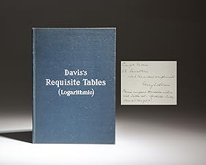
Published by J.D. Potter, London 1905
- Hardcover
- First Edition
- Signed
Seller: The First Edition Rare Books, LLC, Cincinnati, OH, U.S.A.The First Edition Rare Books, LLC
Contact seller5-star sellerCondition: Used - Near fine
US$ 225.00
US$ 6.00 shippingShips within U.S.A.Quantity: 1 available
Cloth. Condition: Near fine. First Edition. Octavo, vi, 178pp. Blue cloth, rigid hardcover, title stamped in white on front cover. Includes hundreds of logarithmic tables. Inscribed by the author: "Capt. Moore / SS Leviathan / with the author's compliments / 1931 / Percy L. Davis / Please compare Haversines within with Table 45…- Where did they get it?" The SS Leviathan, originally built as the SS Vaterland, was a prominent ocean liner in the early 20th century. Launched in 1913 by the Hamburg America Line, the Vaterland was the largest passenger ship in the world at the time of her completion. She began her maiden voyage in 1914, but her career as a German liner was short-lived due to the outbreak of World War I. Seized by the United States in 1917, she was renamed the SS Leviathan and served as a troopship during the war. After the war, the Leviathan was refitted for passenger service and became a flagship for the United States Lines, symbolizing American maritime prowess. She served the transatlantic route, offering luxurious accommodations and epitomizing the grandeur of ocean travel in the Roaring Twenties. The SS Leviathan remained in service until 1934, marking an era of significant transitions in maritime history and technological advancements in shipbuilding. The recipient of this copy, Captain Alfred M. Moore (1887-1967), served in both World Wars as a captain on several U.S. ships. He died in 1967 in Ellsworth, Maine. Inscribed to the captain of the S.S. Leviathan, the first edition of Percy Davis' Requisite Tables for Seamen, published in London in 1905. (illustrator). Signed.
 More images
Published by National Publishing Company, Philadelphia 1869
- Hardcover
- First Edition
Seller: The First Edition Rare Books, LLC, Cincinnati, OH, U.S.A.The First Edition Rare Books, LLC
Contact seller5-star sellerCondition: Used - Very good
US$ 375.00
US$ 6.00 shippingShips within U.S.A.Quantity: 1 available
Cloth. Condition: Very good. First Edition. Octavo, viii, 536pp. Publisher's orange pebbled cloth, title in gilt on spine. Includes frontispiece portrait of Davis, with tissue cover and light foxing to both. Sound text block, light soiling to endpapers and title page. (Howes P-454) (Sabin 63872). A critical look at the life of J…efferson Davis, from the editor of the Richmond Examiner. Pollard treats his subject with hostility, charging him with incompetence, places blame for the failure of the Confederacy on him. Pollard's most famous work was The Lost Cause: A New Southern History of the War of the Confederates, published in 1866. Life Of Jefferson Davis, With A Secret History Of The Southern Confederacy by Edward A. Pollard, published in 1869. (illustrator).
 More images
Published by D. Appleton and Company, New York 1880
- Hardcover
- First Edition
Seller: The First Edition Rare Books, LLC, Cincinnati, OH, U.S.A.The First Edition Rare Books, LLC
Contact seller5-star sellerCondition: Used - Near fine
US$ 1,250.00
US$ 6.00 shippingShips within U.S.A.Quantity: 1 available
Cloth. Condition: Near fine. Salesman's Sample. Octavo, [2], [30pp], [30 ruled pages for subscribers]. Publisher's brown pebbled cloth, title stamped in gilt on front cover, scattered white speckling on front panel. Patterned endpapers. Includes 16 engraved plates found in the first edition of Rise and Fall. The first 30 pages a…re samples from the forthcoming text. The subscriber's list is blank. Includes two binding backstraps on pastedown, featuring the full brown morocco and full sheepskin binding. Both hinges show wear, but stable. Solid text block. Offsetting from backstrap samples to endpapers, scattered foxing to plates. (Eicher 154) (Howes D120) (Nevins II: 51) A scarce work, with only two known copies appearing on the public market. Written by Jefferson Davis (1808-1889), the former President of the Confederate States, The Rise and Fall of the Confederate Government is considered the magnum opus of the Southern cause. It remains a controversial historical piece, with its attempt to justify the Southern cause for secession. Davis followed it with A Short History of the Confederate States of America, completed shortly before his death in 1889. Salesman's Dummy copy of The Rise and Fall of the Confederate Government by Jefferson Davis, published in 1881. (illustrator).
 More images
Published by Government Printing Office in Washington D.C., Washington D.C. 1895
- Map
Seller: JF Ptak Science Books, Hendersonville, NC, U.S.A.JF Ptak Science Books
Contact seller5-star sellerCondition: Used - Near fine
US$ 100.00
US$ 6.00 shippingShips within U.S.A.Quantity: 1 available
No Binding. Condition: Near Fine. Washington D.C. , Maryland, Pennsylvania, Delaware, southern New Jersey, Northern Virginia, West Virginia, Map, published in "Atlas to Accompany the Official Records of the Union and Confederate Armies" (1891-1895) 136 sheet #1 (General Topographical Map). This covers the D.C. region for the are…a 110 miles to the north of DC, 150 miles to the west, 100 miles to the east, and 40 miles to the south. U. S. Government Printing Office, Washington, D. C, 1895. Sheet 29"18". This color lithograph map was published in 1895 at the Government Printing Office in Washington D.C. Published under the direction of the Hons. Redfield Proctor, Stephen B. Elkins and Daniel S. Lamont, secretaries of war, by Maj. George B. Davis, U.S. Army, Mr. Leslie J. Perry, civilian expert, Mr. Joseph W. Kirkley, civilian expert, Board of Publication. Compiled by Capt. Calvin D. Cowles, 23d U.S. Infantry. This is an absolutely stand-out achievement in cartography and an essential element of the massive war records of the Civil War. The maps published in this atlas were tremendously detailed (depending of the scale). In general the maps locate topographic and geographical factors, plus railroads, forts, encampments, and in some cases when the scale allows, it is detailed to individual houses. It of course shows troop movements, battle positions, and lines of battle and its progress. The work done for the atlas is superb. Nothing is printed on the back of the map—the verso is clean and blank. FINE condition. "This is the most detailed atlas yet published on the Civil War. It consists of reproductions of maps compiled by both Union and Confederate soldiers."--"Civil War Maps" by Richard Stephenson. 2nd edition. Scale: 10 miles to the inch.

Published by Government Printing Office in Washington D.C., Washington, D.C. 1895
- Map
Seller: JF Ptak Science Books, Hendersonville, NC, U.S.A.JF Ptak Science Books
Contact seller5-star sellerCondition: Used - Near fine
US$ 100.00
US$ 6.00 shippingShips within U.S.A.Quantity: 1 available
No Binding. Condition: Near Fine. (Kentucky and Tennessee) General Topographical Map, #15 (Plate 150). Map, in "Atlas to Accompany the Official Records of the Union and Confederate Armies" (1891-1895). U. S. Government Printing Office, Washington, D. C, 1895. Sheet 29"18". This color lithograph map was published in 1895 at the G…overnment Printing Office in Washington D.C. Published under the direction of the Hons. Redfield Proctor, Stephen B. Elkins and Daniel S. Lamont, secretaries of war, by Maj. George B. Davis, U.S. Army, Mr. Leslie J. Perry, civilian expert, Mr. Joseph W. Kirkley, civilian expert, Board of Publication. Compiled by Capt. Calvin D. Cowles, 23d U.S. Infantry. This is an absolutely stand-out achievement in cartography and an essential element of the massive war records of the Civil War. The maps published in this atlas were tremendously detailed (depending of the scale). In general the maps locate topographic and geographical factors, plus railroads, forts, encampments, and in some cases when the scale allows, it is detailed to individual houses. It of course shows troop movements, battle positions, and lines of battle and its progress. The work done for the atlas is superb. Nothing is printed on the back of the map—the verso is clean and blank. ABout FINE condition. NOTE: there is no discoloration at the fold--those are shadows that I just can't get rid of. "This is the most detailed atlas yet published on the Civil War. It consists of reproductions of maps compiled by both Union and Confederate soldiers."--"Civil War Maps" by Richard Stephenson. 2nd edition. Scale: 10 miles to the inch. $100.
 More images
Published by Government Printing Office in Washington D.C., Washington D.C. 1895
- Map
Seller: JF Ptak Science Books, Hendersonville, NC, U.S.A.JF Ptak Science Books
Contact seller5-star sellerCondition: Used - Near fine
US$ 125.00
US$ 6.00 shippingShips within U.S.A.Quantity: 1 available
No Binding. Condition: Near Fine. (Kentucky, West Virginia, Ohio, northern Virginia, Map) in "Atlas to Accompany the Official Records of the Union and Confederate Armies" (1891-1895) General Topographical Map, #6 (Plate 141.) U. S. Government Printing Office, Washington, D. C, 1895. Sheet 29"18". This color lithograph map was pu…blished in 1895 at the Government Printing Office in Washington D.C. Published under the direction of the Hons. Redfield Proctor, Stephen B. Elkins and Daniel S. Lamont, secretaries of war, by Maj. George B. Davis, U.S. Army, Mr. Leslie J. Perry, civilian expert, Mr. Joseph W. Kirkley, civilian expert, Board of Publication. Compiled by Capt. Calvin D. Cowles, 23d U.S. Infantry. This is an absolutely stand-out achievement in cartography and an essential element of the massive war records of the Civil War. The maps published in this atlas were tremendously detailed (depending of the scale). In general the maps locate topographic and geographical factors, plus railroads, forts, encampments, and in some cases when the scale allows, it is detailed to individual houses. It of course shows troop movements, battle positions, and lines of battle and its progress. The work done for the atlas is superb. Nothing is printed on the back of the map—the verso is clean and blank. FINE condition "This is the most detailed atlas yet published on the Civil War. It consists of reproductions of maps compiled by both Union and Confederate soldiers."--"Civil War Maps" by Richard Stephenson. 2nd edition. Scale: 10 miles to the inch.

Published by Government Printing Office in Washington D.C., Washington D.C. 1895
Seller: JF Ptak Science Books, Hendersonville, NC, U.S.A.JF Ptak Science Books
Contact seller5-star sellerCondition: Used - Near fine
US$ 145.00
US$ 6.00 shippingShips within U.S.A.Quantity: 1 available
No Binding. Condition: Near Fine. Indian Territory, southern Kansas, western Missouri and Arkansas. General Topography sheet 25, plate 160. Map published in "Atlas to Accompany the Official Records of the Union and Confederate Armies" (1891-1895). U. S. Government Printing Office, Washington, D.C., 1895. Sheet 29"18". This color… lithograph map was published in 1895 at the Government Printing Office in Washington D.C. Published under the direction of the Hons. Redfield Proctor, Stephen B. Elkins and Daniel S. Lamont, secretaries of war, by Maj. George B. Davis, U.S. Army, Mr. Leslie J. Perry, civilian expert, Mr. Joseph W. Kirkley, civilian expert, Board of Publication. Compiled by Capt. Calvin D. Cowles, 23d U.S. Infantry. This is an absolutely stand-out achievement in cartography and an essential element of the massive war records of the Civil War. The maps published in this atlas were tremendously detailed (depending of the scale). In general the maps locate topographic and geographical factors, plus railroads, forts, encampments, and in some cases when the scale allows, it is detailed to individual houses. It of course shows troop movements, battle positions, and lines of battle and its progress. The work done for the atlas is superb. Nothing is printed on the back of the map—the verso is clean and blank. Near-FINE condition, with two very short tears at the bottom-center (about 1" each, repaired on the verso with Japanese tissue adhesive). "This is the most detailed atlas yet published on the Civil War. It consists of reproductions of maps compiled by both Union and Confederate soldiers."--"Civil War Maps" by Richard Stephenson. 2nd edition. Scale: 10 miles to the inch.
 More images
Published by Government Printing Office in Washington D.C., Washington D.C. 1895
- Map
Seller: JF Ptak Science Books, Hendersonville, NC, U.S.A.JF Ptak Science Books
Contact seller5-star sellerCondition: Used - Near fine
US$ 175.00
US$ 6.00 shippingShips within U.S.A.Quantity: 1 available
No Binding. Condition: Near Fine. California, Nevada, Oregon and part of Idaho prepared from Field Surveys and other Reliable Data under the Direction of Bvt. Lt. Col. R.S. Williamson, dran by W.B. Hyde, 1867". Plate 134, a map in "Atlas to Accompany the Official Records of the Union and Confederate Armies" (1891-1895). U. S. Go…vernment Printing Office, Washington, D.C., 1895. Sheet 29"18". This color lithograph map was published in 1895 at the Government Printing Office in Washington D.C. Published under the direction of the Hons. Redfield Proctor, Stephen B. Elkins and Daniel S. Lamont, secretaries of war, by Maj. George B. Davis, U.S. Army, Mr. Leslie J. Perry, civilian expert, Mr. Joseph W. Kirkley, civilian expert, Board of Publication. Compiled by Capt. Calvin D. Cowles, 23d U.S. Infantry. This is an absolutely stand-out achievement in cartography and an essential element of the massive war records of the Civil War. The maps published in this atlas were tremendously detailed (depending of the scale). In general the maps locate topographic and geographical factors, plus railroads, forts, encampments, and in some cases when the scale allows, it is detailed to individual houses. It of course shows troop movements, battle positions, and lines of battle and its progress. The work done for the atlas is superb. Nothing is printed on the back of the map—the verso is clean and blank. FINE condition. "This is the most detailed atlas yet published on the Civil War. It consists of reproductions of maps compiled by both Union and Confederate soldiers."--"Civil War Maps" by Richard Stephenson. 2nd edition. Scale: 10 miles to the inch. This is a two part map on one sheet. Part I shows most of Oregon plus part of upper northern California, and northern Nevada. Part 2 continues the California map from where Part 1 left off and continues south to San Diego.
 More images
Published by Government Printing Office, Washington DC 1895
- Map
Seller: JF Ptak Science Books, Hendersonville, NC, U.S.A.JF Ptak Science Books
Contact seller5-star sellerCondition: Used - Near fine
US$ 175.00
US$ 6.00 shippingShips within U.S.A.Quantity: 1 available
No Binding. Condition: Near Fine. (New Mexico, Map.) Capt. Allen Anderson. Map of the Military Department of New Mexico 1864 (Plate XCVIII) in "Atlas to Accompany the Official Records of the Union and Confederate Armies" (1891-1895). U. S. Government Printing Office, Washington, D. C, 1895. Published under the direction of the H…ons. Redfield Proctor, Stephen B. Elkins and Daniel S. Lamont, secretaries of war, by Maj. George B. Davis, U.S. Army, Mr. Leslie J. Perry, civilian expert, Mr. Joseph W. Kirkley, civilian expert, Board of Publication. Compiled by Capt. Calvin D. Cowles, 23d U.S. Infantry. This map was created under the direction of Brig. Gen. James H. Carleton by Capt. Allen Anderson in 1864 and printed in 1895. Sheet 29"18". This color lithograph map was published in 1895 at the Government Printing Office in Washington D.C., and was compiled by Captain Calvin D. Cowles and others. It is an absolutely stand-out achievement in cartography and an essential element of the massive war records of the Civil War. The maps published in this atlas were tremendously detailed (depending of the scale). In general the maps locate topographic and geographical factors, plus railroads, forts, encampments, and in some cases when the scale allows, it is detailed to individual houses. It of course shows troop movements, battle positions, and lines of battle and its progress. The work done for the atlas is superb. Nothing is printed on the back of the map—the verso is clean and blank. This map details the Southwestern frontier of the Civil war and shows almost the entirety of Arizona and New Mexico. Very sharp and clean and crisp. There is a small short tear along the bottom inch or so of the fold. The fold by the way was integral to publishing and is original to this plate. Note:there are three small insert maps that are not related to the AZ/NM map. Near-FINE condition "This is the most detailed atlas yet published on the Civil War. It consists of reproductions of maps compiled by both Union and Confederate soldiers."--"Civil War Maps" by Richard Stephenson. 2nd edition.
 More images
Published by Washington D.C. 1895
- Map
Seller: JF Ptak Science Books, Hendersonville, NC, U.S.A.JF Ptak Science Books
Contact seller5-star sellerCondition: Used - Near fine
US$ 200.00
US$ 6.00 shippingShips within U.S.A.Quantity: 1 available
No Binding. Condition: Near Fine. "Map of Texas and Part of New Mexico complied by the Bureau of Topographic Engineers chiefly for military purposes, 1857" being a map from the "Atlas to Accompany the Official Records of the Union and Confederate Armies" (1891-1895). U. S. Government Printing Office, Washington, D.C., 1895. Shee…t 29"18". Plate 64. Published under the direction of the Hons. Redfield Proctor, Stephen B. Elkins and Daniel S. Lamont, secretaries of war, by Maj. George B. Davis, U.S. Army, Mr. Leslie J. Perry, civilian expert, Mr. Joseph W. Kirkley, civilian expert, Board of Publication. Compiled by Capt. Calvin D. Cowles, 23d U.S. Infantry. This is an absolutely stand-out achievement in cartography and an essential element of the massive war records of the Civil War. The maps published in this atlas were tremendously detailed (depending of the scale). In general the maps locate topographic and geographical factors, plus railroads, forts, encampments, and in some cases when the scale allows, it is detailed to individual houses. It of course shows troop movements, battle positions, and lines of battle and its progress. The work done for the atlas is superb. Nothing is printed on the back of the map—the verso is clean and blank. FINE condition "This is the most detailed atlas yet published on the Civil War. It consists of reproductions of maps compiled by both Union and Confederate soldiers."--"Civil War Maps" by Richard Stephenson. 2nd edition. Scale: 10 miles to the inch. The very rare original map of 1857 is massively significant and probably somewhere in the vicinity of two orders of magnitude more expensive than this 1895 map—and no doubt worth every penny. There are two small inset maps that have nothing to do with the Texas map: "Plan of the Battle-Field at New Creek, W. Va., August 4th, 1864" and "Plan of the Battle-Field at Pleasant Mills near Cumberland, Md., August 1st, 1864".
 More images
- Hardcover
Seller: The Lawbook Exchange, Ltd., ABAA ILAB, Clark, NJ, U.S.A.The Lawbook Exchange, Ltd., ABAA ILAB
Contact seller5-star sellerConcord [NH]: Published by Hill and Moore, 1821. He Beat Her to Death with a Shovel: McDade 300 [Trial]. Farmer, Daniel Davis [1793-1822], Defendant. Rogers, Artemas, Reporter. Chase, Henry B. [1776 or 1777-1854], Reporter. Trial of Daniel Davis Farmer, For the Murder of the Widow Anna Ayer, At Goffstown, On the 4th of April, A.…D. 1821. Concord [NH]: Published by Hill and Moore, 1821. 72 pp. Octavo (8" x 5-1/4"). Stab-stitched pamphlet with untrimmed edges bound into later quarter cloth over marbled boards, black-stamped title to spine. Light rubbing to extremities, free endpapers lacking, light browning to pamphlet. An attractively bound, well-preserved copy. $350. * Only edition. When Mrs. Ayer charged Farmer with fathering her child, he beat her to death with an iron shovel (McDade mistakenly says "cudgel") and tried to burn her house. Farmer was found guilty and executed. McDade, The Annals of Murder 300. Concord [NH]: Published by Hill and Moore, 1821 (illustrator).

Seller: The Lawbook Exchange, Ltd., ABAA ILAB, Clark, NJ, U.S.A.The Lawbook Exchange, Ltd., ABAA ILAB
Contact seller5-star sellerConcord [NH]: Published by Hill and Moore, 1821. He Beat Her to Death with a Shovel: McDade 300 [Trial]. Farmer, Daniel Davis [1793-1822], Defendant. Rogers, Artemas, Reporter. Chase, Henry B., Reporter. Trial of Daniel Davis Farmer, For the Murder of the Widow Anna Ayer, At Goffstown, On the 4th of April, A.D. 1821. Concord [NH…]: Published by Hill and Moore, 1821. 72 pp. Octavo (8" x 5-1/4"). Disbound stab-stitched pamphlet. Light soiling to exterior, light rubbing to extremities, light browning and occasional light foxing to text. $250. * Only edition. "Mrs. Ayer had charged Farmer with fathering her child. He beat her to death with a cudgel [sic] and tried to burn her house" (McDade). The report states that the murder weapon was an iron shovel. Farmer was found guilty and executed. McDade, The Annals of Murder 300. Concord [NH]: Published by Hill and Moore, 1821 (illustrator).
 More images
- Hardcover
- Print on Demand
Seller: Gyan Books Pvt. Ltd., Delhi, , IndiaGyan Books Pvt. Ltd.
Contact seller5-star sellerCondition: New
US$ 49.97
Free ShippingShips from India to U.S.A.Quantity: Over 20 available
Leather Bound. Condition: New. Language: English. Language: English. Presenting an Exquisite Leather-Bound Edition, expertly crafted with Original Natural Leather that gracefully adorns the spine and corners. The allure continues with Golden Leaf Printing that adds a touch of elegance, while Hand Embossing on the rounded spine l…ends an artistic flair. This masterpiece has been meticulously reprinted in 2025, utilizing the invaluable guidance of the original edition published many years ago in 1898. The contents of this book are presented in classic black and white. Its durability is ensured through a meticulous sewing binding technique, enhancing its longevity. Imprinted on top-tier quality paper. A team of professionals has expertly processed each page, delicately preserving its content without alteration. Due to the vintage nature of these books, every page has been manually restored for legibility. However, in certain instances, occasional blurriness, missing segments, or faint black spots might persist. We sincerely hope for your understanding of the challenges we faced with these books. Recognizing their significance for readers seeking insight into our historical treasure, we've diligently restored and reissued them. Our intention is to offer this valuable resource once again. We eagerly await your feedback, hoping that you'll find it appealing and will generously share your thoughts and recommendations. Lang: - English, Vol:- Volume v.1, Pages:- 464, Print on Demand. If it is a multi-volume set, then it is only a single volume. We are specialised in Customisation of books, if you wish to opt different color leather binding, you may contact us. This service is chargeable. Product Disclaimer: Kindly be informed that, owing to the inherent nature of leather as a natural material, minor discolorations or textural variations may be perceptible. Explore the FOLIO EDITION (12x19 Inches): Available Upon Request. Volume v.1 464 464.


