
Schuble Todd (1 results)
 More images
Published by University of Chicago Committee on Geographical Studies, Chicago 2006
Seller: Walkabout Books, ABAA, Curtis, WA, U.S.A.Walkabout Books, ABAA
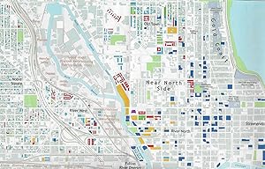
Contact seller4-star sellerColored map, 83 x 63 cm, published in conjunction with the 102nd Annual Meeting of the Association of American Geographers, March 7-11, 2006. Shows both new housing construction (high-rise, low-rise, townhouse, and detached homes) and building conversions (factories, warehouses, and office spaces converted to lofts)in an area of… Chicago bounded by North Ave., Ashland Ave., 31st Street, and Lake Michigan. As explained in text underneath the key, the period from ca. 1985-2005 saw "by far the most extensive, diverse, and privatized activity [in changing land use patterns], leading in many cases to the wholesale physical and social redfinition of entire neighborhoods" in Chicago. "This map presents the spatial extent and morphology of the new residential capacity in the city's central area and indivates how the character of neighborhoods and districts has been affected." Fine condition, folded as issued.
