
Sekisui (32 results)

Published by Tokyo, 1988 **J79, Tokyo 1988
- Hardcover
Seller: Messinissa libri, Milano, MI, ItalyMessinissa libri
Contact seller3-star sellerCondition: Used
US$ 7.09
US$ 47.05 shippingShips from Italy to U.S.A.Quantity: 1 available
Condition: Buono (Good). un volume in ottime condizioni, brossura con sovraccoperta, 150 pagine, illustrato a colori. Book.

Published by Sekisui Museum, china 2013
- Softcover
Seller: Sunny Day Bookstore, SINGAPORE, , SingaporeSunny Day Bookstore
Contact seller4-star sellerCondition: Used - Fine
US$ 60.00
US$ 15.00 shippingShips from Singapore to U.S.A.Quantity: 1 available
Condition: Fine. KOS02400549.
Published by Kojima Yoneyama-kyo 1940
- Softcover
Seller: Sunny Day Bookstore, SINGAPORE, , SingaporeSunny Day Bookstore
Contact seller4-star sellerCondition: Used - Fine
US$ 60.00
US$ 15.00 shippingShips from Singapore to U.S.A.Quantity: 1 available
Condition: Fine. Size: 36mm width 26mm thickness 1.5mm Number of books: 1 book.
Published by Kojima Yoneyama-kyo 1940
- Softcover
Seller: Sunny Day Bookstore, SINGAPORE, , SingaporeSunny Day Bookstore
Contact seller4-star sellerCondition: Used - Fine
US$ 60.00
US$ 15.00 shippingShips from Singapore to U.S.A.Quantity: 1 available
Condition: Fine. Size: 36mm width 26mm thickness 1.5mm Number of books: 1 book.
- Softcover
Seller: Mispah books, Redhill, SURRE, United KingdomMispah books
Contact seller4-star sellerCondition: New
US$ 294.37
US$ 33.08 shippingShips from United Kingdom to U.S.A.Quantity: 1 available
Paperback. Condition: New. NEW. SHIPS FROM MULTIPLE LOCATIONS. book.

Published by Toto [Tokyo] and Naniwa [Osaka], Yahei Asano, [late eighteenthearly nineteenth century]. 1800
- Softcover
Seller: Bernard Quaritch Ltd ABA ILAB, London, , United KingdomBernard Quaritch Ltd ABA ILAB
Contact seller5-star sellerCondition: Used
US$ 6,814.13
US$ 42.34 shippingShips from United Kingdom to U.S.A.Quantity: 1 available
Large folding map (1666 x 920mm), woodcut on paper; text printed in Japanese, hand-coloured in yellow, orange, red, blue, and grey; some worming neatly repaired, a few short tears along folds; else a good copy in later dark blue paper wrappers, blank title label to front cover; early brush-and-ink inscription relating to a templ…e to upper right corner, twentieth-century bookseller's ticket of Motoyama Bunko to bottom left corner of map and front cover.An early hand-coloured impression of this pioneering world map by the 'founder of Japanese geography'. Sekisui Nagakubo (17171801) is credited with producing the first Japanese map employing lines of latitude and longitude. It is for the present work, the Chikyu bankoku sankai yochi zenzusetsu, that he is now best known, a woodcut world map produced in 1785 based upon Matteo Ricci's pioneering map of 1602 but with significant improvements in the representation of Japan and the Kuril Islands, for example. Later editions appeared well into the nineteenth century. Our map follows the colouring recommended by Ricci for each continent: Africa in white, Europe in yellow, North America in orange, South America in blue, Asia in pink, and the edge of a vast Antarctica in red. The texts at the upper margin include a discussion of the contribution of the Dutch to world mapping. On the map itself we read of Brazil: 'The inhabitants of this country do not build houses. They dig the earth and live in caverns. They like to eat human flesh, however they only eat men and not women. Their clothes are made from birds' feathers'. A caption to Antarctica reads 'night country with no information on the inhabi tants'.
 More images
Published by ??????. ??????. [Itamiya Zenbei. Kawachiya Kihei]. 1857]., ??. [Osaka]. 1857
- Hardcover
- First Edition
Seller: Asia Bookroom ANZAAB/ILAB, Canberra, ACT, AustraliaAsia Bookroom ANZAAB/ILAB
Contact seller5-star sellerCondition: Used
US$ 3,249.89
US$ 21.25 shippingShips from Australia to U.S.A.Quantity: 1 available
6th or 7th edition. Thirteen colour double page woodblock maps, bound in Japanese accordion binding, 34 x 20cm, maps with margin 35 x 40cm. Includes the foreword from the 1789 first edition. Paper on the boards chipped and worn, paper title label upper cover little worn and marked. The maps in this copy are in very good conditio…n. Very good. This Japanese historical atlas of Chinese maps traces Chinese history from the early times through to the Qing Dynasty. First published in 1789, two editions of this atlas were published in 1835. This handsome atlas was very popular and was published in seven different editions between 1789 and 1857. The maps in this atlas are: 1. ?????? [Dai Shinkoku do?teizu] [Map of The Broad World of Great Qing] 2. ????? [Uko? kyu?shu?zu] [Yugong Map of the Nine Provinces] 3. ????? [Shu? Shokuho?-shi zu] [Map of the Nine Provinces of Zhou Dynasty] 4. ????? [Shunju? rekkokuzu] [Map of Five Nations of Chunqiu Period (Eastern Zhou Dynasty)] 5. ????? [Sengoku shichiyu?zu] [Map of Seven States of Zhanguo Period (Eastern Zhou Dynasty)] 6. ????????? [Shin sanju?rokugun narabi ni Etsu shigun] [Map of Thirty-six Administrative Regions of Qin Dynasty] 7. ????? [Seikan shu?gunzu] [Map of Administrative Divisions and subdivisions of Western Han Dynasty] 8. ????? [To?kan shu?gunzu] [Map of Administrative Divisions of Eastern Han Dynasty] 9. ????? [Sangoku teijizu] [Map of Tripartite Confrontation of the Three Kingdoms] 10. ???????? [Ryo? Shin Nanbokucho? shu?gunzu] [Map of Administrative Divisions and Subdivisions of Two Jin Dynasties, Southern and Northern Dynasties (A.D.265-5890] 11. ???? [To? ju?do?zu] [Map of Ten Prefectures of Tang Dynasties] 12. ?????????? [Dai Min itto nikei ju?sansho?zu] [Map of Thirteen Provinces of Great Ming] 13. ??????? [Ajia sho ?To?yo?zu] [Map of Asia and Little Eastern Ocean] The title label on the upper cover suggests this copy is part of the 3rd edition however the colophon, which gives the publisher as ?????? and ?????? [Itamiya Zenbei and Kawachiya Kihei], indicates that it is part of the 6th or 7th edition both of which were published in 1857. ?????? [Kawachiya Kihei] was not in business until the 1850s.
Published by Tokyo, Kansei 10 (1798). 1798
- Softcover
Seller: Manfred Nosbuesch, Kuchenheim, , GermanyManfred Nosbuesch
Contact seller4-star sellerCondition: Used
US$ 886.45
US$ 17.21 shippingShips from Germany to U.S.A.Quantity: 1 available
22,5 x 15,5. With numerous woodcut illustrations. Orig. stitched wrappers with title-labels in modern folding case. Minor staining, a few wormholes else a very good copy.
Published by Kawachiya Kihe; Itamiya Kihe han; Subaraya Mohe Ansei 4 [], Osaka and Edo 1857
- Hardcover
Seller: Cavendish Rare Books, ABA ILAB, London, , United KingdomCavendish Rare Books, ABA ILAB
Contact seller5-star sellerCondition: Used
US$ 1,362.83
US$ 25.14 shippingShips from United Kingdom to U.S.A.Quantity: 1 available
Folio, original embossed yellow paper on boards, 365 x 240 mm, printed cloth label on upper cover, boards somewhat soiled, expertly restored at edges; accordion-fold leaves on heavy paper, pp. (vi) and 13 hand-coloured double-page maps. Marginal worm holes, otherwise sound, clean and bright. First issued in 1789, this is likely…the 4th issue, printed from the original woodblocks; all are Rare. These brilliantly coloured maps illustrate China's geographic and political expansion over the centuries, from Yu the Great, ca. 2000 B.C., to the later Ch'ing dynasty. Distances between cities are given, as are sea routes and distances from Japan to China. One map gives an overview of the 4th c. B.C. Warring States, and another shows a road map of China in the 7th-10th c. Tang dynasty. The final map takes in the Pacific Ocean, Bering Strait and coastal Alaska. Nagakubo (1717-1801) is known as the founder of Japanese cartography. He was also a noted sinologist and Confucian scholar.
 More images
Published by Ca. late Edo period [1820-1850] 1820
- Softcover
- First Edition
Seller: Kagerou Bunko (ABAJ, ILAB), Tokyo, , JapanKagerou Bunko (ABAJ, ILAB)
Contact seller2-star sellerCondition: Used - Near fine
US$ 1,080.00
US$ 35.50 shippingShips from Japan to U.S.A.Quantity: 1 available
Softcover. Condition: Near fine. The influential world map created by famous Edo period geographer and Confucian scholar Nagakubo Sekisui (1717-1801), based on a world map by Italian Jesuit priest and one of the founding figures of the Jesuit China missions, Matteo Ricci (1552-1610). Ricci`s original Chinese map of the world was… published in 1602 and introduced the findings of European exploration to East Asia. The first edition of Sekisui`s map, which had a large influence on Japan`s impression of the world, was published in Japan around 1785. This is a later, small-format woodblock-printed edition in near fine condition. Original upper wrapper, lower wrapper a later addition. With original title slip. Light abrasion to upper wrapper. One small wormhole to a few folds, and occasional minor chipping to extremities. Otherwise near fine. 1 colour woodblock-printed leaf, complete. Text in Japanese. Used book.
 More images
Published by Sakuma Tenpo 15 [1844], Toto [Edo] 1844
- Softcover
Seller: Kagerou Bunko (ABAJ, ILAB), Tokyo, , JapanKagerou Bunko (ABAJ, ILAB)
Contact seller2-star sellerCondition: Used - Very good
US$ 2,000.00
US$ 35.50 shippingShips from Japan to U.S.A.Quantity: 1 available
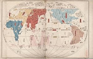
Softcover. Condition: Very good. Re-carved and corrected edition. A re-carved and corrected edition of one the earliest Japanese-made world maps, by famous Edo period geographer and Confucian scholar Nagakubo Sekisui (1717-1801). The map was based on that of Italian Jesuit priest and one of the founding figures of the Jesuit Chi…na missions, Matteo Ricci (1552-1610). Ricci`s original world map in Chinese characters (`Kunyu Wanguo Quantu`) was published in 1602 and introduced the findings of European exploration to East Asia. Nagakubo, considered by many scholars to be the founder of Japanese geography, first published his Japanese edition of Ricci`s map (one of the first in Japan to use longitude lines) around 1785. The title on the title page of this copy reads `Kosei Bankoku Sankai Yochi Zusetsu`. There is no record of this particular edition published by Sakuma in OCLC or Japanese library databases. This is thus a rare unknown corrected edition of one of the earliest Japanese world maps. Original folding `orihon` binding, extremities of wrappers with some wormholing, original title slip intact. Small ex-ownership stamp of famous Japanese mathematician Chiba Tanefusa to margin of map. Stain to lower pastedown, not affecting text. Otherwise in nice condition, and a clear printing. Wrappers blind-stamped with a fish or dolphin motif. 26.5 x 17.8 cm when binding closed, 26.5 x 96 cm when fully opened. Text in Japanese. Used book.
 More images
Published by Ogura Nihe 1805
- Softcover
Seller: Kagerou Bunko (ABAJ, ILAB), Tokyo, , JapanKagerou Bunko (ABAJ, ILAB)
Contact seller2-star sellerCondition: Used - Near fine
US$ 2,700.00
US$ 35.50 shippingShips from Japan to U.S.A.Quantity: 1 available
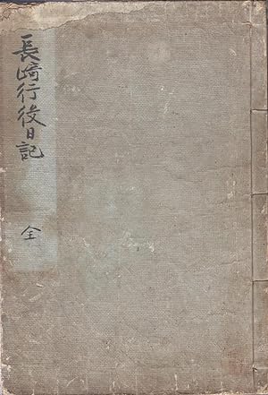
Soft cover. Condition: Near Fine. Original binding, worn, as usual, with nics and tears to extremities. Abrasion to upper outer corner of upper wrapper. Slight gnawing (?) to head of text-block from cover to leaf 7. Light stain to upper margin from title to leaf 12 and to the lower margin for the last 10 or so leaves only. Title… in hand-writing to foot of text-block. Text clear and a very bright printing. Nagakubo Sekisui (1717-1801), the author of this text, is known today as the founder of Japanese geography. `Nagasaki Koeki Nikki` was a detailed record of his trip to Nagasaki and Dejima in 1767, and includes thorough descriptions of the foreigners living there (especially the Dutch and the Chinese) and games and technology as yet unknown to Japan (like thermometers and billiards tables). Sekisui was also responsible for creating the first Japanese map to employ lines of latitude and longitude. Includes numerous illustrations of the foreign residents of Dejima, a map, two plans, etc. Text in Japanese. 3, 78 l. Used book.
 More images
Published by Sakuma 1844
- Softcover
Seller: Kagerou Bunko (ABAJ, ILAB), Tokyo, , JapanKagerou Bunko (ABAJ, ILAB)
Contact seller2-star sellerCondition: Used - Near fine
US$ 2,000.00
US$ 35.50 shippingShips from Japan to U.S.A.Quantity: 1 available
Soft cover. Condition: Near Fine. Original wrappers, scrapes to extremities. Stain to lower pastedown, not affecting map. Revised ed. One of the earliest Japanese-made world maps, beautifully woodblock-printed in colour. Has been stamped with the ex-ownership seal of the famous Japanese mathematician Chiba Tanefusa. Size of item… when spread out = 26.5x96 cm. Text in Japanese. Used book.

Published by Asano (Fujiya) Yahe,
- Map
Seller: Daniel Crouch Rare Books Ltd, London, , United KingdomDaniel Crouch Rare Books Ltd
Contact seller4-star sellerCondition: Used
US$ 27,256.51
US$ 26.46 shippingShips from United Kingdom to U.S.A.Quantity: 1 available
The first Japanese world map with latitudes and longitudes Woodblock map, hand-coloured, minor tears to old folds, and a few worm holes, skilfully repaired, and backed on Japan paper. One of the earliest world maps made in Japan. A reduced hand-coloured copy with latitudes and longitudes based on Matteo Ricci's (1552-1610) revol…utionary world map, 'Kunyu wanguo quantu ' ('Complete geographical map of all countries') published in Beijing in 1602. Nagakubo Sekisui (1717-1801) was a Confucian scholar with samurai status, who studied with Japan's most famous astronomer's disciples, and is considered the founder of modern Japanese geography for his use of lines of latitude and longitude. World maps based on Ricci's work had been made before Sekisui's work, but were drawn by artists with no understanding of cartography. This map, famously credited to Sekisui, contains additions, corrections and improvements to Ricci's map. Geographically, Sekisui's map is a faithful copy of Ricci's map: it strictly resembles the proportion and shape of the continents, oceans, seas, and islands. However, he made significant improvement on the illustration of Japan and Kuril Islands. Sekisui in fact revived Ricci's intended design, which was not realised at the time. Although Ricci recommended using different colours for the identification of the six continents, his own map was engraved and published monochrome by his friend Li Zhizao (1565-1630). Sekisui followed Ricci's advice in colouring Africa in white, Europe in yellow, Asia in light red, North America in orange red, South America in dark blue, and the supposed border of Magellanica (The Antarctic) in dark red. Most of the Chinese inscriptions were copied with extensive annotation and reading marks for the Japanese audience. For example, Sekisui added 'katakana' which is used for transcription of foreign language words into Japanese, next to the hundreds of Chinese toponyms copied from Ricci's map. This certainly made the map more easily understandable and accessible for his contemporaries. Alongside the geographical changes, Sekisui also added some text that seem to be justifying the inaccurate description on Ricci's map. Sekisui's most significant improvements are made to the depiction of Japan and the Kuril Islands, including the shapes of the islands and names of the provinces and roads. He substituted many incorrect place names around Japan on Ricci's map with a few correct ones. For example, the northern most of Japan's main islands is named as Hokkaid ( ) on Ricci's map, and changed to Eso ( ) by Sekisui. To the east of Japan, Sekisui also illustrated the two imaginary islands of Kinshima ( , Isle of gold) and Ginshima ( , Isle of silver) that the Spanish and the Dutch desperately sought after during the seventeenth century. These two mythical islands were not depicted on Ricci's map. A critical section of Sekisui's map is the explanatory text at the top, which contains about 1450 Chinese characters in the style of 'Kanbun' (a technique for making Chinese texts read like Japanese), in 69 columns, with kunten ( , guiding marks) for his Japanese readership. Existing scholarship considers Sekisui's text not a translation but a sophisticated adaptation, particularly concerning Japan itself. By adopting the new concepts of latitude and longitude the latter allowing for the calculation of time-difference - Sekisui was able to clarify the position of Japan in the world. As a result, Sekisui successfully promoted new concepts which resulted in a changing vision of the world; many more editions of his map were published up until the mid-19th century. Beans, Japanese maps, p. 24, 1775.3; Lukacs, Gabor. "Chikyû Bankoku Sankai Yochi Zenzu Setsu: The First Japanese World Map with Latitudes and Longitudes and with an Extensive Japanese Explanatory Note". The Cartographic Journal. 53 (2): 149-157. 2016.
 More images
- Softcover
- First Edition
Seller: Jonathan A. Hill, Bookseller Inc., New York, NY, U.S.A.Jonathan A. Hill, Bookseller Inc.
Contact seller5-star seller19 woodcut illus. & maps, some double-page. 33 folding leaves. Large 8vo, orig. wrappers with the orig. title-slip (label rubbed), new stitching. Osaka: Asano yahei ?????, 1792. First edition of this travelogue from a journey to the northern part of the main island of Honshu. Mutsu and Dewa provinces were very large territories…that today correspond to Fukushima, Miyagi, Iwate, Aomori, Yamagata, and Akita prefectures. At the time of publication, the region was relatively far removed from the center of Japanese civilization. Locations pictured in the book include Shiogama, a town in present-day Miyagi Prefecture; the group of pine-covered islands called Matsushima; and Mount Ch?kai, an active volcano in the region; and other places. Nagakubo (1717-1801) was "a geographer and mapmaker, one of the first to place Japan on the longitude and latitude grid, and creator of a number of influential woodblock-print maps of Japan and of Asia. Sekisui also worked on the Dai Nihon shi, the grand history project centered in his home domain of Mito. His study of geography, and the travels that formed part of his research, were undertaken in the context of that larger project. But in addition to his geographical and historical scholarship, Sekisui was also a prolific author and, as many intellectuals did, he fancied himself an accomplished composer of poetry in the Chinese style (kanshi)" (Yonemoto, Mapping Early Modern Japan, p. 70). "All of Sekisui's travel accounts blended poetry in Chinese with description of local scenery, routes, and roads. In this way, his writings combine his vocation and his avocation, as long stretches of relatively unadorned prose are punctuated by highly allusive kanshi verses and an occasional diagram or illustration" (Marcia Yonemoto, pp. 70-71). Nagakubo includes detailed descriptions of several stele, including the Tagaj? stele ???? and the Nasu no kuni no miyatsuko stele ????? The Tagaj? stele, almost two meters tall, was erected in 762 to commemorate the restoration of the town of Tagaj? The stele records the distances from Tagaj? to various locations throughout Japan, followed by a record of the city's founding and restoration. The stele was discovered in the second half of the 17th century. The Nasu no kuni no miyatsuko stele was erected in memory of a local official who died in 700 CE. This stele too received attention in the late 17th century. In our book, Nagakubo includes transcriptions of the stele inscriptions as well as drawings of the stones. In an appendix to the main text, entitled Hokuetsu shichiki ????, Nagakubo describes the "seven marvels of Echigo." Nagakubo set out to find these locations without earlier guidebooks to help him, but was able to locate them by asking locals. The definition of these seven varies, but in our book they include, for example, the "smelly water," "fire well," the "bundle of eight plums," the "triple chestnut," the "upside-down bamboo," the "mummified Buddha," and the "burnt earth." Nagakubo's book was finished in 1760 but only published in 1792. Fine copy, very minor worming occasionally touching characters, preserved in a chitsu.

Published by Asano Yahei, [c1780s]., Edo and Osaka, 1780
- Map
Seller: Daniel Crouch Rare Books Ltd, London, , United KingdomDaniel Crouch Rare Books Ltd
Contact seller4-star sellerCondition: Used
US$ 27,256.51
US$ 26.46 shippingShips from United Kingdom to U.S.A.Quantity: 1 available
The first Japanese world map with latitudes and longitudes Hand coloured woodblock print, folded into paper boards. One of the earliest world maps made in Japan. A reduced hand-coloured copy with latitudes and longitudes based on Matteo Ricci's (1552-1610) revolutionary world map, Kunyu wanguo quantu ('Complete geographical map…of all countries') published in Beijing in 1602 . Nagakubo Sekisui (1717-1801) was a Confucian scholar with samurai status, studied with Japan's most famous astronomer's disciples, and is considered the founder of the modern Japanese geography for his use of lines of latitude and longitude. World maps based on Ricci's work had been made before Sekisui's work, but were drawn by artists with no understandings of cartography. This map, famously credited to Sekisui, contains additions, corrections and improvements to Ricci's map. Geographically, Sekisui's map is a faithful copy of Ricci's map: it strictly resembles the proportion and shape of the continents, oceans, seas, and islands. However, he made significant improvement on the illustration of Japan and Kuril Islands. Sekisui in fact revived Ricci's intended design, which was not realised at the time. Although Ricci recommended using different colours for the identification of the six continents, his own map was engraved and published monochrome by his friend Li Zhizao (1565-1630). Sekisui followed Ricci's advice in colouring Africa in white, Europe in yellow, Asia in light red, North America in orange red, South America in dark blue, and the supposed border of Magellanica (The Antarctic) in dark red. Most of the Chinese inscriptions were copied with extensive annotation and reading marks for the Japanese audience. For example, Sekisui added 'katakana' which is used for transcription of foreign language words into Japanese, next to the hundreds of Chinese toponyms copied from Ricci's map. This certainly made the map more easily understandable and accessible for his contemporaries. Alongside the geographical changes, Sekisui also added some text that seem to be justifying the inaccurate description on Ricci's map. Sekisui's most significant improvements are made to the depiction of Japan and Kuril Islands, including the shapes of the islands and names of the provinces and roads. He substituted many incorrect place names around Japan on Ricci's map with a few correct ones. For example, the northern most of Japan's main islands is named as Hokkaid ( ) on Ricci's map, and changed to Eso by Sekisui. To the east of Japan, Sekisui also illustrated the two imaginary islands of Kinshima ( , Isle of gold) and Ginshima ( , Isle of silver) that the Spanish and the Dutch desperately sought after during the seventeenth century. These two mythical islands were not depicted on Ricci's map. A critical section of Sekisui's map is the explanatory text at the top, which contains about 1450 Chinese characters in the style of 'Kanbun' (a technique for making Chinese texts read like Japanese), in 69 columns, with kunten ( , guiding marks) for his Japanese readership. Existing scholarship considers Sekisui's text not a translation but a sophisticated adaptation, particularly concerning Japan itself. By adopting the new concepts of latitude and longitude the latter allowing for the calculation of time-difference - Sekisui was able to clarify the position of Japan in the world. As a result, Sekisui successfully promoted new concepts which resulted in a changing vision of the world; many more editions of his map were published up until the mid-19th century. Beans, Japanese maps, p. 24, 1775.3; Lukacs, Gabor. "Chikyû Bankoku Sankai Yochi Zenzu Setsu: The First Japanese World Map with Latitudes and Longitudes and with an Extensive Japanese Explanatory Note". The Cartographic Journal. 53 (2): 149-157. 2016.

Published by Edo. 1857
- First Edition
Seller: Michael Steinbach Rare Books, Wien, , AustriaMichael Steinbach Rare Books
Contact seller5-star sellerCondition: Used
US$ 1,772.89
US$ 22.38 shippingShips from Austria to U.S.A.Quantity: 1 available
36 : 24 cm. 13 coloured, double-page woodblock-maps. Japanese accordion binding, paper title-label on upper cover. This japanese historical atlas of Chinese maps traces Chinese history from the early times through to the Qing Dynasty. Includes the foreward from the 1789 first edition. The popular atlas contains the following map…s: 1. (Dai Shinkoku doteizu) Map of the Broad World of Great Qing. - 2. (Uko kyushuzu) Yugong Map of the Nine Provinces. - 3. Shu Shokuho-shi-zu) Map of the Nine Provinces of Zhou Dynasty. - 4. (Shunju rekkokuzu) Map if the Five Nations of Chunqiu Period (Eastern Zhou Dynasty). - 5. (Sengoku shichiyuzu) Map of Seven States of Zhangou Period (Eastern Zhou Dynasty). - 6. (Shin sanjurokugun narabi ni Etsu shingun) Map of Thirty-six Administrative Regions of Qin Dynasty. - 7. (Seikan shugunzu) Map of Administrative Divisions and Subdivisions of Western Han Dynasty. - 8. (Tokan shungunzu) Map of Administrative Division of Eastern Han Dynasty. - 9.(Sangoku teijizu) Map of Tripartite Confrontation of the Three Kingdoms. - 10. (Ryo Shin Nanbokucho shungunzu). Map of Administrative Divisions and Subdivisions of Two Jin Dynasties, Southern and Northern Dynasties (A.D. 265-5890). - 11. (To judozu) Map of Ten Prfectures of Tang Dynasties. - 12. (Dai Min itto nikei jusanshozu) Map of Thirteen Provinces of Great Ming. - 13. (Ajia sho Toyozu) Map of Asia and Little Eastern Ocean. - Introduction in the upper part with some water-stains, maps not effected; binding partly dusty and a bit wrinkled.

Published by Suharaya Mohe, Asano Yahe c [et al.] Bunka 8 [1811], Edo (Tokyo), Osaka 1811
Seller: Kagerou Bunko (ABAJ, ILAB), Tokyo, , JapanKagerou Bunko (ABAJ, ILAB)
Contact seller2-star sellerCondition: Used - Very good
US$ 2,050.00
US$ 35.50 shippingShips from Japan to U.S.A.Quantity: 1 available
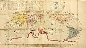
Condition: Very Good. An early 19th century copy of Sekisui`s influential map of Japan, famous for the great reliance that was placed on it by the Japanese people in the late Edo period. The map, woodblock-printed in black and white and hand-coloured in six colours, is also considered by many to be the most beautiful map of crea…ted in the Edo period. This particular edition is a `renewed`, or `re-carved` edition that was published after Sekisui`s death, and is considered to be the third edition of `Kaisei Nihon Yochi Rotei Zenzu`. It is recorded that the famous German traveler and physician Philipp Franz Balthasar von Siebold referred to this particular edition of Sekisui`s work for reference for his own map of Japan. Scarce. One woodblock-printed leaf, hand-coloured, complete. A few small tears to folds, lightly creased, otherwise in very good condition. Text in Japanese. Nagakubo, Sekisui (illustrator). Used book.
 More images
- Hardcover
Seller: Librairie Camille Sourget, Paris, , FranceLibrairie Camille Sourget
Contact seller4-star sellerCondition: Used - Fine
US$ 43,731.30
US$ 34.43 shippingShips from France to U.S.A.Quantity: 1 available
Couverture rigide. Condition: Très bon. Yamazaki Kinbe, Edo et Asana Yahei, Osaka, 5e année de la période Tenmei (1785).Grande carte de 165 x 91 cm gravée sur bois, entièrement coloriée à la main à l'époque. Tampon à l'encre rouge dans le bas. Repliée et préservée dans un étui de protection de toile bleu moderne. Très bon état d…e conservation. --- Première édition de cette superbe et rare carte du Monde publiée au Japon en 1785, qui montre l'état d'avancement des connaissances géographiques et cartographiques japonaises à la fin du XVIIIe siècle.Nagakubo Sekisui ????? (1717-1801) est le plus célèbre cartographe japonais de la fin du XVIIIe siècle.La présente carte contient une multitude d'informations : en haut à droite, un cartouche comporte un texte en chinois classique de Katsuragawa Hoshu (1751-1809), médecin célèbre à la cour de Shogun, connaissant le hollandais et passionné par les sciences et la cartographie européennes.En haut à gauche, un autre cartouche présente 70 lignes de texte en japonais écrites par l'auteur de la carte, avec des explications quant à la contribution de la science hollandaise à la théorie de l'illustration géographique de la terre sphérique. En bas à gauche, dans un troisième cartouche, apparaissent le nom de l'auteur : Nagakubo Sekisui et les noms des éditeurs de la carte : Yamazaki Kinbe, Edo et Asana Yahei, Osaka. A première vue, la carte apparait comme une copie simplifiée de la très célèbre carte du monde que Matteo Ricci (1552-1610) avait présentée en 1602 à l'empereur Ming, Shenzong. A la suite du triomphe du protestantisme au milieu du XVIe siècle, l'église catholique tente de réagir et envoie des missionnaires, d'abord jésuites, en Extrême-Orient, afin de convertir les habitants de ces empires au christianisme. Ricci quitte Rome en 1577 et, en passant par Lisbonne, arrive en Chine en 1583. L'idée lui vient que la conversion doit s'effectuer par une démonstration de la supériorité des sci /// Yamazaki Kinbe, Edo et Asana Yahei, Osaka, 5th year of the Tenmei period (1785).Large wood-engraved map of 165 x 91 cm (65 x 35,8 inches), entirely hand-colored at the time. Red ink stamp in the bottom. Folded and preserved in a modern blue cloth protection case. Very good condition. --- First edition of this superb and rare map of the World published in Japan in 1785, showing the progress of the Japanese geographical and cartographical knowledge at the end of the 18th century.Nagakubo Sekisui ????? (1717-1801) is the most famous Japanese cartographer of the end of the 18th century.This map presents a lot of information: at the top right, a cartouche encloses a text in classical Chinese by Katsuragawa Hoshu (1751-1809), famous doctor at the Shogun court, knowing Dutch and passionate about sciences and European cartography.At the top left, another cartouche presents 70 lines of text in Japanese written by the author of the map, with explanations as for the contribution of Dutch science to the theory of the geographic illustration of the spherical earth. At the bottom left, in a third cartouche, appear the name of the author: Nagakubo Sekisui and the names of the editors of the map: Yamazaki Kinbe, Edo and Asana Yahei, Osaka. At first sight, the map seems to be a simplified copy of the very famous map of the world that Matteo Ricci (1552-1610) had presented in 1602 to the Ming emperor, Shenzong.After the triumph of Protestantism in the middle of the 16th century, the Catholic Church tries to react and send missionaries, first Jesuits, in the Far East, in order to convert the inhabitants of these empires to Christianity. Ricci leaves Rome in 1577 and, via Lisbon, arrives in China in 1583. He has the idea that conversion needs to be carried out through a demonstration of the superiority of the European sciences. The Chinese consider themselves in the middle of the earth (China = middle empire), which has a square shape. Ricci quickly learns Chinese a.
Published by Osaka, Japan 1850
- Map
Seller: Alexandre Antique Prints, Maps & Books, Toronto, ON, CanadaAlexandre Antique Prints, Maps & Books
Contact seller4-star sellerCondition: Used
US$ 2,500.00
US$ 6.00 shippingShips from Canada to U.S.A.Quantity: 1 available
This world map shows Japan as the center of the world, definitely a product of the isolationism that was the cornerstone of Japanese foreign policy under the Tokugawa shogunate from 1641 to 1853. Text is in Japanese. Reduced version of the famous map "Kaisei chikyu bankoku zenzu" by Sekisui Nagakubo (1717-1801) published ca. 178…5, still based on the one by Matteo Ricci. Includes texts on the earth and climate zones, etc. According to Yamashita (page 19), these oval world maps, also known as "southern barbarian world maps", seemed at the time being rather outdated, but their representation was very popularNagakubo Sekisui (1717-1801) was an Edo period geographer and Confucian scholar, described by Yanagita Kunio as the founder of Japanese geography. Sekisui is credited with the creation of numerous maps and travel writings, and innovations such as the first Japanese map to employ lines of latitude and longitude., Size : 430x633 (mm), 16.93x24.92 (Inches), Printed in Color with Some Hand Coloring Very Good. Laid down on old silk. A few areas of worm holes repaired.

Language: Japanese
- Hardcover
- Print on Demand
Seller: S N Books World, Delhi, , IndiaS N Books World
Contact seller5-star sellerLeatherbound. Condition: NEW. BOOKS ARE EXEMPT FROM IMPORT DUTIES AND TARIFFS; NO EXTRA CHARGES APPLY. Leatherbound edition. Condition: New. Leather Binding on Spine and Corners with Golden leaf printing on spine. Bound in genuine leather with Satin ribbon page markers and Spine with raised gilt bands. Pages: 166. A perfect gift… for your loved ones. Reprinted from 1767 edition. NO changes have been made to the original text. This is NOT a retyped or an ocr'd reprint. Illustrations, Index, if any, are included in black and white. Each page is checked manually before printing. As this print on demand book is reprinted from a very old book, there could be some missing or flawed pages, but we always try to make the book as complete as possible. Fold-outs, if any, are not part of the book. If the original book was published in multiple volumes then this reprint is of only one volume, not the whole set. IF YOU WISH TO ORDER PARTICULAR VOLUME OR ALL THE VOLUMES YOU CAN CONTACT US. Resized as per current standards. Sewing binding for longer life, where the book block is actually sewn (smythe sewn/section sewn) with thread before binding which results in a more durable type of binding. Volume 1-2 Language: Japanese Pages: 166 Volume 1-2.
 More images
- Hardcover
- Print on Demand
Seller: Gyan Books Pvt. Ltd., Delhi, , IndiaGyan Books Pvt. Ltd.
Contact seller5-star sellerCondition: New
US$ 38.55
Free ShippingShips from India to U.S.A.Quantity: Over 20 available
Leather Bound. Condition: New. Language: Japanese. Language: Japanese. Presenting an Exquisite Leather-Bound Edition, expertly crafted with Original Natural Leather that gracefully adorns the spine and corners. The allure continues with Golden Leaf Printing that adds a touch of elegance, while Hand Embossing on the rounded spine… lends an artistic flair. This masterpiece has been meticulously reprinted in 2024, utilizing the invaluable guidance of the original edition published many years ago in 1805. The contents of this book are presented in classic black and white. Its durability is ensured through a meticulous sewing binding technique, enhancing its longevity. Imprinted on top-tier quality paper. A team of professionals has expertly processed each page, delicately preserving its content without alteration. Due to the vintage nature of these books, every page has been manually restored for legibility. However, in certain instances, occasional blurriness, missing segments, or faint black spots might persist. We sincerely hope for your understanding of the challenges we faced with these books. Recognizing their significance for readers seeking insight into our historical treasure, we've diligently restored and reissued them. Our intention is to offer this valuable resource once again. We eagerly await your feedback, hoping that you'll find it appealing and will generously share your thoughts and recommendations. Lang: - Japanese, Pages: - 164, Print on Demand. If it is a multi-volume set, then it is only a single volume. We are specialised in Customisation of books, if you wish to opt different color leather binding, you may contact us. This service is chargeable. Product Disclaimer: Kindly be informed that, owing to the inherent nature of leather as a natural material, minor discolorations or textural variations may be perceptible. Explore the FOLIO EDITION (12x19 Inches): Available Upon Request. 164 164.
 More images
Seller: RARE ORIENTAL BOOK CO., ABAA, ILAB, Aptos, CA, U.S.A.RARE ORIENTAL BOOK CO., ABAA, ILAB
Contact seller5-star seller[Edo 1846, Suhraya].Blue Swastika blind-stamped covers,title slip, folds down to ca. 16 x 24.5 cm.,opens to ca. 95 x 72.4 cm., cover & edges a bit rubbed, hinge backs mended, else a clean & solid, original hand-colored gouache example. RARE . *** **** *** . . KAISEI NIHON YOCHI ROTEI ZENZU: COMPLETE MAP OF JAPAN . . . WITH DISTA…NCE CHART, LARGE WALL MAP . . . ORIGINAL WOODBLOCK PRINTED BLACK OUTLINE . . . SHOWING ALL OF JAPAN & OUTER ISLANDS IN 1779 . . WITH HAND-COLORING . . . JAPAN'S FIRST MAP SHOWING LATITUDE & LONGITUDE LINES . . . AN IMPORTANT & HISTORICAL 'FIRST' MAP , * This superb map was 'revised' by Japan's most eminent cartographer, NAGAKUBO Sekisui [1717-1801]. . This was the work of a Confucian scholar from Mito, and his maps were considered more accurate than his predecessors. He was the founder of Japanese cartography. . He first experienced seeing western maps while in Nagasaki, where he was a Rangakusha [student of Dutch learning]. He began to remake Japanese maps in western style. His first effort was: KAISEI NIHON YOCHI ROTEI ZENZU [COMPLETE MAP OF JAPAN] in 1779. This item we list is an early reprint of that map with his improvements. . This is the first Japanese map to show & use longitude & latitude lines. It describes map usage, with guide & itinerary, amount of walking days with distance chart from each city to next cities. Key & guide to symbols used on the map. A comprehensive map of all of Japan and her islands. . *** MAP CONTENTS & KEYS: The key shows color symbols for rivers mountains, castles, cities & villages, names of ports, famous places, Kuni names, Buddhist & Shinto [Jinja] shrines & temples, capitals, shipping lanes & distances, famous roads & Seki [road barriers], With four inset boxes of texts, description and colophon. . *** AUCTION RECORD: This map was sold by Christie's London July 12, 2008 for 3,600 GPB. Bunka 5th year [1809] a later edition mounted on a screen. See Christies lot lot-4750697. . *** GENERAL: Generic: This map is hand-colored over black-line key woodblocks. It has 10 color directional symbols. The front cover has the original title slip. . *** INDIVIDUAL COPY VARIANTS & DETAILS: . All copies are hand-colored gouache. . COPY 1: This the Bunka 8 year [1811] reprint of the Anei 8 year [1779] First Edition. With typical dusty & spotted, blind-stamped floral decorated covers, some old small spots, lower left front cover paste-on paper cites edition & bibliographic details brushed on paper, former owner's name Sumi ink brushed on back cover. . Contents clean, nicely hand-colored, some four-way folds reinforced in the distant past. The map is now firm and solid. All in all a better than average example. * COPY 2: This is the Tenpo 11 year [1840] reprint of the Anei 8th year [1779] edition. . The covers are very bright, clean and solid, an example. With excellent hand-coloring, with a couple of minor back side mends to hinge, now firm & solid. Far and above average example. * COPY 5: This is an excellent example, published in Koka 3rd year [1846]. An exact reprint of the FIRST EDITION, Anei 8 year [1779]. . Strong folds, no mends or reinforcements, beautifully hand-tinted, pastel colors. A far and above average example, seldom found in such excellent condition. . This map is contained in a new, 3-fold Chitsu, covered in indigo-blue cloth. . * COPY 6: Covers are in blue Swistika blind-stamped paper covered boards. The usual cover minor scuffing, edge & corner wear, several hinges reinforced from the back, now firm, stable & solid. Koka 3rd year, [1846]. . *** Color photos are posted to our website. . *** REFERENCES: . BEANS, George H.: A LIST OF JAPANESE MAPS OF THE TOKUGAWA ERA: 1791.1,1811.2, p.33 List. * Kazukata Unno: "Cartography in Japan" in History of Cartography vol. 2 book 2 (1994). * NANBA, Matsutaro. ed. et al.: OLD MAPS IN JAPAN, p.41 * Hugh Cortazzio Isles of Gold, Antique Maps of Japan, plate 4, for the 1811 issue. * See: nagakubosekisui-org: A website devoted to a.
 More images
Seller: RARE ORIENTAL BOOK CO., ABAA, ILAB, Aptos, CA, U.S.A.RARE ORIENTAL BOOK CO., ABAA, ILAB
Contact seller5-star seller[Edo 1846, Suhraya]. Blue blind-stamped paper covers, title slip, folds down to ca. 16 x 24.3 cm.,opens to ca. 96.5 x 72 cm., covers bright & clean, tiny bit of corner wear,contents exceptionally clean and solid, hand-colored, above average ! . *** **** *** . . KAISEI NIHON YOCHI ROTEI ZENZU: COMPLETE MAP OF JAPAN . . . WITH DIS…TANCE CHART, LARGE WALL MAP . . . ORIGINAL WOODBLOCK PRINTED BLACK OUTLINE . . . SHOWING ALL OF JAPAN & OUTER ISLANDS IN 1779 . . WITH HAND-COLORING . . . JAPAN'S FIRST MAP SHOWING LATITUDE & LONGITUDE LINES . . . AN IMPORTANT & HISTORICAL 'FIRST' MAP , * This superb map was 'revised' by Japan's most eminent cartographer, NAGAKUBO Sekisui [1717-1801]. . This was the work of a Confucian scholar from Mito, and his maps were considered more accurate than his predecessors. He was the founder of Japanese cartography. . He first experienced seeing western maps while in Nagasaki, where he was a Rangakusha [student of Dutch learning]. He began to remake Japanese maps in western style. His first effort was: KAISEI NIHON YOCHI ROTEI ZENZU [COMPLETE MAP OF JAPAN] in 1779. This item we list is an early reprint of that map with his improvements. . This is the first Japanese map to show & use longitude & latitude lines. It describes map usage, with guide & itinerary, amount of walking days with distance chart from each city to next cities. Key & guide to symbols used on the map. A comprehensive map of all of Japan and her islands. . *** MAP CONTENTS & KEYS: The key shows color symbols for rivers mountains, castles, cities & villages, names of ports, famous places, Kuni names, Buddhist & Shinto [Jinja] shrines & temples, capitals, shipping lanes & distances, famous roads & Seki [road barriers], With four inset boxes of texts, description and colophon. . *** AUCTION RECORD: This map was sold by Christie's London July 12, 2008 for 3,600 GPB. Bunka 5th year [1809] a later edition mounted on a screen. See Christies lot lot-4750697. . *** GENERAL: Generic: This map is hand-colored over black-line key woodblocks. It has 10 color directional symbols. The front cover has the original title slip. . *** INDIVIDUAL COPY VARIANTS & DETAILS: . All copies are hand-colored gouache. . COPY 1: This the Bunka 8 year [1811] reprint of the Anei 8 year [1779] First Edition. With typical dusty & spotted, blind-stamped floral decorated covers, some old small spots, lower left front cover paste-on paper cites edition & bibliographic details brushed on paper, former owner's name Sumi ink brushed on back cover. . Contents clean, nicely hand-colored, some four-way folds reinforced in the distant past. The map is now firm and solid. All in all a better than average example. * COPY 2: This is the Tenpo 11 year [1840] reprint of the Anei 8th year [1779] edition. . The covers are very bright, clean and solid, an example. With excellent hand-coloring, with a couple of minor back side mends to hinge, now firm & solid. Far and above average example. * COPY 5: This is an excellent example, published in Koka 3rd year [1846]. An exact reprint of the FIRST EDITION, Anei 8 year [1779]. . Strong folds, no mends or reinforcements, beautifully hand-tinted, pastel colors. A far and above average example, seldom found in such excellent condition. . This map is contained in a new, 3-fold Chitsu, covered in indigo-blue cloth. . * COPY 6: Covers are in blue Swistika blind-stamped paper covered boards. The usual cover minor scuffing, edge & corner wear, several hinges reinforced from the back, now firm, stable & solid. Koka 3rd year, [1846]. . *** Color photos are posted to our website. . *** REFERENCES: . BEANS, George H.: A LIST OF JAPANESE MAPS OF THE TOKUGAWA ERA: 1791.1,1811.2, p.33 List. * Kazukata Unno: "Cartography in Japan" in History of Cartography vol. 2 book 2 (1994). * NANBA, Matsutaro. ed. et al.: OLD MAPS IN JAPAN, p.41 * Hugh Cortazzio Isles of Gold, Antique Maps of Japan, plate 4, for the 1811 issue. * See: nagakubosekisui-org: A website devoted to.
 More images
Seller: RARE ORIENTAL BOOK CO., ABAA, ILAB, Aptos, CA, U.S.A.RARE ORIENTAL BOOK CO., ABAA, ILAB
Contact seller5-star seller[Edo 1840, Suhraya]. Yellow blind-stamped paper covers,title slip, folds down to 16 x 28.7 cm., opens to 130.5 x 86 cm., covers bright, edges & corners a bit rubbed, hand-colored, a better than average example, reprint of Anei 11 [1828]. RARE . *** **** *** . . KAISEI NIHON YOCHI ROTEI ZENZU: COMPLETE MAP OF JAPAN . . . WITH DIS…TANCE CHART, LARGE WALL MAP . . . ORIGINAL WOODBLOCK PRINTED BLACK OUTLINE . . . SHOWING ALL OF JAPAN & OUTER ISLANDS IN 1779 . . WITH HAND-COLORING . . . JAPAN'S FIRST MAP SHOWING LATITUDE & LONGITUDE LINES . . . AN IMPORTANT & HISTORICAL 'FIRST' MAP , * This superb map was 'revised' by Japan's most eminent cartographer, NAGAKUBO Sekisui [1717-1801]. . This was the work of a Confucian scholar from Mito, and his maps were considered more accurate than his predecessors. He was the founder of Japanese cartography. . He first experienced seeing western maps while in Nagasaki, where he was a Rangakusha [student of Dutch learning]. He began to remake Japanese maps in western style. His first effort was: KAISEI NIHON YOCHI ROTEI ZENZU [COMPLETE MAP OF JAPAN] in 1779. This item we list is an early reprint of that map with his improvements. . This is the first Japanese map to show & use longitude & latitude lines. It describes map usage, with guide & itinerary, amount of walking days with distance chart from each city to next cities. Key & guide to symbols used on the map. A comprehensive map of all of Japan and her islands. . *** MAP CONTENTS & KEYS: The key shows color symbols for rivers mountains, castles, cities & villages, names of ports, famous places, Kuni names, Buddhist & Shinto [Jinja] shrines & temples, capitals, shipping lanes & distances, famous roads & Seki [road barriers], With four inset boxes of texts, description and colophon. . *** AUCTION RECORD: This map was sold by Christie's London July 12, 2008 for 3,600 GPB. Bunka 5th year [1809] a later edition mounted on a screen. See Christies lot lot-4750697. . *** GENERAL: Generic: This map is hand-colored over black-line key woodblocks. It has 10 color directional symbols. The front cover has the original title slip. . *** INDIVIDUAL COPY VARIANTS & DETAILS: . All copies are hand-colored gouache. . COPY 1: This the Bunka 8 year [1811] reprint of the Anei 8 year [1779] First Edition. With typical dusty & spotted, blind-stamped floral decorated covers, some old small spots, lower left front cover paste-on paper cites edition & bibliographic details brushed on paper, former owner's name Sumi ink brushed on back cover. . Contents clean, nicely hand-colored, some four-way folds reinforced in the distant past. The map is now firm and solid. All in all a better than average example. * COPY 2: This is the Tenpo 11 year [1840] reprint of the Anei 8th year [1779] edition. . The covers are very bright, clean and solid, an example. With excellent hand-coloring, with a couple of minor back side mends to hinge, now firm & solid. Far and above average example. * COPY 5: This is an excellent example, published in Koka 3rd year [1846]. An exact reprint of the FIRST EDITION, Anei 8 year [1779]. . Strong folds, no mends or reinforcements, beautifully hand-tinted, pastel colors. A far and above average example, seldom found in such excellent condition. . This map is contained in a new, 3-fold Chitsu, covered in indigo-blue cloth. . * COPY 6: Covers are in blue Swistika blind-stamped paper covered boards. The usual cover minor scuffing, edge & corner wear, several hinges reinforced from the back, now firm, stable & solid. Koka 3rd year, [1846]. . *** Color photos are posted to our website. . *** REFERENCES: . BEANS, George H.: A LIST OF JAPANESE MAPS OF THE TOKUGAWA ERA: 1791.1,1811.2, p.33 List. * Kazukata Unno: "Cartography in Japan" in History of Cartography vol. 2 book 2 (1994). * NANBA, Matsutaro. ed. et al.: OLD MAPS IN JAPAN, p.41 * Hugh Cortazzio Isles of Gold, Antique Maps of Japan, plate 4, for the 1811 issue. * See: nagakubosekisui-org: A website devoted to.
 More images
Seller: RARE ORIENTAL BOOK CO., ABAA, ILAB, Aptos, CA, U.S.A.RARE ORIENTAL BOOK CO., ABAA, ILAB
Contact seller5-star seller[Edo 1811, Suhraya]. Yellow blind-stamped paper covers,title slip,folds down to ca.16 x 28.7 cm.,opens to 139.5 x 85 cm., as usual covers spotted, dusty,edges & corners a bit rubbed, hand-colored, contents better than average example. RARE ! . *** **** *** . . KAISEI NIHON YOCHI ROTEI ZENZU: COMPLETE MAP OF JAPAN . . . WITH DIST…ANCE CHART, LARGE WALL MAP . . . ORIGINAL WOODBLOCK PRINTED BLACK OUTLINE . . . SHOWING ALL OF JAPAN & OUTER ISLANDS IN 1779 . . WITH HAND-COLORING . . . JAPAN'S FIRST MAP SHOWING LATITUDE & LONGITUDE LINES . . . AN IMPORTANT & HISTORICAL 'FIRST' MAP , * This superb map was 'revised' by Japan's most eminent cartographer, NAGAKUBO Sekisui [1717-1801]. . This was the work of a Confucian scholar from Mito, and his maps were considered more accurate than his predecessors. He was the founder of Japanese cartography. . He first experienced seeing western maps while in Nagasaki, where he was a Rangakusha [student of Dutch learning]. He began to remake Japanese maps in western style. His first effort was: KAISEI NIHON YOCHI ROTEI ZENZU [COMPLETE MAP OF JAPAN] in 1779. This item we list is an early reprint of that map with his improvements. . This is the first Japanese map to show & use longitude & latitude lines. It describes map usage, with guide & itinerary, amount of walking days with distance chart from each city to next cities. Key & guide to symbols used on the map. A comprehensive map of all of Japan and her islands. . *** MAP CONTENTS & KEYS: The key shows color symbols for rivers mountains, castles, cities & villages, names of ports, famous places, Kuni names, Buddhist & Shinto [Jinja] shrines & temples, capitals, shipping lanes & distances, famous roads & Seki [road barriers], With four inset boxes of texts, description and colophon. . *** AUCTION RECORD: This map was sold by Christie's London July 12, 2008 for 3,600 GPB. Bunka 5th year [1809] a later edition mounted on a screen. See Christies lot lot-4750697. . *** GENERAL: Generic: This map is hand-colored over black-line key woodblocks. It has 10 color directional symbols. The front cover has the original title slip. . *** INDIVIDUAL COPY VARIANTS & DETAILS: . All copies are hand-colored gouache. . COPY 1: This the Bunka 8 year [1811] reprint of the Anei 8 year [1779] First Edition. With typical dusty & spotted, blind-stamped floral decorated covers, some old small spots, lower left front cover paste-on paper cites edition & bibliographic details brushed on paper, former owner's name Sumi ink brushed on back cover. . Contents clean, nicely hand-colored, some four-way folds reinforced in the distant past. The map is now firm and solid. All in all a better than average example. * COPY 2: This is the Tenpo 11 year [1840] reprint of the Anei 8th year [1779] edition. . The covers are very bright, clean and solid, an example. With excellent hand-coloring, with a couple of minor back side mends to hinge, now firm & solid. Far and above average example. * COPY 5: This is an excellent example, published in Koka 3rd year [1846]. An exact reprint of the FIRST EDITION, Anei 8 year [1779]. . Strong folds, no mends or reinforcements, beautifully hand-tinted, pastel colors. A far and above average example, seldom found in such excellent condition. . This map is contained in a new, 3-fold Chitsu, covered in indigo-blue cloth. . * COPY 6: Covers are in blue Swistika blind-stamped paper covered boards. The usual cover minor scuffing, edge & corner wear, several hinges reinforced from the back, now firm, stable & solid. Koka 3rd year, [1846]. . *** Color photos are posted to our website. . *** REFERENCES: . BEANS, George H.: A LIST OF JAPANESE MAPS OF THE TOKUGAWA ERA: 1791.1,1811.2, p.33 List. * Kazukata Unno: "Cartography in Japan" in History of Cartography vol. 2 book 2 (1994). * NANBA, Matsutaro. ed. et al.: OLD MAPS IN JAPAN, p.41 * Hugh Cortazzio Isles of Gold, Antique Maps of Japan, plate 4, for the 1811 issue. * See: nagakubosekisui-org: A website devoted to.

- Map
Seller: Tmecca Inc., Seoul, , Korea, Republic ofTmecca Inc.
Contact seller2-star sellerCondition: Used - As new
US$ 3,500.00
US$ 19.99 shippingShips from Korea, Republic of to U.S.A.Quantity: 1 available
No Binding. Condition: As New. 71.9 x 100 cm. A multi-sheet woodcut map, showing Japan orientated north west to south east, compass roses, with various text blocks giving information on roads, crops of each Daimyo, their crests, Eki (an old system where a horse and labourer were available for travel), inns, famous places, histor…ic spots, shrines & temples.
- First Edition
- Manuscript
Seller: Arader Galleries - AraderNYC, New York, NY, U.S.A.Arader Galleries - AraderNYC
Contact seller5-star sellerCondition: Used - Very good
US$ 15,000.00
Free ShippingShips within U.S.A.Quantity: 1 available
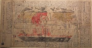
No Binding. Condition: Very Good. 1st Edition. Ca. 1850. Single sheet (12 3/8" x 23 1/8", 314mm x 587mm). Ink and watercolor on washi paper, laid down on heavier paper for support. Sometime folded into 16 with some losses along the old folds. With some small water stains and ink stains. With pigment oxidation verso. Stamped at l…ower left. Nagakudo Sekisui (1717-1801) was an Edo-period geographer and Confucian scholar, described as the founder of Japanese geography, and the first Japanese cartographer to use lines of latitude and longitude on his maps. He was born into a peasant family in Hitachi province, but in 1767 went to Nagasaki and was able to visit Dejima (the artificial island created to allow foreign traders to reside in Japan, which was otherwise closed) and learn some of the geography of the world from the Dutch. In 1771 he was sent to Edo as the official tutor to the daimyo of Mito han. In 1779 his new revised map of Japan appeared and then in 1785 his new map of the world based on the geography of Matteo Ricci. The present map is a manuscript copy of Sekisui's woodcut world map based on Ricci's (on an oval projection). The form and lettering copies the woodcut map very closely, with the exception of a variant in the depiction of southern Africa and additional text in the margins. The Ricci form became the standard world map form in Japanese cartography for the next 70 years; copying Sekisui's map was commonplace, and undoubtedly manuscript copies also circulated, probably secretly among scholars. Japan had been closed to the outside world for 200 years (those who left Japan faced execution upon return) and knowledge of the form of the world was not widely circulated. Sekisui's maps and their derivatives are therefore a foundation stone in the opening up of Japan to the outside world, and the changes in society brought about in the Meiji period.
 More images
Seller: RARE ORIENTAL BOOK CO., ABAA, ILAB, Aptos, CA, U.S.A.RARE ORIENTAL BOOK CO., ABAA, ILAB
Contact seller5-star sellerJapan 1844, Denken. Orange stiff oxidized front cover, back cover replaced with stiff text, contained in a blue cloth Chitsu case, folds down to 11.7 x 17.8 cm., opens to 92.5 x 36 cm., woodblock printed by hand, on hand-made paper. RARE . *** **** *** . . CHIKYU BANKOKU SANKA YOSHI ZEN ZUSETSU: . . . WORLD MAP OF COUNTRIES ON T…HE GLOBE . . 1789 . * A very nice reissue of his most celebrated & excellent 1788 CHIKYU BANKOKU SANKA YOSHI ZEN ZUSETSU: WORLD MAP OF THE COUNTRIES ON THE GLOBE. . * Hand-coloured outline for oceans, countries & the continents. The sheet is very large and contains the title and oval projection map on the right half; the left half [about 40%] contains the descriptive text, dated colophon and cartographer's name, and the key to symbols. Truly a most lovely & charming primitive Japanese world map. This map was influenced by Matthew Ricci's World Map. Japanese cartography lagged Europe by about a hundred years, due to the political policy of Sakoku or "closed nation." . * A very small amount factual cartographic information rickled in through Deshima Island, a small island in Nagasaki Bay. There the Dutch were restricted to living on a tiny place, virtual prisoners and not allowed to visit the mainland without invitation or armed guards. Nevertheless, Rangaku-sha or Japan students of Dutch learning visited Deshima, and studied under the Dutch, or learned from those who learned from the Dutch which inspired many Japanese scientists, doctors, innovators and even native cartographers. . * Because Japan, was a "closed nation" there was a great thirst for Western knowledge. Maps of this sort were very popular and gave the Japanese their first true "world view." A famous cartographer and map, see Sir Hugh Cortazzi's ISLES OF GOLD, p.35, where he discusses Sekisui at length. Sekisui was the forerunner of the greatest Japanese cartographer, Ino Tadataka. This slightly distorted version of the world shows a large area is devoted to both the Arctic & Antarctic regions. Asia is central, with a vague North and South American continents. . * An excellent example of early & primitive Japanese world cartography. Nagakubo was also known as Genju Mito. This map was revised by Den Rinkoku. The paper is remarkably white & quite bright, by & large a most obscure example. . *** Color photos are posted to our website. . *** CONDITION: There are three small light spots in top margin, not affecting the map or text; and one faint spot in the text. . *** REFERENCE: . G. Beans: LIST, SUPPLEMENT "A": p.23: as 1844.01. * Kobe City Museum: AKIOKA KOCHIZU KOREKUSHON MEIHIN TEN: p.14, #13, & p.90. * M. Namba; OLD MAPS IN JAPAN, p.163 where he cites this first edition of this map, with many other citations about Nagakubo. * See: nagakubosekisui-org click at bottom for English. THE MEMORIAL SOCIETY OF NAGAKUBO SEKISUI. Excellent website with details on his life & maps: Accomplishments and personality Sekisui and his work as a geographer Sekisui as a scholar of Confucianism Sekisui as a scholar of agricultural policies A place bound to Sekisui Nagakubo Gallery . *.
 More images
Seller: RARE ORIENTAL BOOK CO., ABAA, ILAB, Aptos, CA, U.S.A.RARE ORIENTAL BOOK CO., ABAA, ILAB
Contact seller5-star seller[Japan] Bunka 8 [1811], Suharaya. Folded map, wooden covers woodblock printed in color, with-hand coloring, 88.5 x 133 cm., folded, minor closed tears and a bit old restored folds and old worming now solid, very good contition. R A R E ! . *** . . . . . * Although this map was printed with the blocks from 1779, edition, it has a… new imprint colophon at the lower left, which shows this to be the 1811 or Bunka 8th year printing, with publisher's name Suhara-ya. A grand size wall map showing all of Japan, the major & minor islands, covering from 30-41 degrees South to North. , * Showing 10 hand colored compasses, rivers and lakes in blue, mountains in green, cities, villages named, shrines, temples & castles, famous places, ancient castles & battle grounds, port towns, rivers, sea lanes distance chart, in the inset on the lower left corner showing the later date. . Beautifully color woodblock printed, suitable for display. Highly detailed work with through legend, with all provinces clearly divided each in a different color. . *** WHO WAS NAGAKUBO Sekisui [1717-1801]: . This was the work of a Confucian scholar from Mito, and his maps were considered more accurate than his predecessors. He was the founder of Japanese cartography. He first experienced seeing western maps while in Nagasaki, and was a Rangakusha [student of Dutch learning]. He began to remake Japanese maps in western style. His first effort was: KAISEI NIHON YOCHI ROTEI ZENZU [COMPLETE MAP OF JAPAN] in 1779. . This is the first Japanese example to show, use and print longitudinal lines. . *** Color photos are posted to our website. . *** BIBLIOGRAPHY: . H. Cortazzi: ISLES OF GOLD ANTIQUE MAPS OF JAPAN: p.110, color plate 41 is the exact map we list here. Our copy matches his illustrated version. * G. Beans: A LIST OF JAPANESE MAPS OF THE TOKUGAWA ERA: p.25; p.24 1779.1; p.29 1791.2; p.33 1811.1 for the variants. * H. Nakamura: MONUMENTA CARTOGRAPHICA JAPONICA: color illustrated on p.70, plate 33. * M. Namba OLD MAPS IN JAPAN, color illustrated on p.41, #29. * See: nagakubosekisui-org click at bottom for English. THE MEMORIAL SOCIETY OF NAGAKUBO SEKISUI. Excellent website with details on his life & maps: Accomplishments and personality Sekisui and his work as a geographer Sekisui as a scholar of Confucianism Sekisui as a scholar of agricultural policies A place bound to Sekisui Nagakubo Gallery . *.


