Order Total (1 Item Items):
Shipping Destination:

Tooley Bricker Charles (61 results)
Skip to main search results
Search filters
Product Type
- All Product Types
- Books (60)
- Magazines & Periodicals (No further results match this refinement)
- Comics (No further results match this refinement)
- Sheet Music (No further results match this refinement)
- Art, Prints & Posters (No further results match this refinement)
- Photographs (No further results match this refinement)
- Maps (1)
- Manuscripts & Paper Collectibles (No further results match this refinement)
Condition Learn more
- New (2)
- As New, Fine or Near Fine (15)
- Very Good or Good (22)
- Fair or Poor (No further results match this refinement)
- As Described (22)
Binding
Collectible Attributes
Language (4)
Free Shipping
Seller Location
Seller Rating
-

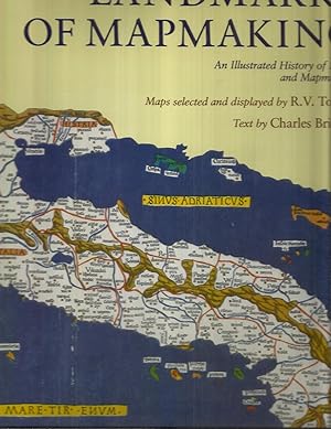
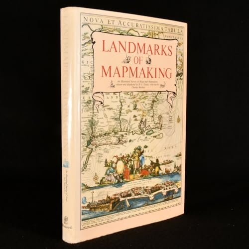
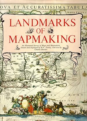
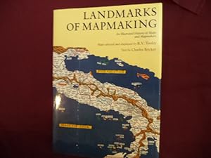
Landmarks of Mapmaking: An Illustrated History of Maps and Mapmakers
Seller: Wonder Book, Frederick, MD, U.S.A.
Seller rating 5 out of 5 stars

Condition: Very Good. Very Good condition. Good dust jacket. A copy that may have a few cosmetic defects. May also contain light spine creasing or a few markings such as an owner's name, short gifter's inscription or light stamp. NOT AVAILABLE FOR SHIPMENT OUTSIDE OF THE UNITED STATES.
-
Landmarks of Mapmaking: An Illustrated History of Maps and Mapmakers
Language: English
Published by Dorset Press, New York, 1989
ISBN 10: 0880293497 ISBN 13: 9780880293495
Hard Cover with Jacket. Condition: Very Good (Book condition). Dust Jacket Condition: Very Good (Jacket Condition). Book.
-
Landmarks of Mapmaking: An Illustrated History of Maps and Mapmakers
Language: English
Published by Dorset Press, New York, 1989
ISBN 10: 0880293497 ISBN 13: 9780880293495
Hard Cover with Jacket. Condition: Very Good (Book condition). Dust Jacket Condition: Very Good (Jacket Condition). Book.
-

Landmarks of Mapmaking: Illustrated Survey of Maps & Mapmakers
Seller: Sequitur Books, Boonsboro, MD, U.S.A.
Association Member: IOBA
Seller rating 5 out of 5 stars
Hardcover. Condition: Very Good. 276 pages : illustrations (some color), maps (14 folded, some color) ; 40 cm. Hardcover. Good binding and cover. Clean, unmarked pages. Originally published in 1968 by Elsevier-Sequoia, Brussels. Maps chosen and displayed by R.V. Tooley ; text written by Charles Bricker ; preface by Gerald Roe Crone. This is an oversized or heavy book, that requires additional postage for international delivery outside the US.
-

LANDMARKS OF MAPMAKING
Published by Crowell, NY, 1976
Seller: Neil Shillington: Bookdealer/Booksearch, Hobe sound, FL, U.S.A.
Seller rating 4 out of 5 stars

Hardback. Condition: Good. Dust Jacket Condition: Fair. Chipping to dust jacket.; 276 pages.
-
Landmarks of Mapmaking : An Illustrated Survey of Maps and Mapmaking
Seller: Better World Books Ltd, Dunfermline, United Kingdom
Seller rating 5 out of 5 stars
Condition: Very Good. Former library copy. Pages intact with possible writing/highlighting. Binding strong with minor wear. Dust jackets/supplements may not be included. Includes library markings. Stock photo provided. Product includes identifying sticker. Better World Books: Buy Books. Do Good.
-
Landmarks of Mapmaking: An Illustrated History of Maps and Mapmakers
Language: English
Published by Dorset House Publishing, 1989
ISBN 10: 0880293497 ISBN 13: 9780880293495
First Edition
Hardcover. Condition: Very Good. Dust Jacket Condition: Very Good. Color and b/w Illustrations (illustrator). First Edition. In color pictorial jacket over brown cloth with gilt titling, folio, 276pp. Illustrated profusely. Size: Folio - between 12" - 15" Tall. Book.
-
Landmarks of Mapmaking. An Illustrated Survey of Maps and Mapmakers. Maps Chosen and Displayed by R. V. Tooley. Text Written by Charles Bricker.
Published by New York: Thomas Y. Crowell, 1976., 1976
Seller: Scientia Books, ABAA ILAB, Arlington, MA, U.S.A.
Association Member: ABAA ILAB SNEAB
Seller rating 4 out of 5 stars
Hardcover. Condition: Near Fine. Dust Jacket Included. 276 pp; many illustrations. Folio. Original cloth. Near Fine, in dust jacket. There are some small tears along the edges of the dust jacket, and a small stain on the front panel of the dust jacket, but the front flap of the dust jacket is not price-clipped! This copy does NOT have any library markings. First American Edition (originally published by Elsevier in Amsterdam in 1968). NOTE: there will be a substantial extra shipping charge if this book is sent outside the United States.
-
Landmarks of Mapmaking
Language: English
Published by Wordsworth Editions, Ware, England, 1989
ISBN 10: 1853269360 ISBN 13: 9781853269363
Hardcover. Condition: Very Good+. Dust Jacket Condition: Very Good+. Maps chosen for display by R.V. Tooley (illustrator). Special Edition. A solid, clean copy with no marking or underlining; collectible condition; very well illustrated with black and white photographs and reproductions of maps and drawings as well large fold-out maps in full colour; 276 pages. Book.
-
LANDMARKS OF MAPMAKING: An Illustrated History Of Maps And Mapmakers. Preface By Gerald Roe Crone
Language: English
Published by NY. 1989. Dorset Press by arrangement with Wordsworth Editions Ltd., 1989
ISBN 10: 0880293497 ISBN 13: 9780880293495
large brown hardbound folio ~ 2�. very large (14.5" x 10.5") ("coffee table" book), international or priority shipping will cost extra. dustwrapper in protective plastic book jacket cover. fine cond. binding square & tight. covers clean. edges clean. contents free of markings. dustwrapper in fine cond. not worn or torn or price clipped (no price listed). nice clean copy. no library markings or store stamps, no stickers or bookplates, no names, no inking , no underlining, no remainder markings etc ~. first printing (NAP) of this edition (1976 Phaidon original). ~ Please Note: book is larger than scanner so the photos are a bit cropped. illustrated title pg. 276p. 14 large foldout antique map reproductions, mostly in full color. over 350 b&w illustrations, charts,maps & photos. further reading & reference. illusration credits. index. world history exploration. geography. cartography. art history. ~ This spectacular survey of maps and their creators spans more than 2,000 years, from the primitive palm fiber sea charts fashioned by the Marshall Islanders to our modern statistical maps. As the story unfolds, we see how much we owe the cartographers of previous ages who painstakingly assembled the puzzle of the earth's shape, bit by little bit. Their striking maps are included here~maps that stand as works of art in their own right. Innumerable social, political, and economic influences shaped the growing art of mapmaking. The many dangerous voyages undertaken by explorers were invaluable. For instance, until 1606 when Dutch traders mistakenly landed on Australia, this vast continent was no more than a legend. Religious traditions left their mark, such as during medieval times when Christian symbolism took precedence over accuracy. Astronomical and mathematical discoveries furthered the growth of cartography, as did the development of new printing techniques. In fact, the history of cartography provides a unique and fascinating perspective on the history of the world. After first sketching the evolution of cartography in general, the authors discuss chronologically the exploration and mapping of Europe, Asia, Africa, the Americas, and finally the last continent to be discovered, Australia. These developments are readily seen in the profusion of illustrations that accompany the text~over 350 in all, showing maps, portraits of explorers and cartographers, and detail from important contemporary publications. Of special interest are the fourteen fold~out facsimile maps by master cartographers, most in full~color. Each of these handsome maps is a representation of the views of the world and mapmaking techniques in vogue when it was drawn. For example, during the great artistic era of cartography, roughly 1450 to 1650, maps were embellished with a wide range of symbols to convey information on everything from national dress to natural resources. As Gerald Roe Crone says in his preface, these maps "are in fact more than delineations of the known world~they are popular encyclopedias." A detailed index and bibliography complete the book. LANDMARKS OF MAPMAKING will be treasured not only by the growing number of lovers of old maps but by everyone interested in the history of exploration, who will find here a rich and original source of information.
-

Landmarks of Mapmaking
Language: English
Published by Wordsworth Editions Ltd, Ware, 1989
ISBN 10: 1853269360 ISBN 13: 9781853269363
US$ 20.74
US$ 22.82 shipping
Ships from United Kingdom to U.S.A.Quantity: 1 available
Add to basketHardcover. Condition: Very Good. Dust Jacket Condition: Very Good. Dustwrapper is protected by a layer of clear, non adhesive plastic.
-
Landmarks of Mapmaking
Language: English
Published by Wordsworth Editions Ltd, 1989
ISBN 10: 1853269360 ISBN 13: 9781853269363
US$ 22.73
US$ 21.47 shipping
Ships from United Kingdom to U.S.A.Quantity: 1 available
Add to basketHardcover. Condition: Used; Good. **SHIPPED FROM UK** We believe you will be completely satisfied with our quick and reliable service. All orders are dispatched as swiftly as possible! Buy with confidence! Greener Books.
-
Landmarks of Mapmaking: An Illustrated Survey of Maps and Mapmaking
Language: English
Published by Wordsworth Editions Ltd, Hertfordshire, 1989
ISBN 10: 1853269360 ISBN 13: 9781853269363
Seller: Fahrenheit's Books, Denver, CO, U.S.A.
Association Member: RMABA
Seller rating 5 out of 5 stars
First Edition
Hardcover. Condition: Very Good. Dust Jacket Condition: Very Good. 1st Edition Thus. First edition thus, hardcover featuring fold out maps, has a shallow lean to the binding, light bumps to the spine ends and cover corners, some mild edge wear with a hint of rubbing to the covers, and a very small, thin scrape to the fore edge of about half of the text block, otherwise a solid, tight Very Good copy in a like dust jacket, which has light bumps to the spine ends and corners, mild sunning to the spine, and a touch of shelfwear to the edges. Jacket is wrapped in a Mylar cover.
-

Landmarks of Mapmaking : An Illustrated Survey of Maps and Mapmakers
Language: English
Published by Phaidon Press Limited, 1976
ISBN 10: 0714817589 ISBN 13: 9780714817583
Condition: Good. Former library copy. Pages intact with minimal writing/highlighting. The binding may be loose and creased. Dust jackets/supplements are not included. Includes library markings. Stock photo provided. Product includes identifying sticker. Better World Books: Buy Books. Do Good.
-
hardcover. Condition: Good. Dust Jacket Condition: Good. Signed on inside jacket flap by Charles Bricker. A good hardcover with general wear in a good jacket with heavy edgewear and creasing, now in nice mylar wrap.
-
Hardcover. Condition: Fine. Dust Jacket Condition: Very Good. First Edition. Fine in cloth-covered boards and very good dust jacket.
-
36.0 c 26.0cms 276pp b/w & colour illusts including 20 foldout maps very good hardback & dustwrapper (chip at base of spine) The chapters are: the mapmaker's skills; Europe the rise of map publishing; Asia seaway to the Indies; Africa the mysterious continent; the Americas a New World; Australia the Southern Land.
-
Landmarks of Mapmaking: An Illustrated Survey of Maps and Mapmakers
Language: English
Published by Westminster Editions, United Kingdom, 1981
ISBN 10: 187212805X ISBN 13: 9781872128054
Seller: Pendleburys - the bookshop in the hills, Llanwrda, United Kingdom
Seller rating 5 out of 5 stars
US$ 37.27
US$ 15.44 shipping
Ships from United Kingdom to U.S.A.Quantity: 1 available
Add to baskethardback. Condition: Very Good. Dust Jacket Condition: Very Good. hardback, small folio measuring 14 1/4" x 10 1/2", a very good tightly bound copy in a well preserved pictorial dust wrapper that has faded a little to spine, the text is clean and is unmarked, folding colour maps, b&w maps, illustrations, 276pp. Owing to size and weight, a request for additional postage might be made if ordered from certain overseas locations.
-
Geschichte der mittelalterlichen Kartographie Gewicht in Gramm: 550 Schutzumschlag etwas fleckig, sonst gut.
-
Landmarks of Mapmaking; an Illustrated Survey of Maps and Mapmakers. Maps Chosen and Displayed by R.V. Tooley. Preface by Gerald Roe Crone
Published by Elsevier, Amsterdam, Netherlands, 1968
Hardcover. Condition: Very Good. Dust Jacket Condition: Good+. 1968. Nice Firm Clean copy ! Light general wear. 276 pages. 6503L.
-
Hardback-. Condition: Good. 276 pages.
-

Landmarks of Mapmaking An Illustrated Survey of Maps and Mapmakers
Language: English
Published by Thomas Y. Crowell Company, New York, 1976
ISBN 10: 0690011776 ISBN 13: 9780690011777
Seller: Di Mano in Mano Soc. Coop, Cambiago, MI, Italy
Seller rating 5 out of 5 stars
Cartonato con sovracoperta. Testo in inglese. Text in English.Con numerose immagini in b/n e a colori n.t. e f.t. Numero di tavole: 0 pp.276 altezza 0 larghezza 0 Esemplare in buone condizioni. Sovraccoperta con ingiallimento, macchie di polvere, alcuni piccoli strappi ai bordi e piccole mancanze al bordo superiore della prima e del dorso. Tagli con tracce di polvere. Pagine e tagli leggermente ingialliti. Testo in inglese.Text in English. Book in good condition.
-
Condition: Very Good. Dust Jacket Condition: Very Good. In Very Good, mylar wrapped dust jacket.
-
Landmarks of Mapmaking. An Illustrated Survey of Maps and Mapmaking.
Language: English
Published by New York, Dorset Press [Marboo Books Corporation]. 1989, 1989
ISBN 10: 0880293497 ISBN 13: 9780880293495
Seller: Antiquariaat Schot, Hendrik-Ido-Ambacht, Netherlands
Seller rating 5 out of 5 stars
Original publisher's brown paper-covered boards, gilt lettering spine, pictorial dustjacket, folio: frontispiece tipped-in, 276pp., very richly illustrated [several plates folding & double-page large], notes & references, general bibliography, credits illustrations, index, colophon.
-
Landmarks of Mapmaking: An Illustrated Survey of Maps and Mapmaking
Language: English
Published by Wordsworth Editions, Ware, 1989
ISBN 10: 1853269360 ISBN 13: 9781853269363
US$ 30.42
US$ 33.56 shipping
Ships from United Kingdom to U.S.A.Quantity: 1 available
Add to basketHardback. Condition: Very Good. Dust Jacket Condition: Good. Jacket lightly dulled at spine, with some light wear, small tears and minor scuffs at extremities. 355 mm x 255 mm. 276 pp + 14 fold-out colour & b&w plates.
-
LANDMARKS OF MAPMAKING: An Illustrated Survey of Maps and Mapmakers chosen and displayed by R. V. Tooley
Language: English
Published by Wordsworth, Hertfordshire, 1989
ISBN 10: 1853269360 ISBN 13: 9781853269363
US$ 48.40
US$ 28.19 shipping
Ships from United Kingdom to U.S.A.Quantity: 1 available
Add to basketCloth. Condition: Near Fine. Dust Jacket Condition: Near Fine. Text by Charles Bricker. Preface by Gerald Roe Crone. Beautifully Illustrated, including Fold-Out Colour Maps. 14 1/2" Tall. Brown cloth cover with gilt lettering to spine. No inscriptions. Very slight edgewear to jacket. Slight bump to bottom of spine. 2 small faint brown spots on half title page. No inscriptions, very nice copy. Heavy book so postage will be extra. Please ask if you would like any more pictures, information or a shipping quote. Size: Folio - over 12 - 15" tall.
-
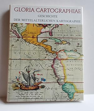
Gloria Cartographiae (Geschichte der mittelalterlichen Kartographie)
Published by G�tersloh. Kartographisches Institut Bertelsmann, 1969, 1969
Ganzleinen mit Schutzumschlag im Schuber, 4�(22 x 28 cm), 239 S., durchgehend mit sW und farbigen Abbildungen auf Tafeln, �Der Lesr wird auch mit den Karten des Altertums bekannt gemacht, auf denen die Welt noch in den wunderlichsten Formen dargestellt ist. Er lernt die runden, mit christlicher Symbolik verzierten Weltkarten des Mittelalters kennen, die erste r�mische Stra�enkarte, die erste Seekarte, die �ltesten Karten der Pilger und Kreuzfahrer und die fr�hesten, bekannten Stadtpl�ne.� Guter Zustand.
-
Landmarks of Mapmaking. An Illustrated Survey of Maps and Mapmakers.
Published by Dorset Press., New York., 1989
Gilt decorated hard cover. First edition thus. Illustrated in black, white and color. Important reference work. Very scarce in this condition. Fine copy in fine (very light rubbing to front panel) dust jacket. 276 pps.
-

Gloria Cartographiae. Geschichte der mittelalterlichen Kartographie.
Language: German
Published by G�tersloh, Kartographisches Institut Bertelsmann, 1971
ISBN 10: 3570031292 ISBN 13: 9783570031292
Seller: Klaus Kuhn Antiquariat Lesefl�gel, K�ln, NRW, Germany
Seller rating 4 out of 5 stars
1. deutsche Auflage,. zahlreiche Karten, 240 Seiten, Zustand: Buch in sehr gutem Zustand; Schutzumschlag mit leichten Gebrauchsspuren. Sprache: Deutsch Gewicht in Gramm: 1350 27,5 x 21,0 cm, gebundene Ausgabe, Leinen mit dunkelbrauner Pr�gung, Originaler-Schutzumschlag.
-

Landmarks of Mapmaking. An Illustrated Survey of Maps And Mapmakers.
Language: English
Published by Phaidon Press Ltd, Oxford, 1976
ISBN 10: 0714817589 ISBN 13: 9780714817583
US$ 41.48
US$ 40.27 shipping
Ships from United Kingdom to U.S.A.Quantity: 1 available
Add to basketHardcover. Condition: As New. Dust Jacket Condition: Fair. R.V Tooley (illustrator). First English Edition. 276 pp., 350 maps & plates in colour and b/w , 4 folding, maps chosen and displayed by R. V. Tooley, preface by Gerald Roe Crone, half-title, title, endpaper plates, biblio, cloth backed boards in slightly rubbed round edges d/w, otherwise copy clean and in very good condition. Over 200 years of cartography are covered in this fascinating study. The author describes chronologically, in separate chapters, the exploration and mapping of Europe, Asia, Africa, and the America. A special reference is made to Muslim contribution to cartography in the middle ages. #8645.