
Walker Cartographer (2 results)
 More images
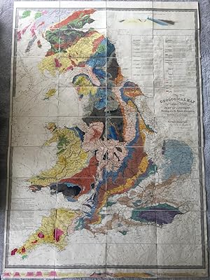
Published by J. & C. Walker, No.3 Burleigh Street, Strand. Circa 1835. 1835
- Hardcover
- Map
Seller: Kerr & Sons Booksellers ABA, Cartmel, CMA, United KingdomKerr & Sons Booksellers ABA
Contact seller5-star sellerCondition: Used - Very good
US$ 2,040.47
US$ 39.62 shippingShips from United Kingdom to U.S.A.Quantity: 1 available
Hardcover. Condition: Very Good. Measures: 1440mm x 1000mm. Published according to Act of Parliament by J. & C. Walker. Hand-coloured engraved folding map, dissected and mounted on linen, in 36 sections. With hand-coloured engraved 'Geological & mineralogical section from the Lands End to the German Ocean' across foot of map and… hand-coloured engraved 'Geological & mineralogical section from the St. George's Channel to the German Ocean' at top right, above a hand-coloured engraved 'Explanation of the colouring', providing a geological key; engraved note on 'Metalliferous tracts of England and Wales' to lower left. An early state of James Knipe and John and Charles Walker's geological map of England, Wales and southern Scotland. Dated Dec. 18th 1835 at foot, this being one of the Walker re-issues with any mention of Knipe removed. Map housed in contemporary green cloth book-form box, gilt ruled spine with red leather title label, edges marbled. Extremities rubbed, particularly corners with some minor loss. Lower edge of map a little curled/creased. Otherwise a clean and bright example of this impressive geological map.
 More images
Published by London: John Murray, Albemarle Street, 1822 1822
Seller: Wittenborn Art Books, San Francisco, CA, U.S.A.Wittenborn Art Books
Contact seller4-star sellerCondition: Used - Good
US$ 3,250.00
US$ 10.00 shippingShips within U.S.A.Quantity: 1 available
Condition: Good. 4to. 21 x 27cm. Modern tooled goatskin and marbled endpapers by the artisan binder Sasha Mosalov , with original spine labels preserved.[30]. 668pp. Very good.,Ownership signature of J. Neville White on top of title page. Lithograph portrait as frontispiece; 6 maps, of which 2 are fold-outs.OCLC Number / Unique…Identifier:3673177: Engraved frontispiece portrait of author from a sketch by Henry Salt.

