Order Total (1 Item Items):
Shipping Destination:

Appleton's Guides (20 results)
Keywords:
appleton's guides
Refine with Advanced Search
Skip to main search results
Search filters
Product Type
- All Product Types
- Books (20)
- Magazines & Periodicals (No further results match this refinement)
- Comics (No further results match this refinement)
- Sheet Music (No further results match this refinement)
- Art, Prints & Posters (No further results match this refinement)
- Photographs (No further results match this refinement)
- Maps (No further results match this refinement)
- Manuscripts & Paper Collectibles (No further results match this refinement)
Condition Learn more
Binding
Collectible Attributes
- First Edition (3)
- Signed (No further results match this refinement)
- Dust Jacket (No further results match this refinement)
- Seller-Supplied Images (12)
- Not Print on Demand (14)
Language (2)
Free Shipping
Seller Location
Seller Rating
-

Appletons' Dictionary of Greater New York
Published by D. Appleton and Company
Seller: Wonder Book, Frederick, MD, U.S.A.
Seller rating 5 out of 5 stars

Condition: Fair. Acceptable condition. (travel, guides, new york, NY) A readable, intact copy that may have noticeable tears and wear to the spine. All pages of text are present, but they may include extensive notes and highlighting or be heavily stained. Includes reading copy only books. Bundled media such as CDs, DVDs, floppy disks or access codes may not be included.
-
US$ 21.36
Free Shipping
Ships from United Kingdom to U.S.A.Quantity: Over 20 available
Add to basketPaperback. Condition: New. Print on Demand. This comprehensive travel guide from 1857 offers a fascinating glimpse into the past, transporting readers to a bygone era of American travel. With detailed descriptions, maps, and illustrations, it serves as a historical record of the United States and British Provinces, showcasing the diverse landscapes, cities, and cultural attractions of the time. The author meticulously guides travelers through various regions, highlighting points of interest, transportation options, and local customs. From bustling cities like New York and Boston to the breathtaking natural wonders of Niagara Falls and the White Mountains, the book captures the essence of 19th-century American life. Beyond its practical value, the guide delves into the social and cultural fabric of the era, offering insights into the people, places, and events that shaped the nation. It reflects the spirit of exploration and discovery that characterized the time, inviting readers to experience the wonders of a rapidly evolving country. Through its vivid descriptions and historical anecdotes, this book provides a valuable window into the past, reminding us of the enduring allure of travel and the transformative power of experiencing different cultures and landscapes. This book is a reproduction of an important historical work, digitally reconstructed using state-of-the-art technology to preserve the original format. In rare cases, an imperfection in the original, such as a blemish or missing page, may be replicated in the book. print-on-demand item.
-
US$ 23.86
Free Shipping
Ships from United Kingdom to U.S.A.Quantity: Over 20 available
Add to basketPaperback. Condition: New. Print on Demand. This book, focusing on the history, culture, and geography of the United States and Canada, is divided regionally, featuring in-depth analysis of each state and province's most important sites. The author highlights historical events and iconic attractions, providing rich, comprehensive guides to major US cities like New York and San Francisco, as well as smaller towns like Trenton, Gettysburg, and Niagara Falls. In addition to providing fascinating insights into the American Civil War, the author covers topics as diverse as mineral springs and Indian territories, providing a glimpse into the continental scope of American history. This book is a reproduction of an important historical work, digitally reconstructed using state-of-the-art technology to preserve the original format. In rare cases, an imperfection in the original, such as a blemish or missing page, may be replicated in the book. print-on-demand item.
-
US$ 26.77
Free Shipping
Ships from United Kingdom to U.S.A.Quantity: Over 20 available
Add to basketPaperback. Condition: New. Print on Demand. This book is an 1865 compendium of travel destinations, city guides, and historical sketches for significant sites in the burgeoning United States and provinces of British North America. The author draws on personal observations and extensive previous publications to craft an invaluable guidebook for the burgeoning travel industry of the era. Through the author's eyes, the reader embarks on a historical and geographical journey experiencing the growth and grandeur of the United States just after the Civil War and as westward expansion gathered momentum. The book serves as both a fascinating historical snapshot and a testament to the enduring appeal of travel and exploration. This book is a reproduction of an important historical work, digitally reconstructed using state-of-the-art technology to preserve the original format. In rare cases, an imperfection in the original, such as a blemish or missing page, may be replicated in the book. print-on-demand item.
-

US$ 27.54
Free Shipping
Ships from United Kingdom to U.S.A.Quantity: Over 20 available
Add to basketPaperback. Condition: New. Print on Demand. This book is an indispensable guide to traveling Europe. It includes meticulous and comprehensive information about countless European cities, from standard attractions to local gems. The author, an experienced world traveler, offers practical advice about travel preparations, best times to visit destinations, hotel recommendations, and more. This edition includes special sections about the viability of traveling by rail and ferry as well as updated content on travel to Russia, Portugal, and other regions. Advanced planning is made simple with historical and cultural insights about each locale. The author emphasizes local immersion, whether that means frequenting a beloved local restaurant or attending religious services in venues that welcome visitors. The book not only guides the journey but encourages engagement with the destination. This book is a reproduction of an important historical work, digitally reconstructed using state-of-the-art technology to preserve the original format. In rare cases, an imperfection in the original, such as a blemish or missing page, may be replicated in the book. print-on-demand item.
-
Appleton's Hand-Book of American Travel. The Northern Tour [Fine Binding]
Language: English
Published by D. Appleton & Co., New York, 1867
Seller: Books & Bidders, Cleveland, OH, U.S.A.
Association Member: IOBA
Seller rating 5 out of 5 stars
Leather. Condition: Very Good. [Fine Binding]. Half calf over marbled boards, raised bands, morocco title label, gitl title and gilt decorative compartments, all edges gilt, marbled endpapers, (7.5 x 5.25 inches). Ninth Annual Edition. xvi, 456 pages, viii Index, plus publisher's adverts. With 11 fold-out maps of the leading routes of travel and of the principal cities, including frontis map of the U.S. Being a Guide through New York, Connecticut, Rhode Island, Massachusetts, New Hampshire, Vermont, Maine, New Jersey, Delaware, Pennsylvania, Ohio, Indiana, Illinois, Missouri, Iowa, Minnesota, Wisconsin, Michigan, Kansas, Nebraska, California, Oregon, Washington, Arizona, New Mexico, Neveda, Utah, Idaho, Montana, Colorado, and Decotah. with descriptive sketches of the cities, towns, waterfalls, battle-fields, mountains, rivers, lakes, hunting and fishing grounds, watering places, summer resorts, and all scenes and objects of importance and interest. A clean, tight copy in handsome leather binding.
-
Appletons' Railway And Steam Navigation Guide - November, 1874
Language: English
Published by D. Appleton & Co., New York, 1874
Soft cover. Condition: Very Good. Small Tears On Front And Back Corners On Top And Bottom Of Spine, As Well As Right Side Of Front Cover, Both Covers Are Nonetheless In Great Shape With Clear Images And Writing, Nothing Is Loose Or Falling Out/Apart, Mild Edgewear, Light Tanning From Age, Otherwise An Unmarked, Clean, And Solid Piece Of History. First page is Index page, no map on front. Many line maps throughout.
-

US$ 33.05
Free Shipping
Ships from United Kingdom to U.S.A.Quantity: Over 20 available
Add to basketPaperback. Condition: New. Print on Demand. This book delves into the fascinating world of gears, exploring the fundamental principles and diverse applications of these mechanical marvels that have shaped the course of engineering. The author expertly guides readers through the intricacies of gear design, covering various types such as spur gears, bevel gears, and screw gears, each with unique characteristics and functionalities. Emerging during the Industrial Revolution, gears played a pivotal role in power transmission and revolutionized machinery across industries. This book meticulously examines the historical context and evolution of gear technology, highlighting the ingenious minds behind key advancements. Readers will gain a comprehensive understanding of the mechanics, mathematics, and engineering principles governing gear systems, along with practical insights into their construction and application. The book delves into the theoretical underpinnings of gear design, delving into concepts like pitch circles, tooth profiles, and contact ratios. It explores the fascinating interplay between geometry and motion, revealing how gear ratios determine speed and torque relationships in machines. The author's clear explanations and insightful illustrations make complex concepts accessible to both seasoned engineers and those new to the field. By illuminating the intricate world of gears and their profound impact on technology, this book offers a captivating journey through the heart of mechanical engineering. It serves as a testament to human ingenuity and the enduring legacy of these essential components in shaping the modern world. This book is a reproduction of an important historical work, digitally reconstructed using state-of-the-art technology to preserve the original format. In rare cases, an imperfection in the original, such as a blemish or missing page, may be replicated in the book. print-on-demand item.
-
The Canadian Guide-Book. Part II. Western Canada. Appletons' Canadian Guide Book.
Published by D. Appleton and Companyh, New York, 1893
Seller: Old Favorites Bookshop LTD (since 1954), Stouffville, ON, Canada
Seller rating 5 out of 5 stars
Hardcover. Condition: Good Condition, Dust Jacket Condition: No Dust Jacket. Illustrated plus 3 fold-out maps in back pocket. (illustrator). Red cloth binding with gilt title on front cover and illustration. Gilt title and small illustration of beaver on spine. Binding shows minor soil. Top and bottom of spine and corners are a little bumped. Front and back flyleaves missing. 262pp. Content clean, bright and sound.
-
Appleton's Handbook of American Winter Resorts; for Tourists and Invalids.
Published by Appleton, Ny, 1877
First Edition
Decorative Cloth. Condition: Good. First Edition. 8pp ads, 138 pp., 20 pp ads. maps, ills. lacks blanks. red decorative cloth rubbed, lightly spotted, spine faded, with 1/4 tear top and bottom. contents good. one of the scarcer appleton guides. Size: 8vo - over 7¾" - 9¾" tall. Book.
-
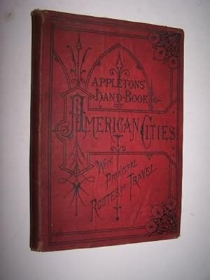
Red Cloth. Condition: Very Good. (12 ads), v, (3), 160, (20 ads) pages; Contents clean and secure in original red cloth binding, decoratively stamped in black. Illustrated with 4 small maps and more than 70 small engravings of cit views and landmarks. Cloth binding darkened along sides, worn at spine ends, rubbed at corners. D. Appleton & Company began publishing Appletons' travel guide books for railway travel in the United States in the 1840s. The Guide to American Cities offered here was first issued in 1876, coinciding with the opening of the Philadelphia Centennial Exposition. From the Preface: "the present work contains a larger amount and greater variety of that kind of information which is really useful to the tourist and sight-seer than many more voluminous and pretentious works. . No mention is made of anything which is not thought worth the traveler's attention.".
-
Appletons' general guide to the United States and Canada. Part II. Western and Southern States. . . .
Published by D. Appleton & Co.,, New York:, 1881
Seller: Zephyr Used & Rare Books, Vancouver, WA, U.S.A.
Association Member: ABAA CBA ESA ILAB
Seller rating 5 out of 5 stars
First Edition
8vo. [8 pp. publ. ads], xiv, [265]-500, [4] pp., plus [20 pp. illust. ads]. Numerous woodcut-engraved illustrations, illustrated ads, numerous maps & plans (10 folding, 2 large inserted in rear pocket). Cobalt-blue publisher's cloth, embossed & decorated on front cover in gilt & black, ad on rear for the New York Life Insurance company (minor shelfwear, rubbing, couple tears at creases on 1 folding map repaired in rear pocket), still a VG copy. First edition, thus, of this early Western and Southern railway guidebook, describing railway schedules and stops from New York to Chicago, Cincinnati to Louisville, St. Louis, as well as travel to San Francisco, the Yostemite Valley, Santa Cruz, Pescadro, Monterey, San Jose, Petrified Forest, Santa Barbara, Colorado Springs, Texas, Yellowstone, Manitoba, and much more.
-
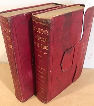
Appleton's European Guide Book 1878 Spring Edition (2 vol.)
Published by D. Appleton, New York, 1878
Hardcover. Condition: Very good. No Jacket. 13th Edition. 12mo or short 8vo, 2 volumes elegantly bound in full red morocco with all edge gilt, folding clasps to keep volumes closed in very good condition as is the binding in general. There is light to moderate soiling of covers, contents generally very good or better, but there are a few cases of stained pages, light foxxing and age toning of paper. All maps and plans called for are present, plus a couple of extras- a Rail Road map of Europe, and a map of the Rhine. pagination is a bit confusing. in part 1 there are ca. 10 pages of ads, then pages 1-12, then xxviii called "Hotel Appendix", then 13- 396, then index pages 793- 815 followed by ca. 50 pages of adverts. Part 2 has 1-28 then "Hotel appendix" of xxviii, then pages 397- 815, which includes index, then ca. 50 pages of adverts at the back. The pocket maps appear to have been mostly folded for the past 140 years as they has small holes at corners of folds and some small closed tears. Part one covers far western Europe while Part 2 covers Northern Europe, Eastern Europe and Egypt and the Holy Land. There is mention of a vocabulary of travel talk, but this is not found. Note: due to size and weight shipping outside the USA or priority shipping may cost more than an average book.
-
Appleton's Southern and Western Travellers' Guide: with New and Authentic Maps, Illustrating Those Divisions of the Country .
Published by New York, New York, 1854
Seller: High Ridge Books, Inc. - ABAA, South Deerfield, MA, U.S.A.
Association Member: ABAA ESA ILAB SNEAB
Seller rating 5 out of 5 stars
Original red gilt-stamped cloth, fine condition. 140, [4] pp., 9 maps (6 folding). This is a very scarce version of Appleton's Guide series, covering the Midwestern and Southern states. Contains details and descriptions of the cities along the Mississippi and Ohio Rivers, including St. Louis, New Orleans and Cincinnati. Also contains guides to Mammoth Cave, the Great Lakes, etc. Lists steamboat and rail routes through the relevant states, including Texas.
-
Appletons? Southern and Western Travellers? Guide: with New and Authentic Maps, Illustrating Those Divisions of the Country?
Published by D. Appleton and Co. c. 1850, New York, 1850
Seller: Alexandre Antique Prints, Maps & Books, Toronto, ON, Canada
Seller rating 5 out of 5 stars
Original publisher?s decorative red pebbled cloth. Gilt title and ornamentation on top cover. Tootled text and ornamentation on bottom cover. Gilt text and ornamentation on spine. , This is a scarce version of Appleton's Guide series, covering the Midwestern and Southern states. Contains details and descriptions of the cities along the Mississippi and Ohio Rivers, including St. Louis, New Orleans and Cincinnati. Also contains guides to Mammoth Cave, the Great Lakes, etc. Lists steamboat and rail routes through the relevant states, including Texas. Bookplate of Wesleyan University Library, from the library of Jarvis Nichols Husted M.D., on the verso of the top cover. There is also the imprint of the Wesleyan University Library on one of the advertising pages., Size : 12mo (161x108mm). , Complete with 9 maps, 3 large hand-coloured folding maps, and several in-text illustrations. The book is in very good condition. Maps and illustrations are clean and crisp.
-
Hardcover. Condition: Near Fine. 1854 Illustrated ATLAS Traveler's Guide MAPS Midwest Railroads New Orleans Texas In the mid-19th-century, Appleton produced numerous travel guides for the United States, Canada, Mexico, and Europe. This guide is an interesting 1850s travel guide to the 'Southern and Western' states. The Railroad and Steamboat companion concentrates on the American Southeast as well as the mid-west and central states including: Railroad routes throughout the Midwest Missouri, Illinois, Indiana Ohio, map of Cincinnati Louisiana, map of New Orleans Southeast states South Carolina, map of Charleston Virginia, Maryland Texas This 1854 edition by Wellington Williams is illustrated with maps and city views, as well as numerous in-text engraved vignettes, of which many plates are double page and fold out maps! Item number: #21132 Price: $750 WILLIAMS, Wellington Appletons' southern and western travellers' guide : with new and authentic maps, illustrating those divisions of the country ; and containing sectional maps of the Mississippi and Ohio rivers ; with plans of cities, views, etc New York: D. Appleton; Philadelphia: Geo. S. Appleton, 1854. Details: Collation: Complete with all pages o 140, [6] o 9 full-page and fold-out maps Language: English Binding: Hardcover; tight and secure o Decorative red cloth Size: ~6.25in X 4.25in (16cm x 10.5cm) Our Guarantee: Very Fast. Very Safe. Free Shipping Worldwide. Customer satisfaction is our priority! Notify us with 7 days of receiving, and we will offer a full refund without reservation! 21132 Photos available upon request.
-
Appleton's northern and eastern traveller's guide: with new and authentic maps . forming, likewise a complete guide to the Middle states, Canada, New Brunswick and Nova Scotia.
Published by D. Appleton; Philadelphia, 1850
First Edition
Hardcover. Condition: Near Fine. 1st Edition. 1850 1ed Illustrated ATLAS Traveler s Guide MAPS Niagara Railroads New York & USA In the mid-19th-century, Appleton produced numerous travel guides for the United States, Canada, Mexico, and Europe. This guide is an interesting 1850s travel guide to the middle states of Canada, Nova Scotia, and New Brunswick, as well as other northern and eastern sections of America. The Railroad and Steamboat companion concentrates on the Eastern United States and Canada but discusses also Southern and Mid-Western states. Interesting topics includes: Origins and Development of the Railroad and Steamboats Different Railroads Routes in different cities The White Mountains New York Boston New Hampshire New Brunswick Baltimore South Carolina Georgia New Orleans And many more! This 1850 edition by Wellington Williams is illustrated with maps and city views, as well as numerous in-text engraved vignettes, of which many plates are double page and fold out maps! Item number: #21131 Price: $750 WILLIAMS, Wellington Appleton's northern and eastern traveller's guide: with new and authentic maps . forming, likewise a complete guide to the Middle states, Canada, New Brunswick and Nova Scotia. New York: D. Appleton; Philadelphia: Geo. S. Appleton, 1850. First edition. Details: Collation: Complete with all pages o 313 o 30 numbered maps (folding, double-page, and single-page) Numerous in-text engravings throughout Language: English Binding: Hardcover; tight and secure o Red cloth Size: ~6.5in X 4.5in (16.5cm x 11cm) Our Guarantee: Very Fast. Very Safe. Free Shipping Worldwide. Customer satisfaction is our priority! Notify us with 7 days of receiving, and we will offer a full refund without reservation! 21131 Photos available upon request.
-
Appleton's northern and eastern traveller's guide: with new and authentic maps . forming, likewise a complete guide to the Middle states, Canada, New Brunswick and Nova Scotia.
Published by D. Appleton; Philadelphia: Geo. S. Appleton, 1853
Hardcover. Condition: Near Fine. 1853 Illustrated ATLAS Traveler's Guide MAPS Niagara Railroads New York & USA In the mid-19th-century, Appleton produced numerous travel guides for the United States, Canada, Mexico, and Europe. This guide is an interesting 1850s travel guide to the 'middle states' of Canada, Nova Scotia, and New Brunswick, as well as other northern and eastern sections of America. The Railroad and Steamboat companion concentrates on the Eastern United States and Canada but discusses also Southern and Mid-Western states. Interesting topics includes: Origins and Development of the Railroad and Steamboats Different Railroads Routes in different cities The White Mountains New York Boston New Hampshire New Brunswick Baltimore South Carolina Georgia New Orleans And many more! This 1853 edition by Wellington Williams is illustrated with maps and city views, as well as numerous in-text engraved vignettes, of which many plates are double page and fold out maps! Item number: #16604 Price: $750 WILLIAMS, Wellington Appleton's northern and eastern traveller's guide: with new and authentic maps . forming, likewise a complete guide to the Middle states, Canada, New Brunswick and Nova Scotia. New York: D. Appleton; Philadelphia: Geo. S. Appleton, 1853. Details: Collation: Complete with all pages [3], 303, [9] 27 full-page and fold-out maps Language: English Binding: Hardcover; tight and secure Decorative red cloth Size: ~6.5in X 4.5in (16.5cm x 11.5cm) Our Guarantee: Very Fast. Very Safe. Free Shipping Worldwide. Customer satisfaction is our priority! Notify us with 7 days of receiving, and we will offer a full refund without reservation! 16604 Photos available upon request.
-
APPLETON'S NORTHERN AND EASTERN TRAVELLER'S GUIDE: WITH NEW AND AUTHENTIC MAPS.A COMPLETE GUIDE TO THE MIDDLE STATES, CANADA, NEW BRUNSWICK, AND NOVA SCOTIA.
Published by New York: D. Appleton & Company, 1853., 1853
Seller: William Reese Company, New York, NY, U.S.A.
Association Member: ABAA ESA ILAB SNEAB
Seller rating 5 out of 5 stars
The "new and revised" edition of a component of Appleton's guidebook series, originally issued in 1847. A railroad guide for several major routes in the Northeast. "This is one of the most complete travel guides for the eastern and northern United States and parts of Canada.also included are sketches pertaining to Washington." - Clark. Scarce. CLARK III:432. Original gilt red cloth. Spine rubbed and slightly chipped at head, corners bumped. Scattered foxing, contemporary ownership inscription on front free endpaper. About very good.
-
Softcover. Condition: New. English: Print-on-demand reprint. Original edition: 1847. of the 1847. Appletons' railroad and steamboat companion is a practical travel guide for New England, the middle states, the southern and western states, and Canada, illustrated with numerous maps and engravings. A useful bibliographic and historical reference for collectors of early American travel guides, railroad literature, and nineteenth-century transportation ephemera. Images are not contractual. of the 1847. Appletons' railroad and steamboat companion is a practical travel guide for New England, the middle states, the southern and western states, and Canada, illustrated with numerous maps and engravings. A useful bibliographic and historical reference for collectors of early American travel guides, railroad literature, and nineteenth-century transportation ephemera. Images are not contractual. Book images are non-contractual. - Informations complémentaires : Langue : Anglais | Format : Livre broché | État : Neuf | Nombre de pages : 235.


![Seller image for Appleton's Hand-Book of American Travel. The Northern Tour [Fine Binding] for sale by Books & Bidders](https://pictures.abebooks.com/inventory/md/md32234944298.jpg)