Order Total (1 Item Items):
Shipping Destination:

Asia Map (Over 2,400 results)
Skip to main search results
Search filters
Product Type
- All Product Types
- Books (1,515)
- Magazines & Periodicals (8)
- Comics (No further results match this refinement)
- Sheet Music (No further results match this refinement)
- Art, Prints & Posters (141)
- Photographs (No further results match this refinement)
- Maps (800)
- Manuscripts & Paper Collectibles (4)
Condition Learn more
Collectible Attributes
Language (12)
Free Shipping
Seller Location
Seller Rating
-

Asia/Folded Map
Language: English
Published by Hammond World Atlas Corporation, 1985
ISBN 10: 0843703261 ISBN 13: 9780843703269
Paperback. Condition: Good.
-
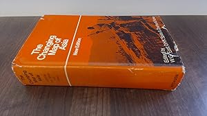
Changing Map of Asia
Seller: BoundlessBookstore, Wallingford, United Kingdom
Seller rating 5 out of 5 stars

Condition: Good. Light wear to boards. Content is clean and bright. Light toning to page ends. DJ with some edge wear, tears and creasing. Book has a lean.
-

map. Condition: Very Good. Connecting readers with great books since 1972! Used books may not include companion materials, and may have some shelf wear or limited writing. We ship orders daily and Customer Service is our top priority!
-

Condition: New. Brand New! Not Overstocks or Low Quality Book Club Editions! Direct From the Publisher! We're not a giant, faceless warehouse organization! We're a small town bookstore that loves books and loves it's customers! Buy from Lakeside Books!
-

Condition: New.
-
Condition: As New. Unread book in perfect condition.
-
Soft cover. Condition: Fine. 1st Edition. xxvii,k 98p plus large folding color map in front pocket.
-

Soft cover. Condition: Very Good.
-

MAP OF EUROPE AND ADJOINING PORTIONS OF AFRICA AND ASIA, 1915
Language: English
Published by National Geographic Society, 1915
Paperback. Condition: Fair. Map of Europe, Color in Pastels, Borders with Intense Color, (28.5 x 31 Inches) (Folded to 6.5 x 9.5 Inches), several breaks at folds, thus Fair only.
-
Lonely Planet Southeast Asia Planning Map: Durable, Waterproof, Easy-Fold Travel Map with Top Attractions, Itineraries & Themed Lists
Book 20 of 21: Planning MapSeller: WorldofBooks, Goring-By-Sea, WS, United Kingdom
Seller rating 5 out of 5 stars
Paperback. Condition: Very Good. The book has been read, but is in excellent condition. Pages are intact and not marred by notes or highlighting. The spine remains undamaged.
-
National Geographic magazine November, 1989 with map supplement Asia-Pacific . Western Pacific Rim.
Published by National Geographic, 1989
First Edition
Magazine. Condition: Very Good. First Edition. this magazine is in Very Good condition. Clean, tight, and bright. supplement is in Very good condition.
-
Condition: NEW.
-
MAP OF THE RACES OF EUROPE AND ADJOINING PORTIONS OF ASIA AND AFRICA, 1918 [NATIONAL GEOGRAPHIC MAP SUPPLEMENT FOR DECEMBER, 1918 MAGAZINE]
Language: English
Published by Nat Geographic Soc, 1918
First Edition
Pamphlet. Condition: Very Good. 1st Edition. Map Supplement, Dec, 1918, 19.75 x 31 inches, Color in Pastels, Folded to 6.75 x 8 3/4 inches, tiny edge tears else VG, 1st ed.
-
UNK. Condition: New. New Book. Shipped from UK. Established seller since 2000.
-

Voyages from Asia to America, for Completing the Discoveries of the North West Coast of America to Which Is Prefixed, a Summary of the Voyages Made Serving as an Explanation of a Map o 1
Language: English
Published by Hardpress Publishing, 2019
ISBN 10: 0461151510 ISBN 13: 9780461151510
PAP. Condition: New. New Book. Shipped from UK. Established seller since 2000.
-
Lonely Planet Southeast Asia Planning Map
Book 20 of 21: Planning MapSeller: PBShop.store UK, Fairford, GLOS, United Kingdom
Seller rating 5 out of 5 stars
US$ 10.48
US$ 4.39 shipping
Ships from United Kingdom to U.S.A.Quantity: 15 available
Add to basketUNK. Condition: New. New Book. Shipped from UK. Established seller since 2000.
-
National Geographic. May, 1961 Map of Southeast Asia
Published by National Geographic Society, Washington, 1961
Map. Condition: Very Good-. The map has slight wear to its edges.
-
National Geographic. December, 1959 Map of Asia and Adjacent Areas
Published by National Geographic Society, Washington, 1959
Map. Condition: Very Good-. The map has slight wear to its edges.
-
National Geographic. March, 1951 map of Asia and Adjacent Areas
Published by National Geographic Society, Washington, 1951
Map. Condition: Good. The map has a little wear to its edges.
-
National Geographic. December, 1942 Map of Asia and Adjacent Areas
Published by National Geographic Society, Washington, 1942
Map. Condition: Good. December, 1942 National Geographic map of Asia and adjacent areas. A little wear to the edges.
-
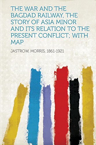
The War and the Bagdad Railway, the Story of Asia Minor and Its Relation to the Present Conflict; With Map
Language: English
Published by Hardpress Publishing, 2013
ISBN 10: 1314565990 ISBN 13: 9781314565997
PAP. Condition: New. New Book. Shipped from UK. Established seller since 2000.
-
Mineral Resources of Asia Explanatory Brochure for the Mineral Distribution Map of Asia
Published by ESCAP, New York, 1979
US$ 11.00 25% offUS$ 8.25
US$ 5.05 shipping
Ships within U.S.A.Quantity: 1 available
Add to basketPaperback. Condition: Good+. Unmarked. Small tea stain on front cover and most corners have mild wear, slight gape from opening. ; Book Description; Spine has no signs of creasing. Pages are clean and not marred by notes or folds. Covers are square with minor wear. Ships Safe and Fast. Errata sheet. ; 8vo 8" - 9" tall; 110 pages DN1.
-

-

Folded. Condition: new. Folded. This bright colorful map shows the countries in the Middle East and Central Asia, along with population and religion information about each one. Helps you pray for missionaries and persecuted Christians in Iran, Iraq, Turkey, Egypt, Afghanistan, Saudi Arabia, Pakistan, Kazakhstan, Uzbekistan, and more. Perfect for studying the 10-40 window.3 Key Features of this Middle East and Central Asia Map Poster1. Easy-to-See Size and Laminated for DurabilityFull color, large Bible wall chart for Bible study, Sunday school or Summer Bible School use. Durable and water resistant (spill proof) - sturdy and unlikely to rip, crease, or wrinkle over time! Size: 19.5 x 26. Printed on heavy chart paper, and laminated front and back with high quality 3 mil lamination. Perfect for use with water-soluble markers. Rolls for easy storage.2. Shows the Middle East and Central Asia Side by Side!This full-color chart is great for visually presenting the following side by side at a glance:CountriesPercent ChristianMain ReligionLargest Ethnic Groups3. Easily Teach Your Sunday School with 4 Reproducible Printable WorksheetsThe back of the chart is packed with bonus teaching curriculum for review and discussion. Sized for easy copying, you can prepare a lesson in just the push of a button! Enjoy having:Teaching tipsA mini mapStatistics about each countryHow to talk with Muslims about Christ Shipping may be from multiple locations in the US or from the UK, depending on stock availability.
-
National Geographic Map - Asia-Pacific - November, 1989 (MAP ONLY)
Published by NATIONAL GEOGRAPHIC SOCIETY, 1989
single_issue_magazine. Condition: New. BRAND NEW. 100% Satisfaction Guaranteed. Orders received before 3PM PT typically ship same day. All profits support the non-profit community.
-
Voyages from Asia to America, for Completing the Discoveries of the North West Coast of America. to Which Is Prefixed, a Summary of the Voyages Made by the Russians on the Frozen Sea, in Search of a North East Passage. Serving as an Explanation of a Map of the Russian Discoveries, Published By.
Language: English
Published by Hardpress Publishing, 2019
ISBN 10: 0461151510 ISBN 13: 9780461151510
Seller: PBShop.store UK, Fairford, GLOS, United Kingdom
Seller rating 5 out of 5 stars
US$ 20.17
US$ 4.39 shipping
Ships from United Kingdom to U.S.A.Quantity: 15 available
Add to basketPAP. Condition: New. New Book. Shipped from UK. Established seller since 2000.
-

map. Condition: Used; Good. Dispatched, from the UK, within 48 hours of ordering. This book is in good condition but will show signs of previous ownership. Please expect some creasing to the spine and/or minor damage to the cover.
-
Geological Map of Asia and the Far East
Published by United Nations Economic Commision for Asia, Calcutta, India, 1961
US$ 13.00 25% offUS$ 9.75
US$ 5.05 shipping
Ships within U.S.A.Quantity: 1 available
Add to basketPaperback. Condition: Very Good-. Unmarked. ; Book Description; Spine has no signs of creasing. Pages are clean and not marred by notes or folds. Covers are square with minor wear. Ships Safe and Fast. folded map in pocket.; Explanatory Brochure; 8vo 8" - 9" tall; 74 pages DP2.
-
Pamphlet. Condition: Very Good. Color Illus Map (8.5 X 10.5 Inches). Map is folded in middle for shipping, else VG.
-
Pamphlet. Condition: Very Good. Color Illus Map (8.5 X 10.5 Inches). Map is folded in middle for shipping, else VG.