

Order Total (1 Item Items):
Shipping Destination:

Bregentz (23 results)
Skip to main search results
Search filters
Product Type
- All Product Types
- Books (9)
- Magazines & Periodicals (No further results match this refinement)
- Comics (No further results match this refinement)
- Sheet Music (No further results match this refinement)
- Art, Prints & Posters (6)
- Photographs (No further results match this refinement)
- Maps (8)
- Manuscripts & Paper Collectibles (No further results match this refinement)
Condition Learn more
- New (1)
- As New, Fine or Near Fine (No further results match this refinement)
- Very Good or Good (2)
- Fair or Poor (No further results match this refinement)
- As Described (20)
Binding
Collectible Attributes
- First Edition (1)
- Signed (No further results match this refinement)
- Dust Jacket (No further results match this refinement)
- Seller-Supplied Images (20)
- Not Print on Demand (22)
Language (3)
Free Shipping
Seller Location
Seller Rating
-
![Stock image for Bregentz : Stadt am Bodensee ; [Begleitpublikation der Ausstellung "Bregentz. Stadt am Bodensee", die von der Kulturabteilung. vom Stadtarchiv der Landeshauptstadt Bregenz ab 30. April 2015 im Martinsturm gezeigt wird] / Thomas Klagian for sale by Homburger & Hepp](https://pictures.abebooks.com/isbn/9783903023086-us-300.jpg)
Bregentz : Stadt am Bodensee ; [Begleitpublikation der Ausstellung "Bregentz. Stadt am Bodensee", die von der Kulturabteilung. vom Stadtarchiv der Landeshauptstadt Bregenz ab 30. April 2015 im Martinsturm gezeigt wird] / Thomas Klagian
Language: German
Published by Bregenz : Bertolini-Verlag,, 2015
ISBN 10: 3903023086 ISBN 13: 9783903023086
First Edition
Okart. 1. Aufl. 99 S. mit Abb., Kt. ; Gutes Exemplar. Sprache: Deutsch Gewicht in Gramm: 400.
-

"Le Tyrol sous le nom duquel l'on comprend le Comté de Tyrol, les Comtés annexes de Bregentz, Feldkirck, Monfort, Pludentz, &c. et les Evechés de Trente, et de Brixen, sous la protection des Comtes de Tyrol." - Tirol Südtirol Tyrol Brixen Trento Bregenz Feldkirch Italia carta Karte map carte
Language: French
Published by Paris, 1753
Seller: Antiquariat Steffen Völkel GmbH, Seubersdorf, Germany
Seller rating 5 out of 5 stars

Map
Großformatige handkolorierte originalKupferstich-Kartevon 1753. - Blattmasse: ca. 51 x 67 cm. -- gut erhalten. || Large handcolored original engraved map from 1753. -- in good condition. || Dies ist ein Original! - Kein Nachdruck! - Keine Kopie! -- This is an original! No copy! - No reprint! // Wir, das Antiquariat Steffen Völkel, kaufen und verkaufen alte Bücher, Handschriften, Zeichnungen, Autographen, Grafiken und Fotografien. Wir sind stets am Ankauf von kompletten Bibliotheken, Sammlungen und Nachlässen interessiert. Sprache: Französisch Gewicht in Gramm: 1550.
-

"Le Tyrol sous le nom duquel l'on comprend le Comté de Tyrol, les Comtés annexes de Bregentz, Feldkirck, Monfort, Pludentz, &c. et les Evechés de Trente, et de Brixen, sous la protection des Comtes de Tyrol." - Tirol Südtirol Tyrol Brixen Trento Bregenz Feldkirch Italia carta Karte map carte
Language: French
Published by Paris, 1753
Seller: Antiquariat Steffen Völkel GmbH, Seubersdorf, Germany
Seller rating 5 out of 5 stars
Map
Großformatige handkolorierte originalKupferstich-Karte. - Blattmasse: ca. 53 x 75 cm. Bild-Maße: ca. 48 x 54 cm. -- nur leicht knittrig, am oberen Außenrand mit kleiner Papierfehlstelle, sonst gut erhalten. || Large handcolored original engraved map. -- only slightly creased, with a small missing fragment of paper on the upper outer margin, otherwise in good condition. // Wir, das Antiquariat Steffen Völkel, kaufen und verkaufen alte Bücher, Handschriften, Zeichnungen, Autographen, Grafiken und Fotografien. Wir sind stets am Ankauf von kompletten Bibliotheken, Sammlungen und Nachlässen interessiert. Sprache: Französisch Gewicht in Gramm: 35.
-

LE TYROL SOUS LE NOM DUQUEL L'ON COMPREND LE COMTE' DE TYROL, LES COMTES ANNEXES DE BREGENTZ, FELDKIRCK, MONFORT, PLUDENTZ, &C. ET LES EVECHES DE TRENTE, ET DE BRIXEN
Published by Venezia, Remondini, Venezia, 1778
Condition: Buono (Good). Dall' ?Atlas Universel? stampato a Venezia nel 1776 e nel 1784. acquaforte acquerellata a mano inciso cm. 56,7 x 49,7 Buono (Good) Buon es. Book.
-

"Le Tyrol sous le nom duquel l'on comprend le Comté de Tyrol, les Comtés annexes de Bregentz, Feldkirck, Monfort, Pludentz, &c. et les Evechés de Trente, et de Brixen" - Tirol Südtirol Tyrol Trento Italia Italy Italien
Language: French
Published by Venezia, Santini & Remondini, 1778
Seller: Antiquariat Steffen Völkel GmbH, Seubersdorf, Germany
Seller rating 5 out of 5 stars
Map
Großformatige altkolorierte Kupferstich-Karte von 1778 -- Blatt-Maße: ca. 52,5 x 75,5 cm. -- im unteren Rand teils leicht fleckig, ansonsten gut erhalten. || Large old colored engraved map from 1778. -- slightly stained in the lower margin, otherwise in good condition. || Francesco Santini was a Venetian publisher. He acquired the printing plates of Vaugondy's Atlas Universel, a commercial and cartographic success, with widespread influence on mapmakers throughout Europe. Together with his brother Paolo, he commissioned a new set of plates and reissued the atlas in 1776. In the following years, Paolo Santini assigned all his publication rights to M. Remondini, who in 1777 reissued the same atlas, but with his name. // Wir, das Antiquariat Steffen Völkel, kaufen und verkaufen alte Bücher, Handschriften, Zeichnungen, Autographen, Grafiken und Fotografien. Wir sind stets am Ankauf von kompletten Bibliotheken, Sammlungen und Nachlässen interessiert. Sprache: Französisch Gewicht in Gramm: 550.
-

Alte Städtestiche - Oude Stadgezichten - Cartes Anciennes. Grätz, Steyr, Moraviae vulgo Merhern, Vienna, Salzburg, Bregentz, Botzen, Insbruck, Klagenfurth, Kueffstein, Lintz, Villach.
Language: German
Published by ohne Verlagsangabe, 1970
4° querformat, Pappband. Condition: Gut. faksimile Ausgabe. 12 Blatt in Box, Einzelblätter diese meist aufklappbar, eines farbig, guter Zustand Sprache: Deutsch Gewicht in Gramm: 1100.
-

"Le Tyrol sous le nom duquél l'on comprend Le Comté de Tyrol, les Comtés annèxes de Bregentz, Feldkirck, Montfort, Pludentz, &c. et les Evéches de Trente, et de Brixen, sous la protection des Comtes de Tyrol. Par le S.r Robert Geographe ordinaire du Roi . Gravé par Delahaye l'ainé".
Published by Paris, Robert de Vaugondy, 1753., 1753
Seller: Antiquariat MEINDL & SULZMANN OG, Wien - Vienna, Austria
Seller rating 5 out of 5 stars
Blattgröße ca. 54 x 62 cm. Bildausschnitt ca. 47 x 54 cm. In der rechten unteren Ecke die Titelkartusche. Im Nordwesten der Bodensee. Im Süden der Gardasee. Didier Robert de Vaugondy (Paris 1723 - 1786) war Geograph des französischen Königs Ludwig XV. 1752 schuf er im Auftrag Ludwigs XV. einen Erd- und einen Himmelsglobus. Unter den in den folgenden Jahren geschaffenen kartographischen Arbeiten ragt der 1757 erschienene und gemeinsam mit seinem Vater herausgegebene "Atlas universel" heraus.- Mittelfalz geglättet. Das Kartenbild in sauberem Erhaltungszustand. Kräftiger Abdruck.
-

Le Tyrol sous le nom duquel l'on cemprend Le Comté de Tyrol, les Comtés anèxes de Bregentz, Fekdkirck, Montfort, Pludentz &c. et les Evèchés de Trente, et de Brixen.
Published by Le Sr. Robert par P. Santini:, 1778
Seller: Antiquariat Gallus / Dr. P. Adelsberger, Innsbruck, A, Austria
Seller rating 5 out of 5 stars
Grenzkolorierte Kupferstichkarte, Bild ohne Blattrand: 48 x 54 cm (Blattgr.: 53 x 71 cm) Tadelloser Erhaltungszustand.
-

Carta di origine francese raffigurante il Tirolo "sotto il cui nome sono compresi la contea del Tirolo, le contee annesse di Bregentz, Feldkirck, Monfort, Pludentz, & C. e i vescovadi di Trento e di Bressanone", come si legge nel titolo entro l'elegante cartiglio posto nell'angolo inferiore destro. L'autore, il geografo del Re di Francia Robert de Vaugondy, dedica la sua attenzione ai segni della presenza dell'uomo sul territorio, tracciando con minore precisione i dati fisici. Scheda bibliografica tratta da "Il territorio trentino-tirolese nell'antica cartografia" di Gino Tomasi, scheda n. 69. Disponibile anche in cornice per 450 euro. Formato: Incisione in rame di dimensioni 46x53 cm.
-

Le Tyrol sous le nom duquel l'on comprend le Comte de Tyrol, les Comtes annexes de Bregentz, Feldkirck, Monfort, Pludentz, &C. et les Eveches de Trente, et de Brixen, sous la protection des Comtes de Tyrol
Published by Paris, 1753
Seller: Alexandre Antique Prints, Maps & Books, Toronto, ON, Canada
Seller rating 4 out of 5 stars

Map
Condition: Excellent. Size : 494x578 (mm), 19.375x22.75 (Inches), Original Outline Coloring.
-

Condition: ACEPTABLE. Par le Sr. Robert Geographe ordinaire du Roi. Avec Privilege 1753 / Gravé par Delahaye laine Gilles y Didier Robert de Vaugondy, padre e hijo, fueron famosos cartógrafos franceses del siglo XVIII. Eran descendientes del también cartógrafo Nicolas Sanson de quien heredaron gran parte de su material cartográfico. En 1760, Didier Robert de Vaugondy fue nombrado geógrafo de Luis XV En 1757 publicaron su más famosa obra, el Atlas Universel Formato (cm): 58x49.
-

"Bregentz." - Bregenz Bodensee Vorarlberg Österreich
Language: German
Published by Frankfurt am Main, 1650
Seller: Antiquariat Steffen Völkel GmbH, Seubersdorf, Germany
Seller rating 5 out of 5 stars
Art / Print / Poster
Original Kupferstich von ca. 1650 von Matthäus Merian. -- Blatt-Maße: ca. 30 x 40 cm -- teils etwas fleckig - sonst gut erhalten. || Original copper engraving by Matthäus Merian from c. 1650. -- partly somewhat stained - otherwise in good condition. || Matthäus Merian der Ältere war ein schweizerisch-deutscher Kupferstecher und Verleger. Er wurde 1593 in Basel geboren. Er gab zahlreiche Landkarten, Städteansichten und Chroniken heraus. Sein Hauptwerk ist die Topographia Germaniae. Er lernte beim Zürcher Kupferstecher Friedrich Meyer das Zeichnen, Kupferstechen und Radieren. Von 1610 bis 1615 studierte und arbeitete er u.a. in Straßburg bei Friedrich Brentel und in Paris bei Jacques Callot. 1615 entstand sein berühmter großer Stadtplan von Basel.Nach seinen Reisen über Augsburg, Stuttgart und die Niederlande kam Merian 1616 nach Frankfurt am Main und Oppenheim, wo er für den Verleger und Kupferstecher Johann Theodor de Bry arbeitete. 1620 zog Merian in seine Geburtsstadt Basel zurück, wo er das Zunftrecht erwarb und sich selbständig machte. Nach dem Tod seines Schwiegervaters im Jahre 1623 führte er dessen Verlagshaus in Frankfurt fort und erwarb 1626 das Frankfurter Bürgerrecht. 1627 nahm er Wenzel Hollar als Schüler in seine Werkstatt auf. Matthäus Merian starb nach langer Krankheit am 19. Juni 1650 in Langenschwalbach bei Wiesbaden. Er wurde auf dem Peterskirchhof in Frankfurt bestattet. Nach seinem Tod übernahmen seine Söhne Matthäus und Caspar den Verlag und gaben unter dem Namen Merian Erben seine Werke weiter heraus. // Wir, das Antiquariat Steffen Völkel, kaufen und verkaufen alte Bücher, Handschriften, Zeichnungen, Autographen, Grafiken und Fotografien. Wir sind stets am Ankauf von kompletten Bibliotheken, Sammlungen und Nachlässen interessiert. Sprache: Deutsch Gewicht in Gramm: 15.
-

Bregentz.
Language: German
Published by Frankfurt, 1649
Seller: Wiener Antiquariat Ingo Nebehay GmbH, Wien, Austria
Seller rating 5 out of 5 stars
Art / Print / Poster
Kupferstich aus Matthäus Merian, Topographia Sveviae, Frankfurt um 1655, 21 x 36,5 cm. - Gesamtansicht vom Bodensee aus mit 21-teiliger Legende. - Schöner sauberer Abzug. Nebehay-Wagner 408/16; Fauser 1831.
-

Bregentz wie Statt und Clausen A. 1647 den 5. Ienner von dem Schwedischen Feldmarschal Wrangeln mitt Sturm erobert worden.
Seller: Antiquariat Martin Barbian & Grund GbR, Saarbruecken, Germany
Seller rating 5 out of 5 stars
Art / Print / Poster
Kupferstich aus G. Bodenehr: "Force d'Europe", Augsburg um 1700, 15,5 x 22 cm (links und rechts etwas knapprandig, etwas berieben).
-

BREGENZ Bildausschnitt 15,5 x 22 cm, Legende an beiden Seiten, diese links mit ganz geringem Textverlust beschnitten, unterer Papierrand etwas ausgefranst. NW 106/27.
-

Le Tyrol sous le nom duq'uel l'on comprend le Comte de Tyrol, les Comtes annexes de Bregentz, Feldkirck, Monfort, Pludentz, etc., et les Eveches de Trente, et de Brixen, sous la protection des Comtes de Tyrol.
Publication Date: 1753
Seller: Geographicus Rare Antique Maps, Brooklyn, NY, U.S.A.
Association Member: ABAA ESA ILAB
Seller rating 4 out of 5 stars
Map
Very good. Minor wear along original centerfold. Original platemark visible. Some spotting. Size 20 x 22 Inches. This is a scarce 1753 map of the county of Tyrol in modern day Italy and Austria, by Robert de Vaugondy. It covers this historic region from Lake Constance east to Lienz, Austria and south as far as Lake Garda in Italy. It includes the modern day countries of Austria, Italy and Liechtenstein. The entire region is depicted in extraordinary detailed, offering both topographical and political information, with forests and mountains beautifully rendered in profile. Originally a state of the Holy Roman Empire, the County of Tyrol became a province of the Austrian Empire in 1814 and was later a part of Austria-Hungary. The region was divided between Austria and Italy after World War I. A large decorative title cartouche appears near the bottom right quadrant of the map. Issued in the 1757 issue of the Atlas Universal . The Atlas Universal was one of the first atlases based upon actual surveys. Therefore, this map is highly accurate (for the period) and has most contemporary town names correct, though historic names are, in many cases, incorrect or omitted. References: Rumsey 3353.068. Pedley, Mary Sponberg Belle et Utile: The Work of the Robert de Vaugondy Family of Mapmakers, 280.
-

Bregentz.
Published by Augspurg [um 1720]., 1720
Seller: Antiquariat Burgverlag, Wien, Austria
Association Member: ILAB VDA VDAO
Seller rating 5 out of 5 stars
Kupferstich. 20 x 46 cm. (Blattgr.). Im w. Rd. leicht gebäunt, sonst In sehr gutem Zustand. Nebehay-W. 104, I, 35 - Gesamtansticht aus Bodenehrs Curioses Staats und Kriegs Theatrum. Gewicht in Gramm: 500.
-
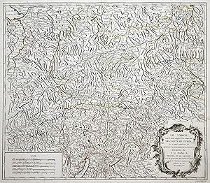
Kupferstich- Karte, v. Delahaye b. Robert, "Le Tyrol. Bregentz, Feldkirck, Montfort, Pludentz, &.".
Language: German
Seller: Antiquariat Clemens Paulusch GmbH, Berlin, Germany
Seller rating 5 out of 5 stars
Map
mit Grenzkolorit, dat. 1753, 47 x 54,5 Unten rechts große ornamentale Kartusche. Gebiet Bodensee, Saalfelden, Gardasee.
-
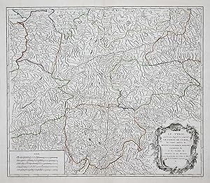
Kupferstich- Karte, von Delahaye bei Robert de Vaugondy, "Le Tyrol sous le nom duquel l'on comprend Le Comte De Tyrol, Les Comtes annexes de Bregentz, Feldkirck, Montfort, Pludenz, & c. et les Eveches de Trente, Et De Brixen, sous la protection des Comtes de Tyrol.".
Language: German
Seller: Antiquariat Clemens Paulusch GmbH, Berlin, Germany
Seller rating 5 out of 5 stars
Map
mit altem Grenzkolorit, um 1755, 47,5 x 54,5 Tirol im Kartenbild bis 1800: Ausstellungskatalog zum 40. Deutschen Geographentag Innsbruck, 81 (dort jedoch die spätere Variante von Satini); Karte in Maulwurfshügelmanier von Garmisch-Partenkirchen im Norden bis zum Gardasee im Süden, von Vorarlberg bis Salzburg, mit Liechtenstein als Grafschaft Feldkirch; Variante ohne Datierung, gut erhalten.
-
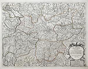
Kupferstich- Karte, v. Franciscus Donia n. G. Cantelli da Vignola b. Rossi, "Il Tirolo con li Vescovati di Trento e Brixen e la Citta Imperiale di Costanza che sono in protezione de Conti del Tirolo le Contee di Bregentz e Pludentz.".
Language: German
Seller: Antiquariat Clemens Paulusch GmbH, Berlin, Germany
Seller rating 5 out of 5 stars
Map
mit altem Grenzkolorit, dat. 1686, 40,5 x 53,5 Tomasi, Il Territorio Trentino-Tirolese, Nr. 45 (u. Abb. S. 73). Zeigt ganz Tirol zwischen Kufstein und dem Gardasee sowie Vorarlberg und den ganzen Bodensee. Darüber hinaus in der Schweiz große Teile Graubündens, Vaduz in Liechtenstein, das Veltlin und den ganzen Comer See. Aus einer Plano-Ausgabe ohne Mittelfalz.
-

Gesamtansicht , vom Bodensee aus, "Bregentz".
Language: German
Seller: Antiquariat Clemens Paulusch GmbH, Berlin, Germany
Seller rating 5 out of 5 stars
Art / Print / Poster
Kupferstich v. Merian aus Topographie Schwaben, 1643, 21 x 37 Nebehay-Wagner 408/16. - Etwas flauer Abdruck, in Summe aber ein gutes Exemplar.
-
"Bregentz". Kupferstich von Matthäus Merian. Aus: Topographia Sueviae.
Language: German
Published by Frankfurt, Merian,, 1643
Seller: Matthaeus Truppe Antiquariat, Graz, Austria
Seller rating 5 out of 5 stars
Art / Print / Poster
Ca. 20,5 cm x 37 cm. Schöne Gesamtansicht von Bregenz vom Bodensee aus von M. Merian. - Papierbedingt leicht gebräunt. Linker Aussenrand ca. 3 cm verstärkt. 5 mm großer Rostfleck im Bild, nicht störend. *** *** Copyright: Matthaeus TRUPPE Buchhandlung & Antiquariat - Stubenberggasse 7 - A-8010 Graz - ++43 (0)316 - 829552 *** *** Sprache: Deutsch Gewicht in Gramm: 0.
-
Leather Bound. Condition: New. Language: German. Language: German. Presenting an Exquisite Leather-Bound Edition, expertly crafted with Original Natural Leather that gracefully adorns the spine and corners. The allure continues with Golden Leaf Printing that adds a touch of elegance, while Hand Embossing on the rounded spine lends an artistic flair. This masterpiece has been meticulously reprinted in 2025, utilizing the invaluable guidance of the original edition published many years ago in 1685. The contents of this book are presented in classic black and white. Its durability is ensured through a meticulous sewing binding technique, enhancing its longevity. Imprinted on top-tier quality paper. A team of professionals has expertly processed each page, delicately preserving its content without alteration. Due to the vintage nature of these books, every page has been manually restored for legibility. However, in certain instances, occasional blurriness, missing segments, or faint black spots might persist. We sincerely hope for your understanding of the challenges we faced with these books. Recognizing their significance for readers seeking insight into our historical treasure, we've diligently restored and reissued them. Our intention is to offer this valuable resource once again. We eagerly await your feedback, hoping that you'll find it appealing and will generously share your thoughts and recommendations. Lang: - German, Pages:- 180, Print on Demand. If it is a multi-volume set, then it is only a single volume. We are specialised in Customisation of books, if you wish to opt different color leather binding, you may contact us. This service is chargeable. Product Disclaimer: Kindly be informed that, owing to the inherent nature of leather as a natural material, minor discolorations or textural variations may be perceptible. Explore the FOLIO EDITION (12x19 Inches): Available Upon Request. 180 180.


![Seller image for Veldkirch. Das ist. Historische Beschreibung Der Loblichen O:O: vor dem Arlenberg gelegnen Statt Veldkirch: In welcher der Vrsprung, Fortpflantzung, vnnd Auffnam, auch andere Begebenheiten vnd Zufähl besagter Statt; wie nit weniger dero Gottsdienst, vnnd Geistlichkeit, die Alte Herren Graffen von Montfort . Mithin auch die Vor Arlbergische Herr- und Landschaffte[n], von Bregentz biß an den Arlenberg, und an die Staig, gantz getrewlich, kurtz, doch außfüehrlich, beschriben werden 1685 [Leather Bound] for sale by Gyan Books Pvt. Ltd.](https://pictures.abebooks.com/inventory/md/md31998777471.jpg)