Order Total (1 Item Items):
Shipping Destination:

China by Map, First Edition (30 results)
Skip to main search results
Search filters
Product Type
- All Product Types
- Books (22)
- Magazines & Periodicals (No further results match this refinement)
- Comics (No further results match this refinement)
- Sheet Music (No further results match this refinement)
- Art, Prints & Posters (1)
- Photographs (No further results match this refinement)
- Maps (7)
- Manuscripts & Paper Collectibles (No further results match this refinement)
Condition Learn more
- New (No further results match this refinement)
- As New, Fine or Near Fine (3)
- Very Good or Good (17)
- Fair or Poor (1)
- As Described (9)
Binding
Collectible Attributes
Language (2)
Free Shipping
Seller Location
Seller Rating
-

PEASANT REVOLTS IN CHINA, 1840-1949; LIBRARY OF WORLD CIVILIZATION SERIES
Published by W.W.NORTON & CO, NY, 1973
ISBN 10: 0039093441 ISBN 13: 9780039093440
First Edition
Paperback. Condition: Good. Illustrated by MANY PHOTOS, MAP (illustrator). First Edition. GOOD CONDITION .PENCIL NOTES & UNDERLINKG THROUGH OUT BOOK, OTHERWISE QITE CLEAN, SOLID & BRIGHT ; Black titles on white spine striip.light yellow cover showing man in blue with battle flags on horses. ; China's historical cultureal evolution; aspects of secret societies; Triads 1800-1860 .much on successes of Mao & Communist party.
-

China: A History in Art
Language: English
Published by Doubleday [ca. 1972], Garden City, NY, 1976
ISBN 10: 0385116306 ISBN 13: 9780385116305
First Edition
Hardcover. Condition: Very Good. Dust Jacket Condition: Very Good. 305 color plates / b/w map (illustrator). First Thus. VG+/VG (slight yellowing to DJ). Tall 4to with DJ 296 Introductions by Derk Bodd e and Nelson I. Wu. Size: 8vo - over 7�" - 9�" tall. Book.
-

Burma--Gateway to China (Smithsonian Institution War Background Studies # Seventeen (17)
Language: English
Published by Smithsonian Institution, Washingtion, D.C, 1943
Seller: Dorley House Books, Inc., Hagerstown, MD, U.S.A.
Seller rating 4 out of 5 stars

First Edition
Paperback. Condition: Very Good. 16 B/W Plates; Fold-out Map (illustrator). 1st. 1st printing; disbound; owner's stamp; 85 clean, unmarked pages/selelcted bibliography; includes an overview of the area, the demographics, caste system; the culture, economic organization, arts, religion etc; ownership samp of K.V. Krombein, (Karl Vorse Krombein was an American entomologist specializing in Hymenoptera.).
-

China (Smithsonian Institution War Background Studies # Twenty (20)
Language: English
Published by Smithsonian Institution, Washingtion, D.C, 1944
Seller: Dorley House Books, Inc., Hagerstown, MD, U.S.A.
Seller rating 4 out of 5 stars
First Edition
Paperback. Condition: Very Good. 26 B/W Plates; 2 Fold-out Map, etc. (illustrator). 1st. 1st printing; disbound; owner's stamp; 83 clean, unmarked pages/selected bibliography; includes an overview of the area, an illustrated booklet designed to educate the American public and military about China's geography, culture, history, and people during World War II. It aimed to build understanding of the nation and its role in the war, part of a 21-volume series focused on Pacific regions. [ ownership stamp of K.V. Krombein, (Karl Vorse Krombein was an American entomologist specializing in Hymenoptera].
-

China: A Short Cultural History
Published by Cresset Press, London, 1950
Seller: Clausen Books, RMABA, Colorado Springs, CO, U.S.A.
Association Member: IOBA RMABA
Seller rating 5 out of 5 stars

First Edition
Cream Cloth. Condition: Very Good. B & W Illustrations and Photos; Map (illustrator). Revised Edition. Clean and sound textblock with soiling and fading to cloth; a couple of bumped corners. Excellent map of Mongolia tipped in rear. Binding protected in clear, 5-mil mylar. 619 pp., including index. Size: 8vo - over 7�" - 9�" tall. Hard Cover.
-

Bartholomew World Travel Map: China: scale : 1 : 4, 500, 000
Published by Edinburgh: John Bartholomew & Son Ltd., 1977
ISBN 10: 0851526403 ISBN 13: 9780851526409
First Edition
First Edition. Near fine folding map. Remains well preserved overall; tight, bright, clean and sharp-cornered. Physical description; 1 folded map : text, col. map ; 25 cm. Subjects; China ; Maps. E0732900 E1344600 N0533300 N0175700. Scale 1:4,500,000. (E 73�29'00"--E 134�46'00"/N 53�33'00"--N 17�57'00"). Genre; Map. 3 Kg.
-

Bartholomew World Travel Map: China: scale : 1 : 4, 500, 000
Published by Edinburgh: John Bartholomew & Son Ltd., 1977
ISBN 10: 0851526403 ISBN 13: 9780851526409
First Edition
First Edition. Near fine folding map. Remains well preserved overall; tight, bright, clean and sharp-cornered. Physical description; 1 folded map : text, col. map ; 25 cm. Subjects; China ; Maps. E0732900 E1344600 N0533300 N0175700. Scale 1:4,500,000. (E 73�29'00"--E 134�46'00"/N 53�33'00"--N 17�57'00"). Genre; Map. 1 Kg.
-

Thunder Out of China
Published by William Sloane Associates, New York, 1946
Seller: Ground Zero Books, Ltd., Silver Spring, MD, U.S.A.
Seller rating 5 out of 5 stars
First Edition
Hardcover. Condition: Good. Frank Stockman and Tony Sodaro (Endpaper map) (illustrator). Presumed First Edition, First printing. xvi, 331, [1] pages. . Endpaper map. Maps. A Note to the Reader. Maps. Index. No dust jacket present. Cover has some wear and soiling. Theodore Harold White (May 6, 1915 May 15, 1986) was an American political journalist and historian, known for his reporting from China during World War II and the Making of the President series. White started his career reporting for Time magazine from wartime China in the 1940s. He was the first foreigner to report on the Chinese famine of 194243 and helped to draw international attention to the shortcomings of the Nationalist government. He reported on post-war Europe for popular magazines in the early 1950s, but lost these assignments because of his association with the "Loss of China". He regained national recognition with The Making of the President 1960, whose combination of interviews, on the ground reporting, and vivid writing were developed in best-selling accounts of the 1964, 1968, 1972, and 1980 presidential elections, and became a model for later journalists. Annalee Whitmore Fadiman (May 27, 1916 February 5, 2002) was a scriptwriter for MGM, and World War II foreign correspondent for Life and Time magazines. Under the name Annalee Jacoby she was the co-author with Theodore H. White of Thunder Out of China. She was the first woman to be managing editor of the Stanford Daily student newspaper. Fadiman survived a month-long escape from the Philippines, and did six weeks of reporting from the front lines of Bataan and Corregidor. She became the only female correspondent reporting from Chongqing, China's wartime capital. From the first outbreak of hostilities in northern China in 1937 to the Japanese surrender aboard the U.S.S. Missouri in 1945, this book re-creates the decade of upheaval when China was caught in the grip of revolution and war and torn from its feudal past. The authors Time-Life correspondents during the war years, report firsthand on the rise and fall of the Kuomintang nationalist government and its leader, Chiang Kaishek, who ironically misunderstood his own people as much as the Japanese. At the same time, we see how the Communists won popular support both with more extensive social reforms and with their unrelenting war against Japan. White and Jacoby also shed new light on the actions of "Vinegar Joe" Stilwell (the only American who assessed the Chinese situation accurately) and the diplomacy of Ambassador Patrick J. Hurley, also providing a classic account of the Chinese peasant and his revolution which has since proved to be the recurrent pattern of events in the developing Third World.
-

China railway atlas
Seller: Nick Tozer Railway Books, Huddersfield, United Kingdom
Seller rating 5 out of 5 stars
First Edition
-
![Stock image for Lonely Planet: Shanghai - The Pulse of Modern China [Lonely Planet Publications] for sale by gearbooks](https://pictures.abebooks.com/isbn/9780864425072-us-300.jpg)
Lonely Planet: Shanghai - The Pulse of Modern China [Lonely Planet Publications]
Language: English
Published by Lonely Planet Publications Pty Ltd, Melbourne, VIC, Australia, Oakland, CA, London, Paris, France, 2001
ISBN 10: 0864425074 ISBN 13: 9780864425072
First Edition
Soft Cover, Canvass. Condition: Very Good. Lonely Planet Images (Photos); Cleaning Windows Has Become An Increasingly Dangerous Profession in High-Rise Pudong, Bradley Mayhew (Front Cover Photo); Nanjing Dong Lu or Nanjing Road As Seen At Night With Hordes of Shoppers, Chris Mellor (Map Section) (illustrator). 1st Edition: January 2001. 224 + pp. Solidly bound copy with minimal overall wear and use. Copy with clean text on crisp pages. Essentially a near flawless copy.
-

An Outline History of China: With a Thorough Account of the Republican Era Interpreted in Its Historical Perspective
Published by D. Appleton and Co., NY, 1926
Seller: Clausen Books, RMABA, Colorado Springs, CO, U.S.A.
Association Member: IOBA RMABA
Seller rating 5 out of 5 stars
First Edition
Green Cloth. Condition: Very Good. folded map (illustrator). First Edition. Overall clean and tight textblock, gently aged; Front hinge shaken; Green cloth binding, worn at the spine extremities and boards; Spine titling faded; Lacking the original paper dust jacket, this copy is now protected by clear, five-mil mylar. Tipped-in at page 527 is a large, folded map of China; 542p., including a bibliography and index. Size: 8vo - over 7�" - 9�" tall. Hardcover.
-
Wandering in China
Language: English
Published by T Fisher Unwin, London UK, 1924
Seller: Begging Bowl Books, Lincoln, United Kingdom
Association Member: IOBA
Seller rating 5 out of 5 stars
First Edition
US$ 34.64
US$ 30.94 shipping
Ships from United Kingdom to U.S.A.Quantity: 1 available
Add to basketHardcover. Condition: Fair. Map + photographs (illustrator). 1st Edition. With a map and 171 photos. Plain library style binding, but no markings and traditional style armorial bookplate on ffep. Spine ends worn. Inside, foxing to front endpapers. Signs of bookplate removal on the rear inside cover with surface damage. Text block generally clean with some foxing to the last couple of pages. p497/8 has edge tears and looks worn, probably re-tipped in. Firm binding. 8vo, xx + 502pp, 950g.
-

Confessions of a China - Hand
Published by Hodder and Stoughton, 1950
Seller: Lavender Fields Books PBFA, Gloucestershire, United Kingdom
Association Member: PBFA
Seller rating 5 out of 5 stars
First Edition
US$ 13.86
US$ 37.66 shipping
Ships from United Kingdom to U.S.A.Quantity: 1 available
Add to basketHardcover. Condition: Very Good. Dust Jacket Condition: Very Good. Illustrated map endpapers (illustrator). 1st Edition. All books outside UK sent airmail and all books sent tracked. PayPal accepted. All dust wrappers are film protected. First Edition. The Author worked in China in commerce, Pre - The Second World War. Original green cloth with a gilt dragon design, some slight edge spotting but a very good copy in pictorial dust wrapper which is a little marked but complete with the original price.
-
China Syndrome; The True Story of the 21st Century's First Great Epidemic
Published by HarperCollinsPublishers, New York, 2006
Seller: Ground Zero Books, Ltd., Silver Spring, MD, U.S.A.
Seller rating 5 out of 5 stars
First Edition
Hardcover. Condition: Very good. Dust Jacket Condition: Very good. Dennis Wong (Map) and Wei Leng Tay (Photographer) (illustrator). xx, 442, [2] pages. Dramatis Personae. Notes on Sources and Further Reading. Index. Karl Taro Greenfeld (born 1964 in Kobe, Japan) is a journalist, novelist and television writer known primarily for his articles on life in modern Asia and both his fiction and non-fiction in The Paris Review. Born in Kobe, Japan, to a Japanese mother and an American father, the writers Fumiko Kometani and Josh Greenfeld, Greenfeld grew up in Los Angeles and went to college in New York City, graduating from Sarah Lawrence in 1987. He served as an Assistant Language Teacher on the JET Programme in Japan from 1988-89. A regular contributor to publications such as GQ, The Atlantic and Vogue, Greenfeld was the managing editor of Tokyo Journal before becoming the editor of Time Asia from 2002-2004 and editor-at-large at Sports Illustrated from 2004-2007. He was the Tokyo correspondent for The Nation. He is the author of three books about Asia: Speed Tribes: Days and Nights with Japan's Next Generation and Standard Deviations: Growing Up and Coming Down in the New Asia, and an account of the breakout of the SARS virus, China Syndrome: The True Story of the 21st Century's First Great Epidemic. His novel Triburbia is about a group of families living in the Tribeca neighborhood of Manhattan. His novel The Subprimes about a woman who may or may not be the messiah and the band of impoverished homeless Americans she comes to lead. He is a Henry Crown Fellow of the Aspen Institute and a Knight-Bagehott Fellow of Columbia University. Derived from a Kirkus review: Former Time Asia editor Greenfeld probes the SARS outbreak and the Chinese government's efforts to deny its existence. "Yoga instructors in Santa Monica and investment bankers in New York have no idea of the role that a few scientists, doctors, and public health officials in Hong Kong play in keeping them hale and hearty," writes Greenfeld. A horseracing track in Hong Kong marked the debut there of what became known as SARS-Severe Acute Respiratory Syndrome-and its management feared that this new disease would result in the deaths of at least a thousand thoroughbreds and the loss of millions of dollars. That management, and the doctors and epidemiologists called to the case, were right to worry that the disease might jump across species. Indeed, elsewhere in China, people were becoming sick, soon dying in droves. The race to discover the cause of SARS, which first appeared in the fall of 2002, makes a fascinating story, and Greenfeld recounts it vividly and coherently; yet, as he points out, much of that story of scientific detection and international teamwork remains little known simply because other world events-chiefly the U.S. invasion of Iraq-kept the story off the front page. The Chinese government refused to acknowledge the problem and that Chinese doctors discouraged Western disease specialists from offering aid; by the sixth month of the outbreak, which lasted slightly more than a year. Hundreds died by the time a cause and remedy were found. A taut scientific thriller, well told. Kirkus ended its review by writing "Suffice it to say that conditions are ripe for a replay of the disease; keep an eye out for a grim sequel." Few would challenge the assertion that COVID-19 is that grim sequel. First Edition [Stated], First Printing [Stated].
-
Science and Civilisation in China: Volume5 Chemistry and Chemical Technology: Missiles and Sieges, Part 6: Military Technology
Language: English
Published by Cambridge University Press, Cambridge, UK, 1994
Seller: Begging Bowl Books, Lincoln, United Kingdom
Association Member: IOBA
Seller rating 5 out of 5 stars
First Edition
US$ 138.55
US$ 30.94 shipping
Ships from United Kingdom to U.S.A.Quantity: 1 available
Add to basketHardcover. Condition: Fine. Dust Jacket Condition: Near Fine. Illustrated + map (illustrator). 1st Edition. Volume 4, Part 3 in Needham's monumental work on Chinese science and civilisation. The series has been continued since his death and to date there are 27 volumes. With illustrations. Others in the series available. Book has minimal signs of wear. Dj has light creasing to spine at top and bottom and along top edge . In a protective wrapper. 4to,xxviii +601p, 1530g.
-
Science and Civilisation in China: Volume4 Physics and Physical Technology, Part 3: Civil Engineering and Nautics
Language: English
Published by Cambridge University Press, Cambridge, UK, 1971
Seller: Begging Bowl Books, Lincoln, United Kingdom
Association Member: IOBA
Seller rating 5 out of 5 stars
First Edition
US$ 138.55
US$ 30.94 shipping
Ships from United Kingdom to U.S.A.Quantity: 1 available
Add to basketHardcover. Condition: Near Fine. Dust Jacket Condition: Good. Illustrated + map (illustrator). 1st Edition. Volume 4, Part 3 in Needham's monumental work on Chinese science and civilisation. The series has been continued since his death and to date there are 27 volumes. With illustrations. Others in the series available. Book has minimal signs of wear. Edge tear to lower edge of title page. Dj has archival tape repair of extensive split at top and bottom of front spine edge.Short tear to lower front dj flap. In a protective wrapper. 4to, lv + 931p, 1420g.
-
The Cable Car and the Dragon - SIGNED by Author, 1972. ,1ST Edition, 3rd Printing ,San Francisco's China Town.This intricately illustrated exploration of "The City by the Bay" is engagingly told by venerable SF columnist Caen. Ages 4-8, rollicking tale
Language: English
Published by Doubleday, Garden City, N.Y., 1972
ISBN 10: 087701390X ISBN 13: 9780877013907
Seller: Bluff Park Rare Books, LONG BEACH, CA, U.S.A.
Association Member: IOBA
Seller rating 4 out of 5 stars
First Edition Signed
Hardcover. Condition: Very Good. Dust Jacket Condition: Very Good. 1st Edition. HBDJ, 1972. 1ST EDITION , 3RD PRINTING .SIGNED BY AUTHOR, NF/NF-, AS-IS, .Yellow COLOR ILLUSTRATED Boards surrounding Color Illustration of Cable Car with 2 B/W Eyes in Front Chugging Uphill in Front of Houses Hardcover. TITLED IN BLACK ON FRONT CVR, Book Condition: A very NEAR Fine copy . DJ LIGHT RUB, WEAR SMALL EDGECREASEs & tiny Tears DJ is NF- CONDITION Oblong large octavo in color illus yellow boards; [32] pgs. col. illus. 20 x 24 cm. In a super-sturdy sewn library binding. Signed by Caen on title page. , DJ protected Clear Mylar, Unpaginated, DJ Spine Tiny Chips, This is the only children's book ever done by Mr. Caen. , The late Herb Caen was a humorous and active voice for the city by the bay. This charming children's book was written for his son Christopher. , Numerous full color illustrations from water color. rollicking tale of the adventures of Charlie, the youngest cable car. Only sixty years old, he is tired of the same old rut. story of an unusual friendship between a cable car and a chance encounter with a dragon during Chinese New Year. dragon and old San Francisco, wonderful adventures by one of San Francisco's favorite natives, takes you on wonderful adventures in the City by the Bay, Nob Hill, China Town, Russian Hill, and the possibility of a disasterous plunge in the San Francisco Bay unless a miracle occurs, A zany tale set in S. Signed by Author(s).
-
![Seller image for Horizon Hunter; The Adventures Of A Modern Marco Polo. [China, Muslim China: Arab, Uigar, And Salar, Japanese In China, Manchukuo, Russia] for sale by Arroyo Seco Books, Pasadena, Member IOBA](https://pictures.abebooks.com/inventory/md/md32112346324.jpg)
Horizon Hunter; The Adventures Of A Modern Marco Polo. [China, Muslim China: Arab, Uigar, And Salar, Japanese In China, Manchukuo, Russia]
Language: English
Published by Robert M. Mcbride, New York, 1940
Seller: Arroyo Seco Books, Pasadena, Member IOBA, Pasadena, CA, U.S.A.
Association Member: IOBA
Seller rating 4 out of 5 stars
First Edition
Hardcover. Condition: Very Good. No Jacket. Map Endpapers, Plates. (illustrator). 1st Edition. 314 P. Gray Cloth Stamped In Red. Map Endpapers. Plates. First Edition Stated (The National Travel Club Edition Is A Reprint). Light Usage, Tiny Fray At Lower Front Tip, Hinges Tight. Front Flap Of Dust Jacket Laid In Loosely. One Of The Last First-Hand Accounts Of Personal Travel Throughout China Before The Complete Communist Takeover. Much Information On The Arab, Uigar, And Salar Origins Of Moslemia. Per Wikipedia, Harrison Forman ( 1904 - 1978) Was An American Photographer And Journalist. He Wrote For The New York Times And National Geographic. During World War Ii He Reported From China And Interviewed Mao Zedong. He Graduated From The University Of Wisconsin With A Degree In Oriental Philosophy. Forman And His Wife Sandra Had A Son, John, Who Later Changed The Spelling Of His Name To Foreman, And A Daughter, Brenda-Lu Forman, Who Collaborated With Her Father On One Of His Books, And Also Wrote A Series Of Children's Books On Given Names. His Collection Of Diaries And Fifty Thousand Photographs Are Now At American Geographical Society Library At University Of Wisconsin-Milwaukee. Forman Who Travelled To The Tibetan Plateau In 1932 And Filmed The Panchen Lama At The Labrang Monastery In Xiahe, Gansu Province, Served As The Tibetan Technical Expert On Frank Capra's Lost Horizon Film Of 1937. A Manicured Biographical Notice Focusing On A List Of His Publications, As Indexed Somewhere, Possibly Indicating There Is An Interesting Story Here.
-
The Cable Car and the Dragon, 1972. STATED First edition, 1st Printing, DOUBLEDAY PUBL Francisco's China Town.This intricately illustrated exploration of "The City by the Bay" is engagingly told by venerable SF columnist Caen. Ages 4-8, rollicking tale of
Published by Doubleday, Garden City, N.Y., 1972
Seller: Bluff Park Rare Books, LONG BEACH, CA, U.S.A.
Association Member: IOBA
Seller rating 4 out of 5 stars
First Edition
Hardcover. Condition: Very Good. Dust Jacket Condition: Very Good. 1st Edition. HBDJ, 1972. STATED First edition on Copyright Pg, 1ST Printing, VG+/VG, AS-IS, Yellow COLOR ILLUSTRATED Boards surrounding Color Illustration of Cable Car with 2 B/W Eyes in Front Chugging Uphill in Front of Houses Hardcover. TITLED IN BLACK ON FRONT CVR, Book Condition: A VERY GOOD+ copy . DJ LIGHT RUB, WEAR, VG CONDITION WITH TINY Chips Extremities, Oblong large octavo in color illus yellow boards; [32] pgs. col. illus. 20 x 24 cm. In a super-sturdy sewn library binding , DJ protected Clear Mylar, Unpaginated,Pages are clean and unmarked. Covers show very minor shelf wear. Binding is tight, hinges strong. Dust jacket shows light edge wear. Light Rub scuff DJ FIRST EDITION (stated) 1972 hardcover Pictorial boards. Cover is worn at corners, shows a tiny dent at middle back near the spine, and some general shelf rubbing. Gift inscription handwritten on second front page. Binding is solid. ,Only sixty years old, he is tired of the same old rut. story of an unusual friendship between a cable car and a chance encounter with a dragon during Chinese New Year. dragon and old San Francisco, wonderful adventures by one of San Francisco's favorite natives, takes you on wonderful adventures in the City by the Bay, Nob Hill, China Town, Russian Hill, and the possibility of a disasterous plunge in the San Francisco Bay unless a miracle occurs, A zany tale set in San Francisco during the Chines.
-
Maryknoll Mission Letters: China Extracts from Letters and Diaries of the Pioneer Missioners of the Catholic Foreign Mission Society of America Volume I
Published by The Macmillan Company, New York, 1923
Seller: COVENANT HERITAGE LIBRIS, Saint John, NB, Canada
Seller rating 5 out of 5 stars
First Edition
Hardcover. Condition: Very Good. No Jacket. Photo Reproductions & Map (illustrator). First Edition. minor shelf wear. S3 4.
-
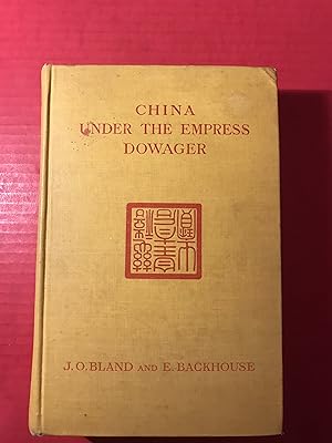
China Under the Empress Dowager: Being the History of the Life and Times of Tzu Hsi
Published by J. B. Lippincott Company, Philadelphia, Pennsylvania, 1910
Seller: COVENANT HERITAGE LIBRIS, Saint John, NB, Canada
Seller rating 5 out of 5 stars
First Edition
Hardcover. Condition: Good. Dust Jacket Condition: No Dj. Map and Photo Reproductions (illustrator). First American Edition. binding tight, no markings, no pages missing, light soiling. S4 6.
-

MAP: "China & Japan".from Bradley's Atlas of the Eastern Hemisphere
Published by Wm. M. Bradley & Co., Philadelphia, 1887
Seller: Dorley House Books, Inc., Hagerstown, MD, U.S.A.
Seller rating 4 out of 5 stars
Art / Print / Poster First Edition
Unbound. Condition: Very Good. Handcolored Map (illustrator). 1st. Antique 27" x 18.75" hand colored map of "China & Japan". in 1887 including full index of places Size: 27" x 18.75".
-
[I]. NARRATIVE OF THE EXPEDITION OF AN AMERICAN SQUADRON TO THE CHINA SEAS AND JAPAN, PERFORMED IN THE YEARS 1852, 1853, AND 1854, UNDER THE COMMAND OF COMMODORE M. C. PERRY, UNITED STATES NAVY, BY ORDER OF THE GOVERNMENT OF THE UNITED STATES. - COMPILED FROM THE ORIGINAL NOTES AND JOURNALS OF COMMODORE PERRY AND HIS OFFICERS, at his Request, and under his Supervision, by Francis L. Hawks, D.D. L.L.D.; WITH NUMEROUS ILLUSTRATIONS*. --- SENATE EDITION, P. G. WASHINGTON'S COPY; INSCRIBED BY HIM to then German U.S. Ambassador Friedrich Karl Joseph Freiherr von Gerolt. / II. 33rd Congress, 2nd Session: REPORTS ON NATURAL HISTORY AND ECONOMIC GEOGRAPHY incl. the Facsimile of the 'Treaty of Kanagawa'. / III 'UNITED STATES JAPAN EXPEDITION: OBSERVATIONS ON THE ZODIACAL LIGHT, from April 2, 1853, to April 22, 1855, made chiefly on Board the United States Steam-Frigate Mississippi, during her late Cruise in Eastern Seas, and her Voyage homeward; with Conclusions from the Data thus obtained.'. -
Published by Washington, Beverley Tucker - Senate Printer (I/III) / A.O.P. Nicholson (House Printer), 1856/1857., 1857
Seller: C O - L I B R I , Bremen - Berlin ; Deutschland / Germany ., Berlin, Germany
Seller rating 5 out of 5 stars
First Edition
I. 2 blank sheets, XVII (I); 537 pages, with 78 xylographic illustrations in the text; 86 singleside-printed toned or colour-lithographic plates (incl. portraits after Daguerreotypes by Eliphalet Brown) and 3 foldout-colourplates of japanese woodblock-prints (89 plates in total) and 3 geographical maps (1 foldout) bound within; 2 blank sheets. / II. (House Edition, 1857). (8) 414, (1) 14 pages ('Treaty of Ka-na-ga-wa'[Kanagawa], the first document ever negotiated by the Empire of Japan with any western nation according to International Law), (1) XI (1) p.; some xylographic text-illustrations, 4 (3 coloured) lithographic plates 'Agriculture of China', 22 (of 23, 17 [hand-]coloured) plates of Natural History (Yack, Japanese Fox), Ornithology (Japanese Birds, 5 of 6), Ichthyology (Japanese Fishes, 10), Conchyology (Japanese Shells, 5); 3 (2 folded) maps in the text, 16 plates with meteorological diagrams; 15 of 17 very large multiple folded maps at the end. / III. XLIII, 705 pages with 365 (of 366) astronomic xylographic plates (lacking plate 66); all plates in I and II on singleside printed cardboards. - I. Thick and heavy 'night-blue' full morocco-binding of the period over 4 raised bands with gilt-ornamental frames at panels and bands and gilt title and owner's name ('P. G. Washington') at bottom-of-spine, colour-marbled endpapers; II./III. Blind-tooled (naval motive) publisher's cloth bindings; lex.-4to.(ca. 31 x 23 x 20 cm; ca. 9 kg.). *** (Sabin #30958, Cordier 'Japonica' #513, Nissen ZBI #3132) I. FIRST EDITION, BIBLIOPHILE BOUND ORIGINAL; THE SENATE-EDITION (Senate executive Documents #34 of 33rd Congress, 2nd Session), published parrallel to Nicholson's 'House-Editon'. - FIRST BLANK SHEET WITH 4-LINE INSCRIPTION ''to Baron Gerolt / with the kind regards / of P. G. Washington / Feby. 16 1857''. Peter Grayson Washington (1798-1872), son of the Nephew of a Cousin of George Washington (1732-1799, American Founding Father and first President of the United States) served as 'Assistant Secretary of the Treasury Virginia New York City'; Friedrich Karl Joseph Freiherr von Gerolt (1797-1879) was the German-Prussian 'Envoy Extraordinary and Minister Plenipotentiary in the United States' and has been the longest-ever serving ambassador of Germany in the U.S. In the quarter+ century of service, Gerolt met presidents James K. Polk, Zachary Taylor, Millard Fillmore, Franklin Pierce, James Buchanan, Abraham Lincoln, Andrew Johnson and Ulysses Grant. As a studied mining geologist (Freiberg Mining Academy) in ''1824 he travelled to Mexico as an agent of the German-American Mining Association, where significant silver mines were suspected. Together with Carl de Berghes, also an Mining Association Agent, he published the 'Carta geognostica de los principales distritos minerales del Estado de Mexico' in 1827 with Arnz & Comp., a special mineralogical map of central Mexico, which is considered the first geological map of Mexico printed in colour.''(german wikipedia). - Corners of the leather-binding partly somewhat rubbed, panels slightly rubbed and slightly scratched; some textpages opposite of lithographic plates with slight offsetting (shadow) last sheets with slim humidity-stain at top sharp-corner, last 10 sheets (incl. rear endpaper) with small hole in the blank bottom margin; A MAGNIFICIENT COPY WITH A 'WELL NAMED' ASSOCIATION OF THE PERIOD. --- II. Binding somewhat rubbed, lacks plate 6 of Ornithology and textpages 257-262 (beginning of Ichthyology); Acceptably used. / III. Binding rubbed, many pages with humiditystain at foreedge or top sharp-corner (growing towards the end), lacks zodiac-plate #66 (of 352). --- MAIN OFFER IS THE LUXOURIUS EQUIPPED AND COMPLETE HISTORIC ASSOCIATION COPY OF VOLUME I; Vols. II and III have been added from another set to create scientific completeness (more or less). . .
-
Map of the Kingdoms of Siam and Cochin China.
Publication Date: 1828
Seller: Geographicus Rare Antique Maps, Brooklyn, NY, U.S.A.
Association Member: ABAA ESA ILAB
Seller rating 4 out of 5 stars
Map First Edition
Soft cover. 1st Edition. Good. Some wear along old fold lines. Repaired and reinforced split along bottom horizontal fold. Some discoloration and repair where originally tabbed into volume, at center. Laid down on archival tissue. Size 37 x 25 Inches. This rare large-format 1828 map of Southeast Asia, compiled by John Walker to illustrate John Crawfurd's mission to Siam (Thailand), is the first accurate survey of the coasts of Siam. Coverage extends from China to Singapore and from the Gulf of Martaban (Burma) to Vietnam and Hainan. Siam at the time was inaccessible to European merchants and even diplomats, with its coasts and interior largely unknown. This map is an amalgam of European sources, but with regard to Siam, it was derived primarily from secretly acquired early 19th-century Siamese surveys previously unknown to Europeans and, for all intents and purposes, still lost. Historical Context Following the resurgence of the Kingdom of Siam after the Burmese-Siamese War (1765 - 1767), Siam emerged as a major political power and the central state in Southeast Asia. The regional destabilization following Siamese victory led to a power vacuum in Burma, which precipitated a series of further conflicts, both between Siam and Burma and between Burma and Great Britain, lasting well into the early 19th century. The British took advantage of the weak Burmese military to seize additional territory in Assam, Manipur, and Arakan during the First Anglo-Burmese War (1824 - 1826). At the same time, Siam continued to grind away at both Burmese territory to the west and parts of Laos and Cambodia to the east, stopped only by Vietnamese and French forces in Indochina. To the south, Britain exerted a strong influence over the Malay States, leaving only Siam as a fully independent and powerful Southeast Asian state resistant to European influence. The Crawfurd Mission The Scottish linguist, diplomat, doctor, and colonial administrator John Crawfurd (1783 - 1868) was sent to the Kingdom of Siam by the Governor-General of India, Lord Francis Edward Rawdon-Hastings (1754 - 1826). Hastings was interested in evaluating the growing power of Siam, acquiring a reliable reconnaissance of Siamese lands, establishing trade relations, and understanding Siamese policy with regard to both the Malay States to the south (particularly Penang, to which the British had laid claim) and to French attempts to establish a colonial presence in Vietnam. While the mission failed to establish trade relations, evaluate Siamese political positions regarding Penang, or explore the interior, Crawfurd did collect cartographic materials detailing the coast, much of which John Walker compiled into this map. The 'Mohammedan Mariner' In the appendix to Crawfurd's Journal of an Embassy from the Governor-General of India to the Courts of Siam and Cochin-China , he lists the sources of this remarkable map. Many are new surveys conducted en route , earlier British surveys of the Malay States and Bengal, and French sources for Indochina, but the bulk of the map as it relates to Siam is based upon cartography passed clandestinely to Crawfurd by a Siamese Muslim navigator. To quote Crawfurd, From the Cape of Patani to the point of Kwiis taken from a Mohammedan mariner, a native of Siam, possessed of considerable intelligence-who was acquainted with the use of maps and the quarterstaff, and could even take an altitude of the sun with our quadrants. he goes on to describe how this same mariner, in fear of his life, divulged less and less information the closer the came to Siam, .a great deal of useful information . as we approached Siam they became much more shy and reserved, and now communicated nothing without a strict injunction to secrecy. They constantly resisted our solicitations to assist in translating the Governor-general's letter into Siamese, observing that the communication of his Majesty's titles would be considered as the divulgement of a state secret, which might cost them their lives. The comman.
-
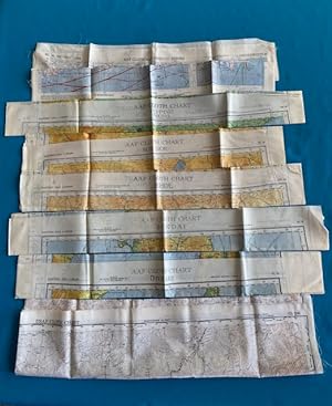
GROUP OF EIGHT ARMY AIR FORCES (AAF) WWII ESCAPE AND EVASION MAPS (China & USSR)
Published by Army Map Service, Washington D.C., 1944
Map First Edition
No Binding. Condition: As New. 1st Edition. MAP DESCRIPTIONS: Seven original WWII Escape and Evasion Maps, dated 1942-44 + one USAF Cold-War era Evasion Map dated 1950. Double-sided colored printed maps on fabric (likely synthetic silk). Most are 1:1,000,000 scale with 2 at 1:2,000,000 scale. The maps measure approximately, 23"(h) x 25"(w), with some variations. Map CL204/205 is 40"(h) x 37.5"(w). CONDITION DESCRIPTION: All in fine, near new condition. All folded as issued and look to never have been used; very clean with no markings. LIST OF SPECIFIC MAPS & SERIES NUMBERS: 1) 2 COPIES of #34 SE CHINA - FORMOSA / #35 NE CHINA (1:2million); 2) NL 50 PEIPING / NL 51 RYOJUN (1:1million); 3) NK 50 BUIR NOR / NK 51 TSITSIHAR (1:1million); 4) NK 50 JEHOL / NK 51 SHEN-YANG (MUKDEN) (1:1million); 5) NJ 53 KANAZAWA / NJ 54 SENDAI (1:1million); 6) NL 53 VLADIMORE-ALEKSANDROUSKOYE, USSR / NL 54 OTOMARI, JAPAN (1:1million); 7) CL 204 MONGOLIA / CL 205 NORTHEAST CHINA (1:2million). CONTENTS DESCRIPTION: These vintage fabric aircrew evasion maps were produced by the US Army, and later the USAF. These maps were provided to aircrews for use in case of ditching, crash-landing, or forced downing. Given the opportunity, the flyers would use these maps for ground navigation. At the produced scales of 1 or 2 to a million, ground navigation would be limited to macro directions and destinations for recovery by friendly forces. Difficult, but certainly usable as designed. Today the USAF continues to produce these kinds of maps using modern technology and using a different fabric (Tyvek) and at different scales more useful for ground evasion and more detailed navigation. These authentic WWII maps are bright and clean; beautifully displayed, show great details for the day and are fine military artifacts. With the duplicate of map #34/35, framing side by side would provide a complete region overview.
-

China.
Publication Date: 1846
Seller: Geographicus Rare Antique Maps, Brooklyn, NY, U.S.A.
Association Member: ABAA ESA ILAB
Seller rating 4 out of 5 stars
Map First Edition
1st Edition. Excellent. Slight marginal soiling. Size 12 x 15 Inches. A fine example of S. A. Mitchell's 1846 map of China and Korea. A Closer Look Coverage embraces China, Taiwan (Formosa), and Korea, with parts of adjacent countries. The map is divided into China's traditional provinces. Concession cities and treaty ports, like Shanghai and Canton, are underscored. Hong Kong is named a British territory. The Great Wall appears north and west of Beijing (Peking). The map features the Carey and Hart borders, which were replaced in 1847-48 with new Mitchell borders. Publication History and Census This map was published in 1846 in the first edition of Samuel Augustus Mitchell's New Universal Atlas . The map is based on the work of Henry S. Tanner, c. 1836, which Mitchell acquired from Carey and Hart in 1846, who had acquired them from Tanner in 1843. Importantly, in the course of changing hands, the atlas was converted from engraved steel or copper plates to lithographic stones. Mitchell issued the atlas in early 1846 with Tanner's name still on the maps. References: Rumsey 0537.068.
-

China.
Publication Date: 1815
Seller: Geographicus Rare Antique Maps, Brooklyn, NY, U.S.A.
Association Member: ABAA ESA ILAB
Seller rating 4 out of 5 stars
Map First Edition
1st Edition. Very good. Some offsetting. Size 24 x 20.5 Inches. This is John Thomson's 1815 map of China with its provinces. A Closer Look The map details the traditional bounds of China with Yunnan, Sichuan, and Shaanxi being the westernmost provinces. The northern boundary is defined by the Great Wall. Of similar note, monumental architectural feats, the Grand Canal, running from Beijing (Peking) to Hangzhou is boldly illustrated. Taiwan or Formosa Island, appearing in the lower right quadrant, is woefully misshapen, although Tayouan (Anping), site of the former Dutch factory of Zeelandia is noted. Macartney Embassy Interestingly, the map shows the course of the British 'Macartney Embassy' of 1793. Escorted by the Royal Navy gunship H.M.S. Hindoostan , the H.M.S. Lion transported Lord George Macartney to China for a meeting with Emperor Qianlong. Macartney attempted, unsuccessfully, to ease trade restrictions between the two nations. Macartney's failure was largely based on incompatibilities between the European and Chinese worldviews. The Qianlong Emperor operated on the assumption that all nations were in fact tributary to China whether they knew it or not and returned a letter to King George III commanding him to 'Tremblingly obey and show no negligence!' The episode aroused the imagination of the British public and generated interested in the lucrative China trade in general. Publication History and Census This map was prepared and engraved in 1815 for Robert Scott for inclusion in the 1817 first edition of John Thomson's New General Atlas . References: Rumsey 1007.042.
-

China Sheet IV. Eastern Coast from Chauan Bay to Port Matheson Including the Pescadore Islands.
Publication Date: 1849
Seller: Geographicus Rare Antique Maps, Brooklyn, NY, U.S.A.
Association Member: ABAA ESA ILAB
Seller rating 4 out of 5 stars
Map First Edition
1st Edition. Average. Professionally restored and rebacked. Closed tears in upper left corner. Area of infill in upper left quadrant in the inset maps. Size 26.25 x 39.5 Inches. This is an 1849 British Admiralty Hydrographic Office nautical map of the Fujian coast of China. First published in 1844, only two years after the end of the First Opium War (1839 - 1842), Xiamen (Amoy) was the first of five treaty ports opened to the Europeans after the signing of the Treaty of Nanking, officially opening China to European traders. Before this treaty, only one port, Guangzhou, was open to European traders. Thus, this chart provided necessary details for mariners and traders taking advantage of this new market. A Closer Look Coastal locations are identified from Chauan Bay to Meichen Sound, along with the Pescadores or Penghu Islands, and myriad depth soundings are indicated throughout, allowing sailors a better understanding of what lay ahead. That said, little detail is included inland from the coast, rendering apparent the Admiralty's lack of knowledge about the territory, even if it had surveyed the coastline. Two inset maps are situated along the left border. The First Opium War The First Opium War, or the Anglo-Chinese War, (1839 - 1842) was a series of engagements fought between the United Kingdom and Qing China over trade and diplomatic relations. By the middle of the 19th century, an enormous trade imbalance had developed between Europe and China due to the high demand for Chinese goods (silk, porcelain, tea) in Europe and the low demand for European goods (English wool, anyone?) in China. To balance the trade, the British East India Company introduced Indian-grown opium to the Chinese market. The opium trade led to waves of addiction throughout China and reversed the trade imbalance within a couple of years. In 1839, the Daoguang Emperor, seeking to stem the tide of narcotic addiction in China, banned opium entirely and blockaded China's only open trade port - Canton (Guangzhou). They also seized and destroyed nearly 20,000 chests, roughly 1200 tons, of opium. Foreign traders within Canton were confined to their offices without access to outside food or supplies - essentially forcing them into a 'capitulate or starve' situation. The British subsequently dispatched a naval and military force to China. The Royal Navy used its cannon power to inflict a series of decisive defeats on the Qing at various Chines ports, forcing them to the negotiating table - a tactic later referred to as 'gunboat diplomacy.' By 1842, when this map was drawn, the Qing were forced to sign the Treaty of Nanking, the first of the Unequal Treaties. The Treaty of Nanking created five open treaty ports and ceded Hong Kong to the British Empire. The Opium trade quickly resumed, but escalating tensions led to the Second Opium War (1856 - 1860) just 14 years later in 1856. Blueback Charts Blueback nautical charts began appearing in London in the late 18th century. Bluebacks, as they came to be called, were privately published large-format nautical charts known for their distinctive blue paper backing. The backing, a commonly available blue manila paper traditionally used by publishers to warp unbound pamphlets, was adopted as a practical way to reinforce the low-quality paper used by private chart publishers in an effort to cut costs. The earliest known blueback charts include a 1760 chart issued by Mount and Page, and a 1787 chart issued by Robert Sayer. The tradition took off in the early 19th century, when British publishers like John Hamilton Moore, Robert Blachford, James Imray, William Heather, John William Norie, Charles Wilson, David Steel, R. H. Laurie, and John Hobbs, among others, rose to dominate the chart trade. Bluebacks became so popular that the convention was embraced by chartmakers outside of England, including Americans Edmund March Blunt and George Eldridge, as well as Scandinavian, French, German, Russian, and Spanish chartmakers. Blueback charts rema.
-

Map of Hong Kong and the Territory Leased to Great Britain under the Convention Between Great Britain and China Signed at Peking on the 9th of June 1898.
Publication Date: 1922
Seller: Geographicus Rare Antique Maps, Brooklyn, NY, U.S.A.
Association Member: ABAA ESA ILAB
Seller rating 4 out of 5 stars
Map First Edition
1st Edition. Very good. Dissected and mounted on linen in 32 panels. Soiling. Paste down map reading instructions adhered to third panel from top in far right column. Size 29.625 x 38.25 Inches. This is a 1922 British War Office map of Hong Kong and the New Territories. It was issued in March of 1922, shortly following the historic Hong Kong Seaman's Strike. A Closer Look Coverage embraces Hong Kong from Tai-shan Bay to Mirs Point and from China to Po Toi (Pu Toi). Cities, towns, and villages are labeled throughout the Crown Colony, including Victoria and Kowloon. In Victoria, Murray Barracks, the hospital, the sugar refinery, and the Tai-ku Sugar Factory are identified. Roads are illustrated, and topography is illustrated using contours. Manuscript notations mark police stations in the New Territories and several newly constructed roads. Bays, channels, and other coastal locations are also noted. The entire chart is overlaid by a grid meant to make finding a specific location easier. Instructions on how to use this grid are included via a pastedown along the right border. Hong Kong Seamen's Strike of 1922 In January 1922, the Seaman's Strike disrupted commerce in the region. At the time, there was an extraordinary gap between the wages paid to Chinese and British seamen. Seeking more equitable treatment, over 30,000 Chinese seamen from Hong Kong and Canton (Guangzhou) declared a strike. The strike lasted 52 days. By February, over $5 million in cargo was floundering in Hong Kong Harbor and shipping companies began bypassing the island. By early March, the city was near anarchy, with food rationed, trash piling up, businesses closed, and public transportation halted. On March 5, the shipping companies eventually backed down and agreed to a 15-30% wage increase. Publication History and Census This map was created by the Geographical Section of the General Staff of the British War Office. The first edition was published in 1905, and the current example was published in 1922. We note four examples in institutional collections at the British Library, the University of Kansas, the University of British Columbia, and the National Library of Scotland. We are aware of only one other instance when this chart entered the private market. References: OCLC 779582655.
-

China Sea Singapore Strait Eastern Portion.
Publication Date: 1927
Seller: Geographicus Rare Antique Maps, Brooklyn, NY, U.S.A.
Association Member: ABAA ESA ILAB
Seller rating 4 out of 5 stars
Map First Edition
1st Edition. Very good. Even overall toning. Light wear along original fold lines. Size 27.25 x 58.5 Inches. This is a first edition 1927 British Admiralty nautical chart or maritime map of the eastern portion of the Singapore Strait. The map was issued during the Interwar Period when British naval hegemony was waning and the 'Singapore Strategy' attempted to turn the island colony into a 'Gibraltar of the East.' A Closer Look Coverage embraces from Singapore Island to Pulo Bintan (Pulau Bintan) and from Johore and the Johore Strait to Pulo Batam (Pulau Batam). Depth soundings, measured in fathoms, populate the map. Various reefs, shoals, and other nautical hazards appear as well, along with some coastal landmarks. Yellow dots mark the few lights present in the region. A profile view of the coastline between Carter Shoal and South Ledge appears along the upper border in Johore. A table of tidal information is situated in the lower right corner. The Singapore Strategy As this map was being printed, Singapore became central to the Singapore Strategy, a naval defense policy instituted by the British Empire between 1919 and 1941. Following World War I (1914 - 1918), the Royal Navy faced challenges to its long-established supremacy by the rising naval forces of the United States and Imperial Japan. While the growing U.S. Navy, a strong ally, was not a serious cause of concern, it quickly became apparent that the Imperial Japanese naval buildup would clash with British interests in the Far East. The British determined to establish a 'Gibraltar of the East,' zoning in on Singapore for its exceptional strategic position. Starting work in 1919, the British began a series of extensive improvements to the port at an expense of some 500,000 GBP. Completed over the subsequent twenty years, Singapore was outfitted with the largest dry dock in the world, the third largest wet dock, and enough fuel tanks to support the entire Royal Navy for six months. The island's defenses also included an enormous Royal Air Force base and mounted 15-inch stationary guns. Despite what appeared to be a highly defensible position, in 1942, when hostilities finally broke out between the British Empire and Imperial Japan, Singapore fell to Japanese invaders after just fifteen days of fighting, an event described by British Prime Minister Winston Churchill as the 'worst disaster and largest capitulation in British history.' Publication History and Census This chart was published by the Admiralty in 1927 as Admiralty Chart 3834. We note a single cataloged example, which is part of the collection at the British Library. References: OCLC 557485932.