
China by Map: Signed (5 results)
 More images
- Hardcover
- First Edition
- Signed
Seller: Bluff Park Rare Books, LONG BEACH, CA, U.S.A.Bluff Park Rare Books
Contact seller4-star sellerCondition: Used - Very good
US$ 188.00
US$ 8.85 shippingShips within U.S.A.Quantity: 1 available
Hardcover. Condition: Very Good. Dust Jacket Condition: Very Good. 1st Edition. HBDJ, 1972. 1ST EDITION , 3RD PRINTING .SIGNED BY AUTHOR, NF/NF-, AS-IS, .Yellow COLOR ILLUSTRATED Boards surrounding Color Illustration of Cable Car with 2 B/W Eyes in Front Chugging Uphill in Front of Houses Hardcover. TITLED IN BLACK ON FRONT CVR,… Book Condition: A very NEAR Fine copy . DJ LIGHT RUB, WEAR SMALL EDGECREASEs & tiny Tears DJ is NF- CONDITION Oblong large octavo in color illus yellow boards; [32] pgs. col. illus. 20 x 24 cm. In a super-sturdy sewn library binding. Signed by Caen on title page. , DJ protected Clear Mylar, Unpaginated, DJ Spine Tiny Chips, This is the only children's book ever done by Mr. Caen. , The late Herb Caen was a humorous and active voice for the city by the bay. This charming children's book was written for his son Christopher. , Numerous full color illustrations from water color. rollicking tale of the adventures of Charlie, the youngest cable car. Only sixty years old, he is tired of the same old rut. story of an unusual friendship between a cable car and a chance encounter with a dragon during Chinese New Year. dragon and old San Francisco, wonderful adventures by one of San Francisco's favorite natives, takes you on wonderful adventures in the City by the Bay, Nob Hill, China Town, Russian Hill, and the possibility of a disasterous plunge in the San Francisco Bay unless a miracle occurs, A zany tale set in S. Signed by Author(s).
Language: English
Published by Odyssey Publications; Airphoto International Ltd., Hong Kong * * * * * 2007
- Softcover
- Signed
- Map
Seller: L. Michael, North Hollywood, CA, U.S.A.L. Michael
Contact seller4-star sellerCondition: Used - Fine
US$ 315.20
US$ 15.26 shippingShips within U.S.A.Quantity: 1 available
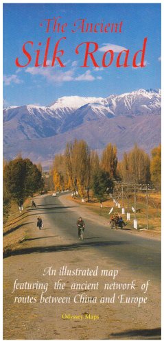
Soft cover. Condition: Fine. Map: Fine/, $589.80, Reduced From. 9789622177888 the ANCIENT SILK ROAD MAP: an Illustrated Map Featuring the Ancient Network of Routes Between CHINA and EUROPE; One large overview map and three detailed regional maps. Comprehensive notes with cultural and Historical information on key places and peop…le, 35 superb colour photographs, easy~to~use fold~out format. ONLINE Synopsis: Made famous in the West by the Venetian adventurer, Marco Polo, the ancient Silk Road spanned one-quarter of the circumference of the Earth. An intricate network of trading routes, in its heyday it stretched from Lyoyang and Xi'an in China, through Central Asia to Istanbul and Rome, perhaps the first example of the globalisation of trade. Untold perils, both natural and man-made, awaited the hardy merchants and travellers who ventured along the Silk Road's many branches in search of profit, learning or simply adventure. Conquering armies, too, swept back and forth throughout the centuries of the Road's existence. All have left their mark in some way. Inside are four detailed maps of the Silk Road's arteries supplemented by 35 colour photographs and historical notes on key places and notable people.* TUCKER, Jonathan; TOZER, Antonia Odyssey Publications; Airphoto International Ltd. 2007 Hong Kong * * * * * UnStated Edition Tall Wide Folding Map S/c Soft Cover Map: Fine/, Slight, Shelf, Edge And Corner Wear. Pages Printed On 0ff~White Paper, Clean And Tight To The Spine, In Fine/ Condition. Appear To Be Viewed. D/j: None. This Item Will Be Sent Wrapped In Plastic, Taped Shut And In A = Padded Mailing Envelope To Prevent Shipping Damage So That It Will Arrive In The Description Described Which Applies To This B00K, Only. = No Odors, No Writing, No Names, No Rippling, Not Stuck Together, No Book Plate, Not X~Library, No Other Marks. = Will Make It, An Excellent Addition To Your Own Personal Library Collection, Or As A Gift, For The Discriminating Reader / Collector. = WORLD WIDE SHIPPING, AVAILABLE *. Map: Fine/, 2007 (illustrator). Signed by Author(s).

Plan of the Foreign Settlements Shanghai. Drawn for Crow's 'Handbook for China'.
1921 Crow City Plan or Map of the Foreign Settlements, Shanghai, China
- Signed
- Map
Seller: Geographicus Rare Antique Maps, Brooklyn, NY, U.S.A.Geographicus Rare Antique Maps
Contact seller4-star sellerGood. Left margin extended. Small area of infill along left border. Exhibits wear, toning, and light dampstaining along original fold lines. Size 9.25 x 13.75 Inches. This is a c. 1921 Carl Crow city plan or map of part of the International Settlement in Shanghai, China. With the Huangpu River and the world-famous Shanghai Bund…near the bottom border, the map depicts part of the British and French concessions. Streets are labeled throughout, along with the public recreation ground, several churches and cathedrals, hotels, the customs house, and the Shanghai Club. The British Consulate is identified as are the French municipal offices and the French Consulate. The Bund The Bund is a waterfront area in central Shanghai. The name is derived from the old German term, 'bund,' meaning simply embankment or causeway. Many Asian colonial cities supported a Bund, but none became more famous or iconic than the Shanghai Bund. The area centers on the section of Zhongshan Road within the former Shanghai International Settlement, which runs along the western bank of the Huangpu River, facing Pudong, in the eastern part of Huangpu District. The Bund usually refers to the buildings and wharves on this section of the road, as well as some adjacent area. It is one of the most famous tourist destinations in Shanghai and a designated historic zone. Lining the Huangpu River, the Shanghai Bund has dozens of historical buildings that once housed important banks and trading houses from the United Kingdom, France, United States, Italy, Russia, Germany, Japan, Netherlands and Belgium, as well as the consulates of Russia and Britain, a newspaper, the Shanghai Club and the Masonic Club. The Bund lies north of the old walled city of Shanghai and was initially a British settlement. A building boom at the end of the 19th century and the beginning of the 20th century led to the Bund becoming the major financial hub of East Asia. The former French Bund, east of the walled city was formerly more a working harbor. Shanghai International Settlement The Shanghai International settlement was created in 1863 when the British and American Shanghai enclaves merged. These concessions had been granted to England and the United States as part of the Unequal Treaties that followed the Opium Wars. From about 1854 the settlements were governed by the Shanghai Municipal Council, a British dominated board of government officials and powerful merchants. The board issued restrictions limiting Chinese habitation on International Settlement territory and oversaw the construction of public services, including Trams, a sewage system, highways, and port buildings. The International settlement expanded several times in the late 19th and early 20th century. It became an enclave of peace and prosperity when the Japanese invaded Shanghai in 1837 but this abruptly came to an end with the Japanese bombing of Pearl Harbor and subsequent invasion of the International Settlement in 1941. After the war the International Settlement lands were returned to Chinese sovereignty. Shanghai 1910 - 1932 The 1910s-20s were a golden age for Shanghai, at least in the Concessions. While China was ruled by Chiang Kai-shek, Shanghai was dominated by several consolidated foreign trade Concessions. Under the strict administrative control of the Concessions, the city became a cosmopolitan haven in the midst of political unrest and a center for global trade and finance. The Concessions occupied what is today central Shanghai's most desirable land, hugging the Huangpu River and Wusong River (Suzhou Creek). These extraterritorial European, Japanese, and American enclaves had modern housing, fine roads, streetcars, elegant shops, clubs, and more. It was a place of excess, art, and extravagance, where fortunes could be made by the enterprising - and lost by the foolish. Moreover, lacking the moral constrains that limited social life in Europe and America, Shanghai became nexus for the opium trade, sexual excess, ga. Signed by Author(s).

- Signed
- Map
Seller: Geographicus Rare Antique Maps, Brooklyn, NY, U.S.A.Geographicus Rare Antique Maps
Contact seller4-star sellerGood. Newsprint. Verso repairs to fold separations. Closed tear extending 2 inches within printed area professionally repaired on verso. Closed tear extending 1.5 inches into printed area from left margin professionally repaired on verso. Closed edge tears professionally repaired on verso. Text and printed images on verso. Size…14.5 x 20.75 Inches. This is a 1945 Edwin Sundberg map of China marking American air bases. It predicts future military operations in the region near the end of World War II (1939 - 1945). Nonetheless, it appeared just 9 days before the atomic bomb was dropped on Hiroshima, Japan, and the end of the Pacific War. A Closer Look The map depicts from Nagasaki (in the upper right corner) south to northern Luzon and from Yunnan to Amami in the Ryukyu Islands. Red stars mark American airbases in southern China. The largest identifies Chongqing (labeled Chungking), Chiang Kai-shek's provisional capital after the 1937 Japanese capture of Nanjing (Nanking). Cities and towns are labeled throughout China, French Indochina, and Japanese Taiwan (Formosa). A short caption in the lower right corner provides additional information, stating that this part of China is where the fighting between the Chinese and Japanese is taking place. It also predicts military operations likely to commence within the next few months. At this time, the Allies had indeed been planning a massive ground operation in southeastern China to capture a port. However, after the atomic bombs were dropped on Hiroshima (August 6) and Nagasaki (August 9), and the Soviets invaded Manchuria (August 9), the Japanese surrendered. Emperor Hirohito announced the surrender on August 15, and it was formally signed on September 2. The Second Sino-Japanese War The Second Sino-Japanese War was fought between the Republic of China and the Empire of Japan. Some disagreement exists as to when the war officially started. Two different 'Incidents' are used to mark the beginning of hostilities. Historically, the July 7, 1937, Marco Polo Bridge Incident is considered the official start, when Chinese and Japanese troops began exchanging fire at the Marco Polo (Lugou) Bridge, along a main access route to Beijing. This exchange of fire escalated into an all-out battle, leading to Japanese forces capturing both Beijing and its port city, Tianjin. Other scholars, and since 2017 the Chinese government, trace the beginning of the Second Sino-Japanese War to the Mukden Incident and the September 1931 Japanese invasion of Manchuria. This 'incident' was based on trumped-up Japanese charges that their rights in Manchuria, which had been guaranteed following the Russo-Japanese War (1904 - 1905), were being infringed upon. More likely, the Japanese simply saw an opportunity to easily capture an essentially limitless supply of raw materials, a new market for their manufactured goods, and create a 'buffer zone' between Japanese-occupied Korea and the Soviet Union. After five months of fighting, in early 1932, the Japanese created the puppet state of Manchukuo and installed Puyi, the last Emperor of China, as its ruler. Even though there is some debate over when the war started, the result is the same: years of war, famine, atrocities, and death. Following the December 7, 1941, Japanese attack on Pearl Harbor, the Second Sino-Japanese War is usually folded into the China-Burma-India Theater of World War II. Although there is some debate on when the war began, there is no doubt when it ended. Following the atomic bombings of Hiroshima and Nagasaki in August 1945, the Japanese unconditionally surrendered to the Allies on September 2, 1945, bringing an end to the largest Asian war of the 20th century. Publication History and Census This map was drawn by Edwin Sundberg and published in the July 29, 1945 edition of the Sunday News . This is the only known cataloged example. Signed by Author(s).

Map of Shanghai Published by the North-China Daily News and Herald, Limited.
1918 North-China Daily News / Municipal Council Map of Shanghai, China
- Signed
- Map
Seller: Geographicus Rare Antique Maps, Brooklyn, NY, U.S.A.Geographicus Rare Antique Maps
Contact seller4-star sellerCondition: Used
US$ 19,600.00
US$ 17.00 shippingShips within U.S.A.Quantity: 1 available
Very good. Minor verso reinforcement at most fold intersections. Size 28.5 x 59.5 Inches. An extremely rare 1918 North-China Daily News and Herald map of Shanghai, China. Focusing on the Bund and the International Settlement, the map extends from the Shanghai Hangchow Ningpo Railroad in the west to Post Garden and the Standard O…il facility in the east. Derived roughly from the Municipal Council Map of the same year, this map is intensely detailed, with streets, businesses, clubs, parks, government offices, and civic institutions noted. Just outside the International Settlement boundary the Shanghai Jewish Club is noted. Shanghai 1910 - 1932 The 1910s-20s were a golden age for Shanghai, at least in the Concessions. While China was ruled by Chiang Kai-shek, Shanghai was dominated by several consolidated foreign trade Concessions. Under the strict administrative control of the Concessions, the city became a cosmopolitan haven in the midst of political unrest and a center for global trade and finance. The Concessions occupied what is today central Shanghai's most desirable land, hugging the Huangpu River and Wusong River (Suzhou Creek). These extraterritorial European, Japanese, and American enclaves had modern housing, fine roads, streetcars, elegant shops, clubs, and more. It was a place of excess, art, and extravagance, where fortunes could be made by the enterprising - and lost by the foolish. Moreover, lacking the moral constrains that limited social life in Europe and America, Shanghai became nexus for the opium trade, sexual excess, gambling, and other vices. This ephemeral world come crashing down on January 28, 1932, when the 'Shanghai Incident' or 'January 28 Incident' pitted the Republic of China against the Empire of Japan. Responding to Chinese student protests against the Japanese occupation of Manchuria, the Japanese Navy bombarded Shanghai. Chiang Kai-shek sent the Chinese army in to defend the Shanghai students, threatening to escalate the conflict. The League of Nations, fearing all-out war, united to demand a ceasefire, which was signed. Nonetheless, most consider The January 28 incident to be the opening salvo of the Second Sino-Japanese War (1938 - 1945) which ultimately merged into World War II. Shanghai International Settlement The Shanghai International Settlement was created in 1863 when the British and American Shanghai enclaves merged. These concessions had been granted to England and the United States as part of the Unequal Treaties that followed the Opium Wars. From about 1854 the settlements were governed by the Shanghai Municipal Council, a British dominated board of government officials and powerful merchants. The board issued restrictions limiting Chinese habitation on International Settlement territory and oversaw the construction of public services, including trams, a sewage system, highways, and port buildings. The International Settlement expanded several times in the late 19th and early 20th century. In addition, they constructed and administered Extra-Settlement Roads into the surrounding country, which further allowed for informal expansion. It became an enclave of peace and prosperity when the Japanese invaded Shanghai in 1937 but this abruptly came to an end with the Japanese bombing of Pearl Harbor and subsequent invasion of the International Settlement in 1941. After the war the International Settlement lands were returned to Chinese sovereignty. Shanghai French Concession - ????? On April 6, 1849, Lin Kouei (??), the Chinese governor of Shanghai, granted French Consul Charles de Montigny (1805 - 1868) a proclamation ceding extraterritoriality to France in order to establish a trading colony. The Concession initially occupied a narrow collar of land around the northern end of the Chinese City, south of the British settlement, an area of 66 hectares. It was subsequently expended several times. A further small strip of riverside land to the east of the Chinese City was added in 1861, to al. Signed by Author(s).


