Coltons Michigan (18 results)

Published by Colton 1856
- Softcover
Seller: Larry W Price Books, Portland, OR, U.S.A.Larry W Price Books
Contact seller5-star sellerCondition: Used - Good
US$ 75.00
US$ 4.95 shippingShips within U.S.A.Quantity: 1 available
Pamphlet. Condition: Good. Map is 18.5 x 16 inches, Elaborate border, Hand-WaterColored in Pastels, edgechips and soil but not closer than 1 inch from elaborate border, also light brn waterstain running from lower left to upper center of map, visible but not greatly objectionable considering the age of the map, it is still Attra…ctive & Could be Nicely Framed (Map is dated 1855).
Published by Colton 1856
- Softcover
Seller: Larry W Price Books, Portland, OR, U.S.A.Larry W Price Books
Contact seller5-star sellerCondition: Used - Good
US$ 75.00
US$ 4.95 shippingShips within U.S.A.Quantity: 1 available
Pamphlet. Condition: Good. Map is 18.5 x 16 inches, Elaborate border, Hand-WaterColored in Pastels, 1 page of text about map included, light brn waterstain extends from lower right to center left but is scarcely visible within the map, thus still Attractive & worth Framing (Map is dated 1855).
Published by Sheldon, New York 1883
- Hardcover
- First Edition
Seller: John M. Gram, Port Huron, MI, U.S.A.John M. Gram
Contact seller5-star sellerCondition: Used - Fair
US$ 65.00
US$ 6.45 shippingShips within U.S.A.Quantity: 1 available
Hardcover. Condition: Fair. No Jacket. 1st Edition. spine ends and fore corners worn, front free end paper removed, creasing to rear free end paper, staining to front board, front hinge starting, former owner's name in a couple places, scattered stains from flower pressings, a few scattered tears, otherwise sound, tall quarto, 1…24 pages, plus 16 page school geography of Michigan supplement prepared by Daniel Putnam, 37 color topographical and political maps of various regions of the world and United States, plus 2 page color map of the state of Michigan, brick colored cloth with black printed titles and decorations, publication date printed on the front board, but the internal information dates to the period from 1874-1880.

Published by Colton, G. B. & G. W., New York 1874
- Map
Seller: mediumraremaps.com, Franklin, TN, U.S.A.mediumraremaps.com
Contact seller4-star seller24 1/4 x 17 1/4 inches. Very nice copy of Colton's Michigan with the hand coloring taken down to the township level. The map is highly detailed with its presentation of railroads. Only a small part of the Upper Peninsula is included. Lake Michigan is on the left and Lake Huron is on the right with the main landmass of the state…in-between. There is a very fine border around the map with the vertical margins trimmed closely. This is an excellent cartographic artifact of the mid-19th Century. Very good with minor tears expertly repaired with archival mending tape.
Published by New York (Johnson & Browning) (Entered according to Act of Congress 1855). 1855
Seller: Antiquariat Kurt Lammek, Oldenburg, GermanyAntiquariat Kurt Lammek
Contact seller4-star sellerCondition: Used
US$ 81.86
US$ 11.30 shippingShips from Germany to U.S.A.Quantity: 1 available
39,2 x 32 cm. Coloured Steel-Engraving. Good condition.
Published by New York 1870
- Hardcover
Seller: Hoffman Books, ABAA, IOBA, Columbus, OH, U.S.A.Hoffman Books, ABAA, IOBA
Contact seller3-star sellerCondition: Used - Very good
US$ 200.00
US$ 8.00 shippingShips within U.S.A.Quantity: 1 available
Hardcover. Condition: Very Good. G.W. Colton's County and Township Railroad Map of Ohio, Indiana and Michigan - published 1870. Bound in worn brown cloth covers measuring 5 3/4 x 3 3/4 inches this Colton Pocket Map with the original hand colored map which is in nice shape with some small separations at folds.
 More images
Published by New York, New York 1866
- Hardcover
Seller: High Ridge Books, Inc. - ABAA, South Deerfield, MA, U.S.A.High Ridge Books, Inc. - ABAA
Contact seller5-star sellerOriginal cloth, spine split, front board detached. Map has small separations at some fold junctions, otherwise very good. Full color by county. A very late edition of a popular map first published around 1847. Inset view of Maidens Rock at left of vignette and Arch Rocks at top right. A scarce late issue of this well-known map o…f the Midwest.
Published by New York (Johnson & Browning) (Entered according to Act of Congress 1859). 1859
Seller: Antiquariat Kurt Lammek, Oldenburg, GermanyAntiquariat Kurt Lammek
Contact seller4-star sellerCondition: Used
US$ 93.56
US$ 11.30 shippingShips from Germany to U.S.A.Quantity: 1 available
32 x 39,5 cm. Coloured Steel-Engraving, good condition.
Published by G.W. & C.B. Colton & Co., New York 1857
Seller: Nicholas D. Riccio Rare Books, ABAA, Florham Park, NJ, U.S.A.Nicholas D. Riccio Rare Books, ABAA
Contact seller4-star sellerNew York: G.W. & C.B. Colton & Co., 1857. Unbound, colored engraved map, 16"x 13". Some toning and aging, chip in left margin (not affecting image or boarder line); overall bright and clean and in very good condition. Maps are wrapped with acid free board, or in rigid sleeves. Beginning with J. H. Colton (1800-1893), the Colton…family published atlases for over 30 years. Colton's Atlas of the World was first published in 1855 in a large two volume set. In 1857 it became Colton's General Atlas, and Colton's sons, George Woolworth and Charles B. would take over the business. This map of Michigan is from the rather scarce 1857 edition of Colton's General Atlas. The map has decent color with a fair amount of detail of the counties in Michigan. May require extra postage. Ristow 313-326.

Published by J.H. Colton & Co.,, New York: 1857
Seller: Nicholas D. Riccio Rare Books, ABAA, Florham Park, NJ, U.S.A.Nicholas D. Riccio Rare Books, ABAA
Contact seller4-star sellerUnbound, colored engraved map, 16 " x 13". Slight toning, darkening and aging; overall bright and clean and in very good condition. Maps are wrapped with acid free board, or in rigid sleeves. Beginning with J. H. Colton (1800-1893), the Colton family published atlases for over 30 years. Colton's Atlas of the World was first publ…ished in 1855 in a large two volume set. In 1857 it became Colton's General Atlas, and Colton's sons, George Woolworth and Charles B. would take over the business. This map of Northern Michigan is from the 1857 edition of Colton's General Atlas, even though the copyright date on the map indicates 1855. The mapis unusual in that Lake Superior is emphasized, and only the northern portion of the state is shown. Extra postage may be required. Ristow 313-326.
Published by G.W. & C.B. Colton & Co., New York 1866
Seller: Nicholas D. Riccio Rare Books, ABAA, Florham Park, NJ, U.S.A.Nicholas D. Riccio Rare Books, ABAA
Contact seller4-star sellerNew York: G.W. & C.B. Colton & Co., 1866. Unbound, colored engraved map, decorative boarder, 16"x 13". Slight toning and aging; overall bright and clean and in very good condition. Maps are wrapped with acid free board, or in rigid sleeves. Beginning with J. H. Colton (1800-1893), the Colton family published atlases for over 30…years. Colton's Atlas of the World was first published in 1855 in a large two volume set. In 1857 it became Colton's General Atlas, and Colton's sons, George Woolworth and Charles B. would take over the business. This map of Michigan is probably from the 1866 edition of Colton's General Atlas, even though the copyright date on the map indicates 1855. The map has nice color with a fair amount of detail of the counties in Michigan, and a map of Lake Superior is on the reverse side. Extra postage may be required. Ristow 313-326.
 More images
Published by Published by J. H. Colton, 172 William St., New York 1861
Seller: David M. Lesser, ABAA, Woodbridge, CT, U.S.A.David M. Lesser, ABAA
Contact seller5-star sellerBrilliantly colored folded folio map, in a cloth case with title stamped in gilt on front cover. Inner hinges cracked, binding firm. Occasional minor fold split without loss. Near Fine. With inlays of Maidens Rock, census statistics. OCLC records only later printings.

Published by J.H. Colton, New York 1854
- Hardcover
Seller: James & Mary Laurie, Booksellers A.B.A.A, Minneapolis, MN, U.S.A.James & Mary Laurie, Booksellers A.B.A.A
Contact seller3-star sellerCondition: Used - Fine
US$ 1,400.00
Free ShippingShips within U.S.A.Quantity: 1 available
Hardcover. Condition: Fine. Bound in publisher's original brown cloth with front cover stamped in gilt and back cover blind stamped. Contains a large, beautiful, fold-out multi-color map affixed in the rear of the book, with a single 1 1/2 inch tear on a folded seam. The book is in remarkable shape, fine, looks and feels new, wi…th the barest of wear to corners, head and heel. Tight, clean, bright text block. Previous owner's bookplate on front paste-down endpaper. 3 3/4 x 6 inches. 112 pages plus map.

Seller: Art Source International Inc., Boulder, CO, U.S.A.Art Source International Inc.
Contact seller5-star sellerWe are pleased to offer this map issued as part of Colton's General Atlas, published in 1865. The Civil War ended April 9, 1865 and this atlas was one of the first post-Civil War atlas' published. Colton continued his tradition of beautiful hand coloring with this atlas. This map measures 16 inches by 13 inches.

Seller: Art Source International Inc., Boulder, CO, U.S.A.Art Source International Inc.
Contact seller5-star sellerWe are pleased to offer this map issued as part of Colton's General Atlas, published in 1865. The Civil War ended April 9, 1865 and this atlas was one of the first post-Civil War atlas' published. Colton continued his tradition of beautiful hand coloring with this atlas. This map measures 13 inches by 16 inches.

Seller: Art Source International Inc., Boulder, CO, U.S.A.Art Source International Inc.
Contact seller5-star sellerJoseph Hutchins Colton (1800-1893) started one of the premier map publishing firms in the U.S. His first printed map dated 1833, was a reprint of David Burrs map of the state of New York. The Colton firm was one of the primary publishers of guidebooks, immigrant maps, and railroad maps. In 1855 Colton issued his first atlas, "Co…lton's Atlas of the World." They refused to compromise quality, choosing to compete for sales in the finer quality international market rather than the inexpensive domestic one. Because of this, all maps were engraved by steel plates rather than by wax engraving which was the most common method used at this time. This map is very detailed with identification of provinces and or regions, cities, towns and villages, transportation routes including rail roads, common roads, and canals, rivers and lakes, battle fields, and mountain ranges. Each map has beautiful muted red, green, tan, pink, and yellow hand coloring. Art Source International is proud and excited to offer maps from this very rare atlas. We have been in the antique map business for over forty years and these are the true first edition maps (1855) we have ever offered. Don't wait too long to purchase this piece of American mapping history! This map measures 16.5 inches by 13.25 inches.
 More images
Published by J. H. Colton & Co. 1855
- Map
Seller: Sage Rare & Collectible Books, IOBA, Livonia, MI, U.S.A.Sage Rare & Collectible Books, IOBA
Contact seller5-star sellerAssociation member: IOBA
Condition: Used - Very good
US$ 600.00
US$ 6.50 shippingShips within U.S.A.Quantity: 1 available
Map. Condition: Very Good+. Antique hand colored maps (2) are toned with modest foxing to the northern Michigan map but overall in very good condition. 18.5" x 16". Includes the seperate accompanying page of text about the region which can also be framed.
 More images
- Map
Seller: Bookseller, Inc., Akron, OH, U.S.A.Bookseller, Inc.
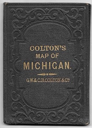
Contact seller5-star sellerCOLTON'S MICHIGAN. New York: G.W. and C.B. Colton & Co., 1870. 1 leaf, 15 1/2" x 13 1/2", folding into 4 3/4 x 3 1/2" case, paper lining of case has some wear, map has a little light foxing, vg. A detailed colored map of Michigan up to Straits of Mackinaw. Charles B. (1832-1916) and George Woolworth Colton (1827-1901) were promi…nent publishers, geographers, and engravers of maps in the mid-1900s.


