
Order Total (1 Item Items):
Shipping Destination:

Denmark by Hall (20 results)
Skip to main search results
Search filters
Product Type
- All Product Types
- Books (17)
- Magazines & Periodicals (No further results match this refinement)
- Comics (No further results match this refinement)
- Sheet Music (No further results match this refinement)
- Art, Prints & Posters (No further results match this refinement)
- Photographs (No further results match this refinement)
- Maps (3)
- Manuscripts & Paper Collectibles (No further results match this refinement)
Condition Learn more
- New (5)
- As New, Fine or Near Fine (2)
- Very Good or Good (9)
- Fair or Poor (No further results match this refinement)
- As Described (4)
Binding
Collectible Attributes
Language (2)
Free Shipping
Seller Location
Seller Rating
-

paperback. Condition: Very Good. Connecting readers with great books since 1972! Used books may not include companion materials, and may have some shelf wear or limited writing. We ship orders daily and Customer Service is our top priority!
-
-
Lonely Planet Scandinavia: Plan the Trip of a Lifetime | Detailed Itineraries & Maps | Insider Tips | Covers Iceland, Norway, Sweden, Denmark, Finland and more (Travel Guide)
Seller: Ria Christie Collections, Uxbridge, United Kingdom
Seller rating 5 out of 5 stars

US$ 25.62
US$ 15.85 shipping
Ships from United Kingdom to U.S.A.Quantity: Over 20 available
Add to basketCondition: New. In.
-

The Management of the Prosecution Process in Denmark, Sweden, and the Netherlands
Language: English
Published by James Hall, Leamington Spa, 1981
ISBN 10: 0907471013 ISBN 13: 9780907471011
First Edition
US$ 20.44
US$ 23.82 shipping
Ships from United Kingdom to U.S.A.Quantity: 1 available
Add to basketPaperback. Condition: Very Good. 1st Edition. Some underlining in pencil.
-
-

The Ultimate Cruise Passenger's Guide: DENMARK, ICELAND, GREENLAND
Language: English
Published by Independently published, 2019
ISBN 10: 1081984767 ISBN 13: 9781081984762
Soft cover. Condition: Very Good. WE SHIP DAILY! Book has minor wear. ***PROMPT, PROFESSIONAL SERVICE!***.
-

Single sheet. This fine coloured map covers not only modern Denmark but also Germany as far South as Hamburg and delineates Lauenburg as well. 26 x 38 cm.
-
A Short History of The Buffs, East Kent Regiment (3rd Foot), formerly designated the Holland Regiment and Prince George of Denmark's Regiment
Published by London : The Medici Society, 1950, Second edition,, 1950
US$ 20.44
US$ 26.47 shipping
Ships from United Kingdom to U.S.A.Quantity: 1 available
Add to basketSoft cover. Condition: Good. paperback, 12mo, 128pp, 9 plates, 4 maps, edges browned, slight foxing, contents clean and sound, printed card covers, foxed, corners scuffed, owner's name inside front cover, Good condition.
-

Denmark.
Published by Walker's Universal Atlas, London, 1823, 1823
Seller: Pennymead Books PBFA, Knaresborough, United Kingdom
Association Member: PBFA
Seller rating 5 out of 5 stars
US$ 22.69
US$ 19.85 shipping
Ships from United Kingdom to U.S.A.Quantity: 1 available
Add to basketEngraved map with hand coloured outline. Some pencil marks added by schoolboy. 7.5 x 9".
-

Lonely Planet Scandinavia : Plan the Trip of a Lifetime | Detailed Itineraries & Maps | Insider Tips | Covers Iceland, Norway, Sweden, Denmark, Finland and more
Language: English
Published by Lonely Planet Jul 2025, 2025
ISBN 10: 1837583706 ISBN 13: 9781837583706
Taschenbuch. Condition: Neu. Neuware - Lonely Planet's local travel experts reveal all you need to know to plan the trip of a lifetime in this latest edition of our guide to Scandinavia.Discover Scandinavia's most popular experiences and best kept secrets from joining an eco boat trip to see endangered ringed seals in Saimaa; to spotting the aurora borealis on a ski trip in the mountains around Iceland's Akureyri; and visiting quiet Sigtuna-Sweden's oldest town-home to church ruins and pretty, winding lanes.Build a trip to remember with Lonely Planet's Scandinavia travel guide:- Our classic guidebook format contains the most comprehensive level of information for planning multi-week trips- All-new structure and design that's easy to use so you can navigate Scandinavia effortlessly- Exciting itineraries help you create your perfect adventure with suggestions for extended journeys, day trips, walking tours and activity-led excursions- Expert local recommendations on eating, drinking, nightlife, shopping, accommodation, festivals, when to go and more- Vibrant photography and maps including a pull-out map of Scandinavia- Get fresh takes on must-visit sights from Egeskov Slot to Bonk and Sn�fellsj�kull National Park- Essential information toolkit containing tips on arriving, transport, local etiquette, using money, LGBTIQ+ travel advice, useful words and phrases, accessibility and responsible travel- Connect with Scandinavian culture through stories that delve deep into local life, history and traditions- Covers: Denmark, The Faroe Islands, Finland, Iceland, Norway, SwedenCreate a trip that's uniquely yours and get to the heart of this extraordinary part of the world with Lonely Planet's Scandinavia.
-

US$ 34.01
US$ 29.05 shipping
Ships from United Kingdom to U.S.A.Quantity: 1 available
Add to basketSoftcover. Condition: Very Good. 1854. A fairly well-presented map, with a scattering of foxing and browning across the entire surface giving a reasonably aged appearance, vertical fold line as originally presented but no major creases or wear. Why on Amazon do most sellers not describe their actual book? Buy with confidence and support a genuine Independent Bricks & Mortar Real Bookshop. We are Maynard & Bradley CAMBO & PBFA(now lapsed) members here in Leicester City Centre. Size: 290 x 230 mm. 1. Item Type: Book. Quantity Available: 1. Shipped Weight: Under 500 grams. Category: Geography & Maps; Britain/UK; 19th century; Inventory No: 47498.
-
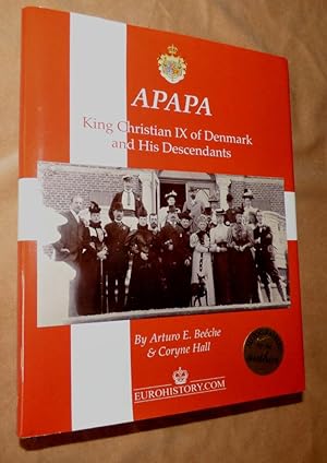
APAPA: King Christian IX of Denmark and His Descendants
Language: English
Published by Eurohistory, East Richmond Heights, 2014
ISBN 10: 0985460342 ISBN 13: 9780985460341
First Edition Signed
US$ 102.22
US$ 33.08 shipping
Ships from United Kingdom to U.S.A.Quantity: 1 available
Add to basketHardcover. Condition: Fine. Dust Jacket Condition: Fine. 1st Edition. SIGNED by both authors, fine condition in fine dust wrapper, quarto, blue cloth, gilt titles across front, 8 unpaginated, i plus 299 pages including genealogical chart, bibliography and index. [QH] [QP]. Signed by Author(s).
-

Condition: Like New. Signed Copy hardcover. Text block, pages, boards and binding are pristine. Dust wrapper is like new. Signed by author on title page. Supporting Bay Area Friends of the Library since 2010. Well packaged and promptly shipped.
-

The Ultimate Cruise Passenger's Guide: DENMARK, ICELAND, GREENLAND
Language: English
Published by Independently published, 2019
ISBN 10: 1081984767 ISBN 13: 9781081984762
Condition: very_good. Book is in very good condition. Clean with little to no signs of wear or markings highlights.
-

The Ultimate Cruise Passenger's Guide: DENMARK, ICELAND, GREENLAND
Language: English
Published by Independently published, 2019
ISBN 10: 1081984767 ISBN 13: 9781081984762
Condition: good. All pages and cover are intact including the dust cover, if applicable . Spine may show signs of wear. Pages may include limited notes and highlighting. May include "From the library of" labels. Shrink wrap, dust covers, or boxed set case may be missing. Item may be missing bundled media.
-
![Seller image for Map of Denmark [ taken from Walker's Atlas ] for sale by Keoghs Books](https://pictures.abebooks.com/inventory/md/md510761758.jpg)
Map of Denmark [ taken from Walker's Atlas ]
Published by Published by Longman, Orme & Co. no date givenapproximately 1823, London, 1823
Seller: Keoghs Books, Skipton, United Kingdom
Association Member: PBFA
Seller rating 5 out of 5 stars
Map First Edition
US$ 27.26
US$ 37.05 shipping
Ships from United Kingdom to U.S.A.Quantity: 1 available
Add to basket, 26 x 21 cm engraved map with hand coloured political boundaries, double page plate 1 cm margins First Edition thus , central fold, a little edge wear, slight tanning, otherwise map in very good condition 26 x 21 cm Map ISBN:
-

US$ 88.59
US$ 29.05 shipping
Ships from United Kingdom to U.S.A.Quantity: 1 available
Add to basketSoftcover. Condition: Very Good. c.1820. A very well-presented engraving, clean and unmarked across the entire image surface with no notable creases or wear, neatly trimmed and bearing only a few very minor signs of prior handling and storage, confined to the margins with no major encroachment onto the printed content. Why on Amazon do most sellers not describe their actual book? Buy with confidence and support a genuine Independent Bricks & Mortar Real Bookshop. We are Maynard & Bradley CAMBO & PBFA(now lapsed) members here in Leicester City Centre. Size: 320 x 440 mm. 1. Item Type: Book. Quantity Available: 1. Shipped Weight: Under 500 grams. Category: Geography & Maps; Britain/UK; 19th century; Inventory No: 46034.
-

Condition: New.
-

US$ 115.85
US$ 29.05 shipping
Ships from United Kingdom to U.S.A.Quantity: 1 available
Add to basketSoftcover. Condition: Very Good. c.1820. A very well-presented engraving, clean and unmarked across the entire image surface with some discreet and tasteful hand-coloured highlighting of borders. No notable creases or wear, neatly trimmed and bearing only a few very minor signs of prior handling and storage, confined to the margins with no major encroachment onto the printed content. Why on Amazon do most sellers not describe their actual book? Buy with confidence and support a genuine Independent Bricks & Mortar Real Bookshop. We are Maynard & Bradley CAMBO & PBFA(now lapsed) members here in Leicester City Centre. Size: 320 x 440 mm. 1. Item Type: Book. Quantity Available: 1. Shipped Weight: Under 500 grams. Category: Geography & Maps; Britain/UK; 19th century; Inventory No: 46035.
-

Denmark.
Publication Date: 1835
Seller: Geographicus Rare Antique Maps, Brooklyn, NY, U.S.A.
Association Member: ABAA ESA ILAB
Seller rating 4 out of 5 stars

Map First Edition
1st Edition. Very good. Original platemark visible. Minor wear along original centerfold. Some offsetting. Blank on verso. Size 21 x 17 Inches. This is a beautiful map of Denmark from Sidney Hall's extremely scarce 1835 New General Atlas . It covers all of Denmark inclusive of the Duchy of Holstein and the islands of Zeeland, Funen and Laland. The Kattegat (Cattegat) is also identified. Hall notes the site for the 1801 Battle of Copenhagen under Vice Admiral Horatio Nelson and the 1807 Battle of Copenhagen under Admiral James Gambier. At this time in history, all of Scandinavia was in the midst of a prolonged period of peace and prosperity that led to a cultural and population boom. Towns, rivers, mountains, railroads, marshes and various other important topographical details are noted. Elevation throughout is rendered by hachure and political and territorial boundaries are outlined in color. Sidney Hall's New General Atlas was published from 1830 to 1857, the first edition being the most common, with all subsequent editions appearing only rarely. Most of the maps included in the first edition of this atlas were drawn between 1827 and 1828 and are most likely steel plate engravings, making it among the first cartographic work to employ this technique. Each of the maps in this large and impressive atlas feature elegant engraving and an elaborate keyboard style border. Though this is hardly the first map to employ this type of border, it is possibly the earliest to use it on such a large scale. Both the choice to use steel plate engraving and the addition of the attractive keyboard boarder are evolutions of anti-forgery efforts. Copper plates, which were commonly used for printing bank notes in the early 19th century, proved largely unsuitable due to their overall fragility and the ease with which they could be duplicated. In 1819 the Bank of England introduced a �20,000 prize for anyone who could devise a means to print unforgeable notes. The American inventors Jacob Perkins and Asa Spencer responded to the call. Perkins discovered a process for economically softening and engraving steel plates while Spencer invented an engraving lathe capable of producing complex patters repetitively - such as this keyboard border. Though Perkins and Spenser did not win the prize, their steel plate engraving technique was quickly adopted by map publishers in England, who immediately recognized its value. Among early steel plate cartographic productions, this atlas, published in 1830 by Longman Rees, Orme, Brown & Green stands out as perhaps the finest. This map was issued by Sidney Hall and published by Longman Rees, Orme, Brown & Green of Paternoster Row, London, in the 1835 edition of the Sidney Hall New General Atlas . References: Rumsey 4224.015 (1830 edition). Philips (Atlases) 758. Ristow, W., American Maps and Mapmakers: Commercial Cartography in the Nineteenth Century, p. 303-09.
