France by Dower (7 results)

Published by Mid C19
- Map
Seller: theoldmapman, Clevedon, United Kingdomtheoldmapman
Contact seller4-star sellerCondition: Used
US$ 11.02
US$ 8.69 shippingShips from United Kingdom to U.S.A.Quantity: 1 available
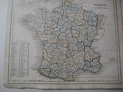
Add to basketSingle sheet. Original outline hand-coloured map. 26 x 21 cm.

Published by Orr, UK 1850
- Softcover
Seller: Maynard & Bradley, Leicester, United KingdomMaynard & Bradley
Contact seller5-star sellerCondition: Used - Good
US$ 17.84
US$ 29.35 shippingShips from United Kingdom to U.S.A.Quantity: 1 available
Add to basketSoftcover. Condition: Good. 1850. A fairly well-presented map, lightly browned and worn around the outer edges but the majority of the image remaining clear and legible with no major signs of wear. Just a few small nicks reinforced with conservation tape, with no major encroachments onto the print itself, vertical fold line as o…riginally presented. Why on Amazon do most sellers not describe their actual book? Buy with confidence and support a genuine Independent Bricks & Mortar Real Bookshop. We are Maynard & Bradley CAMBO & PBFA(now lapsed) members here in Leicester City Centre. Size: 300 x 240 mm. 1. Item Type: Book. Quantity Available: 1. Shipped Weight: Under 500 grams. Category: Geography & Maps; Britain/UK; 19th century; Inventory No: 47265.

Published by Orr & Comp Amen Corner Paternoster Row Ca1870 1870
Seller: PROCTOR / THE ANTIQUE MAP & BOOKSHOP, DORCHESTER, United KingdomPROCTOR / THE ANTIQUE MAP & BOOKSHOP
Contact seller5-star sellerCondition: Used
US$ 17.90
US$ 26.74 shippingShips from United Kingdom to U.S.A.Quantity: 1 available
Add to basketSize of engraved surface: 25cm x 30cm. In very good condition. Red pen markings on map. Uncoloured.

Published by Orr & Company [c1849], London 1849
- Map
Seller: Renaissance Books, ANZAAB / ILAB, Dunedin, New ZealandRenaissance Books, ANZAAB / ILAB
Contact seller5-star sellerCondition: Used - Very good
US$ 30.00
US$ 35.00 shippingShips from New Zealand to U.S.A.Quantity: 1 available
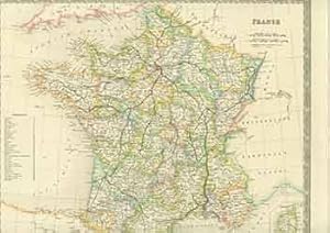
Add to basketMap. Condition: Very Good. No Dust Jacket. Moderate foxing. 2 folds. ; No date [c1849]. Dimensions: oblong 272 x 220mm. Drawn and engraved by I. Dower. This map is from James Bell, "A System of Geography, Popular and Scientific [. . .] Vol. II" (London: A. Fullarton and Co., 1849).
Language: German
Seller: Alte Bücherwelt, Perg, AustriaAlte Bücherwelt
Contact seller4-star sellerCondition: Used
US$ 27.32
US$ 20.19 shippingShips from Austria to U.S.A.Quantity: 1 available
Add to basket23 x 23 cm. Original-Landkarte "France" v. J. Dower, hrsg. 1850, Stahlstich koloriert, guer-sehr guter Zustand, kl. Randlässuren, genuine map Sprache: Deutsch Gewicht in Gramm: 450.

Language: German
Published by London, Ott & Comp., ca. 1820. 1820
- Softcover
Seller: Alte Bücherwelt, Perg, AustriaAlte Bücherwelt
Contact seller4-star sellerCondition: Used
US$ 92.67
US$ 20.19 shippingShips from Austria to U.S.A.Quantity: 1 available
Add to basket4°, Broschiert. Original Landkarte "France" gest. von J. Dower, hrsg. Ott & Comp., London, ca. 1820, koloriert, Blattgröße ca. 32 x 24 cm.guter-sehr guter Zustand. Sprache: Deutsch Gewicht in Gramm: 850.
Published by London: Henry Teesdale, [1800s]. 1800
- Manuscript
Seller: Wittenborn Art Books, San Francisco, U.S.A.Wittenborn Art Books
Contact seller5-star sellerCondition: Used - Good
US$ 100.00
US$ 10.00 shippingShips within U.S.A.Quantity: 1 available
Add to basketCondition: Good. 15 x 19 inches. Very Good. Half in tear at top and bottom edges along fold. 19th Century, folded map, printed in color.


