Order Total (1 Item Items):
Shipping Destination:

Hereford Map, First Edition (12 results)
Skip to main search results
Search filters
Product Type
- All Product Types
- Books (9)
- Magazines & Periodicals (No further results match this refinement)
- Comics (No further results match this refinement)
- Sheet Music (No further results match this refinement)
- Art, Prints & Posters (No further results match this refinement)
- Photographs (No further results match this refinement)
- Maps (3)
- Manuscripts & Paper Collectibles (No further results match this refinement)
Condition Learn more
- New (No further results match this refinement)
- As New, Fine or Near Fine (3)
- Very Good or Good (7)
- Fair or Poor (No further results match this refinement)
- As Described (2)
Binding
Collectible Attributes
- First Edition (12)
- Signed (No further results match this refinement)
- Dust Jacket (1)
- Seller-Supplied Images (8)
- Not Print on Demand (12)
Language (2)
Free Shipping
Seller Location
Seller Rating
-
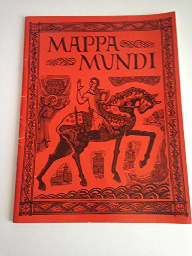
Mappa Mundi: The Map of the World in Hereford Cathedral
Language: English
Published by Friends of Hereford Cathedral, 1987
ISBN 10: 0904642062 ISBN 13: 9780904642063
Seller: Jt,s junk box, Newcastle, STAFF, United Kingdom
Seller rating 5 out of 5 stars

First Edition
Soft cover. Condition: Good. 1st Edition. good condition.
-
Mappa Mundi: The Map of the World in Hereford Cathedral
Language: English
Published by Friends of Hereford Cathedral, 1987
ISBN 10: 0904642062 ISBN 13: 9780904642063
Seller: BettsBooksWales, Aberystwyth, CERED, United Kingdom
Seller rating 5 out of 5 stars
First Edition
Soft cover. Condition: Near Fine. 1st Edition. Fine copy. Particularly well-preserved; tight, bright, clean and strong. Internally the pages are immaculately clean and complete.
-
Mappa Mundi: The Map of the World in Hereford Cathedral
Language: English
Published by Published by the Friends of Hereford Cathedral Publications Committee for the Dean and Chapter, 1987
ISBN 10: 0904642062 ISBN 13: 9780904642063
First Edition
Soft cover. Condition: Very Good. 1st Edition. Spot at top of front cover, and 2 marks from removed labels on back cover.
-

Mappa Mundi - The Hereford World Map. Second Edition.
Published by Hereford Cathedral, GB, 2002
Seller: Richard Sylvanus Williams (Est 1976), WINTERTON, United Kingdom
Seller rating 5 out of 5 stars
First Edition
Paperback. Condition: nrFine. 1st Thus. Inscription of owner at start of book. Book is in nearly fine condition with only slightest signs of wear and/or age.
-
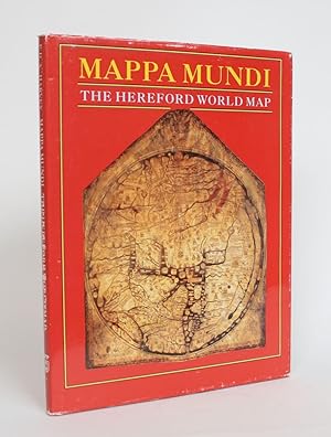
Mappa Mundi: The Hereford World Map
Published by University of Toronto Press, Toronto and Buffalo, 1996
Seller: Minotavros Books, ABAC ILAB, Whitby, ON, Canada
Seller rating 5 out of 5 stars
First Edition
Hardcover. Condition: Near Fine. Dust Jacket Condition: Very Good. First Edition. 12mo. Orig. burgundy cloth, 58pp. Illustrated. Light bumping to spine o/w near fine in a worn but very good d/w. An authoritative interpretation of the mappa mundi, or hereford world map created in the 13th century.
-
The London Guarantee Touring Map of Hereford & Malvern District (No. 20)
Published by Published by London Guarantee & Accident Co. no date given[1913], Birmingham, 1913
Seller: Keoghs Books, Skipton, United Kingdom
Association Member: PBFA
Seller rating 5 out of 5 stars
Map First Edition
US$ 27.66
US$ 37.59 shipping
Ships from United Kingdom to U.S.A.Quantity: 1 available
Add to basket, 18-section folding map with 'Why, When, How & Where to Insure' information on reverse First Edition , corners a little rubbed, map unmarked, a few light spots to reverse of map, in very good condition , red cloth with black titles to front and rear 25 x 30 cm folding into 9 x 6 cm booklet Hardback ISBN:
-
Cyclists Road Map of Hereford, Worcester, Gloucester, Oxford, etc.
Published by Pattisons, Leith, 1897, 1897
Seller: ROBIN SUMMERS BOOKS LTD, Aldeburgh, United Kingdom
Seller rating 5 out of 5 stars
Map First Edition
US$ 41.48
US$ 38.93 shipping
Ships from United Kingdom to U.S.A.Quantity: 1 available
Add to basketCondition: Very Good. First edition. Hardback. Compact folding colour map, 9.5 x 13 inches, folding down to 25 x 3.5 in tan cloth illustrated hardback. Slight tearing to map at creases, otherwise very good. From the short lived Whisky distillery.
-
THE SILURIAN SYSTEM founded on Geological Researches in the Counties of Shropshire, Hereford, Radnor, Montgomery, Carmarthen, Brecon, Pembroke, Monmouth, Gloucester, Worcester, and Stafford with descriptions of the coal-fields and overlying formations by Roderick Impey Murchison. First edition WITH THE RARE THREE SECTION MAP 1839
Language: English
Published by John Murray, London, 1839
Seller: Andrew Cox PBFA, Shropshire, United Kingdom
Association Member: PBFA
Seller rating 5 out of 5 stars
First Edition
US$ 13,828.10
US$ 26.18 shipping
Ships from United Kingdom to U.S.A.Quantity: 1 available
Add to basketHalf-Leather. Condition: Good. 1st Edition. Published in London by John Murray in 1839 two volumes, here bound together in one, this is the First Edition of Murchison's landmark work in which he set up the Silurian System based on his studies of the rocks of Wales, Shropshire and the Welsh border counties of England, Murchison included both what were later to be classified as the Ordovician and Devonian periods within in his Silurian System, the work is well illustrated with hand coloured sections, folding and single page plates and a series of plates of the fossil fauna, all plates are present the book was sold on subscription with a list of subscribers at the front of the book, this copy was originally the property of David Davies of Froodvale in Llandovery, who was one of the original subscribers, his name appears in the list of subscribers immediately below Charles Darwin's, and as far as I am aware this is also the first time Darwin's name appeared in print. The rare three section linen backed map is present with this copy, housed in a nice clamshell box with an old original Victorian CDV photo of Murchison loosely inset into the inside cover, along with an original signature of Murchison's underneath. CONDITION both bindings are in very good condition. Internally foxing to the title page and plates, wear and foxing along top edge of one of the folding plates (pictured) and edge wear with small edge tears with no loss to the last of the folding sections, else the book is in very good general condition, the three section map was originally the property of Manchester Public Libraries with their withdrawn and sold stamps to the reverse of each section, also there are blind embossed stamps to every panel on the maps, but as can be seen in the photos these are not very noticeable, there are a few small splits in the maps along the fold lines and browning to the reverse, else the maps are in good general condition. A handsome example of the First Edition with the rare three section hand coloured map.
-

Mappa Mundi: The Map of the World in Hereford Cathedral
Published by The Friends of Hereford Cathedral Publications Committee for the Dean and Chapter, Hereford, 1987
Seller: Between the Covers-Rare Books, Inc. ABAA, Gloucester City, NJ, U.S.A.
Association Member: ABAA ESA ILAB IOBA
Seller rating 5 out of 5 stars
First Edition
Softcover. Condition: Fine. First edition. Quarto. 29pp. Cover and engravings by R. Boulton. Photographs by Gordon Taylor. Fine in stapled wrappers. Laid in are five unused postcards with two being of the Hereford Cathedral library, Prospect Point on the Hills, Sunset Silhouette of the Malvern Hills, and Oxford, Lady Margaret Hall Punting, c1897.
-
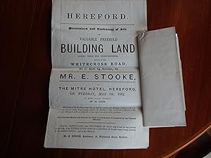
Whitecross Road Hereford - Auction Sale Prospectus 1872 with a Large Coloured Foding Map. HR4 0DG HR4 0LS HR4 0DE HR4 0DT HR4 0DZ
Published by Mr.E.Stooke, Hereford, 1872
Seller: Creaking Shelves Books, Spean Bridge, United Kingdom
Association Member: PBFA
Seller rating 5 out of 5 stars
First Edition
US$ 47.02
US$ 18.12 shipping
Ships from United Kingdom to U.S.A.Quantity: 1 available
Add to basketOriginal Wrappers. Condition: Very Good. 1st Edition. Auction Sale Prospectus: Full title: Hereford. Particulars and Conditions of Sale of valuable freehold building land giving votes for Herefordshire situate in the Whitecross Road to be sold by Auction, by Mr.E.Stooke at The Mitre Hotel Hereford o Tuesday May 17th at seven o'clock precisely in 14 lots. 4p with a detached large folding coloured map which includes White Cross Road, Ranelagh Road, Ingestre Road, Meyrick Road, Baggallay Road and Gruneisen Road, with stipulations for some of the lots. The map is clean but ruffled at the lower edge measuring 27"x 17". Now HR4 0DG HR4 0LS HR4 0DE HR4 0DT HR4 0DZ See scans.
-
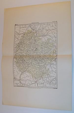
Map of Hereford, England - Circa 1902
Published by Publisher Not Stated, UK, 1902
Seller: RareNonFiction, IOBA, Ladysmith, BC, Canada
Association Member: IOBA
Seller rating 5 out of 5 stars
First Edition
Map. Condition: Very Good. First Edition. Outside dimensions 14.5" x 10.5" Circa 1902. Centerfold. Light wear. Please see our photo for details.
-
Hereford World Map Mappa Mundi Faksimile Facsimile COMMENTARY VOLUMES NOT INCLUDED
Published by Folio Society
Map First Edition
Hardcover. Condition: Very Good. 1st Edition. This is the exclusive Folio Society facsimile edition of the legendary Hereford World Map Atlas. IT DOES NOT INCLUDE THE COMMENTARY VOLUMES. According to Wikipedia: "The Hereford Mappa Mundi (Latin: mappa mundi) is the largest medieval map still known to exist (140x118 cm) (4 ft 7.1 x 3 ft 10.5 inches)!!!, depicting the known world. It is a religious rather than literal depiction, featuring heaven, hell, and the path to salvation. Dating from ca. AD 1300, the map is drawn in a form deriving from the T and O pattern. It is displayed at Hereford Cathedral in Hereford, England. The map was created as an intricate work of art rather than as a navigational tool. Sources for the information presented on the map include the Alexander tradition, medieval bestiaries and legends of monstrous races, as well as the Bible." *** Very hard to find!