
Ireland Map Folder (5 results)

Published by The Irish Tourist Association 1938
- Map
Seller: Manian Enterprises, Nashua, NH, U.S.A.Manian Enterprises
Contact seller5-star sellerCondition: Used - Very good
US$ 35.00
US$ 4.75 shippingShips within U.S.A.Quantity: 1 available
No Binding. Condition: Very Good. A multi-fold vintage tourist brochure/map that when folded, measures 4" x 9". When fully opened, there is a 24" x 27" detailed map of Ireland on one side printed in several colors, and information on Ireland (motoring, sporting, tourist information, etc.) with vintage sepia-toned photographs on…the reverse. At the bottom of the map there is an indication that it was originally prepared in 1935 by the Ordinance Survey Office, Phoenix Park, Dublin and revised in 1938. A faint stamped impression on the front cover indicates the following: "Tourist Information Bureau, Irish Pavilion, New York World's Fair" (1939). On the inside of the brochure there is also reference to the Irish Pavilion at the 1939 New York World's Fair. On the back cover, there is a diagonally stamped overprint in green: "Printed in Ireland". In very good condition with no marks of any kind.

Published by Northern Ireland Tourist Board Belfast 1976
- Map
Seller: JIRI Books, Lisburn, , United KingdomJIRI Books
Contact seller5-star sellerCondition: Used - Very good
US$ 16.62
US$ 24.88 shippingShips from United Kingdom to U.S.A.Quantity: 1 available
No Binding. Condition: Very Good. Large folded map with rext on the reverse. A VG copy. Light. Postage will be reduced on processing the order.
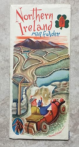
Published by The Tourist Information Centre, Belfast 1950
Seller: Joe Collins Rare Books, Dublin, , IrelandJoe Collins Rare Books
Contact seller5-star sellerCondition: Used - Near fine
US$ 35.85
US$ 29.01 shippingShips from Ireland to U.S.A.Quantity: 1 available
No Binding. Condition: Near Fine. Single sheet, printed both sides, folded illustrated map and tourist information guide. 200x90mm opening out to 540x395mm. *Pictorial map of Northern Ireland by Frederick Griffin with heraldic border at top and bottom. With accompanying illustrations by Rowel Friers. Printed by McCaw, Stevenson…& Orr, Ltd.* A near fine copy without any, library stamps, inscriptions or other markings. Images and further information available on request. *** Lower than average weight - shipping charge will be reduced at processing stage of order. ***.
Published by De Burca Rare Books / Edmund Burke Publishers, Dublin, Ireland 1990
- Hardcover
- First Edition
Seller: BOOKMARK, Auckland, , New ZealandBOOKMARK
Contact seller3-star sellerCondition: Used - Very good
US$ 361.83
US$ 27.00 shippingShips from New Zealand to U.S.A.Quantity: 1 available
Hb. Condition: VG. None. Third Edition. Introduction by Kenneth Nicholls. Clean dark green cloth on boards with blindstamped titles & decorative Irish impression to front of cover and gilt titles & gilt vertical design to the spine. Edges: moderate foxings and a thin smudge to some bottom edge corner. A slight concave dip down t…he spines. Eps: moderate foxings. Few only foxings to a few pages, albeit mostly to the margins. Bindings are As New. Seven volumes +To enhance the value of this masterpiece a colour reproduction of Baptista Boazio's map of Ireland 1609 is included in a matching folder. : 4,096p. Heavy set: 14 kgs.
Published by Royal Irish Automobile Club; The Irish Tourist Association, Great Southern Railways, Ormond Printing Co., ca. 1937-1938]., [Dublin, Ireland: 1937
- First Edition
Seller: Zephyr Used & Rare Books, Vancouver, WA, U.S.A.Zephyr Used & Rare Books
Contact seller5-star sellerTen pieces. 8vo. [8 pp (unpaginated).], photo illustrated throughout. Green pictorial softcovers, colour cover art (minor shelfwear, slight creasing); 8vo. 4 x 9 in. which folds out into 23 x 27 in. large map printed in red, black & green, photo illustrations on recto & verso (slight shelfwear); 8vo. 4.5 x 8.5 in. folds out into… 23.5 x 24 in. map in red & back, stiff printed & illustrated covers in blue & red; 8vo. 4 x 8.75 in. 158, [2] pp. Orange printed softcovers, cover w/ green & black decorative lettering (minor scuffing, slight closed tear head of spine); 8vo. [12 pp (unpaginated).], leporello accordion style, printed & illustrated in orange & black, map of Galway, self-printed softcovers (minor shelfwear, slight bumping to corner); 8vo. [12 pp (unpaginated).], leporello accordion style, printed & illustrated in blue, red & black, photo illustrations, self-printed colour-illustrated softcovers; 3 vols. 8vo. [12 pp (unpaginated).], leporello accordion style printed & illustrated in colour, folding to the center, all three w/ self-printed colour-illustrated softcovers; 4to. 40 pp. Photo-illustrated throughoug. Colour-illustrated softcovers, Shamrock cover art front cover, photo cover art on back (some scuffing, remnants of mailing flap on front cover upper fore-edge), still a VG grouping, w/ Complimentary Letter from the Royal Irish Automobile Club laid-in, addressed to Harold Berson (1926-1986), later World traveler, and noted children's book illustrator. First editions, thus, of these automobile travel brochures, maps, and directories promoting the "See Ireland First" campaign developed by the Royal Irish Automobile Club, and the Irish Tourist Association during the Great Depression to encourage UK tourists to visit Ireland, as well as Americans. The campaign designed to emulate the "See America First" good roads campaign in the United States was focused on touting the amenities for automobile enthusiasts, the improved roads and connections between the Free State of Ireland, and Northern Ireland between the Wars, but also the many different hotels, roadside inns, historic attractions, and sporting opportunities, including angling, golf, and hunting. Several of these including the first are either not located in Worldcat, or, just a couple copies.

