Order Total (1 Item Items):
Shipping Destination:

Journal Voyages (Over 9,800 results)
Skip to main search results
Product Type
- All Product Types
- Books (9,460)
- Magazines & Periodicals (306)
- Comics (1)
- Sheet Music
- Art, Prints & Posters (3)
- Photographs (4)
- Maps (1)
-
Manuscripts &
Paper Collectibles (34)
Condition
Binding
Collectible Attributes
- First Edition (805)
- Signed (72)
- Dust Jacket (273)
- Seller-Supplied Images
- Not Printed On Demand (7,411)
Free Shipping
Seller Location
Seller Rating
-
A Cruising Voyage Round the World: First to the South Seas, thence to the East-Indies, and Homewards by the Cape of Good Hope. Begun in 1708, and Finish'd in 1711.Containing a Journal of all the Remarkable Transactions. An Account of Alexander Selkirk's living alone four years and four months on an island
Published by London: Printed for A. Bell and B. Lintot, 1718
Seller: Bruce Marshall Rare Books, Cheltenham, United Kingdom
Seller Rating:

Book
Hardcover. Condition: Very Good. 2nd Edition. Second Edition London: Printed for A. Bell and B. Lintot, 1718, 8vo, five folding maps, including a folding map of the world, contemporary panelled calf gilt, rebacked. This work is an account of one of the most colourful and swashbuckling voyages written about the buccaneers. Bristol was England's second largest port, thriving on the growing trade with the American colonies. William Dampier persuaded the merchant and sea captain Woodes Rogers to join him in a circumnavigation (Dampier's third) and to pursue the Spanish Treasure Galleons. The war of the Spanish Succession was still under way so Rogers and a prominent Bristol consortium of respected citizens were receptive to Dampier's plans to plunder from privateering in the Pacific against England's enemies, the French and the Spanish. The consortium purchased two ships: the 320 tons, 30 guns Duke and the 260 tons, 26 guns Duchess. Dampier was to be the 'pilot for the South Seas'. They left Bristol on 2 August 1708 and struck out for the long haul to Brazil via Cape Horn, sighting the coast on 14 November. Re-provisioned they arrived in the Pacific and set course for the Juan Fernandez Islands where they found and rescued Alexander Selkirk, the source for Defoe's Robinson Crusoe. After illness, near mutiny and unrest from unruly crews, the privateers captured the large ship Havre de Grace, attacked and plundered the Spanish stronghold of Guayaquil in Ecuador. There was bitter arguments over the distribution of plunder but Rogers dealt severely with the ringleaders and kept the rest of the crew in check. Their greatest prize was the capture of the Manila Treasure Ship - the galleon Nuestra Senora de la Encarnacion Disengano. During this engagement Rogers was hit on the jaw by musket shot, and had to wait until they made the long voyage to Batavia to have it properly attended by a doctor. On October 1711, the battered little squadron sailed up the Thames to an enthusiastic reception. They brought back nearly �150,000 from the Manila galleon, and even after legal fees, customs dues and payment to the East India Company there was still a fortune left. Dampier had fulfilled his ambition of seizing a Spanish treasure ship, although he had difficulty acquiring his share of the spoils. Rogers went on to become Governor of the Bahamas and was instrumental in controlling piracy on the islands. He was also involved in the engagement and death of Edward Teach (Blackbeard). An important narrative and one of the best known English buccaneering narratives. Hill 1479; Howes R421; Cox I, 46; Sabin 72753; Cowan, p.194; Diana & Michael Preston. A Pirate of Exquisite Mind.
-
An Historical Journal of the Transactions at Port Jackson and Norfolk Island, with the Discoveries which have been made in New South Wales and in the Southern Ocean, since the publication of Phillip's Voyage, compiled from the Official Papers; Including the Journals of Governors Phillip and King, and of Lieut. Ball; and the Voyages from the First Sailing of the Sirius in 1787, to the Return of that Ship's Company to England in 1792
Published by John Stockdale, London, 1793
Seller: Hordern House Rare Books, Surry Hills, NSW, Australia
Association Member: ANZAAB ILAB
Seller Rating:
Quarto, with 17 engraved plates and charts; with the list of subscribers; a very large copy, edges uncut, in original paper boards, remnants of original paper label to spine, worn; quarter morocco box. An exceptional copy, unsophisticated in original publisher's boards binding, completely uncut and very large (page size 312 x 250 mm). This impressive copy was acquired by its first owner (Brydges, see provenance) in March of the year of publication, 1793; his name does not appear in the list of subscribers, but it is worth noting that the subscription amounted to 595 copies, of which a full two-thirds went to booksellers. The second governor's important Journal describing the first years of settlement at Sydney was published by Stockdale, who had earlier prepared Phillip's journal for publication. In many ways it is a continuation to Phillip's book and is certainly its equal in importance as the extended official account of the new colony. Second captain of the Sirius under Phillip for the voyage to Botany Bay, Hunter was an experienced sea captain and the most dedicated navigator of the First Fleeters. Actively engaged in surveying and exploration in New South Wales, he left for England in late 1791 after the loss of the Sirius at Norfolk Island while under his command. He spent the next few years preparing his journals for publication before going to sea again, and finally returning to the colony as its second governor in 1795. Hunter's particular skills in surveying and charting make his book in effect the first pilot for Australian waters and a significant companion to Cook in particular. The maps here, many of them from original cartography by Hunter, as well as Dawes and Bradley, are very fine. The engraved plates include the well-known "View of the Settlement at Sydney Cove, Port Jackson, 20th August 1788" (the first published engraving of Sydney) and P.G. King's "A Family of New South Wales", engraved by William Blake (Essick, William Blake's Commercial Book Illustrations, XXVII). Hunter gives an excellent account of recent exploration, prints Phillip's despatches to the end of 1791, and describes the settlement at Norfolk Island (the first account of Norfolk Island and the first publication of anything by Philip Gidley King). The book was edited for the press by the Scottish antiquarian George Chalmers, and was heavily subscribed by booksellers (including 50 copies to Robinson); its clout can easily be measured by noting that its other subscribers include Joseph Banks, Lord Sydney, Evan Nepean, and Alexander Dalrymple. . Provenance: H.S.J. Brydges (second and third initials uncertain but bold ink inscription on front flyleaf dated from Bath, 20 March 1793); Robert Henry Lee Warner (1823-1895, with armorial bookplate). Lee-Warner inherited Tyberton Court, Hereford, from the Brydges family. Spine very worn and boards rubbed, but in impressive original condition.
-

Journal du voyage fait par ordre du Roi, a l'�quateur, servant d'introduction historique � la Mesure des trois premiers degr�s du M�ridien.
Published by Imprimerie Royale, Paris, 1751
First Edition
In-4 de (2)-xxxvi-280-xv pp., 2 cartes et 5 planches hors texte repli�es. LA CONDAMINE (Charles Marie de). Mesure des trois premiers degr�s du M�ridien dans l'H�misph�re austral, tir�e des observations de MM. de l'Acad�mie royale des sciences, envoy�s par le roi sous l'�quateur, par M. de La Condamine. Paris, Imprimerie Royale, 1751. In-4 de (12)-266-X-VIII pp., 3 planches hors texte dont 2 repli�es.Les deux pi�ces reli�es en 1 vol. in-4, veau marbr�, dos orn� � nerfs, pi�ce de titre en maroquin rouge, triple filet dor� d'encadrement sur les plats, tranches dor�es sur marbrure (reliure de l'�poque). �dition originale des deux pi�ces. R�union rare du journal et du rapport de Charles-Marie de La Condamine qui participa � l'exp�dition au P�rou de 1735 � 1744 pour, entre autres, mesurer un arc du m�ridien � l'�quateur afin de d�terminer la forme de la Terre. L'exp�dition scientifique fran�aise au P�rou qui comptait le savant et acad�micien Charles de la Condamine, Louis Godin (math�maticien), Joseph de Jussieu (m�decin et naturaliste) et Pierre Bouguer (math�maticien et astronome) fut organis�e par l'Acad�mie des Sciences dans le but de faire des observations permettant de d�terminer la figure de la Terre. Elle fut �galement l'occasion pour La Condamine d'observer l'attraction des masses entre elles, et de s'engager dans le d�bat sur le projet de mesure universelle en proposant de choisir pour unit� la longueur du pendule battant la seconde � l'�quateur. La relation est suivie d'une "Histoire des pyramides de Quito". Le Journal est illustr� de 7 planches hors texte dont deux cartes, un plan de Quito, une vue, un plan de pyramides repli�s, et une figure all�gorique, le tout grav� en taille-douce, et un tableau repli�.Dans les Observations, La Condamine aborde dans une premi�re partie les op�rations effectu�es pour la mesure des trois degr�s du m�ridien, entre Quito et Cuenca, puis, dans une seconde parte, donne les r�sultats des exp�riences pour d�terminer l'amplitude de l'arc du m�ridien. Suivi de : Nouveau projet d'une mesure invariable propre � devenir universelle.Tr�s bon exemplaire. D�part de fente aumors sup�rieur.[Journal :] Brunet, III, 729 ; Sabin, 38479 ; [Mesure :] Borba de Moraes, I, 447 ; Norman, 1249 ; Sabin, 38483.
-
Voyage fait par Ordre du Roi en 1768 et 1769, � diff�rentes Parties du Monde, Pour �prouver en mer les Horloges Marines invent�es par M. Ferdinand Berthoud. Premi�re partie, Contenant 1. Le Journal des Horloges Marines, ou la suite de quatorze v�rific. - [TESTING BERTHOUD'S CHRONOMETER.]
First Edition
Paris, Imprimerie Royale, 1773. 4to. 2 nice contemp. full mottled calf. 5 raised bands. Richly gilt spines, tome-and titlelabels with gilt lettering. Neat repairs to top of spines. Stamps on title-pages. Corners a bit bumped. (4),LXXIX,803"(4),622 pp., 5 folded engraved maps, 1 engraved plate and 5 folded tables. Light browning to a few quires. Lower right corners on the last 3 leaves in volume 1 with a mild foxing. First edition of this splendid work, in which the observations from the testing of Berthaud's marine chronometer were presented for the first time. Fleurieu took part in a one-year sea campaign to test Berthoud's first marine chronometer, in an attempt to beat Britain in the race to find a reliable way to calculate longitude. The chronometers he thus refined with Ferdinand Berthoud for their later experiments, were the object of major struggles with the king's horologer, Pierre Le Roy. Finally, Claret de Fleurieu and Berthoud were entrusted with the task, setting out on the testing expedition from autumn 1768 to 11 October 1769 on the frigate Isis under Fleurieu's command. The chronometers almost invariably indicated the hour as accurately after the ship had left port, as if they were still on land. Knowing the actual local time at each present location by astronomy, they could easily determine the ship's exact position and longitude on a chart. The results of their observations were published in 1773 under the title Voyage fait par ordre du roi, pour �prouver les horloges marines ("Voyage made by order of the king, to test marine chronometers").Sabin, 24750.
-
An Historical Journal of the Transactions at Port Jackson and Norfolk Island, with the Discoveries which have been made in New South Wales and in the Southern Ocean, since the publication of Phillip's Voyage, compiled from the Official Papers; Including the Journals of Governors Phillip and King, and of Lieut. Ball; and the Voyages from the First Sailing of the Sirius in 1787, to the Return of that Ship's Company to England in 1792
Published by John Stockdale, London, 1793
Seller: Hordern House Rare Books, Surry Hills, NSW, Australia
Association Member: ANZAAB ILAB
Seller Rating:
First Edition
Condition: Some age marks throughout. Quarto, with 17 engraved plates and charts; with the list of subscribers; a fine and large copy, completely uncut, in later quarter vellum and plain boards; slipcase. A splendid copy of the first edition of Hunter's important Journal of the first years of settlement at Sydney. This memoir by the second governor was published by Stockdale, who had earlier prepared Phillip's journal for publication. In many ways it is a continuation to Phillip's book and is certainly its equal in importance as the extended official account of the new colony. This is a fine, large copy and the title-page, often cropped by the binder, here has generous margins. Second captain of the Sirius under Phillip for the voyage to Botany Bay, Hunter was an experienced sea captain and the most dedicated navigator of the First Fleeters. Actively engaged in surveying and exploration in New South Wales, he left for England in late 1791 after the loss of the Sirius at Norfolk Island while under his command. He spent the next few years preparing his journals for publication before going to sea again, and finally returning to the colony as its second governor in 1795. Hunter's particular skills in surveying and charting make his book in effect the first pilot for Australian waters and a significant companion to Cook in particular. The maps here, many of them from original cartography by Hunter, as well as Dawes and Bradley, are very fine. The engraved plates include the well-known "View of the Settlement at Sydney Cove, Port Jackson, 20th August 1788" (the first published engraving of Sydney) and P.G. King's "A Family of New South Wales", engraved by William Blake (Essick, William Blake's Commercial Book Illustrations, XXVII). Hunter gives an excellent account of recent exploration, prints Phillip's despatches to the end of 1791, and describes the settlement at Norfolk Island (the first account of Norfolk Island and the first publication of anything by Philip Gidley King). The book was edited for the press by the Scottish antiquarian George Chalmers, and was heavily subscribed by booksellers (including 50 copies to Robinson); its clout can easily be measured by noting that its other subscribers include Joseph Banks, Lord Sydney, Evan Nepean, and Alexander Dalrymple. .
-
Journal of a voyage from Okkak on the coast of Labrador to Ungava Bay, westward of Cape Chudleigh ; undertaken to explore the coast, and visit the Esquimaux in that unknown region
Published by Printed for the [United] Brethren's Society for the Furtherance of the Gospel Among the Heathen by W. M'Dowall, London, 1814
Seller: Rodger Friedman Rare Book Studio, ABAA, Tuxedo, NY, U.S.A.
Seller Rating:

First Edition
First edition. 22cm; 83 pages, folding engraved map. Bound in recent polished calf ruled in gilt on both boards and tooled at each corner. A bit sun-drenched on spine. Reference: AB 8996. Fine condition. The son of a Warsaw baker, Benjamin Kohlmeister apprenticed as a cabinetmaker before wandering into the Moravian congregation at Dresden. In 1790, he was sent to Labrador where he served a 12-year residence at Okak, the Moravians' northernmost station. After a hiatus in Europe, he returned to Okak in 1810 with Georg Kmoch. Accompanied by 15 Inuit, the pair traveled north from the settlement to Cape Chidley , the Ungava Bay, and as far north as the Koksoak River scoping out sites for settlement. The volume offered here is the account of that voyage. In 1818, Kohlmeister became the general superintendent of the mission, headquartered at Nain.
-
JOURNAL D'UN VOYAGE A LA LOUISIANE, FAIT EN 1720
Published by Chez Musier, Fils, & Fournier, Paris, 1768
Seller: William Reese Company - Americana, New Haven, CT, U.S.A.
Association Member: ABAA ESA ILAB SNEAB
Seller Rating:
8,316,[3]pp. Half title. 12mo. Modern calf, tooled in gilt, spine gilt, gilt leather label. Light foxing. Very good. A rare account by the commander of the 1720 French scientific expedition to Louisiana, the French West Indies, and the Gulf of Mexico. Vallette Laudun led the first detailed survey made of Louisiana by the French government, three years after the founding of New Orleans and at the height of enthusiasm over John Law's Mississippi Company. "Vallette was the commander of the TOULOUSE, which sailed from Toulon in March, 1720, and reached Dauphin Island, on Mobile Bay, early in July" - Clark. The text consists of 132 letters to an unnamed French lady, which collectively provide a vivid picture of Vallette Laudun's voyage, the French dominions in Louisiana and the Mississippi Valley, and the things Vallette Laudun saw there. The same voyage is described in Laval's sumptuous work of 1728. Not in Servies but should be, as the author led the survey described by Laval, which Servies does include. One of the rarest early publications about Louisiana. HOWES V12. CLARK I:164. BELL V14. SABIN 98393. REESE, BEST OF THE WEST 4 (note).
-
Journal of a Voyage to New South Wales with sixty-five plates of nondescript animals, birds, lizards, serpents.
Published by J. Debrett, London, 1790
Seller: Hordern House Rare Books, Surry Hills, NSW, Australia
Association Member: ANZAAB ILAB
Seller Rating:
Quarto, engraved title page with vignette and 65 plates; in a very good period-style quarter calf binding by Aquarius, flat spine gilt in compartments. This is a travel and ornithological classic by a medical voyager: John White was the chief surgeon on the "First Fleet", the expedition that colonised New South Wales in 1788. His Journal is one of the most attractive, as well as one of the earliest, Australian bird books. Many of the plates were drawn in England by leading natural history artists of the day, such as Sarah Stone and Frederick Nodder, from original sketches done in the colony. The book was an immediate success on publication, with subscribers alone accounting for seven hundred copies. John White was chief surgeon of the First Fleet, and was particularly successful in that he overcame serious medical problems in appalling conditions both on the voyage out and when the settlement was founded. On joining the First Fleet he had begun to keep a journal in which he would later make notes about birds in the new colony. It was this manuscript which formed the nucleus of his journal. It also provided an interesting and valuable account of the voyage from London, with long, detailed accounts of the stops at Rio de Janeiro, Cape Town and of the colonial voyages to Norfolk Island. White was a keen amateur naturalist and after arriving at Port Jackson found time to accompany Governor Phillip on two journeys of exploration. The natural history content makes White's particularly noteworthy amongst the First Fleet journals. White's interest in natural history continued until he left New South Wales in December 1794. When the convict artist Thomas Watling arrived in the colony in October 1792 he was assigned to White and in the next two years made many drawings of birds for him. It is possible that White himself had some skill as an artist and that he may have been responsible himself for a portion of the original sketches for some of the engravings here. Others of the engravings, drawn by leading natural history artists of the day such as Sarah Stone, were based on actual specimens which had been sent to England, and which were on display in the windows of the publisher Debrett in a very successful attempt to drum up subscribers for the book. This copy is complete with both the list of subscribers and the publisher's advertisement. . Provenance: A private New South Wales collection. Apart from just a few scattered age marks a fine copy.
-
An Account of the First Aerial Voyage in England, in a series of letters to his guardian Chevalier Gherardo Compagni and Journal kept by H.B.H.B during an Aerial Voyage with Mr James Sadler Sen. Two volumes in one.
Published by Printed for the Author and G. Woodfall (Journal) 1784 and 1811, London, 1784
, [6] 66 [6], 39 pages, 3 plates comprising engraved frontispiece by Bartolozzi after Cosway and two folding engraved plates, publisher's list to final leaf verso of An Account of the First Aerial Voyage. Second volume has drop title with cropped imprint at foot, including tables of observations made at Hackney Wick, at the moment the balolon was seen rising over the trees, and a folding equation table for the barometer (Journal). Front free endpaper inscribed Robert Todd, June. 12. 1909, From The Beaufoy Library Sale with bookplate to front pastedown First Editions , Henry Sotheran & Co. book label at foot of upper pastedown, minor foxing up to page 33 of first volume section and title page of Journal, ghosting of engravings on folding pages. Slight damage to head and tail of spine, rubbing to rear cover leather near spine, slight damage to paper of upper hinge, good condition , half bound black morocco, gilt title on spine with 6 panels (4 contain gilt flower motifs) and 5 raised bands with marbled paper and text block edge , Quarto , 21.5cm x 13.5cm Hardback ISBN:
-
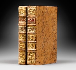
Journal du Voyage de Montaigne en Italie
Couverture rigide. Condition: Tr�s bon. Montaigne, Michel de. Journal du Voyage de Michel de Montaigne en Italie, Par la Suisse & l Allemagne en 1580 & 1581. Avec des Notes par M. de Querlon. A Rome, et se trouve � Paris, Le Jay, 1774. 2 volumes in-12 de�: I/ (5) ff. y compris le portrait, cviii et 324 pp., (4) ff.; II/ (2) ff. et 603 pp. (mal chif. 601). Veau glac� marbr�, filet � froid encadrant les plats, dos � nerfs orn� de filets et fleurons dor�s, pi�ces de titre en maroquin rouge, coupes d�cor�es, tranches marbr�es. Reliure de l �poque. 165 x 96 mm. Edition originale du Journal de Voyage en Italie de Michel de Montaigne. Le manuscrit in�dit de cette relation, �crit en partie de la main de Montaigne fut d�couvert par l abb� Prunis, parmi les papiers de l ancien ch�teau de Montaigne. ��On consid�re en g�n�ral le ��Journal de Voyage�� de Montaigne � travers l Europe comme un document biographique et litt�raire ; � ce titre il est d�j� int�ressant de p�n�trer dans les coulisses des Essais, de distinguer du sujet de l uvre de sagesse le personnage historique. Mais les indiscr�tes notations du malade ne doivent pas masquer l'infinie disponibilit� d'une curiosit� ouverte avec int�r�t aux rencontres, aux moindres manifestations des cultures �trang�res, � l'�coute aussi bien des papotages de courtisanes romaines que des disputes th�ologiques�� (Guy Demerson). Indispensable compl�ment des Essais, ce voyage en Italie devait profond�ment marquer la sensibilit� de Montaigne. Son influence sera d�cisive sur le troisi�me livre des Essais. La diversit� des milieux, la vari�t� des coutumes ont accru son sens de la relativit�, en m�me temps que celui de l'unit� de la nature humaine au travers de la diff�rence des usages et des comportements. Tr�s bel exemplaire conserv� dans son �l�gante reliure de l �poque. Provenance�: biblioth�que Mr. Dubois, avec ex-libris. Le Docteur Potti�e-Sperry vouait un culte au Journal de voyage de Montaigne.
-
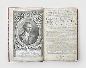
A New, Authentic, and Complete Collection of Voyages Round the World, undertaken and performed by royal authority. Containing an authentic, entertaining, full, and complete history of Captain Cook's first, second, third and last voyages,. To which will be added, genuine narratives of other voyages of discovery round the world. The whole comprehending a full account, from the earliest period to the present time, of whatever is curious, entertaining, and useful, both by sea and land, in the various countries of the known world, faithfully extracted from the original journals of the respective voyagers. Now publishing under the immediate direction of George William Anderson, Esq. Assisted by a principal officer who sailed in the Resolution sloop, and by many other gentlemen of the most distinguished naval abilities.
Published by London: Alexander Hogg, [1784-86], 1784
Seller: Peter Harrington. ABA/ ILAB., London, United Kingdom
Association Member: ABA ILAB PBFA
Seller Rating:
First Edition
First edition of this valuable compendium of the three voyages of Captain Cook and others. "An important collection of English voyages. [which] sometimes gives the original accounts, others are edited or abridged versions, and frequently additional material from other sources are added to give scope and depth to the narratives" (Hill). This attractive copy has the title page in the first state, with the date in the imprint. Originally issued in 80 weekly parts costing sixpence each, printed in double column in "large new Types, constructed on Purpose to comprise much Matter in a little Compass", Hogg's edition helped disseminate knowledge of Cook's discoveries to those unwilling or unable to afford the nine quartos and atlas volumes of the official accounts. The text is paraphrased and reordered to avoid impinging on the literary property of the Admiralty. The splendidly verbose title page notes the addition of the expeditions of Byron, Wallis, Carteret, Mulgrave, Anson, and Drake. Those of the first three were included in Hawkesworth's edition of Cook's first voyage; the accounts of the voyages of Phipps, Anson, and Drake are reprinted from David Henry's An Historical Account of All the Voyages Round the World, Performed by English Navigators (1773-74). The book is often referred to as "Anderson's Cook", though George William Anderson is most likely a pseudonym calculated to evoke vague identification with William Anderson, the surgeon and naturalist who accompanied Cook on his second and third voyages. The publisher, Alexander Hogg, a specialist in "Paternoster Row numbers", had a penchant for tripartite pseudonyms. Beddie, Cook, 18; ESTC N5224; Forbes 61; Hill 18; Howgego I, C176; Spence p. 26; Parks Collection 104. Folio (382 x 252 mm). Contemporary tree calf professionally rebacked, single gilt fillet border to sides, Antique Spot pattern marbled endpapers. 29 engraved charts and plans and 125 engraved plates, including portrait frontispiece of Cook and allegorical second frontispiece, folding chart of Cook's voyages. Binding professionally refurbished, some old scratches and marks to covers, a few plates with weak impressions, small chip at foot of plate "Queen Charlottes Island", light offsetting from some plates, contents clean. An imposing copy.
-
NARRATIVE OF THE EXPEDITION OF AN AMERICAN SQUADRON TO THE CHINA SEAS AND JAPAN, Performed in the Years 1852, 1853, and 1854, Under the Command of Commodore M. C. Perry, United States Navy, By Order of the Government of the United States. Compiled From the Original Notes and Journals of Commodore Perry and His Officers, At His Request and Under His Supervision. [Volume III titled:] UNITED STATES JAPAN EXPEDITION. OBSERVATIONS ON THE ZODIACAL LIGHT, From April 2, 1853, to April 22, 1855, Made Chiefly on Board The United States Steam-Frigate Mississippi, During Her Late Cruise in Eastern Seas, and Her Voyage Homeward; With Conclusions from the Data Thus Obtained; by Rev. George Jones, A.M., Chaplain United States Navy.
Published by Washington A.O.F. Nicholson, Printer by Order of the Congress of the United States 1856, 1856
Seller: Buddenbrooks, Inc., Newburyport, MA, U.S.A.
Association Member: ABAA ILAB SNEAB
Seller Rating:
3 volumes. First Edition of the original three volume quarto issue. Profusely decorated with all illustrations called for or suppressed, Volume I with 90 lithographic plates INCLUDING the suppressed bathing plate which is not present in most copies, a great many of the plates in colours, and with the 3 "facsimiles" of Japanese woodblock prints in colours; 6 maps and charts (2 folding); 79 woodcuts in the text; Volume II with 79 woodcuts in the text, 4 coloured lithographs of Chinese scenes; 2 natural history engraved plates; 6 hand-coloured lithographs of birds; 10 hand-coloured steel-engraved plates of fish; 5 lithographs of shells, 2 hand-coloured; 16 diagram plates of winds and currents; the 14-page facsimile of the Japanese language version of the U.S.-Japan treaty, the English version and 17 large folding charts on 16 sheets; Volume III with the 352 full page woodcut star charts and observations on the zodiacal light as called for Thick, large quarto, handsomely bound in three quarter black morocco over black cloth covered boards, the spines gilt ruled and lettered in gilt, the covers with gilt rules at the joins. xvii, [1], 537 + plates; [viii], 414, [4], 14, [2], xi, [4] + plates and maps; xliii, [1], 705, [1] pages including the 352 full--page woodcut zodiacal star charts A very well preserved, clean and handsome copy, the bindings in fine order and the text-blocks and plates all beautifully preserved, the maps in a very pleasing state of preservation showing only light evidence of use or age. FIRST EDITION OF THIS HIGHLY IMPORTANT WORK, A PRODIGIOUS ACHIEVEMENT WITH SUPERB ILLUSTRATIONS, MAPS AND CHARTS. Hawks' report of Perry's expedition was published in three volumes in Washington as a report to the Congress of the United States. The first volume contains the narrative of the expedition, and the second and third volumes consist of scientific data. This first edition also includes all the scientific, natural history and astronomical data that was not included in later editions. During this expedition Perry negotiated the treaty between the United States and Japan which opened the latter to the influences of western civilization. The more important articles of the treaty provided "that the port of Simoda, in the principality of Idzu, and the port of Hakodate, in the principality of Matsmai, were constituted as ports for the reception of American ships, where they could buy such supplies as they needed; that Japanese vessels should assist American vessels driven ashore on the coasts of Japan, and that the crews of such vessels should be properly cared for at one of the two treaty ports; that shipwrecked and other American citizens in Japan should be as free as in other countries, within certain prescribed limits; that ships of the United States should be permitted to trade at the two treaty ports under temporary regulations prescribed by the Japanese, that American ships should use only the ports named, except under stress of weather, and that privileges granted to other nations thereafter must also be extended to the United States" (Encyc. Brit.). The Perry Expedition (Japanese: , kurofune raik , "Arrival of the Black Ships") was a diplomatic and military expedition to the Tokugawa Shogunate, involving two separate voyages by warships of the United States Navy which took place during 1853 54. The most important goals of the expedition included exploration, surveying, the establishment of diplomatic relations and the negotiation of trade agreements with various nations of the region. The opening of contact with the government of Japan was considered the most important priority of the expedition, and was one of the key reasons for its inception. The expedition was commanded by Commodore Matthew Calbraith Perry, under orders from President Millard Fillmore. Perry s primary goal was to force an end to Japan s 220-year-old policy of isolation and to open Japanese ports to American trade, through the use of gunboat diplomacy if necessary. The Perry Expedition led directly to the establishment of diplomatic relations between Japan and the western Great Powers, and eventually to the collapse of the ruling Tokugawa shogunate and the restoration of the Emperor. Following the expedition, Japan's burgeoning trade routes with the world led to the cultural trend of Japonisme, in which aspects of Japanese culture influenced art in Europe and America. Growing commerce between America and China, the presence of American whalers in waters off Japan, and the increasing monopolization of potential coaling stations by European colonial powers in Asia were all contributing factors in the decision by President Fillmore to dispatch an expedition to Japan. The Americans were also driven by concepts of manifest destiny and the desire to impose the benefits of western civilization and the Christian religion on what they perceived as backward Asian nations. By the early nineteenth century, the Japanese policy of isolation was increasingly under challenge. In 1844, Dutch King William II sent a letter urging Japan to end the isolation policy on its own before change would be forced from the outside. Between 1790 and 1853 at least twenty-seven U.S. ships (including three warships) visited Japan, only to be turned away. There were increased sightings and incursions of foreign ships into Japanese waters, and this led to considerable internal debate in Japan on how best to meet this potential threat to Japan s economic and political sovereignty. In May 1851, American Secretary of State Daniel Webster authorized Commodore John H. Aulick, commander of the American East India Squadron, to attempt to return seventeen shipwrecked Japanese sailors residing in San Francisco, which might provide the opportunity for opening commercial relations with Japan. On May 10, 1851, Webster drafted a letter addressed to the "Japanese Emperor" with assurances that the expedition had no religious purpose, but was only to request "f.
-
HISTOIRE ET DESCRIPTION GENERALE DE LA NOUVELLE FRANCE, AVEC LE JOURNAL HISTORIQUE D'UN VOYAGE FAIT PAR ORDRE DU ROI DANS L'AM�RIQUE SEPTENTRIONALE
Published by Chez Pierre-Fran�ois Giffart, Paris, 1744
Seller: William Reese Company - Americana, New Haven, CT, U.S.A.
Association Member: ABAA ESA ILAB SNEAB
Seller Rating:
Six volumes. [6],viii,454; [2],501; [2],465; [2],388; [2],456; [2],434,[4]pp., plus twenty- eight maps, and ninety-six plates on forty- four sheets. 12mo. Contemporary speckled calf, raised bands, spines gilt, leather labels, marbled endpapers, all edges red. Slight wear at joints, spine ends, and corners. 19th-century bookplate on each front pastedown. Internally clean. Very good. First duodecimo edition, printed the same year as the three-volume quarto edition of this classic work of Canadian history, including important material on French settlement in the Mississippi Valley. The journal consists of thirty-six letters, six of which relate to the southern colonies. "The principal work of this great Jesuit traveller and historian and the pre-eminent authority on the French period in the West" - Howes. "This work is one of the best authorities concerning various Indian tribes, some of which no longer exist. The laborious accuracy with which the work was executed can be estimated by the fact that the maps, dated 1743, are marked with the latest discoveries, in 1742, in the extreme north of America" - Lande. Most of the maps in this work were drawn by French cartographer Nicholas Bellin, including his important rendering of North America, a frequent source for later mapmakers, as well as some of the most definitive and up-to-date maps available of Canada. Besides its great importance as a historical and cartographical work, Charlevoix's narrative is of considerable interest for the section entitled "Description des Plantes Principales de l'Amerique Septentrionale," which in the duodecimo edition occupies much of the fourth volume. Here the author describes ninety-six plants, mainly ones native to Canada, but including herbs of the Mississippi Valley as well. Most of the plants described are of medicinal value. The text is accompanied by forty-four folding plates illustrating all ninety-six species discussed. LANDE 125. WHEAT TRANSMISSISSIPPI 120. PILLING, PROOF-SHEETS 756. TPL 188. HOWES C307, "b." MICHIGAN RARITIES 8. CLARK I:59. SABIN 12136. KARPINSKI, p.137. GREENLY, MICHIGAN 11. EUROPEAN AMERICANA 744/56. ARENTS 730. CUMMING & DE VORSEY 259. SERVIES 380. REESE, BEST OF THE WEST 5 (ref).
-
Journal of a Voyage to New South Wales with sixty-five plates of nondescript animals, birds, lizards, serpents.
Published by J. Debrett, London, 1790
Seller: Hordern House Rare Books, Surry Hills, NSW, Australia
Association Member: ANZAAB ILAB
Seller Rating:
First Edition
Quarto, with an engraved title page and 65 engraved plates; old full speckled calf. First edition: the foundation of natural history of the new colony, John White's Journal is a travel and ornithological classic by a medical voyager. The handsome volume is "graced by sixty-five engraved plates, all but one of which illustrate the natural history of New South Wales" (Australian Rare Books). John White was chief surgeon of the First Fleet, and was particularly successful in managing both the difficult conditions on the voyage out and the early years of the settlement. He was also a keen amateur naturalist and after arriving at Port Jackson found time to accompany Phillip on two journeys of exploration. The natural history content of the published account makes White's particularly noteworthy amongst the First Fleet journals. Many of the plates were drawn in England by leading natural history artists of the day, such as Sarah Stone, from original sketches done in the colony. White's journal also contains an interesting and valuable account of the voyage from London, with long, detailed accounts of the stops at Rio de Janeiro and Cape Town and of the colonial voyages to Norfolk Island. The book was an immediate success, with subscribers alone accounting for seven hundred copies. There has been much discussion over the years regarding variations in the printing of the first edition of this work, but this copy is a typical example of the standard configuration most often seen, with the earlier errors of the list of subscribers corrected, and the text describing the female wattled Wattled Bee-eater (for a full discussion see Ferguson, 97; Matthews, Birds of Australia, Supplement; and Wantrup, Australian Rare Books, pp. 75-7). An interesting note about this copy is that the front endpaper includes the ownership inscription of a surgeon named Richard Wright dated November 29th 1804; it is perhaps not surprising to see a surgeon's account of the First Fleet owned by another member of the profession. . Provenance: With the manuscript inscription on endpaper "Richard Wright. Surgeon November 29th. 1804". A good copy, expertly rebacked; some occasional spotting and joints reinforced.
-
Voyage to Cochinchina In the Years 1792 and 1793 Containing a General View of the Valuable Productions and the Political Importance of this Flourishing Kingdom, and Also of Such European Settlements as Were Visited on the Voyage: with Sketches of the Manners, Character, and Condition of Their Several Inhabitants : To which is Annexed an Account of a Journey, Made in the Years 1801 and 1802, to the Residence of the Chief of the Booshuana Nationa, Being the Remotest Point in the Interior of Southern Africa to which Europeans Have Hitherto Penetrated. The Facts and Descriptions taken from a Manuscript Journal. With a Chart of the Route.
Published by Printed for T. Cadell and W. Davies, London, 1806
Seller: Heritage Book Shop, ABAA, Beverly Hills, CA, U.S.A.
Seller Rating:
First Edition
First edition. Quarto (10 1/2 x 8 3/8 inches; 266 x 212 mm). xviii, [2], 447, [1, blank] pp. With twenty-one hand-colored aquatint plates and maps, two of which are double page and one which is folding. Contemporary speckled calf, rebacked preserving original spine. Boards tooled in gilt. Spine with two morocco spine labels, lettered and stamped in gilt. Board edges stamped in gilt. Edges speckled red and green. Marbled endpapers. Previous owner's bookplate on front pastedown. Some toning from plates. Small hole to leaf G2, barely touching a letter. Small tear to bottom margin of leaf P2, not affecting text. Overall a very good copy. "This is the first illustrated English work on what was then called Cochin China, now southern Vietnam. The work is described as being 'Illustrated and embellished with several engravings by Medland, coloured after the original drawings by Mr. Alexander and Mr. Daniell.' In the Paris edition of 1807, the plates were published in a separate atlas folio. The voyage visited Madeira, the Canary Islands, and Rio de Janeiro; a description of that city and of Brazil in general is given. Touching at Tristan da Cunha, the ship rounded the Cape and eventually reached Cochin China via the city of Batavia on Java. The volume is also of Cook interest, as it describes finding Captain Cook's Resolution transformed into a smuggling whaler under the French flag. This book is the account of Barrow's voyage on the way to China as a member of Lord Macartney's embassy and is dedicated to his traveling companion, Sir George Staunton. The detailed information on Cochin China is taken from a manuscript memoir drawn up by Captain Barissy, a French naval officer, who had the means and opportunity of collecting accurate information. A supplementary article, 'An account of a journey to Leetakoo, the residence of the chief of the Booshuana nation' (p. [361}-437), covers an overland expedition from Cape Town to the interior of South Africa into the then little-known territory of Bechuanaland. It is taken from a manuscript journal originally writ- ten in Dutch by Pieter Jan Truter, one of the Commissioners of that expedition, which had been ordered by the Cape government. The supplement is accompanied by a fine map of the country and four handsome aquatints from drawings by Samuel Daniell. Barrow continued in the service of Lord Macartney after the latter became governor of Cape Colony, from 1796 to 1798." (Hill, 66). "As a writer Barrow is best known for his Mutiny on the Bounty (1831) but, during his lifetime, his accounts of his travels in eastern Asia and southern Africa, published between 1801 and 1807, were better known and more influential. These established new standards for travel writing. In all, he wrote or edited seventeen full length books. His interests ranged widely, but the great bulk of his output had a geographical focus, usually with an underlying imperial theme and a belief in progress and the superiority of British civilization. He wrote extensively about Asia, the Americas, Australia and the Pacific, the eastern Mediterranean, and Africa." (Oxford DNB). Abbey, Travel 514. Hill 66 HBS 68671. $5,000.
-
AN ACCOUNT OF THE VOYAGES UNDERTAKEN BY THE ORDER OF HIS PRESENT MAJESTY FOR MAKING DISCOVERIES IN THE SOUTHERN HEMISPHERE (3 Volumes) And successively performed by Commodore Byron, Captain Wallis, Captain Carteret, and Captain Cook, in the Dolphin, the Swallow, and the Endeavour: Drawn up from the Journals which were kept by the several Commanders, and from the Papers of Joseph Banks Esq. In Three Volumes. Illustrated with Cuts, and a great Variety of Charts and Maps relative to Countries now first discovered, or hitherto but imperfectly known.
Published by London W. Strahan and T. Cadell 1773, 1773
Seller: Chaucer Bookshop ABA ILAB, Canterbury, United Kingdom
Seller Rating:
Second Edition. Three Volumes. 4to. (approx. 30 x 23.5cm) hardbacks in full, contemporary calf, rebacked using original spines with red title labels, dark green volume labels and highly decorative gilt, in modern brown clothbound slipcases. Marbled endpapers [NEW]. 456, 410 and 395pp. All volumes illustrated with charts and plates, many folding. 48 of 52 plates present (Vol. I lacking Plate 22 and Vol. II lacking Plates 1, 3 and 7). Each volume has ink inscription of Capt. T. Sackville Crosbie, C. S. Frigate O'Higgins, 1821 to top of title pages (The First Chilean Navy Squadron flagship was the C. S. O'Higgins under Captain Thomas Sackville Crosbie). Occasional pencil notes in margins and to blanks in Crosbie's hand. Ink smudges to margins of pages ii and iii of Vol. Some charts a little creased but generally in very good condition. Some damage and small areas of loss to spines of Vols. I and II. Light rubbing to boards. Overall a GOOD+, HANDSOME SET. (Shelf 9) PLEASE NOTE: Very Heavy Set. Postage rates vary according to destination, weight and speed. For an accurate overseas quote PLEASE either call or email us before ordering. (AbeBooks shipping quote is based on items weighing up to 1 kilo only). ** Pictures available upon request, if not already displayed here.** Visit our homepage for our shop opening hours. Over 20,000 books in stock - come and browse. PayPal, credit and most debit cards welcome. Books posted worldwide. For any queries please contact us direct.
-
Hardcover. Condition: Befriedigend. Journal Du Voyage Du Chevalier Chardin En Perse & Aux Indes Orientales, Par La Mer Noire & Par La Colchide. Chardin, Jean. Verlag: A Londres: Chez Moses Pitt, 1686., 1686 Beschreibung Folio, 31 x 20cm., [X], 150, 181-269, 263-349, [5] pp. With engraved title and 15 plates, some folding. This book is complete in contemporary binding, calf. Please look the pictures. First edition, reprinted in the same year in Amsterdam in a small format. This edition is a publication of the first volume of Chardins manuscript only and deals with the years 1671 - 73. With illustrations of Tiflis, Erivan, Kashan, Kom and a large folding map of the Black sea. Brunet, I, 1802; Chadenat 546; Hage Chahine 909; Weber II, 377; Wilson 40 (pour l'�dition anglaise de 1686); Atabey, 218;
-
6 volumes in-12 de 3 ff.n.ch. VIII 454 pp., 1 f.n.ch. 501 pp., 1 f.n.ch. 465 pp., 1 f.n.ch. 388 pp., 1 f.n.ch. XXVIII 456 pp. et 3 ff.n.ch. 434 pp., pleine basane racin�e de l'�poque, dos � nerfs orn�s, pi�ces de titre et de tomaison, tranches rouges (accrocs � certaines coiffes, quelques coins �mouss�s). Premi�re �dition in-12, publi�e � la date de l'originale in-4 (Sabin 12136). Bon exemplaire de cette �dition recherch�e (Leclerc 316). Ouvrage orn� 72 planches grav�es repli�es dont 28 cartes dress�es par Nicolas Bellin. "L'auteur, ordonn� pr�tre pour les missions au Canada, Arrive � Qu�bec vers fin 1720, navigua sur le fleuve Saint-Laurent et sur les lacs jusqu?� Michillimakinac, d?o� il fit une excursion jusqu?au fond de la baie des Puants, puis il longea la rive orientale du lac Michigan, dans l?intention de gagner la rivi�re des Illinois par celle de Chicagou; mais le peu de profondeur de l?eau le for�a � remonter la rivi�re Saint-Joseph et � gagner les sources du Theakiki, dont les eaux tombent dans la rivi�re des Illinois, qui va se joindre au Mississipi. Il descendit ce fleuve jusqu?� son embouchure et visita le pays des Illinois. Le navire sur lequel il s?�tait embarqu� pour aller de l� � Saint-Domingue, ayant fait naufrage � l?entr�e du canal de Bahama, l?�quipage se dispersa. Charlevoix et ses compagnons revinrent au Mississipi, en prolongeant la c�te de la Floride". "De toutes les relations du Canada, c'est dans celle-ci qu'on peut s'instruire le mieux sur les �tablissements faits dans cette contr�e et sur le caract�re physique et moral des nombreuses peuplades qui y �taient r�pandues". Etude constituant ainsi l?ouvrage le plus complet sur l?histoire et la g�ographie de cette colonie fran�aise (Boucher de la Richarderie VI, p. 24). "Journal de voyage de l?auteur, ayant suivi une singuli�re m�thode, en entrem�lant des r�cits sur les m?urs des Am�ridiens. On y trouve, � part, l?histoire des plantes principales de l?Am�rique septentrionale avec une partie consacr�e � la description des plantes principales de l?Am�rique septentrionale. L?ouvrage est termin� par un projet de corps d?histoire du Nouveau-Monde, par les fastes chronologiques de l?Am�rique, et par une notice raisonn�e et critique sur les diff�rents auteurs qui ont servi � la composition du livre".
-
Journal of a voyage for the discovery of a North-West Passage from the Atlantic to the Pacific; performed in the years 1819-20, in his Majesty's ships Hecla and Griper. With an appendix, containing the scientific and other observations.London, (printed by William Clowes for) John Murray, 1821. Large 4to (27 x 21.5 cm). With 6 engraved maps and charts (4 folding), and 14 plates (9 lithographed and 5 engraved); many figures and tables in the text (1 folding). Contemporary richly gold-tooled calf.With: (2) SABINE, Edward. The North georgia gazette and winter chronicle.London, (printed by William Clowes for) John Murray, 1821. 4to. Later half calf. Untrimmed, leaving deckles intact.
Seller: ASHER Rare Books, T Goy Houten, Netherlands
Seller Rating:
[8], XXIX, 310, [2], CLXXIX pp.Second, corrected edition of Parry's account of his voyage in search of the Northwest Passage. Having sailed to the Arctic under John Ross, Parry believed that Lancaster Sound could provide the opening to the western sea. Equipped with two ships, the Hecla and the Gripper, he set out to confirm his suspicion in 1819. Parry discovered Prince Regent's Inlet, Melville Sound, and Banks Island, and surveyed the south shores of Barrow Strait. He reached 110� West longitude, but ice halted further westward advance. The crew wintered in Winter Harbour, and during this long winter Edward Sabine edited a periodical journal, The North Georgia gazette, and winter chronicle. This periodical was afterwards published by John Murray, and is here offered together with Parry's narrative. Our copy, moreover, has a hand-written inscription by Parry, pasted on the front flyleaf: "Admit the bearer, W.E. Parry". Front board of the narrative slightly damaged; with the engraved bookplate of Samuel Neale. An attractive set, kept together in a slipcase.l Ad 1: Arctic bibl. 13145 note; Howgego, 1800-1850, P9; Sabin 58860; cf. Hill 1311 (1st edition); ad 2: cf. Chavanne 1438 (different imprint).
-
Journal of a Voyage for the Discovery of a North-West Passage From the Atlantic to the Pacific; Performed in the Years 1819-20, in his Majesty's Ships Hecla and Griper, Under the Orders of William Edward Parry, R.N., F.R.S., and Commander of the Expedition. With an Appendix Containing the Scientific and Other Observations. London: John Murray, 1821. [WITH] Journal of a Second Voyage for the Discovery of a North-West Passage From the Atlantic to the Pacific; Performed in the Years 1821-22-23, in his Majesty's Ships Fury and Hecla, Under the Orders of Captain William Edward Parry, R.N., F.R.S., and Commander of the Expedition. Illustrated by Numerous Plates
Published by John Murray, London, 1821
Seller: Karol Krysik Books ABAC/ILAB, IOBA, PBFA, Toronto, ON, Canada
Association Member: ABAC ILAB IOBA PBFA
Seller Rating:
Signed
Hardcover. Condition: Very Good. Folio. Journal of a Voyage for the Discovery of a North-West Passage From the Atlantic to the Pacific; Performed in the Years 1819-20, in his Majesty's Ships Hecla and Griper, Under the Orders of William Edward Parry, R.N., F.R.S., and Commander of the Expedition. With an Appendix Containing the Scientific and Other Observations. London: John Murray, 1821. [WITH] Journal of a Second Voyage for the Discovery of a North-West Passage From the Atlantic to the Pacific; Performed in the Years 1821-22-23, in his Majesty's Ships Fury and Hecla, Under the Orders of Captain William Edward Parry, R.N., F.R.S., and Commander of the Expedition. Illustrated by Numerous Plates. London: John Murray, 1824. First edition. Small 4to (8" x 10.5"). Half contemporary leather over marbled paper boards. Marbled edges and endpapers. Professionally rebacked with new complementary mottled calf spine and nautical gilt decoration to compartments, original label laid down. 1821 volume: xxix, 310 pp., clxxix. Folding map frontis. [20] engraved or aquatint maps and plates, including 4 folding maps, a few engraved illustrations in text. Errata before contents indicating "A Supplement to the Appendix, containing the Zoology, Botany, Geology, &c., of the Arctic Regions, will be published on the 1st of June." Pencil notations to list of plates. Folding chart to Appendix I. 1824 volume: xxx, 571 pp. [31] plates, [8] folding charts at rear. Cropping to fore edge of plate facing p. 198. Light wear to extremities of both volumes, some cracking to original leather. Bookplates to front pastedowns of British industrialist and philanthropist Sir Joseph Verdin, 1st Baronet. Bookseller ticket of Salomon S. Meyer, Amsterdam, to verso of ffeps. Sporadic foxing to interior, offsetting from plates. Very good overall. Having sailed to the Arctic as second in command under John Ross, Parry believed that Lancaster Sound could provide the opening to the western sea despite Ross's assertion that it was landlocked. In 1819 he was given command of the Hecla and Griper, and he sailed up Baffin Bay, through Lancaster Sound and Barrow Strait to Melville Island. On this journey, he surveyed the south shores of the Barrow Strait, discovered Prince Regent's Inlet, and discovered and named twenty islands (including Banks and Somerset Islands). The channel to the west of Lancaster Sound, the opening to the North-West Passage, is also named for him. Parry's second of three voyages took him through the Hudson Strait in Hudson Bay and north. Besides journal entries, the narrative contains an explanation of technical terms, charts from meteorological tables, and chapters on Eskimo culture and language. Sabin 58860 and 58864; Holland pp. 185-86; Arctic Bibliography 13145; Hill, p. 225; Stanton and Tremaine 1295.
-
The Journal of a Voyage for the Discovery of a North-West Passage from the Atlantic to the Pacific, performed in the years 1819-20, in His Majesty's Ships Hecla and Griper. With an Appendix, containing the Scientific and other Observations
Published by John Murray, Publisher to the Admiralty and Board of Longitude, London, 1821
Seller: M RICHARDSON RARE BOOKS (PBFA Member), Ashby cum Fenby, NE Lincolnshire, LINCS, United Kingdom
Association Member: PBFA
Seller Rating:
Book First Edition
Half-Leather. Condition: Very Good. 1st Edition. An exceptionally nice copy of this scarce first edition. The binding could well be contemporary. Brown leather spine and corners which have just a little knocking and rubbing. The title block on the spine is still lovely and crisp. Marble effect boards are clean, if a touch faded with age. Tiny label on front paste down page, at the top edge, of J. Bigg & Son Booksellers of 53 Parliament Street, Westminster. On the same page, in the centre, is the charming ex-libris plate of Earl Granville. The maps, charts and illustrations are in wonderful condition although the large gate fold map opposite page 29 has some creases, is a little edge worn where it has protruded the binding and has a short tear from the bottom on one fold. There is furthermore some foxing and browning here and there but, really, this is a truly exceptional copy, a quality binding which was clearly made to last. Here's a little information about the book and the author. 310 pages plus appendices I-IX, complete with 6 maps, including 4 folding, 14 plates. Rear-Admiral Sir William Edward Parry FRS (1790?1855) led an expedition in 1819 in search of the North-West passage, after taking part in a failed attempt under Capt. John Ross. They got as far a Melville Island where they were frozen in for 10 months. They later turned back, having reached further into the Canadian arctic archipelago than any other explorer, reaching England in October 1820. His account includes lunar and magnetic observations, tide data, and information on health and diseases of the crew. He led two more expeditions in1821 and 1824. Further photos on request.
-
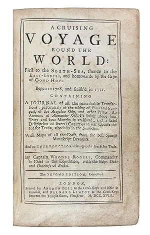
A CRUISING VOYAGE ROUND THE WORLD: First to the SOUTH-SEA, thence to the EAST-INDIES, and homewards by the Cape of GOOD HOPE. Begun in 1708, and finish'd in 1711. CONTAINING A JOURNAL of all the remarkable Transactions; particularly of the takings of Puna and Guiaquil, of the Acapulca Ship, and other Prizes: An Account of Alexander Selkirk's living alone four Years and four Months in an Island; and a brief Description of several Countries in our Course noted for Trade, especially in the South-Sea. With Maps of all the Coast, from the best Spanish Manuscript Draughts. And an INTRODUCTION relating to the South-Sea Trade. By Captain WOODES ROGERS, Commander in Chief in this Expedition, with the Ships Duke and Dutchess of Bristol
Published by Andrew Bell at the Cross-Keys and Bible in Cornhil, and Bernard Lintot at the Cross-Keys between the Temple-Gates, Fleet Street, London, 1718
Seller: Donald A. Heald Rare Books (ABAA), New York, NY, U.S.A.
Seller Rating:
8vo. (7 5/8 x 4 1/2 inches). Second edition, corrected. [i-ii] iii-xix [xx] 1-428, 1-57 [7] with 5 engraved fold-out maps. 512 pp. Sections: Introduction, A Cruising Voyage Round the World, Appendix, Index. Contemporary blind-tooled panelled calf, expertly re-backed with raised bands forming six compartments, gilt red and black Morocco letterpieces in second and third compartments. The desirable second edition of an important early Pacific voyage, a classic of buccaneering literature that inspired Defoe's Robinson Crusoe. A landmark account of privateering in the Pacific. Rogers sailed from Bristol, with William Dampier as pilot, toward the coast of Brazil, round Cape Horn, and then to Juan Fernandez, where he rescued Alexander Selkirk, a Scottish sailor eking out a lonely existence after being marooned on the island for over four years. He writes of Selkirk's rescue: "Febr. 2. [1709] Immediately our Pinnace return's from the shore, and brought an abundance of Craw-fish, with a Man cloth'd in Goat Skins, who look'd wilder than the first Owners of them." It was this famous rescue that provided Rogers's friend Daniel Defoe with the plot for Robinson Crusoe. The three-year expedition crossed the Pacific to Asia and captured several vessels including the Manila galleon at Puerto Seguro. Rogers's account also includes an important early description of California (pp. 279-311). Interestingly, Rogers was able to pursue a course of legally-sanctioned piracy due to the letters of marque issued during the Spanish War of Secession to British merchant ships. In this capacity, he was part of a civilian maritime faction given the right to challenge the French and Spanish trading monopoly in the South Seas. This was only the beginning of his dalliances with the world of piracy: Rogers returned to England from this expedition and was contracted to launch a voyage against the pirates of the Bahamas. He was appointed Captain General and Governor of the islands, and was successful in persuading all but the most ferocious pirates to surrender. Those pirates who resisted, most notably Charles Vane and Edward Teach, also known as Blackbeard, battled against Governor Rogers for control of their former island haunts. One of the more successful early Pacific voyages, Rogers returned to England a national hero. The public was fascinated by the story and his description of the adventurous voyage, and the book sold well. Early editions are scarce, with the second edition of 1718 being the most uncommon. This is the true second edition, though a later printing in 1726 falsely claimed to be the second. The five maps show the voyagers' track around the world and the South Sea coast of America, from the island of Chilo� to Acapulco. A handsome copy of this classic of pirate literature. Borba de Moraes, p. 744. European Americana 712/194. Cowan p.194. Cox I 46. Hill 1479. Howes R421. NMM 472. Sabin 72754. Streeter sale 2429. Wagner, Spanish Southwest, 78.
-
A New, Authentic, and Complete Collection of Voyages Round the World, Undertaken and Performed by Royal Authority. Containing a New, Authentic, Entertaining, Instructive, Full and Complete History of Captain Cook's First, Second, Third and Last Voyages. The Whole of these Voyages of Capt. James Cook, &c. being Newly written by the Editors from the Authentic Journals of Several Principal Officers and other Gentlemen of the most Distinguished Naval and Philosophical Abilities, who sailed in the Various Ships, and now publishing under the Immediate Direction of. Assisted, Very Materially, by a Principal Officer who sailed in the Resolution Sloop, and by Many Other Gentlemen of the Royal Navy.
Published by London: Alexander Hogg, [1784-86], 1784
Seller: Peter Harrington. ABA/ ILAB., London, United Kingdom
Association Member: ABA ILAB PBFA
Seller Rating:
First Edition
First edition of this omnibus of Cook's voyages. Printed in double columns in "large new Types, constructed on Purpose to comprise much Matter in a little Compass" and issued in 80 sixpenny parts with avowedly philanthropic intentions, Hogg's popular edition helped disseminate knowledge of Cook's discoveries. "An important collection of English voyages. [which] sometimes gives the original accounts, others are edited or abridged versions, and frequently additional material from other sources are added to give scope and depth to the narratives" (Hill). The splendidly verbose title page notes the addition of the expeditions of Byron, Wallis, Carteret, Mulgrave, Anson, and Drake. The first three were included in Hawkesworth's edition of Cook's first voyage, while the accounts of Phipps, Anson, and Drake are reprinted from David Henry's An Historical Account of All the Voyages Round the World, Performed by English Navigators (1773-74). The book is often referred to as "Anderson's Cook", though George William Anderson is most likely a pseudonym calculated to evoke vague identification with William Anderson, the surgeon, and naturalist who accompanied Cook on his second and third voyages. The publisher, Alexander Hogg, a specialist in "Paternoster Row numbers", had a penchant for tripartite pseudonyms. Two additional engraved plates laid in, one of The Queen's Hotel, London, the other, hand-coloured, of a pair of shells. Provenance: with the ownership inscription of Captain Thomas Jellis, Northampton Fencibles, on the head of the first page of text, dated 1799. The Northampton Fencibles were raised in 1794. Jellis appears to have moved to America with his family in 1812, settling in Cartersville, Virginia. His grandson, Captain Thomas Jellis Kirkpatrick served in the Confederate Army and was appointed captain of the Amherst Artillery in July 1861, becoming a major in 1865, commanding the Nelson's Battalion. Beddie 18; Hill 18; Howgego I, C176; Spence p. 26; Parks Collection 104. Folio (376 x 246 mm). Recent sprinkled half calf, marbled boards, to style, red morocco label, bands framed by reeded gilt rolls, foliate lozenge gilt in the compartments. With engraved portrait frontispiece and 156 other plates, maps, and charts including one large folding map showing the track of Cook's voyages. Prelims and endmatter professionally restored, a number of short closed marginal tears some with archival tissue repairs ("A General Chart" repaired and reinserted), occasional marginal loss ("Cook's Strait in New Zealand" with some loss of border and text), some foxing. A good copy.
-
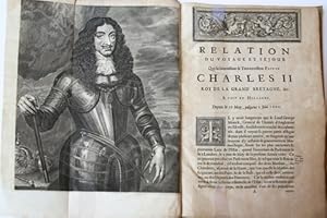
Relation en forme de journal du voyage et sejour que (.) Charles II de la Grand' Bretagne etc. a faith en Hollande. Den Haag, Vlacq, 1660.
Seller: Antiquariaat Arine van der Steur / ILAB, Den Haag, Netherlands
Seller Rating:
Folio, (4) 108 pag. Gebonden in eigentijdse geheel perkamenten band. Geillustreerd met portret en 6 grote gravures (Delft, Den Haag, en Scheveningen) door Philippe en Mathem naar Toorenvliet. Gebonden met: Rob. Keuchenius, 'Anglia triumphans, sive in inaugurationem (.) Caroli II (.) poemation. Den Haag, Vlacq, 1660, 36 pag.
-
Journal d'un voyage � Tembouctou et � Jenn� dans l Afrique centrale, pr�c�d� d observations faites chez les maures Brakna, les Nalous et d autres peuples pendant les ann�es 1824, 1825, 1826, 1827, 1828
Published by imprimerie royale, 1830
Book First Edition
Couverture rigide. Condition: Bon. Edition originale. 1830, � Paris , imprimerie royale , 3 volumes in-8�et 1 atlas ,5 planches et 1 carte et itin�raire d�pliante (900x 650mm). Tr�s rare et complet- tr�s bel exemplaire qqs l�g�res rousseurs, et 1 carte repli�e sous �tui , reli� plein cuir orange, imitation �cailles , dos lisse avec pi�ce d auteur et titre , tomaison Dans l Atlas : 1 grande carte repli�e par Jomard Gay . 243 Numa Broc Afrique pp 64-65. Ren� CAILLIE (1799-1838) a r�alis� deux exploits dont chacun aurait suffi � immortaliser son auteur. 1, atteindre Tombouctou et en revenir vivant. 2 , traverser le Sahara du Niger au Maroc. Dans l Afrique centrale, pr�c�d� d observations faites chez les Maures Braknas, les Nalous et d autres peuples ; pendant les ann�es 1824-1825-1826-1827-1828. Avec une carte itin�raire, et des remarques g�ographiques, par M Jomard, membre de l institut. D�s 1816, il s embarque pour le S�n�gal comme domestique d un officier et il commence � r�ver de Tombouctou en lisant les r�cits de Mungo Park. Apr�s un premier s�jour � la Guadeloupe, il regagne l Afrique et participe en 1818-1819 � la malheureuse exp�dition du major Gray � la recherche du Mungo Park. De retour au S�n�gal en 1824, il s�journe durant pr�s de deux ann�es chez les Maures Brakna, dont il apprend la langue, les coutumes, la religion. Lass� par l indiff�rence des autorit�s fran�aises et anglaises, il d�cide de se lancer seul, sans appuis, presque sans argent, dans l immensit� du continent noir. Le 19 avril 1827, Ren� CAILLIE quitte Kakoudy, sur les bords du Rio Nu�ez ; � travers le Fouta Djalon, il atteint le haut Niger dans la r�gion de Kouroussa. Puis, par Kankan et Tengr�la, il arrive � Djenn� apr�s un an de fatigues et de maladies. L� il embarque sur une pirogue qui en un mois le conduit � Kabara, le port de Tombouctou. Le 20 avril 1828, c est l arriv�e � Tombouctou-la-myst�rieuse et la d�sillusion presque imm�diate : la ville est triste, mal b�tie, moins active que Djenn� et pratiquement vassale des Touaregs. D�s le 4 mai, Cailli�, se faisant toujours passer pour un musulman, prend le chemin du retour, mais quel retour ! Associ� � une immense caravane, il traverse le Sahara occidental par Arouan, Taoudeni et le Tafilelt. Souffrant de la faim et de la soif, maltrait� par ses compagnons, il parvient � bout de force au Maroc. Le 7 septembre 1828, il est � Tanger o� le consul de France, Delaporte, l accueille et le fait rapatrier. Voyageur autodidacte, se d�pla�ant dans des conditions tr�s pr�caires, Caill� n a pu faire une oeuvre rigoureusement scientifique. Ses observations sur la g�ographie, le climat, l agriculture, les populations, les villes des r�gions travers�es n en sont pas moins extr�mement pr�cieuses et seront confirm�es par ses successeurs.(Numa Broc). Bel et pr�cieux exemplaire de cet ouvrage capital, N� de r�f. du libraire 27302 Ren� Cailli�, son of a humble French baker and orphaned at the age of eleven, was inspired by his reading of Robinson Crusoe to become an explorer (howgego).
-
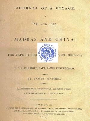
JOURNAL OF A VOYAGE, IN 1811 AND 1812, TO MADRAS AND CHINA. Returning by the Cap
Seller: RARE ORIENTAL BOOK CO., ABAA, ILAB, Aptos, CA, U.S.A.
Seller Rating:
London 1814, Nichols. 3/4 New leather spine over marbled boards, 241p., + list of plates, 24 hand colored beautiful aquatints from drawings by the author, very good copy, as issued 22 x 26.5 cm, an exceptionally R A R E B O O K ! A fascinating and detailed account of the people encountered, customs & products, on his voyage to India, China, Ceylon, Macao, Singapore &c. *** A nice early travel voyage record, that was begun from Gravesend to India and China in January 1811. Written as a narrative, this is a lucid report by a well educated person & keen observer. * The crew included 139 officers and men, 12 passengers, 100 recruits, 6 women, 40 Chinese seamen and 87 Portuguese and Lascar seamen, and off they went. A beautiful commentary on what was seen, their adventures, botany, food found, cultures observed and human nature aboard the ship. * THE PALTES With following plates: New custom-house and buildings near the Black Town, Madras; Fort St. George; Bramin's tomb; Great Pagoda at Conjeveram; View from the summit of the great Pagoda; Second view from the Pagoda; Chingleput & Scenery; View of jetty George Town Pulo Penang; View ascending the hill Penang; Treloa House George Town; House & Mill of Mr. Amee Chinese miller; Ancient Gateway Malacca; Franciscan Monastery at Macao; Church of St. Lazarus Macao; Camoens' Cave; View from Camoen's Garden Macao; Anson's Bay Bocca Tigris; Tigris to second bar Pagoda; River to Bocca Tigris; View Banquetting-room at Mr. Pon-que- qua's house; Part of the India Company's Factories and China street Canton; Col. Doveton's House St. Helena; James Town, St. Helena. *** A great primary work on an Asian voyage, nicely illustrated. *** REFERENCES: Abbey Travel, 517 * Lust 386 * H. Cordier: Sinica p.2107 ***.
-
Hardcover. Condition: Good. This is a rare volume of the publication "The London Quarterly Review" containing an early review of the 1st edition publication of CHARLES DARWIN'S "The Voyage of the Beagle." The volume contains four separate issues: June, October, and December, 1839 and March, 1840. Each issue has its own Contents page. (Curiously, the volume opens with the Contents page for the October, 1837 issue.no contents from this issue are actually present, only the singular Contents page.) There is an Index for the June and October,1839 issues at the front, and a separate Index for the December, 1839 and March, 1840 issues at the center. Volume LXIV. American edition published by Jemima M. Mason in New York. "The London Quarterly Review" was the American edition of the UK version, called the "Quarterly Review." The highlight of this volume is the December, 1839 issue which contains a rare, early (possibly the first), lengthy 21-page review of the books "Journal of Researches into the Geology and Natural History of the Various Countries Visited by the H.M.S. Beagle" by CHARLES DARWIN, and "Narrative of the Surveying Voyages of H.M.S. Adventure and Beagle" by Captain Philip Parker King and Captain Robert Fitzroy. This review of Darwin's book (more commonly known as "The Voyage of the Beagle") was published the same year as the true first edition (London) and precedes the first American edition (1846) by seven years. The reviewer describes Darwin's book as "One of the most interesting narratives of voyaging that it has fallen to our lot to take up, and one which must always occupy a distinguished place in the history of scientific navigation.".
-
A Journal of the Last Voyage Perform'd By Monsr. De La Sale, to the Gulph of Mexico : To Find Out the Mouth of the Missisipi River ; Containing an Account of the Settlements He Endeavour'd to Make on the Coast of the Aforesaid Bay, His Unfortunate Death, and the Travels of His Companions for the space of eight hundred leagues across that inland country of America, now Call'd Louisiana
Published by London : Printed for A. Bell, 1714
Book
Hardcover. Condition: Very Good. Octavo. xxi, [9], 205, [5] p. : folded map ; 19 cm. 1st English Edition. Bound in early 20th century red leather. Gilt lettering on spine. 5 raised bands. AEG. Good binding and cover. Minimal wear to extremities. Scuffer line on lower front board. Clean, unmarked pages with tanning. New end pages. Lovely folding map in cotton facsimile. "Most reliable eye-witness account of La Salle's two-years wanderings in Texas" (Howes). Field 808; Howes J266; Jenkins, Basic Texas Books 114; Raines pp. 130--131; Wagner Spanish Southwest 79 a; Greenly p. 21; Streeter sale 1:112; Church 859; Jones Adventures in Americana 150; Jones 399; Bell p. 274; Harrisse 750; Waterston p. 7; European Americana 714/70; Sabin 36762; Keynes p. 164; Clark Old South I:14; Field 808; Graff 2252. Rene-Robert Cavelier, Sieur de La Salle, or Robert de La Salle was a French explorer. He explored the Great Lakes region of the United States and Canada, the Mississippi River, and the Gulf of Mexico. After sailing for New France in 1666, La Salle began issuing land grants and learning the native language. The Mohawk told him the Ohio River flowed into the Mississippi River. Thinking the river flowed into the Gulf of Mexico, La Salle began his expedition to find a western passage to China. Details La Salle's final expeditions from July 1684 to August 1688. The main goal of the expedition was to establish a French Colony on the Gulf of Mexico, akin to Quebec, on the mouth of the Mississippi River, as a foothold between Spain's holdings in North America. The expedition was a failure, from pirate attacks sinking one ship and poor navigation which sent the foundation of the colony, Fort Saint Louis, 400 miles west of the intend landing. La Salle led a group eastward on foot on three occasions to try to locate the mouth of the Mississippi. On the final search, some of the remaining 36 men mutinied, near present day Navasota, Texas. On March 19, 1687, La Salle was slain by Pierre Duhaut during an ambush while talking to Duhaut's decoy, Jean L'Archeveque. The remaining six men, led by Henri Joutel, made their way to Illinois Country. During their journey through Illinois to Canada, the men did not tell anyone that La Salle was dead. They reached France in the summer of 1688 and informed King Louis of La Salle's death and the horrible conditions in the colony.The colony itself lasting only until 1688, when Karankawa-speaking Native Americans killed the remaining adults and took four children as adopted captives. Joutel's journal provides some of the earliest written information on the interior, natural history, and ethnography of central North America.
-
![Seller image for A Cruising Voyage Round The World, First To The South-Seas, Thence To The East Indies, And Homewards By The Cape Of Good Hope, Begun In 1708, And Finished In 1711. Containing Journal. [Including An Account Of Alexander Selkirk, "Robinson Crusoe"] Lacking All Maps for sale by Arroyo Seco Books, Pasadena, Member IOBA](https://pictures.abebooks.com/inventory/md/md10533077930.jpg)
A Cruising Voyage Round The World, First To The South-Seas, Thence To The East Indies, And Homewards By The Cape Of Good Hope, Begun In 1708, And Finished In 1711. Containing Journal. [Including An Account Of Alexander Selkirk, "Robinson Crusoe"] Lacking All Maps
Published by A. Bell / B/ Lintot, London, 1712
Seller: Arroyo Seco Books, Pasadena, Member IOBA, Pasadena, CA, U.S.A.
Association Member: IOBA
Seller Rating:
Book First Edition
Full Leather. Condition: Fair. Lacking All Maps / Plates (illustrator). First Edition. (I)-(Xii), Including "Memorandum" On Xii, Noting That The Recent Publication Of A Continuation Of Cook's "Voyage", Containing Attempts At Views Of Harbors And Land In The South -Sea, Prevented His Intention Of Supplying Such Views In This Book, But Indicating That They Could Be Presented In A Later Coasting-Pilot-Book For That Trade; 50 Pp., The Appendix, Placed At The Front Of The Book, Containing A Description Of Coasts Etc. 17 Degrees N To 44 Degress S;1-428 Pp; (14) Pp, An Unpaginated Index At End. Defective And Worn, Lacking The Preliminary Pages Before The Title Page, And Lacking All Maps / Plates, Which Were Apparently Neatly Excised; Book Begins At Title Page And Is Otherwise Complete; Conditioned And Furbished. Pages Clean And Square. The First Of Several Early Editions, All Scarce. [Also Included Is A Separate Book, The Longmans, Green & Company Reprint Of This Edition, With Illustrations Including A Single Plate Reproducing The Map Showing The Voyage, Is Included]. Woodes Rogers (C. 1679 ? 15 July 1732) Was An English Sea Captain, Privateer, Slave Trader[1] And, From 1718, The First Royal Governor Of The Bahamas. His Father Held Shares In Many Ships, But He Died When Rogers Was In His Mid-Twenties, Leaving Rogers In Control Of The Family Shipping Business. In 1707, Rogers Was Approached By Captain William Dampier, Who Sought Support For A Privateering Voyage Against The Spanish, With Whom The British Were At War. Rogers Led The Expedition, Which Consisted Of Two Well-Armed Ships, Duke And Duchess, And Was The Captain Of Duke. In Three Years, Rogers And His Men Went Around The World, Capturing Several Ships In The Pacific Ocean. En Route, The Expedition Rescued Selkirk, Finding Him On Juan Fern�ndez Island On 1 February 1709. When The Expedition Returned To England In October 1711, Rogers Had Circumnavigated The Globe, While Retaining His Original Ships And Most Of His Men, And The Investors In The Expedition Doubled Their Money. The Expedition Made Rogers A National Hero, But His Brother Was Killed And Rogers Was Badly Wounded In Fights In The Pacific. On His Return, He Was Successfully Sued By His Crew On The Grounds That They Had Not Received Their Fair Share Of The Expedition Profits, And Rogers Was Forced Into Bankruptcy. He Wrote Of His Maritime Experiences In The Book A Cruising Voyage Round The World, Which Sold Well, In Part Due To Public Fascination At Selkirk's Rescue. Rogers Was Twice Appointed Governor Of The Bahamas, Where He Succeeded In Warding Off Threats From The Spanish, And In Ridding The Colony Of Pirates. Howevwer, His First Term As Governor Was Financially Ruinous, And On His Return To England, He Was Imprisoned For Debt. With Both The Government And His Former Partners Refusing To Honour His Debts, Rogers Was Released From Debtor's Prison Only When His Creditors Took Pity On Him And Absolved Him Of His Debts. Even So, Rogers Wrote That He Was "Perplexed With The Melancholy Prospect Of [His] Affairs". In 1722 Or 1723, Rogers Was Approached By A Man Writing A History Of Piracy, And Supplied Him With Information. The Resulting Work, A General History Of The Robberies And Murders Of The Most Notorious Pyrates, Published Under The Pseudonym Captain Charles Johnson, Was An Enormous Hit On Both Sides Of The Atlantic, And Catapulted Rogers For The Second Time To The Status Of A National Hero. With Public Attention Focused On Him Again, Rogers Was Successful In 1726 In Petitioning The King For Financial Redress. Not Only Did King George I Grant Him A Pension, Retroactive To 1721, But The King's Son And Successor, George Ii, Reappointed Him As Governor On 22 October 1728. The Bahamas Did Not Come Under External Threat During Rogers' Second Term, But The Reappointed Governor Had Difficulties. Still Seeking To Bolster The Island's Defences, Rogers Sought Imposition Of A Local Tax. The Assembly, Which Had Been Instituted In Rogers' Absence, Objected, And Rogers Responded By Dissolving It.
-
JOURNAL D'UN BALEINIER VOYAGES EN OCEANIE
Published by Librairie de L. Hachette et Cie, Paris, 1866
Seller: William Reese Company - Americana, New Haven, CT, U.S.A.
Association Member: ABAA ESA ILAB SNEAB
Seller Rating:
Two volumes. [4],352,8; [4],376pp. Half title in each volume. Original printed yellow wrappers. Minor wear and dust-soiling to wrappers, minor creasing to spines, second volume binding cracked. Contemporary ownership signature on front wrapper and titlepage of both volumes. Minor marginal dampstain to first several leaves of both volumes, light occasional foxing. Overall, a very good set, untrimmed. Each volume in a separate chemise with gilt morocco spine labels, housed together in a paper-covered slipcase. A rare and far-ranging whaling narrative of particular interest for its accounts of Hawaii and the French interests in New Zealand. Louis Thiercelin served as the doctor on two voyages to the South Seas, one between 1837 and 1841 and the next over twenty years later from 1863-65. The duration of time between Thiercelin's expeditions allows him the opportunity to make interesting observations on the development of places like Akarao from one visit to the next. Similarly, he devotes two chapters to the Hawaiian islands, one from 1839 and the other from 1864. Other islands and locations covered by the narrative include Madeira, Liberia, Tahiti, Tasmania, Chatham Islands, Saint Paul Islands, New Amsterdam, the Chesterfield and Bampton Coral Islands, New Caledonia, and more. Thiercelin's account offers new details on whaling vessels and their crews, including thorough descriptions of the different types of whales, particulars on the actual whale hunts, and explanations of some of the newer and more deadly whaling techniques such as poisoned harpoons, and harpoons with explosive charges propelled by gun-like mechanisms. Besides the important information on whaling, the work is significant for recording Thiercelin's observations on the colonial activities of the English and Spanish crowns, most notably the mistreatment of the Bubi people in present-day Equatorial Guinea and the Maori in New Zealand. FORBES 2730. HUNNEWELL, p.69. HILL 1690. JUDD 171. BAGNALL 5522. FERGUSON 16990. O'REILLY & REITMAN 1246. NEBENZAHL 35:94.
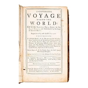
![Seller image for Voyage fait par Ordre du Roi en 1768 et 1769, � diff�rentes Parties du Monde, Pour �prouver en mer les Horloges Marines invent�es par M. Ferdinand Berthoud. Premi�re partie, Contenant 1. Le Journal des Horloges Marines, ou la suite de quatorze v�rific. - [TESTING BERTHOUD'S CHRONOMETER.] for sale by Lynge & S�n ILAB-ABF](https://pictures.abebooks.com/inventory/md/md21520895612.jpg)
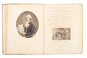
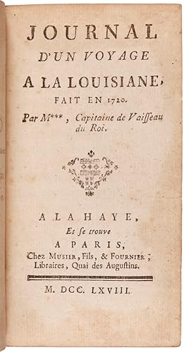

![Seller image for NARRATIVE OF THE EXPEDITION OF AN AMERICAN SQUADRON TO THE CHINA SEAS AND JAPAN, Performed in the Years 1852, 1853, and 1854, Under the Command of Commodore M. C. Perry, United States Navy, By Order of the Government of the United States. Compiled From the Original Notes and Journals of Commodore Perry and His Officers, At His Request and Under His Supervision. [Volume III titled:] UNITED STATES JAPAN EXPEDITION. OBSERVATIONS ON THE ZODIACAL LIGHT, From April 2, 1853, to April 22, 1855, Made Chiefly on Board The United States Steam-Frigate Mississippi, During Her Late Cruise in Eastern Seas, and Her Voyage Homeward; With Conclusions from the Data Thus Obtained; by Rev. George Jones, A.M., Chaplain United States Navy. for sale by Buddenbrooks, Inc.](https://pictures.abebooks.com/inventory/md/md31108066141.jpg)
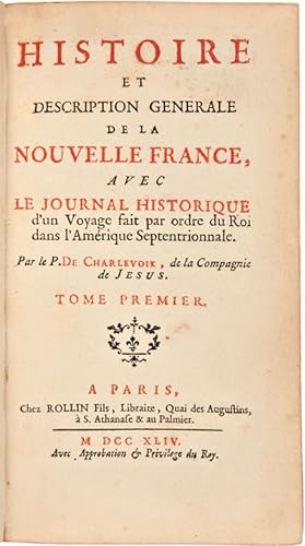
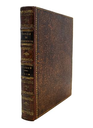
![Seller image for Journal Du Voyage Du Chevalier Chardin En Perse & Aux Indes Orientales, Par La Mer Noire & Par La Colchide. Chardin, Jean. Verlag: A Londres: Chez Moses Pitt, 1686., 1686 Beschreibung Folio, 31 x 20cm., [X], 150, 181-269, 263-349, [5] pp. With engraved title and 15 plates, some folding. This book is complete in contemporary binding, calf. Please look the pictures. First edition, reprinted in the same year in Amsterdam in a small format. This edition is a publication of the first volume of Chardins manuscript only and deals with the years 1671 - 73. With illustrations of Tiflis, Erivan, Kashan, Kom and a large folding map of the Black sea. Brunet, I, 1802; Chadenat 546; Hage Chahine 909; Weber II, 377; Wilson 40 (pour l'�dition anglaise de for sale by Hammelburger Antiquariat](https://pictures.abebooks.com/inventory/md/md30758106302.jpg)
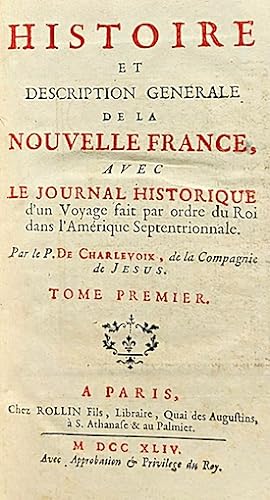
![Seller image for Journal of a Voyage for the Discovery of a North-West Passage From the Atlantic to the Pacific; Performed in the Years 1819-20, in his Majesty's Ships Hecla and Griper, Under the Orders of William Edward Parry, R.N., F.R.S., and Commander of the Expedition. With an Appendix Containing the Scientific and Other Observations. London: John Murray, 1821. [WITH] Journal of a Second Voyage for the Discovery of a North-West Passage From the Atlantic to the Pacific; Performed in the Years 1821-22-23, in his Majesty's Ships Fury and Hecla, Under the Orders of Captain William Edward Parry, R.N., F.R.S., and Commander of the Expedition. Illustrated by Numerous Plates for sale by Karol Krysik Books ABAC/ILAB, IOBA, PBFA](https://pictures.abebooks.com/inventory/md/md31349615774.jpg)