

Order Total (1 Item Items):
Shipping Destination:

München Plan Munich (13 results)
Skip to main search results
Search filters
Product Type
- All Product Types
- Books (2)
- Magazines & Periodicals (No further results match this refinement)
- Comics (No further results match this refinement)
- Sheet Music (No further results match this refinement)
- Art, Prints & Posters (8)
- Photographs (No further results match this refinement)
- Maps (3)
- Manuscripts & Paper Collectibles (No further results match this refinement)
Condition Learn more
- New (No further results match this refinement)
- As New, Fine or Near Fine (No further results match this refinement)
- Very Good or Good (2)
- Fair or Poor (No further results match this refinement)
- As Described (11)
Binding
- All Bindings
- Hardcover (No further results match this refinement)
- Softcover (1)
Collectible Attributes
- First Edition (No further results match this refinement)
- Signed (No further results match this refinement)
- Dust Jacket (No further results match this refinement)
- Seller-Supplied Images (12)
- Not Print on Demand (13)
Language (2)
Free Shipping
- Free Shipping to U.S.A. (No further results match this refinement)
Seller Location
Seller Rating
-

"A Plan of the City of Munich" - München Munich Bavaria Bayern
Language: English
Published by London ca. 1770., 1770
Seller: Antiquariat Steffen Völkel GmbH, Seubersdorf, Germany
Seller rating 5 out of 5 stars

Map
Original Kupferstich-Plan von ca. 1770. -- Blatt-Maße: ca. 20 x 24 cm. -- gut erhalten. || Original engraved plan from ca. 1770. -- in good condition. -- This is an original! - No copy! - No reprint! // Wir, das Antiquariat Steffen Völkel, kaufen und verkaufen alte Bücher, Handschriften, Zeichnungen, Autographen, Grafiken und Fotografien. Wir sind stets am Ankauf von kompletten Bibliotheken, Sammlungen und Nachlässen interessiert. Sprache: Englisch Gewicht in Gramm: 10.
-
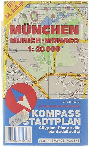
München : mit illustriertem Kurzführer = Munich : city plan.
Published by Mu?nchen : Heinz Fleischmann GmbH und Co., 1986
ISBN 10: 3870512083 ISBN 13: 9783870512088
Paperback. Condition: Good. German.
-

Stadtplan München = Map of Munich = Plan de Munich. Ein Wegweiser zum Vergnügen ; Besichtigen, Essen, Trinken, Tanzen, Bummeln und, und.
Published by München. Lipp., 1980
4to. 1 Karte, mehrfarbig. OKt. Einband leicht berieben, sonst gut erhaltenes Exemplar. Sprache: deutsch.
-

Antique Plan-CITY-MUNCHEN-MUNICH-BAVARIA-GERMANY-Meyers-1895
Publication Date: 1895
Seller: Pictura Prints, Art & Books, Overasselt, Netherlands
Seller rating 5 out of 5 stars
Art / Print / Poster
Original chromolithograph on wove paper. on paper. Size in cm: The overall size is ca. 30.3 x 24.2 cm. The image size is ca. 25.9 x 20.8 cm. Size in inch: The overall size is ca. 11.9 x 9.5 inch. The image size is ca. 10.2 x 8.2 inch.Map: 'Munchen.' (Munich / Munchen, Germany). This attractive original old antique print / plate / map originates from 1885-1907 editions of a famous German encyclopedia: 'Meyers grosses Konversations-Lexikon.', published in Leipzig and Vienna. Meyers Konversations-Lexikon was a major German encyclopedia that existed in various editions from 1839 until 1984, when it merged with the Brockhaus encyclopedia. Several of the plates were also used in Dutch Encyclopedia's like Winkler Prins.Artists and Engravers: The original founder and publisher who initiated this famous enxyclopedia was Joseph Meyer (1796-1856, Hildburghausen, Germany).Condition: Very good, given age. Original middle fold, as issued. Margin edges faintly browned. General age-related toning and/or occasional minor defects from handling. Please study scan carefully.Keywords: ANTIQUE PLAN-CITY-MUNCHEN-MUNICH-BAVARIA-GERMANY-MEYERS(PCOMAN) A179-09.
-
A Plan of the City of Munich (Ein Plan der Stadt München).
Published by John Stockdale, London, 1772
Map
Condition: Gut. Gut. Kupferstich. Blattgröße: 24 x 32,5 cm, Druckspiegel: 18 x 24,5 cm. . Klarer und kräftiger Druck auf etwas gebräuntem Papier, rückseitig Montagereste und Leimschatten, insgesamt gut erhalten. Schöner kleiner Stadtplan des historischen Münchens mit der Stadtmauer (Befestigungsanlage) und einer ausführlichen Legende mit 52 Punkten. Karte Nr. XIX (19) aus Andrews' viel beachtetem Werk "A Collection of Plans of the Most Capital Cities of every Empire, Kingdom, Republic and Electorate in Europe and some Remarkable Cities in the other Three Parts of the World". Bayern, München, Stadtplan, historisch, Stadtansicht, Plan, Grundriss, historische Gebäude, Isar, Isarauen, erklärende Legende, Geschenk. 1200 Gramm.
-

1832 Antique Map Plan of MUNICH Munchen Germany SDUK (LM24-43)
Seller: Antique Paper Company, ASHFORD, KENT, United Kingdom
Seller rating 3 out of 5 stars

Map
US$ 111.21
US$ 8.10 shipping
Ships from United Kingdom to U.S.A.Quantity: 1 available
Add to basket1832A fine original antique Map/Plan of the city of MUNICH in Germany.A very attractive and detailed mid 19th century city plan of Munich which was engraved by T. Bradley and Published under the Superintendence of the Society for the Diffusion of Useful Knowledge. Near the bottom border, architectural illustrations of the citys most prominent buildings are displayed including theTown Hall, the Theatre Royal andthe School of Arts. Size approx 40.5cm x 34.5cm including margins. Condition is excellent with original hand colour.
-

MÜNCHEN. - Plan. "A Plan of the City of Munich". Stadtplan aus der Vogelschau mit Legende von 1-52
Seller: Peter Bierl Buch- & Kunstantiquariat Inh.: Andrea Bierl, Eurasburg, Germany
Seller rating 4 out of 5 stars

Art / Print / Poster
Kupferstich von J. Andrews, um 1770, 16,5 x 22,5 cm.
-

MÜNCHEN. - Plan. "Plan de Munich (Bavière)".
Seller: Franziska Bierl Antiquariat, Eurasburg, Germany
Seller rating 4 out of 5 stars
Art / Print / Poster
Lithographie, in drei Farben gedruckt, nach R. Hausermann bei Fayard, Paris, 1877, 19,5 x 27 cm. Aus "Atlas Universel". - Der detaillierte Plan zeigt das Zentrum mit Hervorhebung der wichtigsten Gebäude. Die Umgebung reicht von der Hackerbrücke bis zum Ostbahnhof mit Bogenhausen, Haidhausen und Au, von der Universität mit Englischem Garten bis zum Südlichen Friedhof. Links Erklärungen 1 - 18.
-

MÜNCHEN. - Plan. "Munich, Ville Capitale des Etats de son Altesse Electorale de Bavarie". Ansicht (Plan) aus der Vogelschau mit herausragenden Gebäuden.
Seller: Peter Bierl Buch- & Kunstantiquariat Inh.: Andrea Bierl, Eurasburg, Germany
Seller rating 4 out of 5 stars
Art / Print / Poster
Teilkolorierter Kupferstich bei Nicolas de Fer, dat. 1705, 24 x 33 cm. Recht unten Erklärung 1-32. - Oben in der Darstellung der Rand gebräunt. An allen vier Seiten alt angerändert und unten die Einfassungslinie ergänzt.
-

MÜNCHEN. - Plan. "Munich (München)". Stadtplan, darunter Gesamtansicht von Osten.
Seller: Peter Bierl Buch- & Kunstantiquariat Inh.: Andrea Bierl, Eurasburg, Germany
Seller rating 4 out of 5 stars
Art / Print / Poster
Teilkolorierter Stahlstich von T. Bradley nach W.B. Clarke bei Baldwin & Cradock, dat. 1832, 31 x 38 cm.
-

MÜNCHEN. - Plan. "Munich, Ville Capitale des Etats de son Altesse Electorale de Bavarie". Ansicht (Plan) aus der Vogelschau mit herausragenden Gebäuden.
Seller: Peter Bierl Buch- & Kunstantiquariat Inh.: Andrea Bierl, Eurasburg, Germany
Seller rating 4 out of 5 stars
Art / Print / Poster
Kupferstich von Coquart bei Nicolas de Fer, dat. 1705, 24 x 33 cm. Recht unten Erklärung 1-32. - Mit dem Textblatt. - Etwas gebräunt.
-

MÜNCHEN. - Plan. "Munich". Stadtplan, darunter Gesamtansicht von Osten.
Seller: Peter Bierl Buch- & Kunstantiquariat Inh.: Andrea Bierl, Eurasburg, Germany
Seller rating 4 out of 5 stars
Art / Print / Poster
Teilkolorierter Stahlstich von T. Bradley nach W.B. Clarke bei G. Cox, London, dat. 1853, 31 x 38 cm.
-

MÜNCHEN. - Plan. "Plan de Munich et de ses Environs". Plan von München und seiner Umgebung, mit Thalkirchen im Westen, Unterföhring im Osten, sowie Nymphenburg im Norden.
Seller: Peter Bierl Buch- & Kunstantiquariat Inh.: Andrea Bierl, Eurasburg, Germany
Seller rating 4 out of 5 stars
Art / Print / Poster
Aquarellierte Tuschfederzeichnung, Anonym, um 1800, 39 x 59,5 cm. Manuskriptkarte mit München im Mittelpunkt, die umliegenden Orte sind ebenfalls mit kleinen Plänen eingezeichnet. - Durchgehend gleichmäßig gebräunt, kleinere restaurierte Fehlstellen, vor allem die Ecke oben rechts, doubliert. - Interessantes Dokument, dass München und seine Umgebung zu der damaligen Zeit darstellt.


