Map Ceylon by Stanford (2 results)
Published by LondonEdward Stanford. N.D. c. 1900
- Hardcover
- Map
Seller: Robert Frew Ltd. ABA ILAB, London, , United KingdomRobert Frew Ltd. ABA ILAB
Contact seller5-star sellerCondition: Used
US$ 443.44
US$ 13.25 shippingShips from United Kingdom to U.S.A.Quantity: 1 available
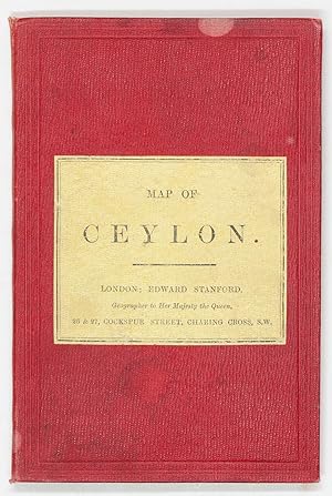
Linen-backed geological map of Ceylon, folded into 20 sections. Overall dimensions 67.5 x 56cm, map 63 x 52cm. Folds to 17.5 x 12cm between hardback red cloth-covered boards with printers label to front. Advertisements to front paste-down. Scale is 11 English miles to 1 inch. Full colour, showing mountain ranges and lakes. Provi…nces are coloured in seperate tints, districts separated by narrow red lines, and thier names underlined in red. Large damp stain to rear board and a few small marks to front. Contents unaffected. Fine condition. Produced by Edward Stanford, geographer to her Majesty the Queen. A quote from Liet Powell & Ethersey Trigonometrical Survey, printed next to the Gulf of Manaar reads: "Adams bridge is composed of shifting sand banks with small intricate channels between them, frequented at times by Native Boats.".

Published by Stanford, London 1893
- Map
Seller: Neil Carver Books, SOUTHPORT, , United KingdomNeil Carver Books
Contact seller4-star sellerCondition: Used - Fine
US$ 54.58
US$ 46.36 shippingShips from United Kingdom to U.S.A.Quantity: 1 available
Condition: Fine. 2nd Edition. A really nice example of this map, clean and sharp and uncreased. There is slight tanning and one repair of half an inch to the margins. Disbound from Stanford's London Atlas of Universal Geography Second Edition with central fold as issued. Overall dimensions are 30 in 76 cm x 22in 56cm including m…argins and in portrait format.

