Order Total (1 Item Items):
Shipping Destination:

Map Dakota, First Edition (48 results)
Skip to main search results
Search filters
Product Type
- All Product Types
- Books (21)
- Magazines & Periodicals (1)
- Comics (No further results match this refinement)
- Sheet Music (No further results match this refinement)
- Art, Prints & Posters (8)
- Photographs (No further results match this refinement)
- Maps (18)
- Manuscripts & Paper Collectibles (No further results match this refinement)
Condition Learn more
- New (No further results match this refinement)
- As New, Fine or Near Fine (11)
- Very Good or Good (28)
- Fair or Poor (1)
- As Described (8)
Binding
Collectible Attributes
- First Edition (48)
- Signed (No further results match this refinement)
- Dust Jacket (1)
- Seller-Supplied Images (36)
- Not Print on Demand (48)
Language (2)
Free Shipping
Seller Location
Seller Rating
-
NORTH DAKOTA SOUTH DAKOTA Highway Map - Standard Oil - 1969
Published by Standard Oil, 1969
Map First Edition
Soft cover. Condition: Very Good. No Jacket. 1st Edition. Folded map size about 4 by 9 inches. Opens to about 18 by 32 inches. Printed on both sides in color. Light wear. VERY GOOD.
-
NORTH DAKOTA SOUTH DAKOTA Highway Map - Standard Oil - 1967
Published by Standard Oil, 1967
Map First Edition
Soft cover. Condition: Very Good. No Jacket. 1st Edition. Folded map size about 4 by 9 inches. Opens to about 18 by 28 inches. Printed in color on both sides. Light edge wear. VERY GOOD.
-

A MAP SEQUENCE OF THE BELLE FOURCHE IRRIGATION PROJECT [SOUTH DAKOTA]
Published by J Geography, 1935
Magazine / Periodical First Edition
Pamphlet. Condition: Very Good. 1st Edition. Vol 34, No 3, pp. 109-119, Maps, Extracted from orig vol, thus begins with title page, trimmed & stapled pamphlet, else VG.
-
North Dakota Grand Forks Sheet Soil Map 1902
Language: English
Published by USDA, place not stated, 1902
First Edition
No Binding. Condition: Very Good. 1st Edition. A 15 by 38.5 inch single sheet map in 6 colors, folded to 6 by 9 inches, as issued. Edition of 1902. Lightly age-darkened paper, else VG. USDA Department of Soils. Shelf 13, map 32.
-
National Geographic Magazine - April, 2004. With Map Supplemnt, Bird Migration. Tornados, Cranes, Johannesburg, South Dakota Badlands, Tigers in the Hukawng Valley of Death (Myanmar), Wiscasset, Maine - Worm Capital of the World
Language: English
Published by National Geographic Society, Washington, DC, 2004
Seller: Singularity Rare & Fine, Baldwinsville, NY, U.S.A.
Seller rating 5 out of 5 stars

First Edition
Soft cover. Condition: Very Good. 1st Edition. Very Good. See scans and description. Washington, DC: National Geographic Society, 2004. The April, 2004 issue of National Geographic magazine, with the included separate map supplement, "Bird Migration". (scan). Quarto, photo-illustrated perfect-bound wraps, 136 pp. Very Good; has been perused, and covers show moderate signs of that, with a notable rear-cover crease. See scans. Contents and map supplement are Fine. Cover article serves up something we all wish we could be doing, "Chasing Tornadoes". Other feature topics include (the migratory) Cranes, Johannesburg, the South Dakota Badlands, Tigers in the Hukawng Valley of Death (Myanmar), and Wiscasset, Maine - "Worm Capital of the World". Yay. Departments include OnScreen and Online, From the Editor, Forum, Geographica, My Seven, Do It Yourself, Behind the Scenes, Who Knew?, Final Edit, On Assignment, and Flashback. Please see scans. This item is on premises, of course. LPR13.
-

MAP: "North Dakota & South Dakota".colored map, Disbound, source Unknown
Published by Dodd, Mead & Company, NY, 1903
Seller: Dorley House Books, Inc., Hagerstown, MD, U.S.A.
Seller rating 4 out of 5 stars

Art / Print / Poster First Edition
Unbound. Condition: Very Good. 1st. 9.5"x12"' colored map. with railroad lines, etc . suitable for framing Size: 9.5" x 12".
-

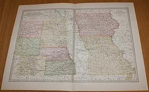
MAP: "Northern States, Western Section" (Minnesota & the Dakota Terriroty).from Van Antwerp, Bragg & Company's Commerical Atlas
Published by Van Antwerp, Bragg & Company, NY, 1882
Seller: Dorley House Books, Inc., Hagerstown, MD, U.S.A.
Seller rating 4 out of 5 stars
Art / Print / Poster First Edition
Unbound. Condition: Very Good. Colored Map (illustrator). 1st. lovely colored amtique map.includes the Dakotas & Minnesota; suitable for framing Size: 6" x 8.5".
-

MAP: "North Dakota".From Cram's Superior Reference Atlas of Kansas & The World
Published by George F. Cram, NY, 1907
Seller: Dorley House Books, Inc., Hagerstown, MD, U.S.A.
Seller rating 4 out of 5 stars
Art / Print / Poster First Edition
Unbound. Condition: Very Good. Handcolored Map (illustrator). 1st. 11" x 14" colored map, suitable for framing Size: 11" x 14".
-

MAP: "South Dakota".From Cram's Superior Reference Atlas of Kansas & The World
Published by Cram, NY, 1907
Seller: Dorley House Books, Inc., Hagerstown, MD, U.S.A.
Seller rating 4 out of 5 stars
Art / Print / Poster First Edition
Unbound. Condition: Very Good. Handcolored (illustrator). 1st. 11'' x 14' colored map; single page, suitable for framing Size: 11'' x 14'.
-

MAP: "North Dakota:. .from Atlas of Michigan & The World
Published by George F. Cram, Chicago, IL, 1908
Seller: Dorley House Books, Inc., Hagerstown, MD, U.S.A.
Seller rating 4 out of 5 stars
Art / Print / Poster First Edition
Unbound. Condition: Very Good. Handcolored Map (illustrator). 1st. 11" x 14" colored map, suitable for framing Size: 11" x 14".
-

MAP: "Block Diagram Showing Relationship of Uranium-Bearing Lignite Beds to the Base of the Whie River Group in North and South Dakota (Geological Survey Bulletin 1055, Plate 32)
Language: English
Published by Geological Survey; US Deptartment of the Interior, Washington, D.C., 1954
Seller: Dorley House Books, Inc., Hagerstown, MD, U.S.A.
Seller rating 4 out of 5 stars
Map First Edition
No Binding. Condition: Near Fine. 1st Edition. folded map, c.15.5" x 11"i in wonderful condition, no tears, no markings.
-

MAP: "Geological Map of Medicine Pole Area, Bowman County, North Dakota (Geological Survey Bulletin 1055, Plate 8)
Language: English
Published by Geological Survey; US Deptartment of the Interior, Washington, D.C., 1954
Seller: Dorley House Books, Inc., Hagerstown, MD, U.S.A.
Seller rating 4 out of 5 stars
Map First Edition
No Binding. Condition: Near Fine. 1st Edition. folded map, c. 9.5" x 8.5i in wonderful condition, no tears, no markings.
-

MAP: "Lignite Sections in the Lodgepole Area, South Dakota, medicine Pole HIlls, North Dakota; and Long Pine Hills, Montana (Geological Survey Bulletin 1055, Plate 9)
Language: English
Published by Geological Survey; US Deptartment of the Interior, Washington, D.C., 1954
Seller: Dorley House Books, Inc., Hagerstown, MD, U.S.A.
Seller rating 4 out of 5 stars
Map First Edition
No Binding. Condition: Near Fine. 1st Edition. folded map, c. 16" x 8.5"in wonderful condition, no tears, no markings.
-

MAP/Chart: "Concentration and Distribution of Uranium in Lignite Core, Medicine Pole Hills Area, Bowman County, North Dakota (Geological Survey Bulletin 1055, Plate 21)
Language: English
Published by Geological Survey; US Deptartment of the Interior, Washington, D.C., 1954
Seller: Dorley House Books, Inc., Hagerstown, MD, U.S.A.
Seller rating 4 out of 5 stars
Map First Edition
No Binding. Condition: Near Fine. 1st Edition. folded map, c.14" x 11" in wonderful condition, no tears, no markings.
-

MAP/Chart: "Stratigraphic Sections Showing Corelation of Lignite Cores, Lodgepole Area and Johnson Outlier, Perkins opunty, South Dakota (Geological Survey Bulletin 1055, Plate #20)
Language: English
Published by Geological Survey; US Deptartment of the Interior, Washington, D.C., 1954
Seller: Dorley House Books, Inc., Hagerstown, MD, U.S.A.
Seller rating 4 out of 5 stars
Map First Edition
No Binding. Condition: Near Fine. 1st Edition. folded map, c.14" x 10.5" in wonderful condition, no tears, no markings.
-
MAP: "Geologial maps & Structure Sections Of the Sentinel Butte and Bullion Butte Areas & Structure Section of the Chalky Buttes Area, Southwestern North Dakota (Geological Survey Bulletin 1055, Plate 31)
Language: English
Published by Geological Survey; US Deptartment of the Interior, Washington, D.C., 1954
Seller: Dorley House Books, Inc., Hagerstown, MD, U.S.A.
Seller rating 4 out of 5 stars
Map First Edition
No Binding. Condition: Near Fine. 1st Edition. folded map, c.16" x 16.25" in wonderful condition, no tears, no markings.
-

MAP: "Lignite Sectin, Table Mountain and North Cave Hills Area, South Dakota, showing Location of Core HOles (Bulletin 1055, Plate 7)
Language: English
Published by Geological Survey; US Deptartment of the Interior, Washington, D.C., 1954
Seller: Dorley House Books, Inc., Hagerstown, MD, U.S.A.
Seller rating 4 out of 5 stars
Map First Edition
No Binding. Condition: Near Fine. 1st Edition. folded map, c. 27" x 11"", in wonderful condition, no tears, no markings.
-

MAP: "Geological Map of the Mendenhall Area, Slim Buttes, Harding County, South Dakota, showing Location of Core HOles (Bulletin 1055, Plate 22)
Language: English
Published by Geological Survey; US Deptartment of the Interior, Washington, D.C., 1954
Seller: Dorley House Books, Inc., Hagerstown, MD, U.S.A.
Seller rating 4 out of 5 stars
Map First Edition
No Binding. Condition: Near Fine. 1st Edition. folded map, c. 13.5" x 12.25", in wonderful condition, no tears, no markings.
-

North Dakota: Every Town on the Map and More
Language: English
Published by Vintage Publications, 2002
ISBN 10: 0966646819 ISBN 13: 9780966646818
First Edition
hardcover. Condition: Very Good +. Dust Jacket Condition: No dust jacket. First Edition.
-
North Dakota: Every town on the map and more : a pictorial history
Language: English
Published by Vintage Publications, 2002
ISBN 10: 0966646819 ISBN 13: 9780966646818
First Edition
Condition: Good. 1St Edition. Former library copy. Pages intact with minimal writing/highlighting. The binding may be loose and creased. Dust jackets/supplements are not included. Includes library markings. Stock photo provided. Product includes identifying sticker. Better World Books: Buy Books. Do Good.
-
Map of Kansas, Nebraska, Colorado, Dakota, Wyoming, Iowa and Missouri - Sheet 73 (part of USA) Disbound from the 1890 'The Library Reference Atlas of the World'
Published by Macmillan and Co., London, 1890
First Edition
US$ 35.26
US$ 19.39 shipping
Ships from United Kingdom to U.S.A.Quantity: 1 available
Add to basketSoftcover. Condition: Very Good. Dust Jacket Condition: No Dust Jacket. First Edition. Single disbound coloured map sheet, from John Bartholomew's Library Reference Atlas, covering part of the United States of America. Suitable for framing. Approx size 35 x 46 cm, vertical centre fold. Map is clean, crisp, clear and bright. Sheet contains two map panels side by side; Kansas, Nebraska, Colorado, Dakota, Wyoming and part of Montana, (including Denver, Cheyenne City, Yellowstone, Bismark, Yankton, Lincoln and Topeka). And; Iowa and Missouri (including Omaha City, Dubuque, St. Louis, Siou City and Kansas City). No dust jacket, as published. Quantity Available: 1. Shipped Weight: under 1 kg. Pictures of this item not already displayed here available upon request. Inventory No: 45020124070. All our books are sent by tracked mail.
-
MAP: "Corrrelation Chart Shoikng Distribution and Concentration of Uranium in Lignite At Core Hioles GS 1-4 and SD 1,2, 3-8, Mendanhall Area Harding County, South Dakota (Bulletin 1055, Plate 24)
Language: English
Published by Geological Survey; US Deptartment of the Interior, Washington, D.C., 1954
Seller: Dorley House Books, Inc., Hagerstown, MD, U.S.A.
Seller rating 4 out of 5 stars
Map First Edition
No Binding. Condition: Near Fine. 1st Edition. folded map, c. 29.5" x 34", in wonderful condition, no tears, no markings.reprinted by US Geo. Survey from the original by James R. Gill.
-
North Dakota: Every Town on the Map and More
Language: English
Published by Vintage Publications, 2002
ISBN 10: 0966646819 ISBN 13: 9780966646818
First Edition
Hardcover. Condition: Very Good. 1st Edition. our photos, binding is solid, light shelf rub on boards, short gift inscription on inside front cover, note on inside front endpaper, text is free of markings, we ship quickly with tracking, to heavy for international shipping.
-
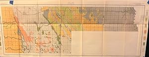
MAP: " Soil Map: Grand Forks, North Dakota: Sheet #32"
Published by U.S. Department of Agriculture, Bureau of Soils, Washington D.C., 1902
Seller: Dorley House Books, Inc., Hagerstown, MD, U.S.A.
Seller rating 4 out of 5 stars
Art / Print / Poster First Edition
Unbound. Condition: Very Good. Colored Map (illustrator). 1st. Early 20th century soil survey of Grand Forks, North Dakota area. includes details on county roads, towns, simple topography and railroads. Various soil types are colored and identified in the legend on either side of the map. Drawn to a scale of 1 inch to 1 mile. clear, bright, unmarked.Grand Forks is the third-largest city in the State of North Dakota (after Fargo and Bismarck) and the county seat of Grand Forks County. Size: 13.1 H x 36.75 W Inches.
-

MAP: Aberdeen (South Dakota) (W-5) Sectional Aeronautical Chart. "Restricted"
Published by U.S. Coast and Geodetic Survey, Washington D.C., 1943
Seller: Dorley House Books, Inc., Hagerstown, MD, U.S.A.
Seller rating 4 out of 5 stars
Art / Print / Poster First Edition
Unbound. Condition: Very Good. Colored Map (illustrator). 1st. World war II restricted air map of the area between the Fargo, North Dakota & Sioux City, Iowa zones, and shows air fields, seaplane bases, hazards & prohibited areas, , radio and communcation items; landmarks, lookout towers, marine lightings and beacons, and more.has warnings.Marked Restricted, "Due to war conditions, lights, radio facilities and other aids to navigation may be changed or discontinued without notice.". Size: 24" x 42".
-
Map of South Dakota With Population and Locations of Principal Towns and Cities
Published by Kenyon Company, Inc. circa 1921, 1921
Map First Edition
Map. Condition: Good+. 1st Edition. Measures 20 x 14-1/2. A fragile map with vertical crease, small chips to green margins with 1" closed tear left margin. Shows congessional districts in green. Reverse side has dampstain and printed "Index of South Dakota With 1920 Official Census, and Shipping and Postal Guide. Previous owner made some pencil notes including several circles around locales, possibly designating travel route. See photographs for precise condition. Map will be shipped with one vertical fold, in plastic and in cardboard. ; MCN35183.
-
Standard atlas of Burke County, North Dakota : including a plat book of the villages, cities and townships of the county : Map of the state, United States and world : Patrons directory, reference businss directory.
Language: English
Published by Geo A. Ogle & Co, Chicago, 1914
First Edition
Hardcover. Condition: Good. 1st Edition. 65, xxiii pages : illustrations, color maps, portraits ; 36 cm. A solid, but well worn copy with various indignities: the spine has been taped, the gutters taped over the end papers, the end papers brittle and showing scribbling. T he interior pages, including the very nice township maps in color. Most rare; OCLC shows mostly microfilmed copies.
-
RAND, McNALLY POCKET MAP AND SHIPPERS' GUIDE OF SOUTH DAKOTA
Published by RAnd McNally & Co. Chicago., 1905
First Edition
Soft cover. Condition: Good. No Jacket. 1st Edition. Tan wraps enclosing 22 pages of text and advertisements along with a 21 by 14 inch color map of South Dakota dated 1905. Folder size about 4 by 6 1/2 inches. Text lists and keys to the map railroads, counties, creeks, lakes, rivers, towns (With population), etc. Very scarce early map of this state. Covers separated at the spine edge; map with some edge tearing, fold intersection tears, etc. with no loss. GOOD Language: eng Language: eng 0.0 Language: eng Language: eng Language: eng.
-

Rand McNally Junior Auto Road Map of North Dakota
Publication Date: 1930
Seller: Art Source International Inc., Boulder, CO, U.S.A.
Seller rating 5 out of 5 stars
First Edition
Rand McNally & Company, still a major name in map publishing to this day, began as a small print shop opened in Chicago in 1856 by William H. Rand. The shop originally printed guidebooks and directories. In 1858, Rand hired Andrew McNally who was later to become a partner. Within the next few years, the shop got into the railroad business by starting to print railway tickets and schedules, a key step in the development of the company. The ticket printing led to the publishing of railway guides, and by 1872 Rand McNally and Company had the capacity to publish maps. This road map of North Dakota came from Rand McNallys Commercial Atlas, sixty-first Edition dated 1930. A highly successful run of atlases that lasted over a decade. This map includes a detailed plan of all existing highways (in red) and all other roads in existance at the time. This map measures 17 inches by 11 inches.
-

Rand McNally Junior Auto Road Map of South Dakota
Publication Date: 1930
Seller: Art Source International Inc., Boulder, CO, U.S.A.
Seller rating 5 out of 5 stars
First Edition
Rand McNally & Company, still a major name in map publishing to this day, began as a small print shop opened in Chicago in 1856 by William H. Rand. The shop originally printed guidebooks and directories. In 1858, Rand hired Andrew McNally who was later to become a partner. Within the next few years, the shop got into the railroad business by starting to print railway tickets and schedules, a key step in the development of the company. The ticket printing led to the publishing of railway guides, and by 1872 Rand McNally and Company had the capacity to publish maps. This road map of South Dakota came from Rand McNallys Commercial Atlas, sixty-first Edition dated 1930. A highly successful run of atlases that lasted over a decade. This map includes a detailed plan of all existing highways (in red) and all other roads in existance at the time. This map measures 17 inches by 11 inches.